

$1,850 / Month
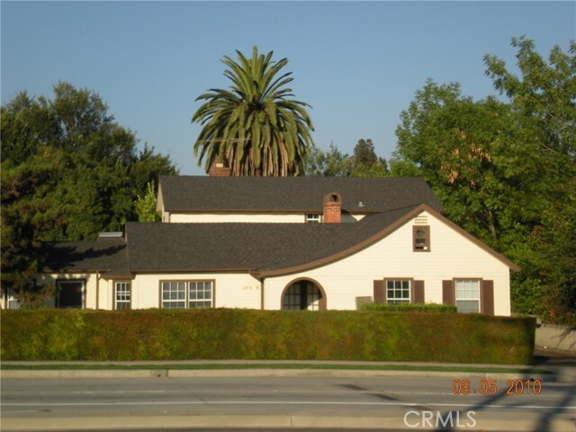
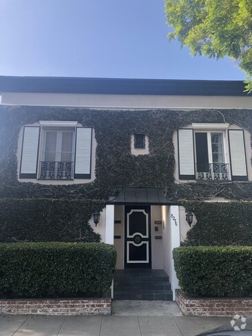
6956 San Gabriel Blvd
San Gabriel, CA 91775
Today
Favorites
626-318-5286
-
Bedrooms
Studio
-
Bathrooms
1
-
Square Feet
600 sq ft
-
Available
Available Now
Highlights
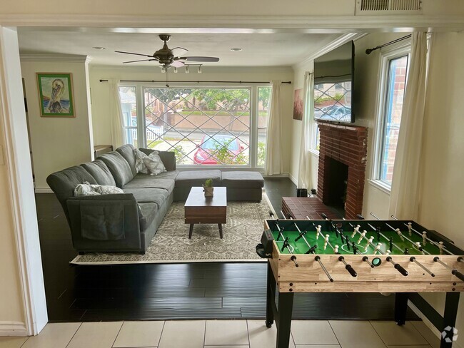
- Art Studio
- Fireplace
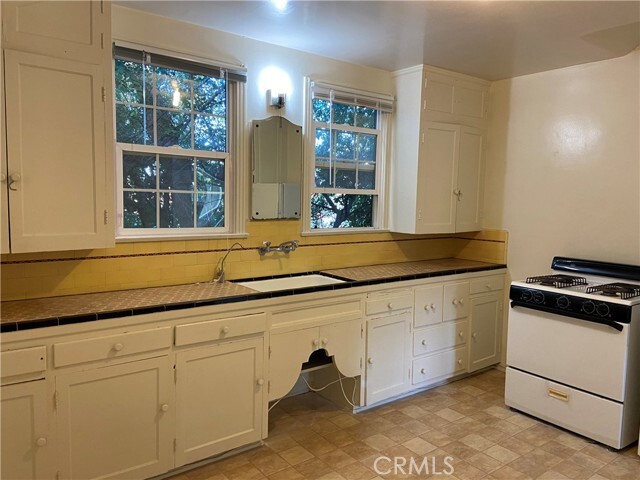
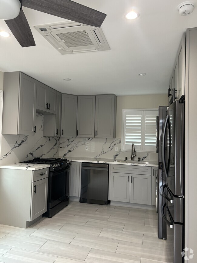
- Eat-In Kitchen
- Cooling System Mounted To A Wall/Window
- Tile Countertops
- Laundry Room
6956 San Gabriel Blvd

Favorites
About This Home
12 Month Lease,
$3,700 deposit,
Available Now
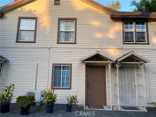
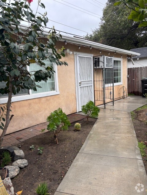
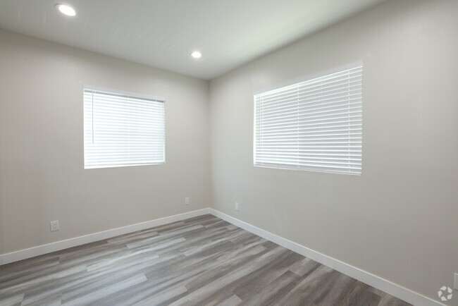
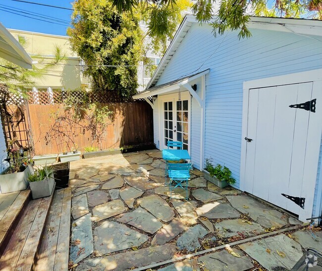
This is the only apartment units in San Marino school district. It's in the unincorporated LA County area with San Gabriel Address and San Marino School. It's a studio unit, Unit #1. Approximately 600 square feet including a big kitchen with eating area. It's the back house on the lot. It's located right South of the AT&T plaza which is at the S/E corner of the San Gabriel Blvd and Huntington Drive. It's also right next to San Marino Carver Elementary School. Water, trash and gardening services paid by the owner.
6956 San Gabriel Blvd is a house located in Los Angeles County and the 91775 ZIP Code. This area is served by the San Marino Unified attendance zone.
* Price shown is base rent and may not include non-optional fees and utilities.
Price, availability, fees, and any applicable rent special are subject to change without notice.
* Square footage definitions vary. Displayed square footage is approximate.
Home Details
Home Type
Single Family Detached Home
Year Built
Built in 1933
Accessible Home Design
Entry on the 1st floor
Bedrooms and Bathrooms
1 Full Bathroom
Home Design
Composition Roof
Interior Spaces
Art Studio
Fireplace
Carpet
Partially Furnished
600 Sq Ft Home
2-Story Property
Kitchen
Eat-In Kitchen
Tile Countertops
Laundry
Laundry Room
Listing and Financial Details
Security Deposit $3,700
12-Month Minimum Lease Term
Available 6/11/24
Legal Lot and Block 004 / 026
Tax Tract Number 5376
Rent includes gardener, trash collection, water
Lot Details
0.4 Acre Lot
Two or More Common Walls
Property is zoned R1
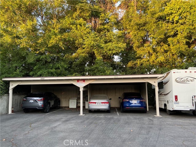
Parking
1 Carport Space
Assigned Parking
Parking Lot
Parking Available
1 Parking Space
Utilities
Cooling System Mounted To A Wall/Window
Wall Furnace
Community Details
Amenities
Laundry Facilities
Overview
5 Units
No Home Owners Association
Fees and Policies
The fees below are based on community-supplied data and may exclude additional fees and utilities.
- Parking
-
Covered--Assigned Parking
-
Other--Assigned Parking
Details
Utilities Included
-
Water
-
Trash Removal
Lease Options
-
12 Months
Property Information
-
Furnished Units Available
Contact
- Listed by YUNG (HELEN) LEE | HUNTINGTON PROP. & INV., INC.
- Phone Number
- Contact
-
Source
 California Regional Multiple Listing Service
Copyright 2025 © California Regional MLS. All rights reserved.
$2,045 / month
$360,000 Listing Price
2 Beds
•1 Baths
•
764 Sq Ft
$1,958 / month
$315,000 Listing Price
2 Beds
•1 Baths
•
773 Sq Ft
$1,870 / month
$325,000 Listing Price
1 Beds
•1 Baths
•
816 Sq Ft
Location
Get Directions
Amenities
- Air Conditioning
- Heating
- Fireplace
- Carpet
- Furnished
- Laundry Facilities
Expenses
Utilities Included
Water, Trash Removal
Included
Situated about ten miles northeast of Los Angeles, San Gabriel is a scenic suburb often regarded as the “Birthplace of the Los Angeles Region.” The city boasts a rich history dating back to the 1700s, when the Mission San Gabriel (known as the “Pride of the California Missions”) was founded.
San Gabriel’s historic roots are on display to this day, with the vibrant Mission District serving as the city’s hub of culture, art, and history. City Hall, the San Gabriel Mission Playhouse, and numerous well-maintained Spanish Colonial Revival style buildings are the cornerstones of the District. A host of diverse eateries, cafes, offices, shops, and museums—including the famed San Gabriel Mission—are also found in this vibrant downtown area.
Area residents enjoy a bevy of outdoor activities at Vincent Lugo Park, Smith Park, and San Gabriel Country Club.
Learn more about living in San Gabriel
Education
| Colleges & Universities | Distance | ||
|---|---|---|---|
| Colleges & Universities | Distance | ||
| Drive: | 6 min | 2.5 mi | |
| Drive: | 7 min | 3.2 mi | |
| Drive: | 8 min | 4.2 mi | |
| Drive: | 10 min | 4.5 mi |
6956 San Gabriel Blvd is within 6 minutes or 2.5 miles from Caltech. It is also near Pasadena City College and Fuller Theological Seminary.
Schools


Public Elementary School
Grades K-5
641 Students
Attendance Zone
Public Elementary School
Grades K-6
454 Students
Nearby
Public Middle School
Grades 6-8
627 Students
Attendance Zone
Public High School
Grades 9-12
806 Students
Attendance Zone
Private Elementary & Middle School
Grades K-8
178 Students
Nearby
Private Elementary, Middle & High School
Grades K-12
Nearby
School data provided by
 The GreatSchools Rating helps parents compare schools within a state based on a variety of school quality indicators and provides a helpful picture of how effectively each school serves all of its students. Ratings are on a scale of 1 (below average) to 10 (above average) and can include test scores, college readiness, academic progress, advanced courses, equity, discipline and attendance data. We also advise parents to visit schools, consider other information on school performance and programs, and consider family needs as part of the school selection process.
View GreatSchools Rating Methodology
View GreatSchools Rating Methodology
Transportation options available in San Gabriel include Sierra Madre Villa Station, located 3.6 miles from 6956 San Gabriel Blvd. 6956 San Gabriel Blvd is near Bob Hope, located 21.3 miles or 29 minutes away, and Long Beach (Daugherty Field), located 26.7 miles or 40 minutes away.
| Transit / Subway | Distance | ||
|---|---|---|---|
| Transit / Subway | Distance | ||
|
|
Drive: | 6 min | 3.6 mi |
|
|
Drive: | 7 min | 3.8 mi |
|
|
Drive: | 10 min | 4.0 mi |
|
|
Drive: | 10 min | 4.8 mi |
|
|
Drive: | 10 min | 5.8 mi |
| Commuter Rail | Distance | ||
|---|---|---|---|
| Commuter Rail | Distance | ||
|
|
Drive: | 13 min | 6.5 mi |
|
|
Drive: | 21 min | 10.1 mi |
|
|
Drive: | 20 min | 10.5 mi |
|
|
Drive: | 21 min | 12.0 mi |
| Drive: | 22 min | 15.8 mi |
| Airports | Distance | ||
|---|---|---|---|
| Airports | Distance | ||
|
Bob Hope
|
Drive: | 29 min | 21.3 mi |
|
Long Beach (Daugherty Field)
|
Drive: | 40 min | 26.7 mi |
Time and distance from 6956 San Gabriel Blvd.
| Shopping Centers | Distance | ||
|---|---|---|---|
| Shopping Centers | Distance | ||
| Walk: | 2 min | 0.1 mi | |
| Drive: | 2 min | 1.2 mi | |
| Drive: | 3 min | 1.6 mi |
6956 San Gabriel Blvd has 3 shopping centers within 1.6 miles, which is about a 3-minute walk. The miles and minutes will be for the farthest away property.
| Parks and Recreation | Distance | ||
|---|---|---|---|
| Parks and Recreation | Distance | ||
|
Huntington Botanical Gardens
|
Drive: | 6 min | 2.0 mi |
|
Los Angeles County Arboretum
|
Drive: | 6 min | 3.1 mi |
|
Eaton Canyon Nature Center
|
Drive: | 8 min | 4.0 mi |
|
Chilao Visitor Center
|
Drive: | 7 min | 4.8 mi |
|
Grassy Hollow Visitor Center
|
Drive: | 7 min | 4.8 mi |
6956 San Gabriel Blvd has 5 parks within 4.8 miles, including Huntington Botanical Gardens, Los Angeles County Arboretum, and Eaton Canyon Nature Center.
| Hospitals | Distance | ||
|---|---|---|---|
| Hospitals | Distance | ||
| Drive: | 2 min | 1.3 mi | |
| Drive: | 5 min | 2.3 mi | |
| Drive: | 6 min | 3.4 mi |
6956 San Gabriel Blvd has 3 hospitals within 3.4 miles, the nearest is Aurora Las Encinas Hospital which is 1.3 miles away and a 2 minute drive.
| Military Bases | Distance | ||
|---|---|---|---|
| Military Bases | Distance | ||
| Drive: | 41 min | 28.7 mi | |
| Drive: | 45 min | 30.3 mi |
6956 San Gabriel Blvd is 28.7 miles from Los Angeles Air Force Base, and is convenient to other military bases, including Los Alamitos Army Airfield.
You May Also Like
Similar Rentals Nearby
What Are Walk Score®, Transit Score®, and Bike Score® Ratings?
Walk Score® measures the walkability of any address. Transit Score® measures access to public transit. Bike Score® measures the bikeability of any address.
What is a Sound Score Rating?
A Sound Score Rating aggregates noise caused by vehicle traffic, airplane traffic and local sources

6956 San Gabriel Blvd
San Gabriel, CA 91775