702 Chestnut St
Vallejo, CA 94590
-
Bedrooms
3
-
Bathrooms
1
-
Square Feet
1,000 sq ft
-
Available
Available Now
Highlights
- Fireplace
- Fenced Lot
About This Home
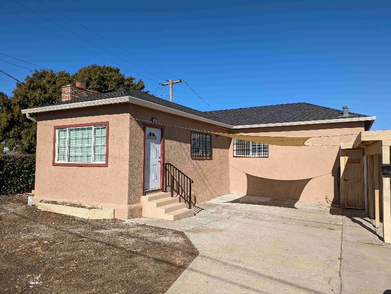
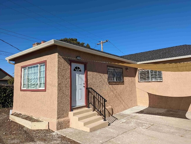
Property Id: 1729047 Recently Renovated, Move-In Ready - 3-bedroom, 1-bath, approximately 1,000 sqft house. Spacious bedrooms with high ceilings Laminated wood floors Heating, AC, and fireplace Updated kitchen with newer cabinets, granite countertops, and modern appliances Conveniently located near Highway 80 W, Downtown Vallejo, Marina, and SF Ferry Terminal Close to Curtola Park and Ride Station Laundry hook-ups available Relaxing patio with a cozy deck Covered carport and driveway parking for up to six cars Rent: $2,350/month Security Deposit: $2,350 Requirements to Move In: First month's rent and security deposit Tenant responsible for all utilities and services No eviction history Reference from current landlord Good credit history Proof of current employment and three months of pay stubs or Section 8 voucher
702 Chestnut St is a house located in Solano County and the 94590 ZIP Code. This area is served by the Vallejo City Unified attendance zone.
House Features
Washer/Dryer
Dishwasher
Microwave
Refrigerator
- Washer/Dryer
- Cable Ready
- Fireplace
- Dishwasher
- Disposal
- Microwave
- Oven
- Refrigerator
- Fenced Lot
Contact
- Listed by Alex brwon
- Phone Number (707) 563-1050
- Contact
-
Source

- Washer/Dryer
- Cable Ready
- Fireplace
- Dishwasher
- Disposal
- Microwave
- Oven
- Refrigerator
- Fenced Lot
Situated just south of Downtown Vallejo, South Vallejo is a quiet community in a central locale. Being predominantly residential, South Vallejo offers an array of apartments and houses available for rent along tranquil tree-lined streets. Many of South Vallejo’s rentals also boast scenic views thanks to the area’s hilly topography.
South Vallejo is home to Cal Maritime, making the community a popular choice for students, faculty, and staff seeking a rental close to campus. The community is also convenient to area attractions such as Benicia State Recreation Area, Mare Island Naval Shipyard, and Six Flags Discovery Kingdom. Commuting from South Vallejo is a breeze with access to Interstate 80 and the Alfred Zampa Memorial Bridge.
Learn more about living in South Vallejo| Colleges & Universities | Distance | ||
|---|---|---|---|
| Colleges & Universities | Distance | ||
| Drive: | 11 min | 4.9 mi | |
| Drive: | 18 min | 12.3 mi | |
| Drive: | 21 min | 13.5 mi | |
| Drive: | 20 min | 13.8 mi |
Transportation options available in Vallejo include El Cerrito Del Norte Station, located 15.4 miles from 702 Chestnut St. 702 Chestnut St is near Metro Oakland International, located 34.4 miles or 45 minutes away, and San Francisco International, located 42.0 miles or 57 minutes away.
| Transit / Subway | Distance | ||
|---|---|---|---|
| Transit / Subway | Distance | ||
|
|
Drive: | 21 min | 15.4 mi |
|
|
Drive: | 21 min | 15.6 mi |
|
|
Drive: | 23 min | 16.4 mi |
|
|
Drive: | 24 min | 16.9 mi |
|
|
Drive: | 23 min | 17.3 mi |
| Commuter Rail | Distance | ||
|---|---|---|---|
| Commuter Rail | Distance | ||
|
|
Drive: | 16 min | 11.4 mi |
|
|
Drive: | 23 min | 17.8 mi |
|
|
Drive: | 26 min | 20.0 mi |
| Drive: | 35 min | 24.0 mi | |
| Drive: | 36 min | 27.1 mi |
| Airports | Distance | ||
|---|---|---|---|
| Airports | Distance | ||
|
Metro Oakland International
|
Drive: | 45 min | 34.4 mi |
|
San Francisco International
|
Drive: | 57 min | 42.0 mi |
Time and distance from 702 Chestnut St.
| Shopping Centers | Distance | ||
|---|---|---|---|
| Shopping Centers | Distance | ||
| Drive: | 4 min | 1.6 mi | |
| Drive: | 4 min | 1.7 mi | |
| Drive: | 3 min | 1.7 mi |
| Parks and Recreation | Distance | ||
|---|---|---|---|
| Parks and Recreation | Distance | ||
|
Dan Foley Park
|
Drive: | 7 min | 3.6 mi |
|
Crockett Hills Regional Park
|
Drive: | 7 min | 4.1 mi |
|
Six Flags Discovery Kingdom
|
Drive: | 8 min | 4.1 mi |
|
Benicia State Recreation Area
|
Drive: | 8 min | 4.3 mi |
|
Carquinez Strait Regional Shoreline
|
Drive: | 12 min | 6.3 mi |
| Hospitals | Distance | ||
|---|---|---|---|
| Hospitals | Distance | ||
| Drive: | 4 min | 2.0 mi | |
| Drive: | 6 min | 2.9 mi | |
| Drive: | 7 min | 3.3 mi |
| Military Bases | Distance | ||
|---|---|---|---|
| Military Bases | Distance | ||
| Drive: | 10 min | 4.3 mi | |
| Drive: | 12 min | 8.1 mi |
You May Also Like
What Are Walk Score®, Transit Score®, and Bike Score® Ratings?
Walk Score® measures the walkability of any address. Transit Score® measures access to public transit. Bike Score® measures the bikeability of any address.
What is a Sound Score Rating?
A Sound Score Rating aggregates noise caused by vehicle traffic, airplane traffic and local sources


