
$4,500 / Month
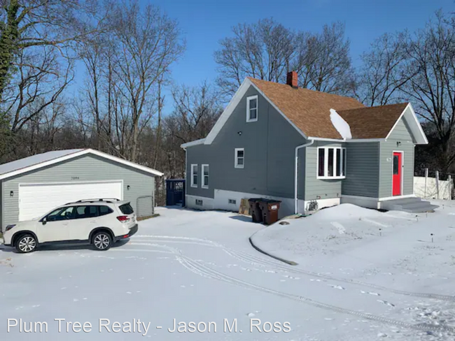
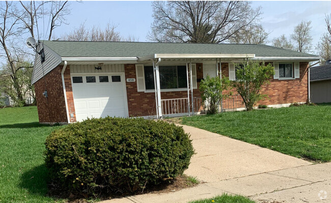
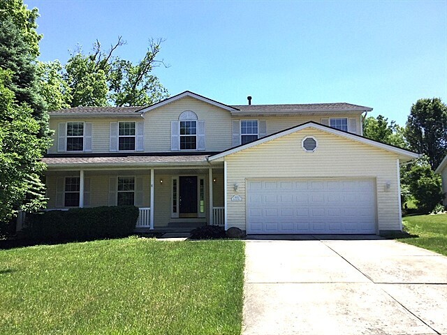
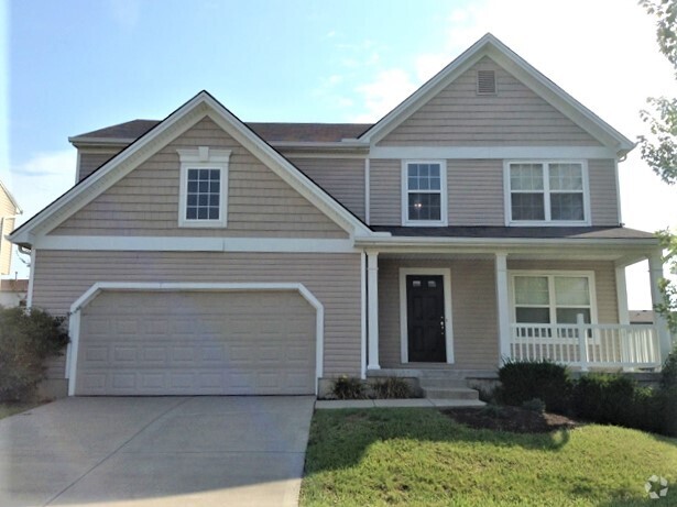
7086 Tylersville Rd
West Chester, OH 45067
2 Weeks Ago
Favorites
7086 Tylersville Rd

Favorites
Check Back Soon for Upcoming Availability
| Beds | Baths | Average SF |
|---|---|---|
| 4 Bedrooms 4 Bedrooms 4 Br | 2 Baths 2 Baths 2 Ba | 1,635 SF |
About This Property
(513) 800-1099 - Beautiful 4 BDR Home - Near I-75 - Bring the whole family to this great place with lots of room for fun, conveniently right off I-75. Downtown Cincinnati is only a 30 minute drive and Downtown Dayton is 35 minutes. (RLNE7280227)
7086 Tylersville Rd is a house located in Butler County and the 45067 ZIP Code. This area is served by the Lakota Local attendance zone.
Location
Get Directions
West Chester is a suburban township located about thirty minutes north of Cincinnati along Interstate 75. Most of the landscape is filled by residential neighborhoods, with several amenities including a shopping mall and a multiplex movie theater in the mix as well.
The northeast corner of town is home to most of the local retail and recreation options, with several shopping centers and restaurants neighboring the huge Voice of America MetroPark and Wetherington Golf-Country Club. The close proximity to Cincinnati, the terrific amenities, and the high-performing schools combine to make West Chester a popular spot for commuters and families to settle down.
Learn more about living in West Chester
Education
| Colleges & Universities | Distance | ||
|---|---|---|---|
| Colleges & Universities | Distance | ||
| Drive: | 18 min | 10.6 mi | |
| Drive: | 24 min | 13.1 mi | |
| Drive: | 21 min | 13.1 mi | |
| Drive: | 23 min | 14.7 mi |
7086 Tylersville Rd is within 18 minutes or 10.6 miles from Cincinnati State, WDC. It is also near Univ. of Cincinnati, Blue Ash and Miami University Hamilton.
Schools


Public Elementary School
Grades PK-2
2,085 Students
Nearby
Public Elementary School
Grades PK-2
486 Students
Nearby
Public Elementary School
Grades K-2
728 Students
Attendance Zone
Public Elementary School
Grades 3-6
631 Students
Attendance Zone
Public Middle School
Grades 7-8
506 Students
Attendance Zone
Public High School
Grades 9-12
2,552 Students
Attendance Zone
Private Elementary, Middle & High School
Grades PK-12
154 Students
Nearby
Private Elementary & Middle School
Grades PK-8
174 Students
Nearby
School data provided by
 The GreatSchools Rating helps parents compare schools within a state based on a variety of school quality indicators and provides a helpful picture of how effectively each school serves all of its students. Ratings are on a scale of 1 (below average) to 10 (above average) and can include test scores, college readiness, academic progress, advanced courses, equity, discipline and attendance data. We also advise parents to visit schools, consider other information on school performance and programs, and consider family needs as part of the school selection process.
View GreatSchools Rating Methodology
View GreatSchools Rating Methodology
Transportation options available in West Chester include Brewery District Station, Elm & Henry, located 21.4 miles from 7086 Tylersville Rd. 7086 Tylersville Rd is near Cincinnati/Northern Kentucky International, located 35.3 miles or 55 minutes away.
| Transit / Subway | Distance | ||
|---|---|---|---|
| Transit / Subway | Distance | ||
| Drive: | 31 min | 21.4 mi | |
| Drive: | 31 min | 21.4 mi | |
| Drive: | 31 min | 21.5 mi | |
| Drive: | 32 min | 21.6 mi | |
| Drive: | 32 min | 21.7 mi |
| Commuter Rail | Distance | ||
|---|---|---|---|
| Commuter Rail | Distance | ||
|
|
Drive: | 30 min | 21.3 mi |
| Airports | Distance | ||
|---|---|---|---|
| Airports | Distance | ||
|
Cincinnati/Northern Kentucky International
|
Drive: | 55 min | 35.3 mi |
Time and distance from 7086 Tylersville Rd.
| Shopping Centers | Distance | ||
|---|---|---|---|
| Shopping Centers | Distance | ||
| Walk: | 8 min | 0.5 mi | |
| Walk: | 10 min | 0.5 mi | |
| Walk: | 12 min | 0.6 mi |
7086 Tylersville Rd has 3 shopping centers within 0.6 mile, which is about a 12-minute walk. The miles and minutes will be for the farthest away property.
| Parks and Recreation | Distance | ||
|---|---|---|---|
| Parks and Recreation | Distance | ||
|
Voice of America MetroPark
|
Drive: | 5 min | 2.6 mi |
|
Liberty Park
|
Drive: | 7 min | 2.7 mi |
|
Wilhelmina Park
|
Drive: | 9 min | 3.3 mi |
|
Keehner Park
|
Drive: | 8 min | 3.4 mi |
|
Maud Hughes Incline Park
|
Drive: | 13 min | 7.4 mi |
7086 Tylersville Rd has 5 parks within 7.4 miles, including Maud Hughes Incline Park, Voice of America MetroPark, and Liberty Park.
| Hospitals | Distance | ||
|---|---|---|---|
| Hospitals | Distance | ||
| Drive: | 5 min | 1.6 mi | |
| Drive: | 11 min | 5.8 mi | |
| Drive: | 11 min | 6.0 mi |
7086 Tylersville Rd has 3 hospitals within 6.0 miles, the nearest is West Chester Hospital which is 1.6 miles away and a 5 minute drive.
| Military Bases | Distance | ||
|---|---|---|---|
| Military Bases | Distance | ||
| Drive: | 44 min | 33.6 mi | |
| Drive: | 50 min | 38.6 mi | |
| Drive: | 52 min | 41.9 mi |
7086 Tylersville Rd has 3 military bases within 41.9 miles, the nearest is Gentile Air Force Station which is 33.6 miles away and a 44 minute drive.
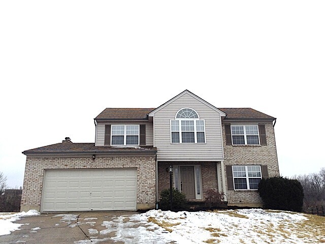
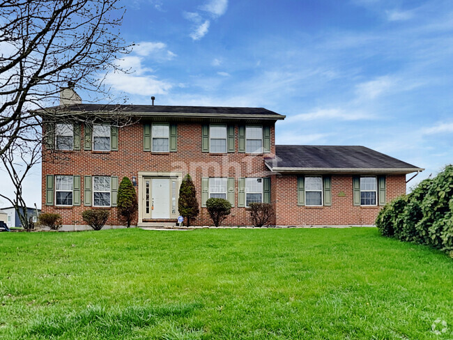
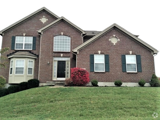
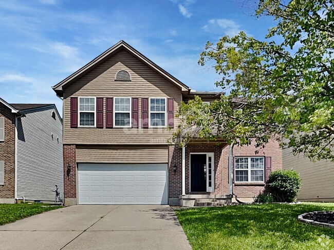
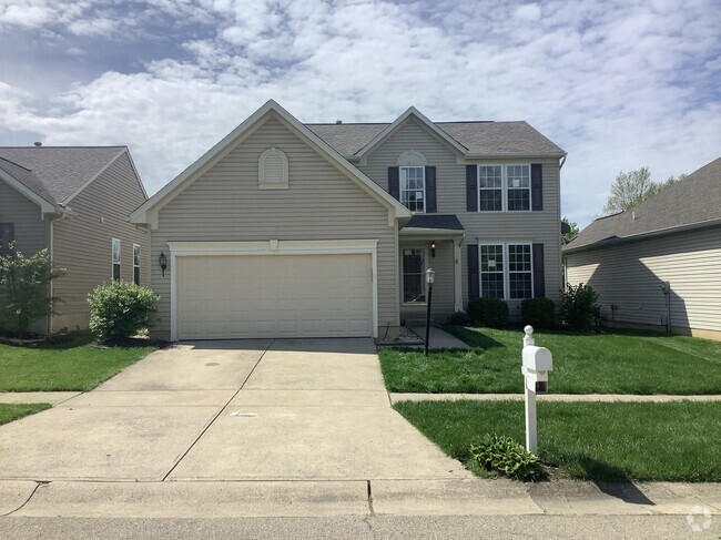
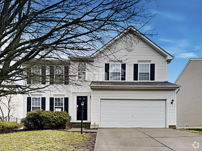
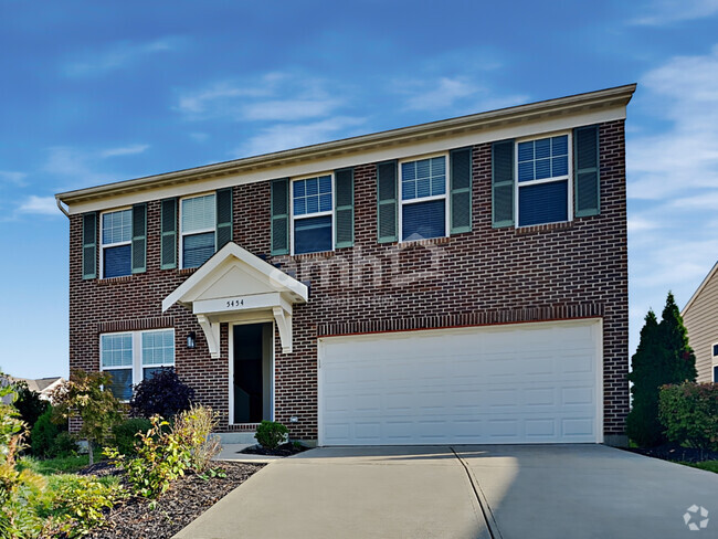
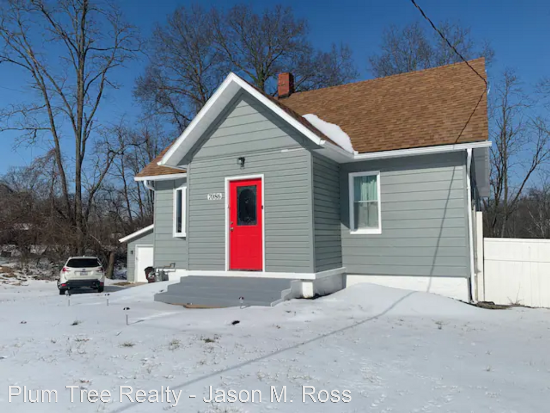
You May Also Like
Similar Rentals Nearby
-
-
-
 $2,7954 Beds, 2.5 Baths, 2,317 sq ftHouse for Rent
 -
-
-
-
-
-
-
What Are Walk Score®, Transit Score®, and Bike Score® Ratings?
Walk Score® measures the walkability of any address. Transit Score® measures access to public transit. Bike Score® measures the bikeability of any address.
What is a Sound Score Rating?
A Sound Score Rating aggregates noise caused by vehicle traffic, airplane traffic and local sources
7086 Tylersville Rd
West Chester, OH 45067