71 Mayfield St Unit 2
Boston, MA 02125
-
Bedrooms
3
-
Bathrooms
1
-
Square Feet
1,200 sq ft
-
Available
Available Now
Highlight
- Basement

About This Home
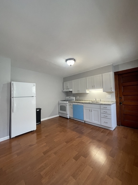
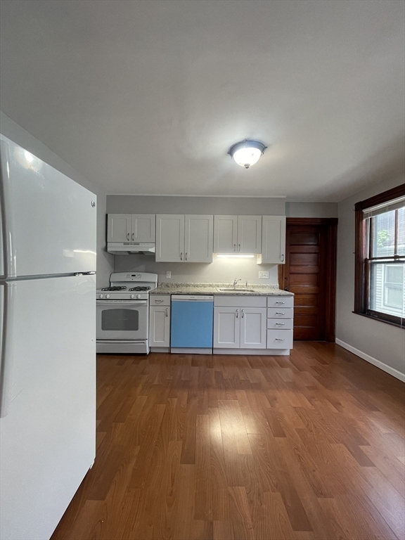
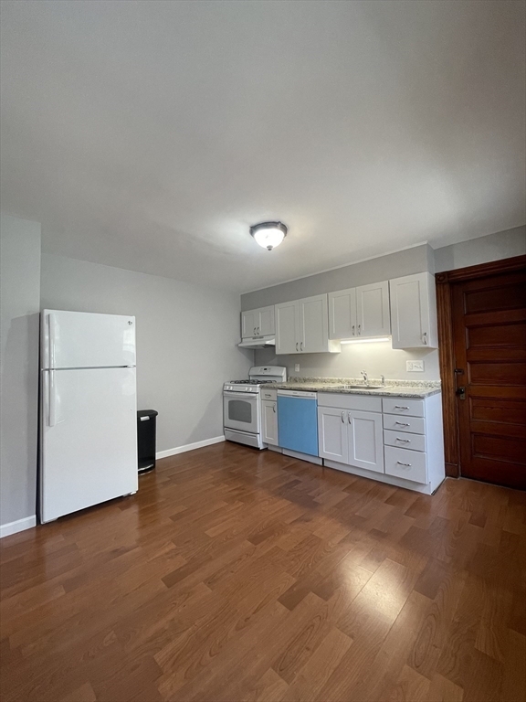
A chance to live in the perfect blend of space and convenience in this over-sized three-bedroom+, bi-level unit located in the heart of Savin Hill, Dorchester's most sought-after neighborhood. Situated just a short distance from both the JFK & Savin Hill T stops, this location makes commuting into the city a breeze. Easy access to 93 North/South. Close to nearby local eateries such as Harp & Bard, Banshee, SBK, and McKennas. Multiple grocery stores nearby as well. This expansive unit offers generous living areas, ideal for those who simply enjoy a little extra room. Hardwood throughout. Elongated front porch off of living area. Washer/Dryer hook-up in basement. Full-sized eat-in kitchen, formal dining/living, along with ample storage space. Bedrooms located on upper level of living, allowing for the perfect set-up for entertaining gatherings, holidays, etc. on the lower living level. Vacant and easy to show. Video walkthrough available. Email/text listing agent.
71 Mayfield St is a condo located in Suffolk County and the 02125 ZIP Code. This area is served by the Boston Public Schools attendance zone.
Condo Features
- Washer/Dryer Hookup
- Eat-in Kitchen
- Basement
- Storage Space
- Porch
Fees and Policies
The fees below are based on community-supplied data and may exclude additional fees and utilities.
- One-Time Move-In Fees
-
Broker Fee$0
Contact
- Contact
People love living in Dorchester, and the Uphams Corner-Jones Hill section is no exception. Just a couple of blocks west of the University of Massachusetts Boston, Upham's Corner is a historic neighborhood located in Dorchester, roughly three miles south of Downtown Boston. The neighborhood is mostly residential, full of big, beautiful houses and several lush public parks. The northwest corner of the neighborhood contains a cluster of shops, cafes, and other businesses, as well as the Strand Theatre, a historic, beautifully restored performing arts venue.
Upham's Corner contains the oldest house in Boston, the James Blake House, built in 1661. It is also the location of the Dorchester North Burying Ground, dating back to 1633 and containing some of Dorchester's most famous founding citizens, including William Stoughton -- the Chief Justice during the Salem witch trials of 1692. This burial ground also contains 40 unknown Revolutionary War soldiers.
Learn more about living in Uphams Corner| Colleges & Universities | Distance | ||
|---|---|---|---|
| Colleges & Universities | Distance | ||
| Drive: | 5 min | 1.7 mi | |
| Drive: | 6 min | 2.7 mi | |
| Drive: | 6 min | 2.9 mi | |
| Drive: | 7 min | 3.1 mi |
 The GreatSchools Rating helps parents compare schools within a state based on a variety of school quality indicators and provides a helpful picture of how effectively each school serves all of its students. Ratings are on a scale of 1 (below average) to 10 (above average) and can include test scores, college readiness, academic progress, advanced courses, equity, discipline and attendance data. We also advise parents to visit schools, consider other information on school performance and programs, and consider family needs as part of the school selection process.
View GreatSchools Rating Methodology
Transportation options available in Boston include Andrew Station, located 1.1 miles from 71 Mayfield St Unit 2. 71 Mayfield St Unit 2 is near General Edward Lawrence Logan International, located 6.0 miles or 12 minutes away.
| Transit / Subway | Distance | ||
|---|---|---|---|
| Transit / Subway | Distance | ||
|
|
Drive: | 2 min | 1.1 mi |
|
|
Drive: | 2 min | 1.4 mi |
|
|
Drive: | 3 min | 1.4 mi |
|
|
Drive: | 5 min | 2.0 mi |
|
|
Drive: | 4 min | 2.1 mi |
| Commuter Rail | Distance | ||
|---|---|---|---|
| Commuter Rail | Distance | ||
|
|
Walk: | 12 min | 0.7 mi |
|
|
Walk: | 13 min | 0.7 mi |
| Walk: | 18 min | 0.9 mi | |
| Drive: | 4 min | 1.7 mi | |
| Drive: | 6 min | 3.1 mi |
| Airports | Distance | ||
|---|---|---|---|
| Airports | Distance | ||
|
General Edward Lawrence Logan International
|
Drive: | 12 min | 6.0 mi |
Time and distance from 71 Mayfield St Unit 2.
| Shopping Centers | Distance | ||
|---|---|---|---|
| Shopping Centers | Distance | ||
| Walk: | 16 min | 0.9 mi | |
| Walk: | 17 min | 0.9 mi | |
| Drive: | 4 min | 1.7 mi |
| Parks and Recreation | Distance | ||
|---|---|---|---|
| Parks and Recreation | Distance | ||
|
Dorchester Shores Reservation
|
Drive: | 3 min | 1.4 mi |
|
Lower Neponset River Trail
|
Drive: | 4 min | 1.9 mi |
|
Franklin Park Zoo
|
Drive: | 4 min | 2.0 mi |
|
Roxbury Heritage State Park
|
Drive: | 5 min | 2.2 mi |
|
Squantum Point Park
|
Drive: | 12 min | 4.6 mi |
| Hospitals | Distance | ||
|---|---|---|---|
| Hospitals | Distance | ||
| Drive: | 3 min | 1.7 mi | |
| Drive: | 4 min | 1.9 mi | |
| Drive: | 6 min | 2.8 mi |
- Washer/Dryer Hookup
- Eat-in Kitchen
- Basement
- Storage Space
- Porch
71 Mayfield St Unit 2 Photos
What Are Walk Score®, Transit Score®, and Bike Score® Ratings?
Walk Score® measures the walkability of any address. Transit Score® measures access to public transit. Bike Score® measures the bikeability of any address.
What is a Sound Score Rating?
A Sound Score Rating aggregates noise caused by vehicle traffic, airplane traffic and local sources


