
Check Back Soon for Upcoming Availability
| Beds | Baths | Average SF |
|---|---|---|
| 2 Bedrooms 2 Bedrooms 2 Br | 1 Bath 1 Bath 1 Ba | — |
About This Property
PETS) there will be a $500.00 non refundable security plus $50.00 per month if there is a pet.
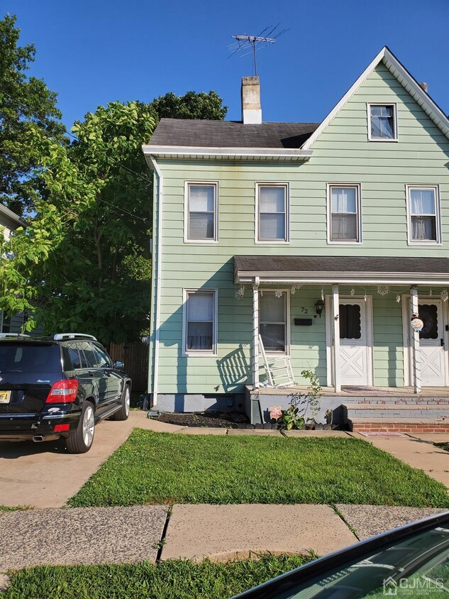
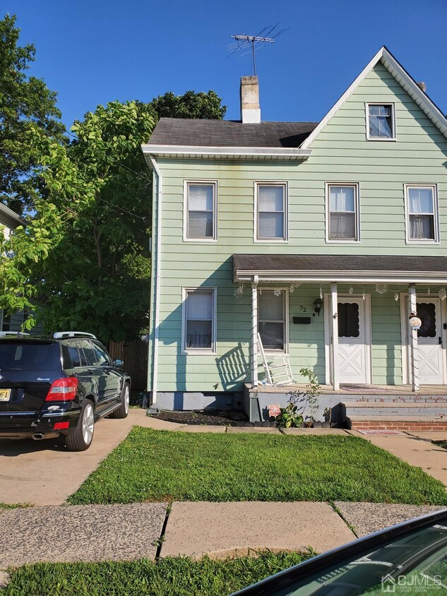
72 Ford Ave is an apartment community located in Middlesex County and the 08850 ZIP Code.
Features
Hardwood Floors
Tile Floors
Basement
Dining Room
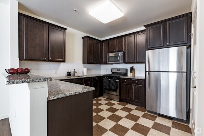
- Kitchen
- Hardwood Floors
- Tile Floors
- Vinyl Flooring
- Dining Room
- Basement
- Attic
- Storage Space
- Fenced Lot
- Yard
Fees and Policies
Details
Lease Options
-
12 Months
 This Property
 Available Property
Residents of the Turnpike West area near South Brunswick, Dayton and Monmouth Junction enjoy a high standard of living. Residents enjoy professional careers with a handful of high-profile employers in the area, including nearby Rutgers University, Princeton and a handful of tech companies.
Head approximately 48 miles south-southwest of the New Jersey city center to an area populated with woodlands, wetlands and many undeveloped plots. Dotted among this rural landscape are schools and libraries that complement the nearby universities and help establish the area as one focused on education and higher learning.
Learn more about living in Turnpike WestBelow are rent ranges for similar nearby apartments
| Beds | Average Size | Lowest | Typical | Premium |
|---|---|---|---|---|
| Studio Studio Studio | 463-486 Sq Ft | $1,100 | $1,884 | $2,611 |
| 1 Bed 1 Bed 1 Bed | 791-797 Sq Ft | $754 | $2,124 | $3,501 |
| 2 Beds 2 Beds 2 Beds | 1081-1086 Sq Ft | $860 | $2,699 | $27,500 |
| 3 Beds 3 Beds 3 Beds | 1678-1705 Sq Ft | $1,033 | $3,160 | $5,441 |
| 4 Beds 4 Beds 4 Beds | 2340 Sq Ft | $2,900 | $4,385 | $7,117 |
- Kitchen
- Hardwood Floors
- Tile Floors
- Vinyl Flooring
- Dining Room
- Basement
- Attic
- Storage Space
- Fenced Lot
- Yard
| Colleges & Universities | Distance | ||
|---|---|---|---|
| Colleges & Universities | Distance | ||
| Drive: | 9 min | 4.3 mi | |
| Drive: | 13 min | 5.3 mi | |
| Drive: | 14 min | 6.0 mi | |
| Drive: | 16 min | 7.4 mi |
Transportation options available in Milltown include 8Th Street Light Rail Station, located 25.8 miles from 72 Ford Ave Unit 1. 72 Ford Ave Unit 1 is near Trenton Mercer, located 28.6 miles or 41 minutes away, and Newark Liberty International, located 29.7 miles or 39 minutes away.
| Transit / Subway | Distance | ||
|---|---|---|---|
| Transit / Subway | Distance | ||
| Drive: | 40 min | 25.8 mi | |
|
|
Drive: | 37 min | 26.2 mi |
|
|
Drive: | 38 min | 26.5 mi |
|
|
Drive: | 41 min | 27.0 mi |
|
|
Drive: | 41 min | 30.5 mi |
| Commuter Rail | Distance | ||
|---|---|---|---|
| Commuter Rail | Distance | ||
|
|
Drive: | 13 min | 4.2 mi |
|
|
Drive: | 10 min | 4.8 mi |
|
|
Drive: | 12 min | 6.5 mi |
|
|
Drive: | 15 min | 9.0 mi |
|
|
Drive: | 24 min | 14.5 mi |
| Airports | Distance | ||
|---|---|---|---|
| Airports | Distance | ||
|
Trenton Mercer
|
Drive: | 41 min | 28.6 mi |
|
Newark Liberty International
|
Drive: | 39 min | 29.7 mi |
Time and distance from 72 Ford Ave Unit 1.
| Shopping Centers | Distance | ||
|---|---|---|---|
| Shopping Centers | Distance | ||
| Drive: | 5 min | 1.7 mi | |
| Drive: | 5 min | 2.0 mi | |
| Drive: | 6 min | 2.2 mi |
| Parks and Recreation | Distance | ||
|---|---|---|---|
| Parks and Recreation | Distance | ||
|
Giamarese Farm
|
Drive: | 5 min | 2.1 mi |
|
Rutgers Gardens
|
Drive: | 8 min | 2.6 mi |
|
Beekman Road
|
Drive: | 9 min | 4.2 mi |
|
Ireland Brook Conservation Area
|
Drive: | 10 min | 4.5 mi |
|
Davidson's Mill Pond Park
|
Drive: | 17 min | 7.2 mi |
| Hospitals | Distance | ||
|---|---|---|---|
| Hospitals | Distance | ||
| Drive: | 11 min | 5.1 mi | |
| Drive: | 12 min | 5.4 mi | |
| Drive: | 18 min | 11.3 mi |
| Military Bases | Distance | ||
|---|---|---|---|
| Military Bases | Distance | ||
| Drive: | 33 min | 19.5 mi | |
| Drive: | 31 min | 19.9 mi |
You May Also Like
Similar Rentals Nearby
What Are Walk Score®, Transit Score®, and Bike Score® Ratings?
Walk Score® measures the walkability of any address. Transit Score® measures access to public transit. Bike Score® measures the bikeability of any address.
What is a Sound Score Rating?
A Sound Score Rating aggregates noise caused by vehicle traffic, airplane traffic and local sources
