
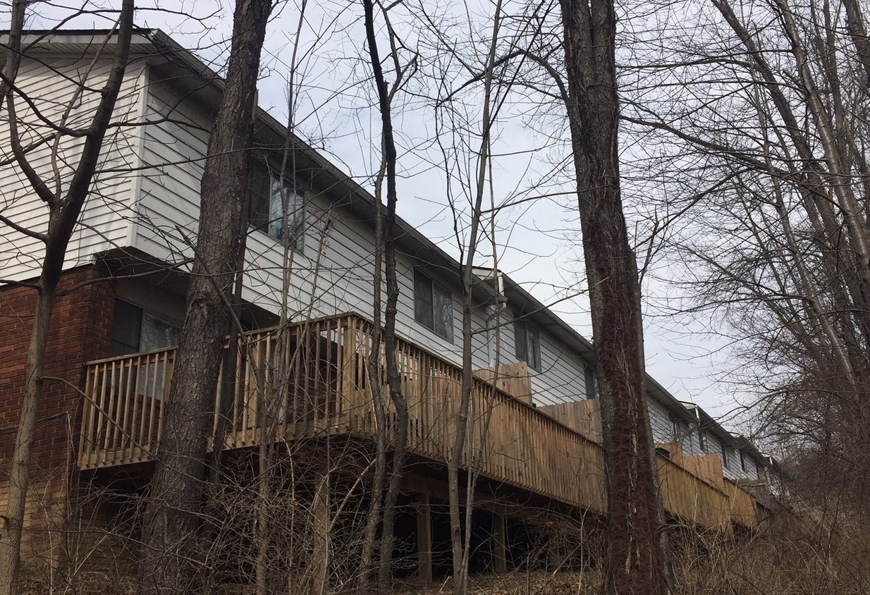
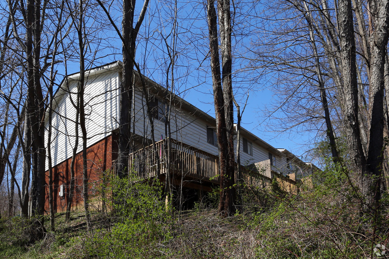
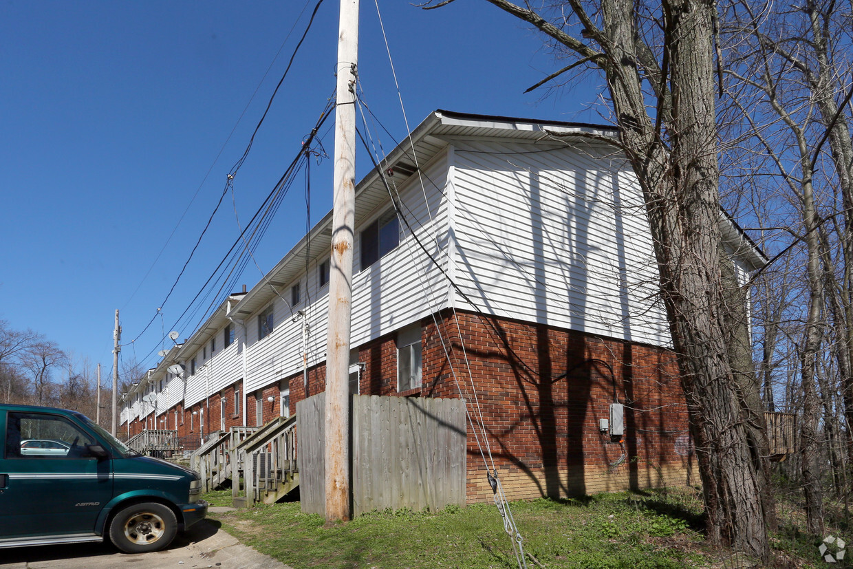
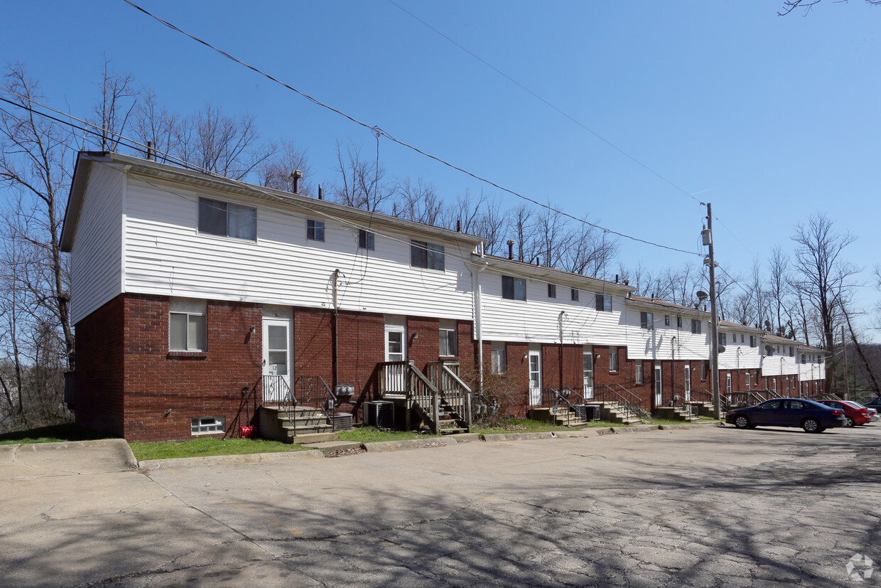
72 S Thomas Rd
72 S Thomas Rd,
Tallmadge,
OH
44278
2 Weeks Ago
Favorites
72 S Thomas Rd
Favorites
Check Back Soon for Upcoming Availability
| Beds | Baths | Average SF | Availability |
|---|---|---|---|
| 2 Bedrooms 2 Bedrooms 2 Br | 1.5 Baths 1.5 Baths 1.5 Ba | 1,000 SF | Not Available |
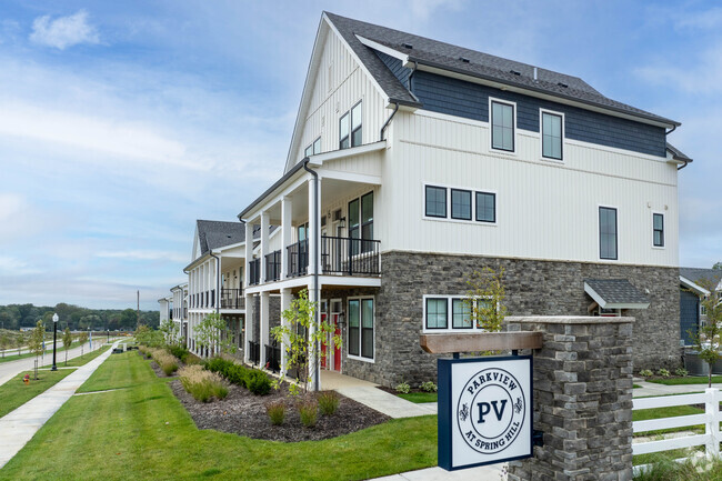
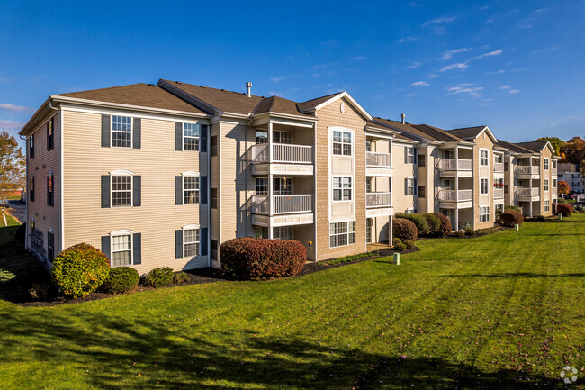
About 72 S Thomas Rd Tallmadge, OH 44278
Discover your next place at 72 S Thomas Rd. This community can be found in the 44278 area of Tallmadge. The leasing staff is ready for you to come by for a visit. Make sure you to view the available floorplans. Drop by the leasing office to schedule a tour.
72 S Thomas Rd is an apartment community located in Summit County and the 44278 ZIP Code. This area is served by the Tallmadge City attendance zone.
Fees and Policies
Details
Property Information
-
12 units/2 stories
Location
Get Directions
About an hour south of Cleveland, Tallmadge is a small suburban city on the northeast corner of Akron. The eight main roads through the community converge at the Tallmadge Town Square Historic District, a small park at the center of the city containing the Old Town Hall history museum and a beautifully preserved church built in 1825. The close proximity to both Akron and Cleveland has made Tallmadge a popular location for commuters, and the terrific local schools boost the appeal for folks raising families.
Learn more about living in Tallmadge
Education
| Colleges & Universities | Distance | ||
|---|---|---|---|
| Colleges & Universities | Distance | ||
| Drive: | 12 min | 4.4 mi | |
| Drive: | 18 min | 8.4 mi | |
| Drive: | 29 min | 19.9 mi | |
| Drive: | 31 min | 20.4 mi |
72 S Thomas Rd is within 12 minutes or 4.4 miles from University of Akron. It is also near Kent State University and Stark State College.
Schools


Public Elementary School
Grades K-5
1,105 Students
Attendance Zone
Public Elementary School
Grades PK-4
353 Students
Nearby
Public Middle School
Grades 6-8
559 Students
Attendance Zone
Public High School
Grades 9-12
800 Students
Attendance Zone
Private Elementary, Middle & High School
Grades 4-12
85 Students
Nearby
Private Elementary School
Grades PK-5
120 Students
Nearby
Private Middle School
Grades 6-8
121 Students
Nearby
School data provided by
 The GreatSchools Rating helps parents compare schools within a state based on a variety of school quality indicators and provides a helpful picture of how effectively each school serves all of its students. Ratings are on a scale of 1 (below average) to 10 (above average) and can include test scores, college readiness, academic progress, advanced courses, equity, discipline and attendance data. We also advise parents to visit schools, consider other information on school performance and programs, and consider family needs as part of the school selection process.
View GreatSchools Rating Methodology
View GreatSchools Rating Methodology
Transportation options available in Tallmadge include Warrensville (Blue Line), located 27.9 miles from 72 S Thomas Rd. 72 S Thomas Rd is near Akron-Canton Regional, located 16.8 miles or 25 minutes away, and Cleveland-Hopkins International, located 40.1 miles or 58 minutes away.
| Transit / Subway | Distance | ||
|---|---|---|---|
| Transit / Subway | Distance | ||
|
|
Drive: | 41 min | 27.9 mi |
|
|
Drive: | 42 min | 28.5 mi |
|
|
Drive: | 42 min | 28.7 mi |
|
|
Drive: | 42 min | 28.8 mi |
|
|
Drive: | 42 min | 29.1 mi |
| Commuter Rail | Distance | ||
|---|---|---|---|
| Commuter Rail | Distance | ||
| Drive: | 9 min | 3.6 mi | |
| Drive: | 16 min | 6.4 mi | |
| Drive: | 22 min | 9.5 mi | |
| Drive: | 23 min | 13.7 mi | |
| Drive: | 28 min | 14.4 mi |
| Airports | Distance | ||
|---|---|---|---|
| Airports | Distance | ||
|
Akron-Canton Regional
|
Drive: | 25 min | 16.8 mi |
|
Cleveland-Hopkins International
|
Drive: | 58 min | 40.1 mi |
Time and distance from 72 S Thomas Rd.
| Shopping Centers | Distance | ||
|---|---|---|---|
| Shopping Centers | Distance | ||
| Walk: | 11 min | 0.6 mi | |
| Walk: | 11 min | 0.6 mi | |
| Walk: | 14 min | 0.7 mi |
72 S Thomas Rd has 3 shopping centers within 0.7 mile, which is about a 14-minute walk. The miles and minutes will be for the farthest away property.
| Parks and Recreation | Distance | ||
|---|---|---|---|
| Parks and Recreation | Distance | ||
|
Goodyear Heights Metro Park
|
Drive: | 8 min | 3.1 mi |
|
Gorge Metro Park
|
Drive: | 10 min | 3.8 mi |
|
Cascade Valley Metro Park - South
|
Drive: | 11 min | 4.3 mi |
|
Munroe Falls Metro Park
|
Drive: | 15 min | 5.2 mi |
|
Cascade Valley Metro Park - North
|
Drive: | 15 min | 6.1 mi |
72 S Thomas Rd has 5 parks within 6.1 miles, including Goodyear Heights Metro Park, Gorge Metro Park, and Cascade Valley Metro Park - South.
| Hospitals | Distance | ||
|---|---|---|---|
| Hospitals | Distance | ||
| Drive: | 8 min | 3.2 mi | |
| Drive: | 8 min | 3.3 mi | |
| Drive: | 11 min | 4.7 mi |
72 S Thomas Rd has 3 hospitals within 4.7 miles, the nearest is Crystal Clinic Orthopaedic Center which is 3.2 miles away and a 8 minute drive.
| Military Bases | Distance | ||
|---|---|---|---|
| Military Bases | Distance | ||
| Drive: | 89 min | 70.4 mi |
72 S Thomas Rd is 70.4 miles and a 89 minute drive from Mansfield Lahm Airport Air Guard Station.
You May Also Like
Similar Rentals Nearby


What Are Walk Score®, Transit Score®, and Bike Score® Ratings?
Walk Score® measures the walkability of any address. Transit Score® measures access to public transit. Bike Score® measures the bikeability of any address.
What is a Sound Score Rating?
A Sound Score Rating aggregates noise caused by vehicle traffic, airplane traffic and local sources
72 S Thomas Rd
Tallmadge, OH 44278
Responded To This Review