-
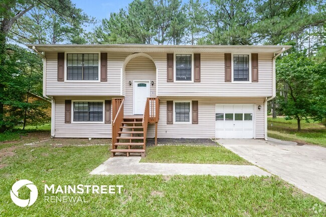
Beautiful 4 bedroom Townehome for rent

-
-
-
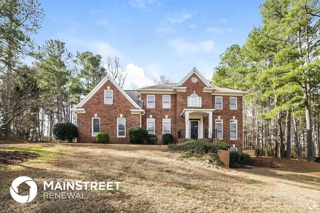
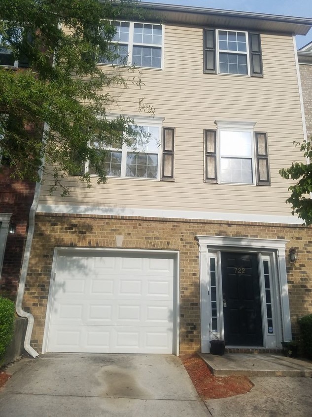
722 Celeste Ln SW
722 Celeste Ln SW,
Atlanta,
GA
30331
Favorites

722 Celeste Ln SW
Favorites
Check Back Soon for Upcoming Availability
| Beds | Baths | Average SF |
|---|---|---|
| 4 Bedrooms 4 Bedrooms 4 Br | 3.5 Baths 3.5 Baths 3.5 Ba | — |
About This Property
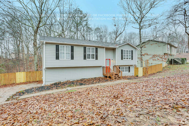
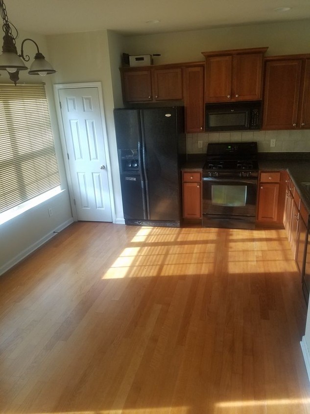
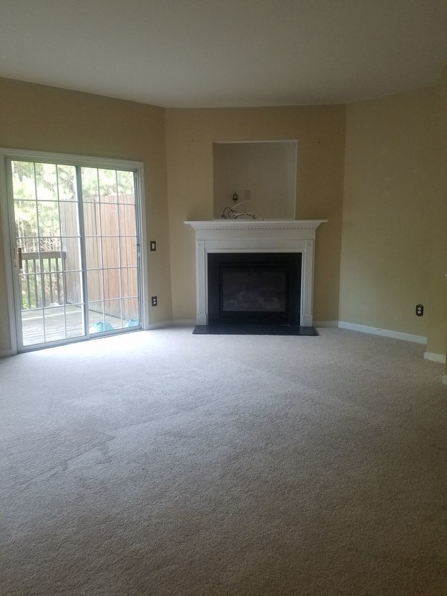
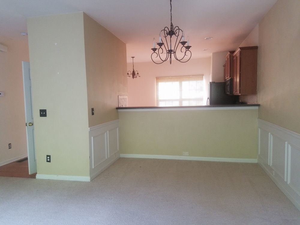
THIS MULTI-LEVEL TOWNHOUSE W/ONE CAR GARAGE IS LOCATED ON LOT HAS 4BDRMS 3.5BATH. SEPARATE LIVING/DINING AND BREAKFAST AREA /BAR PANTRY FIREPLACE IN THE LIVING RM WALK OUT BALCONY IN A GATED COMMUNITY THAT OFFERS WOODEN DECK CLUBHOUSE FOR FAMILY ENJOYMENT. W2W CARPETING ENTRANCE FOYER WALK IN CLOSETS. DOUBLE VANITY. CONVENIENT TO MARTA AND SHOPPING.
722 Celeste Ln SW is a house located in Fulton County and the 30331 ZIP Code. This area is served by the Atlanta Public Schools attendance zone.
Fees and Policies
The fees below are based on community-supplied data and may exclude additional fees and utilities.
- Parking
-
Garage--
Property Address:
722 Celeste Ln SW,
Atlanta,
GA
30331
 This Property
 Available Property
Despite being incorporated only two years ago, South Fulton has already developed a character all its own. Situated partly along the southern section of the Perimeter and stretching southwest over Chattahoochee Hills, South Fulton covers a large portion of residential and undeveloped land. This sprawling area is made up of a number of characterful neighborhoods, all offering access to ATL at a more affordable price.
South Fulton’s entire western border is formed by the Chattahoochee, making it a perfect place for the outdoor-inclined to settle. There’s also plenty of parks and shopping centers to keep residents entertained. Hartsfield-Jackson airport sits on the eastern edge of South Fulton, so if you travel for work but want more space than the city would provide, look no further.
Learn more about living in South FultonBelow are rent ranges for similar nearby apartments
Education
| Colleges & Universities | Distance | ||
|---|---|---|---|
| Colleges & Universities | Distance | ||
| Drive: | 15 min | 7.1 mi | |
| Drive: | 15 min | 7.3 mi | |
| Drive: | 15 min | 7.3 mi | |
| Drive: | 16 min | 7.5 mi |
722 Celeste Ln SW is within 15 minutes or 7.3 miles from Morehouse College. It is also near Clark Atlanta University and Morehouse School of Medicine.
Schools
Public Elementary School
Grades PK-5
516 Students
Attendance Zone
3
Out of 10
Public Middle School
Grades 6-8
747 Students
Attendance Zone
3
Out of 10
Public High School
Grades 9-12
1,337 Students
Attendance Zone
2
Out of 10
Private Elementary & Middle School
Grades PK-8
Nearby
Private Elementary School
Grades PK-5
Nearby
Private Elementary School
Grades PK-3
14 Students
Nearby
Private High School
Grades 9-12
75 Students
Nearby
School data provided by
GreatSchools
The GreatSchools Rating helps parents compare schools within a state based on a variety of school quality indicators and provides a helpful picture of how effectively each school serves all of its students. Ratings are on a scale of 1 (below average) to 10 (above average) and can include test scores, college readiness, academic progress, advanced courses, equity, discipline and attendance data. We also advise parents to visit schools, consider other information on school performance and programs, and consider family needs as part of the school selection process.
Transportation options available in Atlanta include Hamilton E Holmes, located 3.4 miles from 722 Celeste Ln SW. 722 Celeste Ln SW is near Hartsfield - Jackson Atlanta International, located 16.1 miles or 25 minutes away.
| Transit / Subway | Distance | ||
|---|---|---|---|
| Transit / Subway | Distance | ||
|
|
Drive: | 8 min | 3.4 mi |
|
|
Drive: | 10 min | 5.0 mi |
|
|
Drive: | 14 min | 6.0 mi |
|
|
Drive: | 13 min | 6.6 mi |
|
|
Drive: | 15 min | 7.1 mi |
| Commuter Rail | Distance | ||
|---|---|---|---|
| Commuter Rail | Distance | ||
|
|
Drive: | 23 min | 11.5 mi |
| Airports | Distance | ||
|---|---|---|---|
| Airports | Distance | ||
|
Hartsfield - Jackson Atlanta International
|
Drive: | 25 min | 16.1 mi |
Time and distance from 722 Celeste Ln SW.
| Shopping Centers | Distance | ||
|---|---|---|---|
| Shopping Centers | Distance | ||
| Drive: | 4 min | 1.6 mi | |
| Drive: | 6 min | 1.7 mi | |
| Drive: | 5 min | 1.9 mi |
722 Celeste Ln SW has 3 shopping centers within 1.9 miles, which is about a 5-minute drive. The miles and minutes will be for the farthest away property.
| Parks and Recreation | Distance | ||
|---|---|---|---|
| Parks and Recreation | Distance | ||
|
Cascade Springs Nature Preserve
|
Drive: | 7 min | 2.9 mi |
|
Atlanta BeltLine Southwest Connector Spur Trail
|
Drive: | 12 min | 4.4 mi |
|
West Atlanta Watershed Alliance (WAWA)
|
Drive: | 12 min | 5.1 mi |
|
Park Pride
|
Drive: | 15 min | 8.2 mi |
|
Georgia Aquarium
|
Drive: | 17 min | 8.4 mi |
722 Celeste Ln SW has 5 parks within 8.4 miles, including Cascade Springs Nature Preserve, Atlanta BeltLine Southwest Connector Spur Trail, and West Atlanta Watershed Alliance (WAWA).
| Hospitals | Distance | ||
|---|---|---|---|
| Hospitals | Distance | ||
| Drive: | 17 min | 9.1 mi | |
| Drive: | 18 min | 9.3 mi | |
| Drive: | 19 min | 9.7 mi |
722 Celeste Ln SW has 3 hospitals within 9.7 miles, the nearest is Grady Memorial Hospital which is 9.1 miles away and a 17 minutes drive.
| Military Bases | Distance | ||
|---|---|---|---|
| Military Bases | Distance | ||
| Drive: | 17 min | 7.0 mi | |
| Drive: | 28 min | 15.7 mi |
722 Celeste Ln SW is 7.0 miles from Fort McPherson, and is convenient to other military bases, including Dobbins Air Force Base.
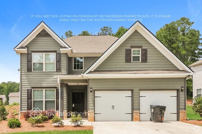
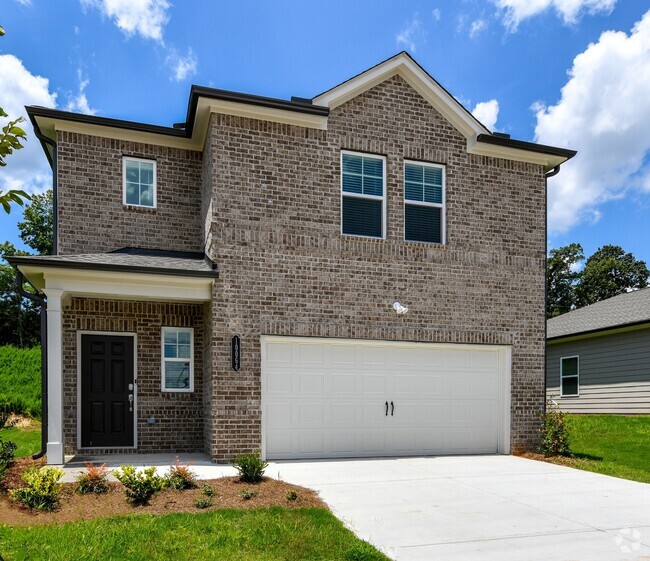
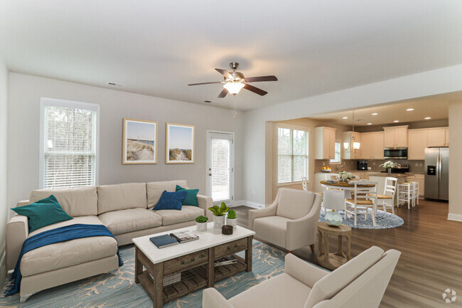
You May Also Like
Similar Rentals Nearby
-
-
-
-
-
-
-
-
-
1 / 38
-
What Are Walk Score®, Transit Score®, and Bike Score® Ratings?
Walk Score® measures the walkability of any address. Transit Score® measures access to public transit. Bike Score® measures the bikeability of any address.
What is a Sound Score Rating?
A Sound Score Rating aggregates noise caused by vehicle traffic, airplane traffic and local sources
722 Celeste Ln SW
Atlanta, GA 30331