
$3,400 / Month
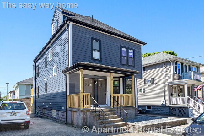
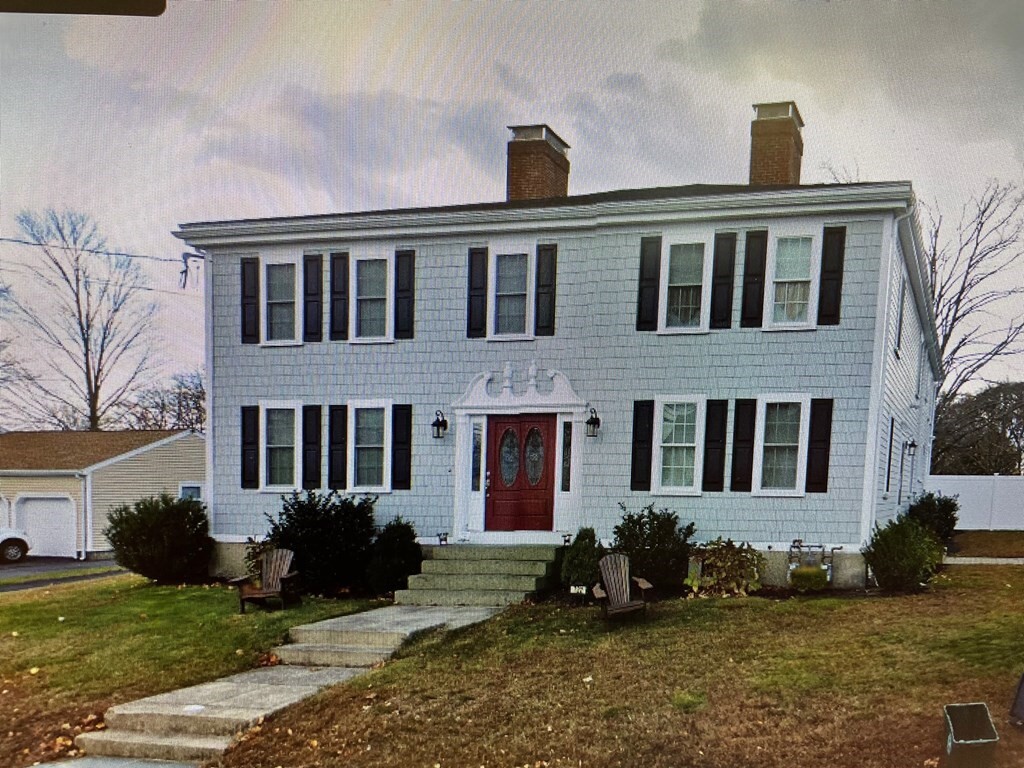
722 Lowell St
Peabody, MA 01960
2 Weeks Ago
Favorites
722 Lowell St

Favorites
Check Back Soon for Upcoming Availability
| Beds | Baths | Average SF |
|---|---|---|
| 3 Bedrooms 3 Bedrooms 3 Br | 2.5 Baths 2.5 Baths 2.5 Ba | 2,422 SF |
About This Property
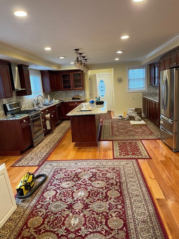
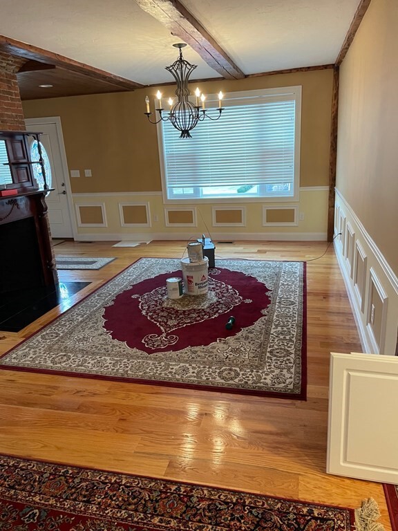
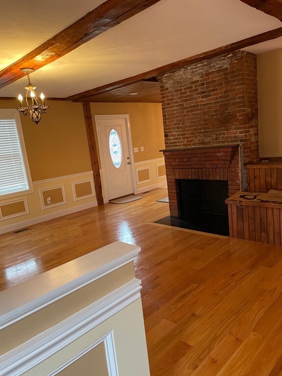
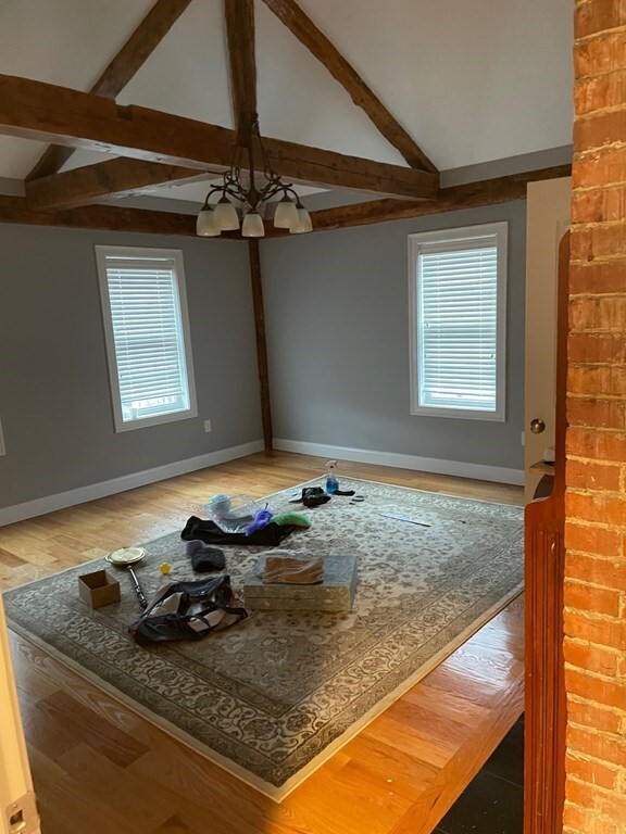
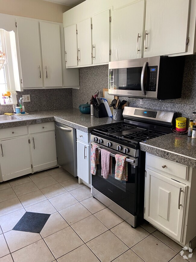
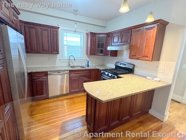
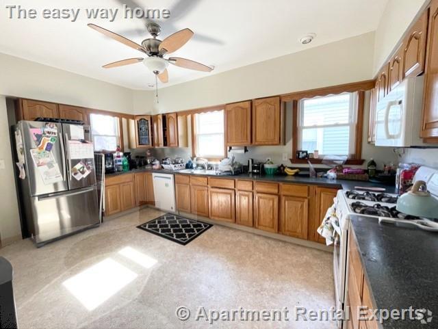
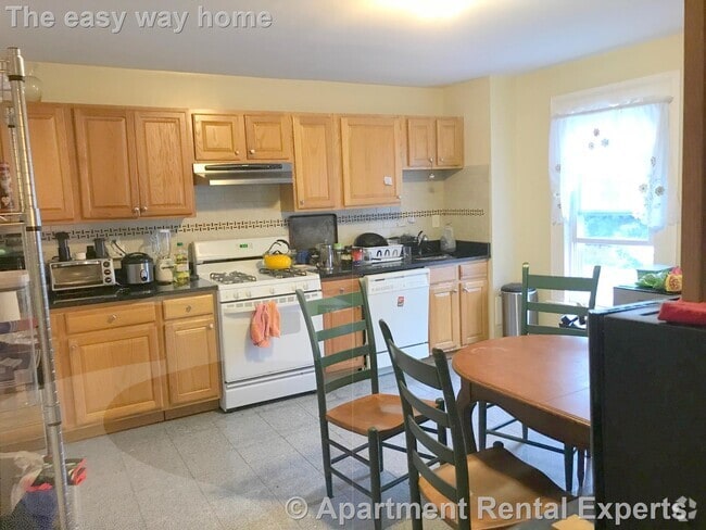
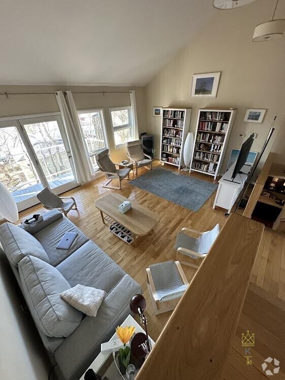
Beautiful 3 bedroom 2.5 bathroom apartment with an abundance of storage space. This unit features many upgrades including gleaming hardwood floors. Eat in kitchen and formal dining room. Large center island for all your entertainment needs. Main bedroom ensuite with a jetted tub! Plenty of off street parking. Absolutely no pets!
722 Lowell St is a townhome located in Essex County and the 01960 ZIP Code. This area is served by the Peabody attendance zone.
Location
Get Directions
Situated about 16 miles north of Boston and 10 miles west of coastal beaches like Phillips Beach, West Peabody is a peaceful wooded area. Most of the town is made up of cozy residential areas, and renters have the choice of a couple of modern apartment complexes along the borders of the neighborhood. Interstate 95 and Highway 1, located near the western border of town, make traveling a breeze, and these roads are lined with plazas featuring shops and a variety of eateries. Recreation is provided by many ponds and parks that dot the area like Winona Pond, or residents can travel a bit outside of the neighborhood for sprawling golf courses and the attractions of the big city.
Learn more about living in West PeabodyBelow are rent ranges for similar nearby apartments
Education
| Colleges & Universities | Distance | ||
|---|---|---|---|
| Colleges & Universities | Distance | ||
| Drive: | 11 min | 5.8 mi | |
| Drive: | 19 min | 8.8 mi | |
| Drive: | 19 min | 8.9 mi | |
| Drive: | 21 min | 11.0 mi |
722 Lowell St is within 11 minutes or 5.8 miles from North Shore C.C., Danvers. It is also near Salem State University and North Shore C.C., Lynn Campus.
Schools


Public Elementary & Middle School
Grades 5-8
713 Students
Nearby
Public Elementary School
Grades PK-5
259 Students
Nearby
Public High School
Grades 9-12
1,476 Students
Attendance Zone
Private Elementary, Middle & High School
Grades PK-12
318 Students
Nearby
School data provided by
 The GreatSchools Rating helps parents compare schools within a state based on a variety of school quality indicators and provides a helpful picture of how effectively each school serves all of its students. Ratings are on a scale of 1 (below average) to 10 (above average) and can include test scores, college readiness, academic progress, advanced courses, equity, discipline and attendance data. We also advise parents to visit schools, consider other information on school performance and programs, and consider family needs as part of the school selection process.
View GreatSchools Rating Methodology
View GreatSchools Rating Methodology
Transportation options available in Peabody include Oak Grove Station, located 11.1 miles from 722 Lowell St. 722 Lowell St is near General Edward Lawrence Logan International, located 16.1 miles or 28 minutes away, and Manchester Boston Regional, located 42.7 miles or 65 minutes away.
| Transit / Subway | Distance | ||
|---|---|---|---|
| Transit / Subway | Distance | ||
|
|
Drive: | 20 min | 11.1 mi |
|
|
Drive: | 21 min | 11.5 mi |
|
|
Drive: | 22 min | 12.3 mi |
|
|
Drive: | 23 min | 12.6 mi |
|
|
Drive: | 23 min | 13.0 mi |
| Commuter Rail | Distance | ||
|---|---|---|---|
| Commuter Rail | Distance | ||
|
|
Drive: | 13 min | 6.0 mi |
|
|
Drive: | 14 min | 6.2 mi |
|
|
Drive: | 17 min | 7.0 mi |
|
|
Drive: | 17 min | 7.6 mi |
|
|
Drive: | 17 min | 8.7 mi |
| Airports | Distance | ||
|---|---|---|---|
| Airports | Distance | ||
|
General Edward Lawrence Logan International
|
Drive: | 28 min | 16.1 mi |
|
Manchester Boston Regional
|
Drive: | 65 min | 42.7 mi |
Time and distance from 722 Lowell St.
| Shopping Centers | Distance | ||
|---|---|---|---|
| Shopping Centers | Distance | ||
| Walk: | 12 min | 0.7 mi | |
| Walk: | 19 min | 1.0 mi | |
| Drive: | 4 min | 2.1 mi |
722 Lowell St has 3 shopping centers within 2.1 miles, which is about a 4-minute walk. The miles and minutes will be for the farthest away property.
| Parks and Recreation | Distance | ||
|---|---|---|---|
| Parks and Recreation | Distance | ||
|
Harold Parker State Forest
|
Drive: | 16 min | 6.9 mi |
|
Saugus Ironworks National Historic Site
|
Drive: | 15 min | 7.1 mi |
|
Lynn Woods
|
Drive: | 14 min | 7.6 mi |
|
Breakheart Reservation
|
Drive: | 19 min | 8.0 mi |
|
Connors Farm
|
Drive: | 15 min | 8.6 mi |
722 Lowell St has 5 parks within 8.6 miles, including Harold Parker State Forest, Saugus Ironworks National Historic Site, and Breakheart Reservation.
| Hospitals | Distance | ||
|---|---|---|---|
| Hospitals | Distance | ||
| Drive: | 16 min | 7.2 mi | |
| Drive: | 16 min | 8.6 mi | |
| Drive: | 20 min | 10.4 mi |
722 Lowell St has 3 hospitals within 10.4 miles, the nearest is North Shore Medical Center which is 7.2 miles away and a 16 minute drive.
| Military Bases | Distance | ||
|---|---|---|---|
| Military Bases | Distance | ||
| Drive: | 20 min | 9.1 mi | |
| Drive: | 26 min | 12.2 mi |
722 Lowell St is 9.1 miles from Fort Pickering, and is convenient to other military bases, including Fort Miller.
You May Also Like
Similar Rentals Nearby


What Are Walk Score®, Transit Score®, and Bike Score® Ratings?
Walk Score® measures the walkability of any address. Transit Score® measures access to public transit. Bike Score® measures the bikeability of any address.
What is a Sound Score Rating?
A Sound Score Rating aggregates noise caused by vehicle traffic, airplane traffic and local sources
722 Lowell St
Peabody, MA 01960