
$1,910 / Month
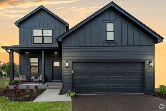
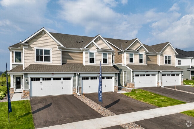
7281 Bond Way
Inver Grove Heights, MN 55076
2 Days Ago
Favorites
7281 Bond Way
Favorites
Check Back Soon for Upcoming Availability
| Beds | Baths | Average SF |
|---|---|---|
| 3 Bedrooms 3 Bedrooms 3 Br | 1.5 Baths 1.5 Baths 1.5 Ba | 1,422 SF |
About This Property
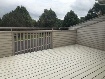
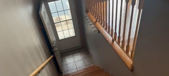
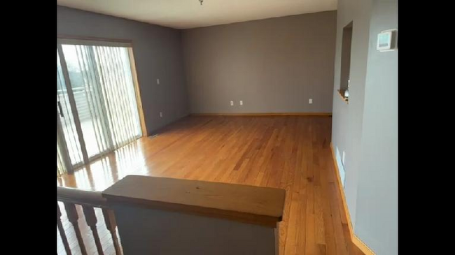
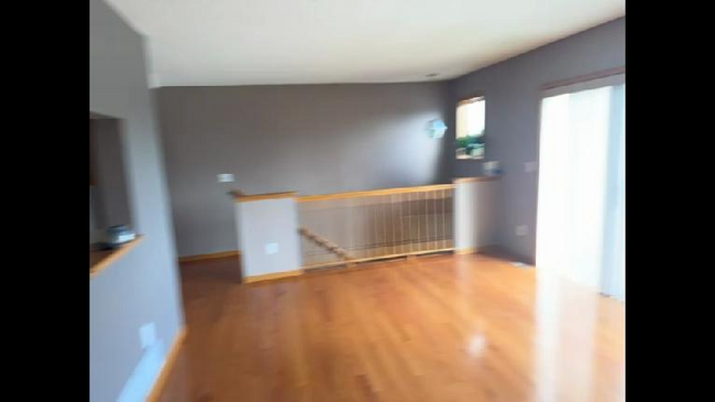
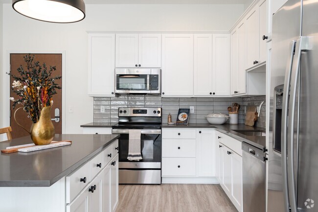
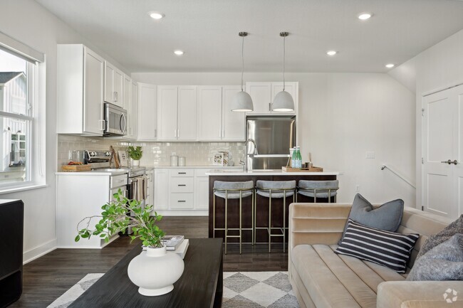
Property Id: 1413789 charming, updated spacious town home with deck that overlooks beautiful green space. Gleaming 3/4 inch real wood floors throughout, ceramic tile in both bathrooms & Den, kitchen with stainless appliances, plus a bonus basement room for office or media or 3rd bedroom that has a huge storage closet. unobstructed greenery views from newly refinished deck. One time lease administrative fee: $350, Tenant responsible for gas, electric, and 1% service fee ($18.75) , Application fee is $55 per person 18+ yrs. Sorry no pets. Tenant must provide proof of a legit address the tenant is choosing to move to upon not extending the lease at the end of one year to get back the security deposit barring no damages to the property which if exists will need to be fixed by the tenant using a vendor provided by landlord. Available April 1st 2025
7281 Bond Way is a townhome located in Dakota County and the 55076 ZIP Code. This area is served by the Inver Grove Heights Schools attendance zone.
Townhome Features
Washer/Dryer
Dishwasher
Hardwood Floors
Microwave
- Washer/Dryer
- Dishwasher
- Disposal
- Microwave
- Oven
- Refrigerator
- Freezer
- Hardwood Floors
- Tile Floors
Fees and Policies
The fees below are based on community-supplied data and may exclude additional fees and utilities.
- Parking
-
Garage--
Details
Utilities Included
-
Water
-
Trash Removal
-
Sewer
Property Address:
7281 Bond Way,
Inver Grove Heights,
MN
55076
Just off the eastern bank of the Mississippi River, Inver Grove Heights, Minnesota has all the natural beauty expected from the state known for its grassy rolling plains. South of the Twin Cities, Inver Grove Heights is a suburb of Saint Paul. This residential city provides easy access to the surrounding areas thanks to the highway that runs through the city, Highway 52.
Residents of this quiet town enjoy several events and volunteer opportunities that keeps people of Inver Grove Heights connected. There are also many local parks and a community center that provides the community with a variety of recreation opportunities and programs. The new development within the area makes Inver Grove a city with a pleasant mix of both old and new.
Learn more about living in Inver Grove Heights
Amenities
- Washer/Dryer
- Dishwasher
- Disposal
- Microwave
- Oven
- Refrigerator
- Freezer
- Hardwood Floors
- Tile Floors
Expenses
Utilities Included
Water, Trash Removal, Sewer
Included
Education
| Colleges & Universities | Distance | ||
|---|---|---|---|
| Colleges & Universities | Distance | ||
| Drive: | 4 min | 1.3 mi | |
| Drive: | 13 min | 7.0 mi | |
| Drive: | 14 min | 9.0 mi | |
| Drive: | 16 min | 9.5 mi |
7281 Bond Way is within 4 minutes or 1.3 miles from Inver Hills Community College. It is also near Argosy University, Twin Cities and Metropolitan State University.
Schools


Public Elementary School
Grades PK-5
655 Students
Nearby
Public Elementary School
Grades PK-5
574 Students
Attendance Zone
Public Middle School
Grades 6-8
761 Students
Attendance Zone
Public High School
Grades 9-12
1,062 Students
Attendance Zone
Private Elementary & Middle School
Grades PK-8
33 Students
Nearby
Private Elementary & Middle School
Grades PK-8
151 Students
Nearby
Private Middle & High School
Grades 6-12
258 Students
Nearby
School data provided by
 The GreatSchools Rating helps parents compare schools within a state based on a variety of school quality indicators and provides a helpful picture of how effectively each school serves all of its students. Ratings are on a scale of 1 (below average) to 10 (above average) and can include test scores, college readiness, academic progress, advanced courses, equity, discipline and attendance data. We also advise parents to visit schools, consider other information on school performance and programs, and consider family needs as part of the school selection process.
View GreatSchools Rating Methodology
View GreatSchools Rating Methodology
Transportation options available in Inver Grove Heights include Central Station, located 8.3 miles from 7281 Bond Way. 7281 Bond Way is near Minneapolis-St Paul International/Wold-Chamberlain, located 11.3 miles or 20 minutes away.
| Transit / Subway | Distance | ||
|---|---|---|---|
| Transit / Subway | Distance | ||
| Drive: | 13 min | 8.3 mi | |
| Drive: | 13 min | 8.4 mi | |
| Drive: | 13 min | 8.6 mi | |
| Drive: | 14 min | 9.0 mi | |
|
|
Drive: | 16 min | 9.5 mi |
| Commuter Rail | Distance | ||
|---|---|---|---|
| Commuter Rail | Distance | ||
|
|
Drive: | 14 min | 8.6 mi |
|
|
Drive: | 31 min | 19.3 mi |
|
|
Drive: | 34 min | 25.1 mi |
|
|
Drive: | 44 min | 33.3 mi |
|
|
Drive: | 46 min | 34.9 mi |
| Airports | Distance | ||
|---|---|---|---|
| Airports | Distance | ||
|
Minneapolis-St Paul International/Wold-Chamberlain
|
Drive: | 20 min | 11.3 mi |
Time and distance from 7281 Bond Way.
| Shopping Centers | Distance | ||
|---|---|---|---|
| Shopping Centers | Distance | ||
| Drive: | 3 min | 1.4 mi | |
| Drive: | 4 min | 1.4 mi | |
| Drive: | 4 min | 1.5 mi |
7281 Bond Way has 3 shopping centers within 1.5 miles, which is about a 4-minute drive. The miles and minutes will be for the farthest away property.
| Parks and Recreation | Distance | ||
|---|---|---|---|
| Parks and Recreation | Distance | ||
|
Dodge Nature Center
|
Drive: | 10 min | 5.7 mi |
|
Cherokee Regional Park
|
Drive: | 16 min | 8.5 mi |
|
Highland Park and Golf Course
|
Drive: | 15 min | 9.3 mi |
|
Crosby Farm Regional Park
|
Drive: | 16 min | 9.7 mi |
|
Fort Snelling State Park
|
Drive: | 21 min | 11.6 mi |
7281 Bond Way has 5 parks within 11.6 miles, including Dodge Nature Center, Cherokee Regional Park, and Highland Park and Golf Course.
| Hospitals | Distance | ||
|---|---|---|---|
| Hospitals | Distance | ||
| Drive: | 14 min | 8.9 mi | |
| Drive: | 14 min | 9.2 mi | |
| Drive: | 15 min | 9.3 mi |
7281 Bond Way has 3 hospitals within 9.3 miles, the nearest is St. Joseph's Hospital which is 8.9 miles away and a 14 minute drive.
| Military Bases | Distance | ||
|---|---|---|---|
| Military Bases | Distance | ||
| Drive: | 17 min | 10.1 mi |
7281 Bond Way is 10.1 miles and a 17 minute drive from Fort Snelling Military Reservation.
You May Also Like
Similar Rentals Nearby


What Are Walk Score®, Transit Score®, and Bike Score® Ratings?
Walk Score® measures the walkability of any address. Transit Score® measures access to public transit. Bike Score® measures the bikeability of any address.
What is a Sound Score Rating?
A Sound Score Rating aggregates noise caused by vehicle traffic, airplane traffic and local sources
7281 Bond Way
Inver Grove Heights, MN 55076