
$3,200 / Month
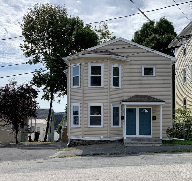
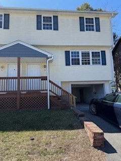
73 Thornton St
Lawrence, MA 01841
Today
Favorites
978-697-5488
-
Bedrooms
3
-
Bathrooms
1
-
Square Feet
1,000 sq ft
-
Available
Available Now
Highlight
- No Cooling
73 Thornton St

Favorites
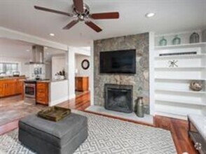
About This Home
$3,200 deposit,
Available Now
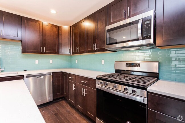
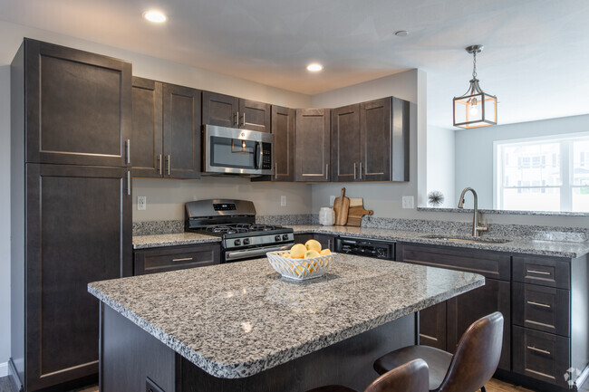
Quiet street Parthum school districtNew electrical,water heater,all flooring,cabinets
73 Thornton St is a townhome located in Essex County and the 01841 ZIP Code. This area is served by the Lawrence attendance zone.
* Price shown is base rent and may not include non-optional fees and utilities.
Price, availability, fees, and any applicable rent special are subject to change without notice.
* Square footage definitions vary. Displayed square footage is approximate.
Home Details
Accessible Home Design
Entry on the 1st floor
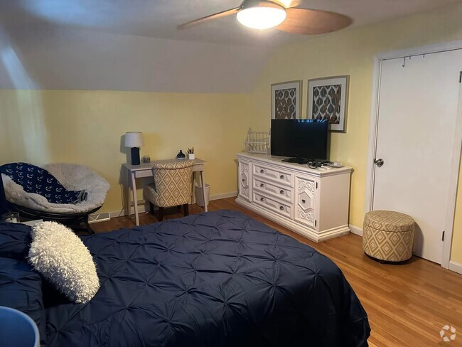
Bedrooms and Bathrooms
1 Full Bathroom
3 Bedrooms
Home Design
Property Attached
Interior Spaces
1,000 Sq Ft Home
Listing and Financial Details
Security Deposit $3,200
12 Month Lease Term
Rent includes water
Parking
2 Car Parking Spaces
Utilities
No Cooling
Community Details
Overview
No Home Owners Association
Pet Policy
No Pets Allowed
Contact
- Listed by Constance Doto | Connie Doto Realty Group
- Phone Number
-
Source
 MLS Property Information Network
The property listing data and information set forth herein were provided to MLS Property Information Network, Inc. from third party sources, including sellers, lessors and public records, and were compiled by MLS Property Information Network, Inc. The property listing data and information are for the personal, non-commercial use of consumers having a good faith interest in purchasing or leasing listed properties of the type displayed to them and may not be used for any purpose other than to identify prospective properties which such consumers may have a good faith interest in purchasing or leasing. MLS Property Information Network, Inc. and its subscribers disclaim any and all representations and warranties as to the accuracy of the property listing data and information set forth herein. All properties are subject to prior sale, change or withdrawal. Copyright © 2025 MLS Property Information Network, Inc. All rights reserved.
$2,134 / month
$329,900 Listing Price
3 Beds
•2.5 Baths
•
1,036 Sq Ft
$3,380 / month
$579,900 Listing Price
3 Beds
•3.5 Baths
•
2,250 Sq Ft
$2,989 / month
$399,900 Listing Price
3 Beds
•1.5 Baths
•
1,660 Sq Ft
Location
Get Directions
North Lawrence sits between the Spicket and Merrimack rivers directly north of Downtown Lawrence. Residents enjoy a variety of nearby parks, including the North Common Neighborhood Reviviendo Playground, a popular spot for picnics and playground fun. Storrow Park, which features a playground, basketball courts, and spacious lawns, is perfect for an afternoon stroll or a weekend game. The cost of living in Lawrence is about 20 percent higher than the national average, yet still eight percent lower than the Massachusetts average, making it relatively affordable compared to other parts of the state.
Many residents in North Lawrence commute to jobs in nearby cities like Boston. The neighborhood is well-connected by major roadways, and public transit offers a smooth commute for those who prefer not to drive. Within Lawrence, top employers include the healthcare and manufacturing sectors, providing ample job opportunities.
Learn more about living in North Lawrence
Education
| Colleges & Universities | Distance | ||
|---|---|---|---|
| Colleges & Universities | Distance | ||
| Drive: | 12 min | 5.7 mi | |
| Drive: | 16 min | 10.2 mi | |
| Drive: | 22 min | 12.6 mi | |
| Drive: | 21 min | 13.7 mi |
73 Thornton St is within 12 minutes or 5.7 miles from Merrimack College. It is also near Northern Essex Comm. Coll. and Middlesex C.C., Lowell Campus.
Schools


Public Elementary School
Grades K-4
677 Students
Attendance Zone
Public Elementary & Middle School
Grades 5-8
568 Students
Attendance Zone
Charter Elementary & Middle School
Grades PK-8
401 Students
Nearby
Public High School
Grades 9-12
3,084 Students
Attendance Zone
Private Elementary & Middle School
Grades PK-8
Nearby
Private High School
Grades 9-12
276 Students
Nearby
School data provided by
 The GreatSchools Rating helps parents compare schools within a state based on a variety of school quality indicators and provides a helpful picture of how effectively each school serves all of its students. Ratings are on a scale of 1 (below average) to 10 (above average) and can include test scores, college readiness, academic progress, advanced courses, equity, discipline and attendance data. We also advise parents to visit schools, consider other information on school performance and programs, and consider family needs as part of the school selection process.
View GreatSchools Rating Methodology
View GreatSchools Rating Methodology
Transportation options available in Lawrence include Oak Grove Station, located 24.9 miles from 73 Thornton St. 73 Thornton St is near Manchester Boston Regional, located 26.9 miles or 43 minutes away, and General Edward Lawrence Logan International, located 32.7 miles or 45 minutes away.
| Transit / Subway | Distance | ||
|---|---|---|---|
| Transit / Subway | Distance | ||
|
|
Drive: | 34 min | 24.9 mi |
|
|
Drive: | 34 min | 26.2 mi |
| Drive: | 35 min | 26.4 mi | |
| Drive: | 35 min | 26.9 mi | |
|
|
Drive: | 37 min | 27.5 mi |
| Commuter Rail | Distance | ||
|---|---|---|---|
| Commuter Rail | Distance | ||
|
|
Drive: | 5 min | 1.9 mi |
|
|
Drive: | 10 min | 5.1 mi |
|
|
Drive: | 10 min | 6.6 mi |
|
|
Drive: | 11 min | 6.9 mi |
|
|
Drive: | 16 min | 7.5 mi |
| Airports | Distance | ||
|---|---|---|---|
| Airports | Distance | ||
|
Manchester Boston Regional
|
Drive: | 43 min | 26.9 mi |
|
General Edward Lawrence Logan International
|
Drive: | 45 min | 32.7 mi |
Time and distance from 73 Thornton St.
| Shopping Centers | Distance | ||
|---|---|---|---|
| Shopping Centers | Distance | ||
| Walk: | 18 min | 1.0 mi | |
| Drive: | 3 min | 1.2 mi | |
| Drive: | 5 min | 2.0 mi |
73 Thornton St has 3 shopping centers within 2.0 miles, which is about a 5-minute walk. The miles and minutes will be for the farthest away property.
| Parks and Recreation | Distance | ||
|---|---|---|---|
| Parks and Recreation | Distance | ||
|
Lawrence Heritage State Park
|
Drive: | 3 min | 1.5 mi |
|
Stevens-Coolidge Place
|
Drive: | 9 min | 4.2 mi |
|
Smolak Farms
|
Drive: | 15 min | 6.4 mi |
|
Windrush Farm
|
Drive: | 22 min | 9.4 mi |
|
Bradford Ski Area
|
Drive: | 16 min | 9.4 mi |
73 Thornton St has 5 parks within 9.4 miles, including Lawrence Heritage State Park, Stevens-Coolidge Place, and Smolak Farms.
| Hospitals | Distance | ||
|---|---|---|---|
| Hospitals | Distance | ||
| Drive: | 3 min | 1.5 mi | |
| Drive: | 12 min | 7.5 mi |
73 Thornton St is 1.5 miles from Holy Family Hospital, and is convenient to other hospitals, including Whittier Pavilion.
| Military Bases | Distance | ||
|---|---|---|---|
| Military Bases | Distance | ||
| Drive: | 46 min | 23.4 mi | |
| Drive: | 52 min | 26.5 mi | |
| Drive: | 39 min | 28.1 mi |
73 Thornton St has 3 military bases within 28.1 miles, the nearest is Fort Pickering which is 23.4 miles away and a 46 minute drive.
You May Also Like
Similar Rentals Nearby

What Are Walk Score®, Transit Score®, and Bike Score® Ratings?
Walk Score® measures the walkability of any address. Transit Score® measures access to public transit. Bike Score® measures the bikeability of any address.
What is a Sound Score Rating?
A Sound Score Rating aggregates noise caused by vehicle traffic, airplane traffic and local sources
73 Thornton St
Lawrence, MA 01841