73 W 21st St Unit 1
Bayonne, NJ 07002
-
Bedrooms
4
-
Bathrooms
3
-
Square Feet
2,500 sq ft
-
Available
Available Now
Highlights
- Contemporary Architecture
- Property is near a park
- Wood Flooring
- Terrace
- Intercom
- Living Room

About This Home
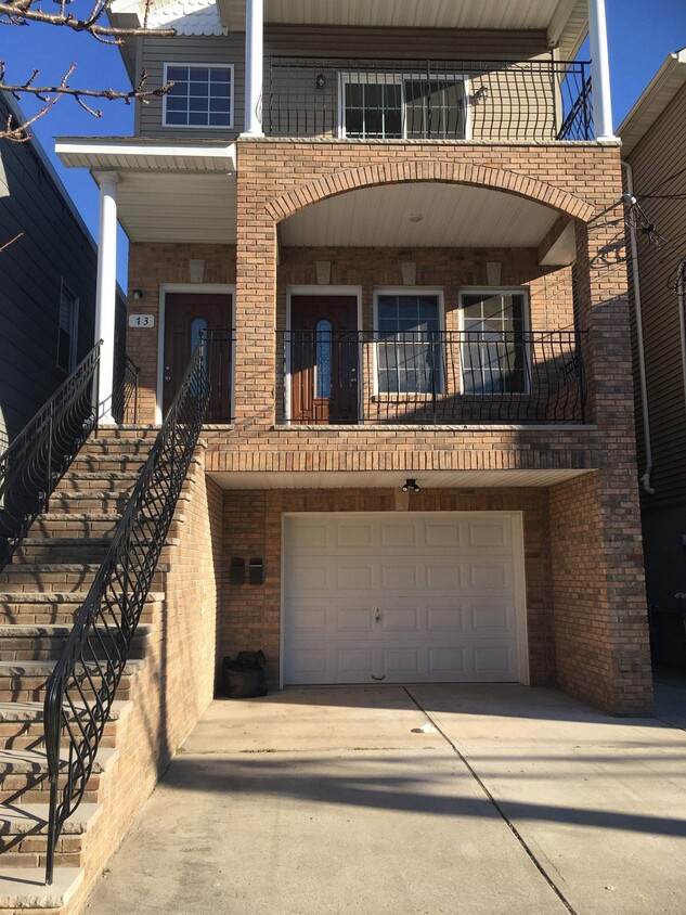
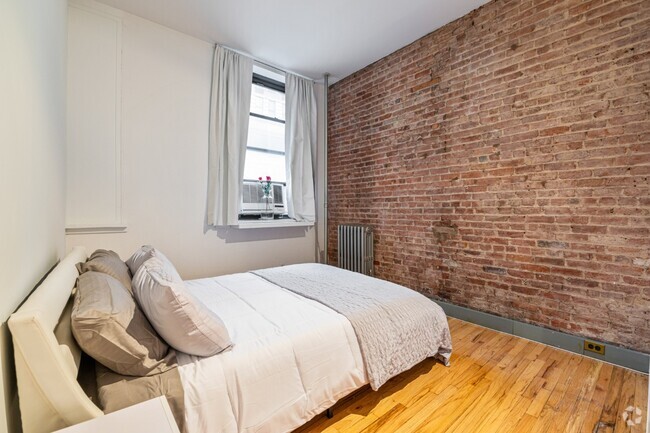
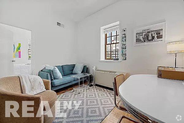
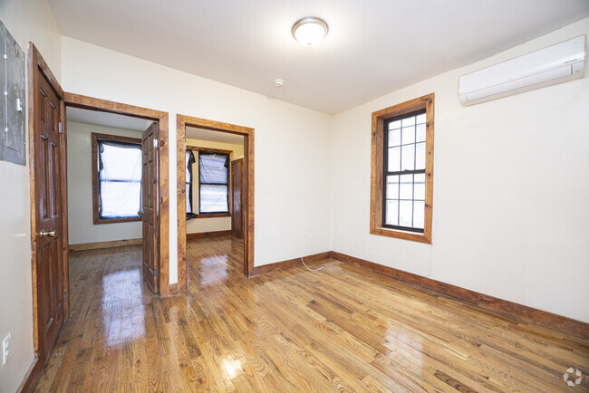
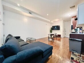
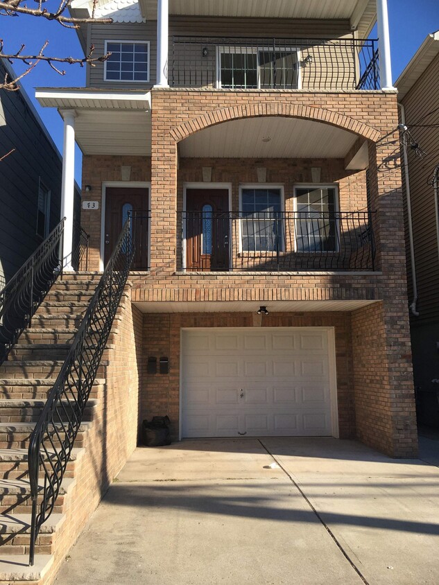
Duplex apartement with 3 bed 3 full bathe 1 car parking , Centeral Air , Extra space in basement with washer and dreyer room .
73 W 21st St is a condo located in Hudson County and the 07002 ZIP Code.
Home Details
Bedrooms and Bathrooms
Finished Basement
Home Design
Home Security
Interior Spaces
Kitchen
Listing and Financial Details
Location
Outdoor Features
Parking
Utilities
Community Details
Amenities
Fees and Policies
The fees below are based on community-supplied data and may exclude additional fees and utilities.
Contact
- Listed by GUIRGIS DEIF | HOME EXCHANGE REALTORS
- Phone Number
- Contact
-
Source
Hudson County Multiple Listing Service
- Intercom
- Oven
- Hardwood Floors
- Storage Space
Also known as Constable's Hook, historic Constable Hook is one of New Jersey and the East Coast’s oldest communities. Nestled between the Hudson River and Newark Bay, Constable Hook consists of the southern portion of Bayonne. Bayonne prides itself on natural conservation and the area is home to several marinas and waterfront greenspaces. Golf fans spend days on the green at the Bayonne Golf Club, while Dennis P. Collins Park is a local favorite for its skatepark and views of the Bayonne Bridge and freight and cruise ships. Along Broadway, residents have access to restaurants, shops, and bars giving the area the feel of a small town. The neighborhood has a relatively low cost of living and has a variety of mid-range to upscale options available for rent.
Learn more about living in Constable Hook| Colleges & Universities | Distance | ||
|---|---|---|---|
| Colleges & Universities | Distance | ||
| Drive: | 9 min | 4.1 mi | |
| Drive: | 12 min | 5.3 mi | |
| Drive: | 17 min | 6.9 mi | |
| Drive: | 17 min | 9.5 mi |
Transportation options available in Bayonne include 22Nd Street, located 0.5 mile from 73 W 21st St Unit 1. 73 W 21st St Unit 1 is near Newark Liberty International, located 7.2 miles or 13 minutes away, and Laguardia, located 19.5 miles or 39 minutes away.
| Transit / Subway | Distance | ||
|---|---|---|---|
| Transit / Subway | Distance | ||
|
|
Walk: | 8 min | 0.5 mi |
| Walk: | 16 min | 0.9 mi | |
|
|
Drive: | 3 min | 1.2 mi |
|
|
Drive: | 7 min | 3.0 mi |
|
|
Drive: | 7 min | 3.2 mi |
| Commuter Rail | Distance | ||
|---|---|---|---|
| Commuter Rail | Distance | ||
|
|
Drive: | 18 min | 7.5 mi |
|
|
Drive: | 18 min | 7.8 mi |
|
|
Drive: | 18 min | 8.1 mi |
|
|
Drive: | 17 min | 9.0 mi |
|
|
Drive: | 18 min | 10.0 mi |
| Airports | Distance | ||
|---|---|---|---|
| Airports | Distance | ||
|
Newark Liberty International
|
Drive: | 13 min | 7.2 mi |
|
Laguardia
|
Drive: | 39 min | 19.5 mi |
Time and distance from 73 W 21st St Unit 1.
| Shopping Centers | Distance | ||
|---|---|---|---|
| Shopping Centers | Distance | ||
| Walk: | 14 min | 0.8 mi | |
| Walk: | 14 min | 0.8 mi | |
| Walk: | 18 min | 1.0 mi |
| Parks and Recreation | Distance | ||
|---|---|---|---|
| Parks and Recreation | Distance | ||
|
G. Thomas DiDomenico Park
|
Walk: | 9 min | 0.5 mi |
|
Stephen Gregg Park
|
Drive: | 6 min | 2.3 mi |
|
Faber Park
|
Drive: | 7 min | 3.7 mi |
|
Snug Harbor Cultural Center & Botanical Garden
|
Drive: | 13 min | 5.9 mi |
|
Staten Island Children's Museum
|
Drive: | 13 min | 5.9 mi |
| Hospitals | Distance | ||
|---|---|---|---|
| Hospitals | Distance | ||
| Walk: | 15 min | 0.8 mi | |
| Drive: | 12 min | 5.8 mi | |
| Drive: | 12 min | 6.0 mi |
| Military Bases | Distance | ||
|---|---|---|---|
| Military Bases | Distance | ||
| Drive: | 7 min | 2.9 mi | |
| Drive: | 20 min | 7.7 mi |
You May Also Like
Similar Rentals Nearby
What Are Walk Score®, Transit Score®, and Bike Score® Ratings?
Walk Score® measures the walkability of any address. Transit Score® measures access to public transit. Bike Score® measures the bikeability of any address.
What is a Sound Score Rating?
A Sound Score Rating aggregates noise caused by vehicle traffic, airplane traffic and local sources
