
765 Greg Thatch Cir
Sacramento, CA 95835
-
Bedrooms
3
-
Bathrooms
2.5
-
Square Feet
1,815 sq ft
-
Available
Available May 24
Highlight
- Fenced Lot

About This Home
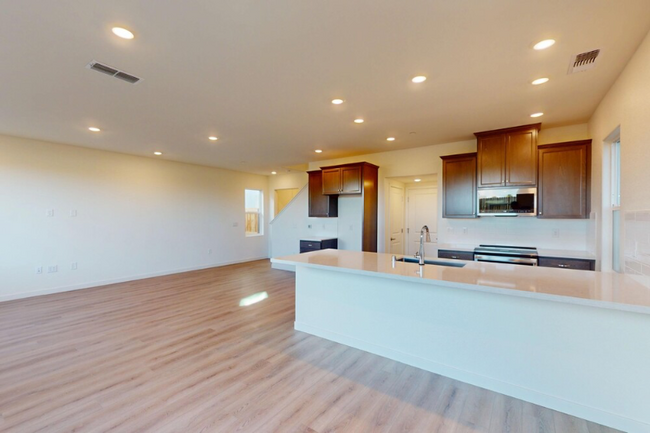
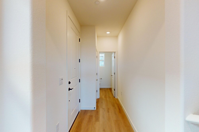
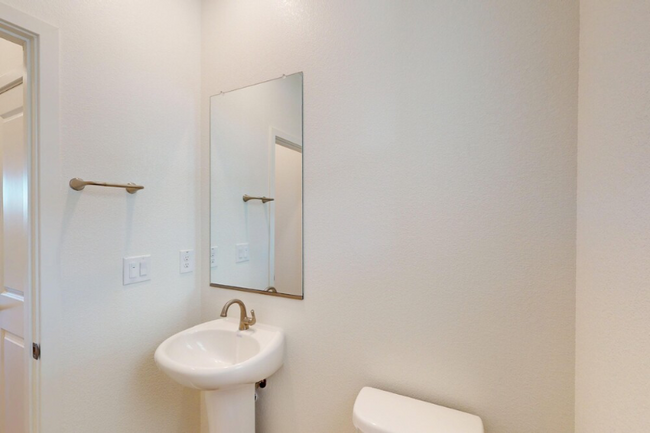
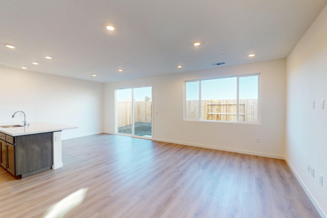
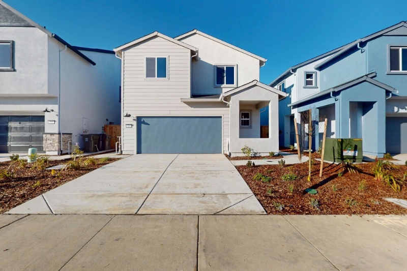
Property Id: 1841767 Be the first to live in this stunning, brand-new 3BR/2.5BA home in North Natomas, Sacramento! Built in 2025, this 1,815 sq ft home offers an open-concept layout, stainless steel appliances, upstairs laundry room, and a private low-maintenance backyard. The home is fully electric—no gas bill—with solar panels, central heating and air, and dual-pane windows for energy efficiency. Includes attached 2-car garage and driveway. Located in a quiet, family-friendly neighborhood near top-rated schools, parks, shopping, and public transit, with easy access to I-5, I-80, downtown Sacramento, and the airport. We proudly welcome tenants with Housing Choice Vouchers (formerly Section 8) and are seeking long-term residents who will care for this beautiful new home. Available now—schedule your private showing today!
765 Greg Thatch Cir is a house located in Sacramento County and the 95835 ZIP Code. This area is served by the Natomas Unified attendance zone.
House Features
Dishwasher
Microwave
Refrigerator
Disposal
- Dishwasher
- Disposal
- Microwave
- Oven
- Refrigerator
- Vinyl Flooring
- Fenced Lot
Fees and Policies
The fees below are based on community-supplied data and may exclude additional fees and utilities.
- Parking
-
Garage--
Details
Utilities Included
-
Water
-
Trash Removal
-
Sewer
Contact
- Phone Number
- Contact
-
Source

- Dishwasher
- Disposal
- Microwave
- Oven
- Refrigerator
- Vinyl Flooring
- Fenced Lot
Surrounded by farmland on nearly three sides, the Natomas Creek neighborhood of Sacramento provides the perfect mix of city and country living. Several neighborhood parks give Natomas Creek its slightly rural feel. Drive roughly three miles south and enjoy the even larger 47-acre North Natomas Regional Park and its freshwater lake.
State Route 99 borders the western edge of the neighborhood, and I-5, which runs past the southwest corner of Natomas Creek, leads to Sacramento International Airport and downtown Sacramento. Most nearby restaurants line up near Del Paso Road, about a three-mile drive. Local favorites include the ultra-modern Tuk Tuk Restaurant, serving Thai fare. Diners wanting to kick things up a notch find that the lively Pete's Restaurant and Brewhouse fits the bill for happy hour drinks and late-night grub.
Learn more about living in Natomas Creek| Colleges & Universities | Distance | ||
|---|---|---|---|
| Colleges & Universities | Distance | ||
| Drive: | 19 min | 12.9 mi | |
| Drive: | 23 min | 13.0 mi | |
| Drive: | 23 min | 14.0 mi | |
| Drive: | 29 min | 21.2 mi |

View GreatSchools Rating Methodology
Transportation options available in Sacramento include Township 9 Station (Wb), located 7.7 miles from 765 Greg Thatch Cir. 765 Greg Thatch Cir is near Sacramento International, located 6.8 miles or 12 minutes away.
| Transit / Subway | Distance | ||
|---|---|---|---|
| Transit / Subway | Distance | ||
| Drive: | 11 min | 7.7 mi | |
|
|
Drive: | 12 min | 8.4 mi |
|
|
Drive: | 14 min | 9.2 mi |
|
|
Drive: | 14 min | 9.3 mi |
|
|
Drive: | 16 min | 10.0 mi |
| Commuter Rail | Distance | ||
|---|---|---|---|
| Commuter Rail | Distance | ||
|
|
Drive: | 29 min | 17.1 mi |
|
|
Drive: | 26 min | 19.3 mi |
|
|
Drive: | 33 min | 21.6 mi |
| Drive: | 46 min | 33.8 mi | |
|
|
Drive: | 46 min | 33.9 mi |
| Airports | Distance | ||
|---|---|---|---|
| Airports | Distance | ||
|
Sacramento International
|
Drive: | 12 min | 6.8 mi |
Time and distance from 765 Greg Thatch Cir.
| Shopping Centers | Distance | ||
|---|---|---|---|
| Shopping Centers | Distance | ||
| Drive: | 4 min | 2.0 mi | |
| Drive: | 5 min | 2.1 mi | |
| Drive: | 5 min | 2.2 mi |
| Parks and Recreation | Distance | ||
|---|---|---|---|
| Parks and Recreation | Distance | ||
|
Natomas Oaks Park
|
Drive: | 11 min | 6.9 mi |
|
Discovery County Park
|
Drive: | 11 min | 7.1 mi |
|
Bannon Creek Parkway
|
Drive: | 12 min | 7.6 mi |
|
California State Railroad Museum
|
Drive: | 13 min | 8.3 mi |
|
Old Sacramento Historic District
|
Drive: | 13 min | 8.3 mi |
| Hospitals | Distance | ||
|---|---|---|---|
| Hospitals | Distance | ||
| Drive: | 16 min | 10.2 mi | |
| Drive: | 18 min | 10.9 mi | |
| Drive: | 18 min | 11.9 mi |
| Military Bases | Distance | ||
|---|---|---|---|
| Military Bases | Distance | ||
| Drive: | 22 min | 9.8 mi |
You May Also Like
What Are Walk Score®, Transit Score®, and Bike Score® Ratings?
Walk Score® measures the walkability of any address. Transit Score® measures access to public transit. Bike Score® measures the bikeability of any address.
What is a Sound Score Rating?
A Sound Score Rating aggregates noise caused by vehicle traffic, airplane traffic and local sources
765 Greg Thatch Cir
Sacramento, CA 95835