
$800 / Month
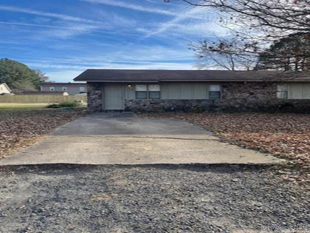
77 Liberty St
Cabot, AR 72023
Today
Favorites
501-843-4473
-
Bedrooms
2
-
Bathrooms
1
-
Square Feet
750 sq ft
-
Available
Not Available
Highlight
- Central Air
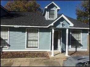
77 Liberty St

Favorites
About This Home
$800 deposit,
Not Available
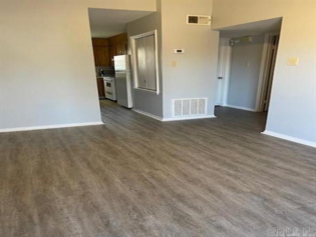
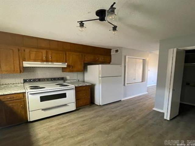
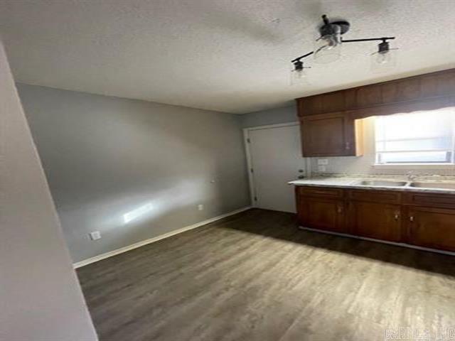
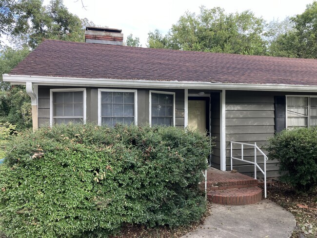
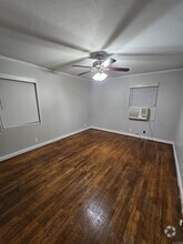
Spacious duplex in the heart of Cabot. Updated flooring and paint. Spacious backyard with room to grow. Skylight in living room. Contact agent for more details.
77 Liberty St is a townhome located in Lonoke County and the 72023 ZIP Code. This area is served by the Cabot attendance zone.
* Price shown is base rent and may not include non-optional fees and utilities.
Price, availability, fees, and any applicable rent special are subject to change without notice.
* Square footage definitions vary. Displayed square footage is approximate.
Home Details
Home Type
Duplex
Year Built
Built in 1983
Bedrooms and Bathrooms
1 Full Bathroom
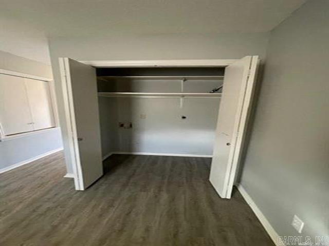
2 Bedrooms
Interior Spaces
750 Sq Ft Home
Kitchen
Oven or Range
Listing and Financial Details
Security Deposit $800
Parking
2 Car Garage
Parking Pad
Utilities
Central Air
Community Details
Contact
- Listed by Holly Clark | CENTURY 21 Real Estate Unlimited
- Phone Number
- Contact
-
Source
 Cooperative Arkansas Realtors® Multiple Listings Services, Inc.
Copyright ©2025 Cooperative Arkansas Realtors® Multiple Listings Services, Inc.
Location
Get Directions
Located about 25 miles northeast of Little Rock, bordering the Little Rock Air Force Base, Cabot continues to draw families for its top-ranked public schools, friendly small-town atmosphere, and close proximity to Little Rock. A host of city parks, athletic fields, and walking trails provide space for all kinds of outdoor recreation in Cabot as well as the dynamic Community Center. Cabot hosts a range of special events for the community, including the annual Strawberry Festival, Cabot Fest, and the Lonoke County Fair. Commuting and traveling from Cabot is easy with access to U.S. 167 and the Bill and Hillary Clinton National Airport.
Learn more about living in Cabot
Education
| Colleges & Universities | Distance | ||
|---|---|---|---|
| Colleges & Universities | Distance | ||
| Drive: | 33 min | 25.1 mi | |
| Drive: | 33 min | 26.2 mi | |
| Drive: | 37 min | 28.0 mi | |
| Drive: | 41 min | 31.0 mi |
77 Liberty St is within 33 minutes or 25.1 miles from Pulaski Technical College. It is also near Philander Smith College and Univ. of Ark. Medical Scis..
Schools


Public Elementary School
Grades PK-4
446 Students
Attendance Zone
Public Elementary School
Grades 5-6
717 Students
Attendance Zone
Public Middle School
Grades 7-8
710 Students
Attendance Zone
Charter Middle & High School
Grades 7-12
321 Students
Nearby
Public High School
Grades 9-12
2,198 Students
Attendance Zone
Private Elementary School
Grades PK
Nearby
Private Elementary, Middle & High School
Grades K-10
18 Students
Nearby
Private Elementary School
Grades PK-4
Nearby
School data provided by
 The GreatSchools Rating helps parents compare schools within a state based on a variety of school quality indicators and provides a helpful picture of how effectively each school serves all of its students. Ratings are on a scale of 1 (below average) to 10 (above average) and can include test scores, college readiness, academic progress, advanced courses, equity, discipline and attendance data. We also advise parents to visit schools, consider other information on school performance and programs, and consider family needs as part of the school selection process.
View GreatSchools Rating Methodology
View GreatSchools Rating Methodology
Transportation options available in Cabot include Main St & Bishop Lindsey Ave, located 23.8 miles from 77 Liberty St. 77 Liberty St is near Bill and Hillary Clinton Ntl/Adams Field, located 27.1 miles or 33 minutes away.
| Transit / Subway | Distance | ||
|---|---|---|---|
| Transit / Subway | Distance | ||
| Drive: | 29 min | 23.8 mi | |
| Drive: | 30 min | 24.0 mi | |
| Drive: | 29 min | 24.2 mi | |
| Drive: | 29 min | 24.2 mi | |
| Drive: | 29 min | 24.2 mi |
| Commuter Rail | Distance | ||
|---|---|---|---|
| Commuter Rail | Distance | ||
|
|
Drive: | 32 min | 25.7 mi |
| Airports | Distance | ||
|---|---|---|---|
| Airports | Distance | ||
|
Bill and Hillary Clinton Ntl/Adams Field
|
Drive: | 33 min | 27.1 mi |
Time and distance from 77 Liberty St.
| Shopping Centers | Distance | ||
|---|---|---|---|
| Shopping Centers | Distance | ||
| Walk: | 18 min | 0.9 mi | |
| Walk: | 20 min | 1.1 mi | |
| Drive: | 3 min | 1.3 mi |
77 Liberty St has 3 shopping centers within 1.3 miles, which is about a 3-minute walk. The miles and minutes will be for the farthest away property.
| Hospitals | Distance | ||
|---|---|---|---|
| Hospitals | Distance | ||
| Drive: | 15 min | 11.7 mi |
77 Liberty St is 11.7 miles and a 15 minute drive from North Metro Medical Center.
| Military Bases | Distance | ||
|---|---|---|---|
| Military Bases | Distance | ||
| Drive: | 27 min | 17.4 mi | |
| Drive: | 47 min | 21.3 mi | |
| Drive: | 53 min | 34.6 mi |
77 Liberty St has 3 military bases within 34.6 miles, the nearest is Little Rock Air Force Base which is 17.4 miles away and a 27 minute drive.
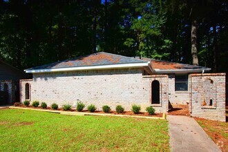
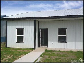
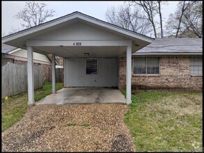
You May Also Like
Similar Rentals Nearby

What Are Walk Score®, Transit Score®, and Bike Score® Ratings?
Walk Score® measures the walkability of any address. Transit Score® measures access to public transit. Bike Score® measures the bikeability of any address.
What is a Sound Score Rating?
A Sound Score Rating aggregates noise caused by vehicle traffic, airplane traffic and local sources
77 Liberty St
Cabot, AR 72023