
$2,800
/ Month
777 San Antonio Rd Unit 46
Palo Alto, CA 94303
2 Weeks Ago
|
Edit
Favorites
777 San Antonio Rd Unit 46

Favorites
Check Back Soon for Upcoming Availability
| Beds | Baths | Average SF |
|---|---|---|
| 2 Bedrooms 2 Bedrooms 2 Br | 1 Bath 1 Bath 1 Ba | 946 SF |
Fees and Policies
The fees below are based on community-supplied data and may exclude additional fees and utilities.
- Parking
-
Garage--
Details
Utilities Included
-
Water
-
Trash Removal
About This Property
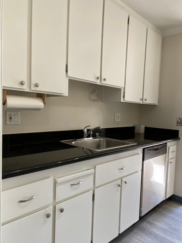
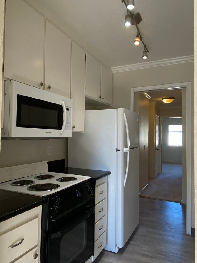
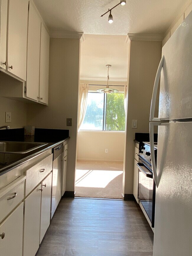
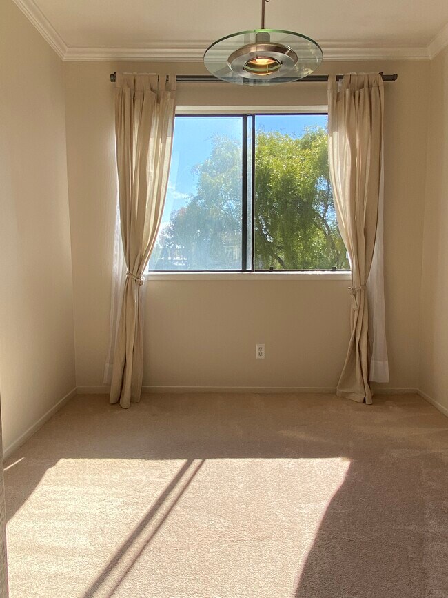
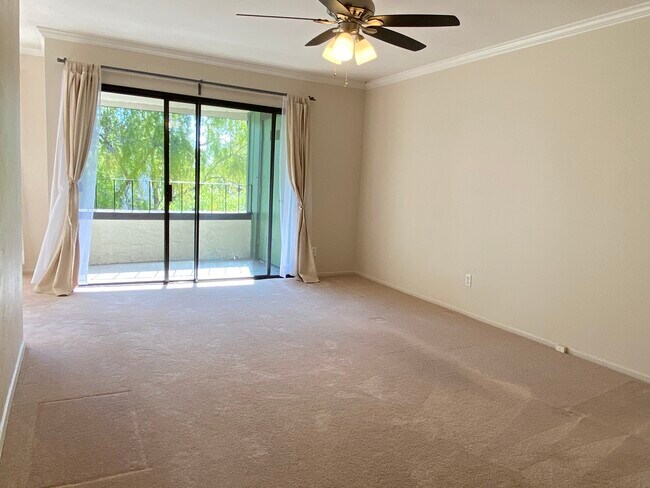
Top floor condo in the Greenhouse complex- * 2 bedrooms (1 has walk in closet), * 1 bath * dining room * private balcony with storage closet * extra closets in the hallway * in unit washer/dryer * 2 parking spaces (1 car in garage and one uncovered space) * Rent includes water and garbage. * The grounds have well kept walking paths, community pool, green belt trails, and par course. * Conveniently located near shopping areas and Silicon Valley hot spots - Charleston Plaza with Piazza's gourmet market, pet store, ice cream shop and more. Short distance to Costco, Krispy Creme and other popular stores and restaurants. Located near major employers. Rent: $2,800/month Deposit: $4,000 Credit income and income verification
777 San Antonio Rd is a condo located in Santa Clara County and the 94303 ZIP Code.
Condo Features
Washer/Dryer
Dishwasher
Walk-In Closets
Microwave
- Washer/Dryer
- Heating
- Smoke Free
- Dishwasher
- Disposal
- Kitchen
- Microwave
- Refrigerator
- Dining Room
- Walk-In Closets
- Double Pane Windows
- Fitness Center
- Pool
- Balcony
- Greenhouse
Location
Get Directions
Living in Palo Alto places you in Silicon Valley, where historic neighborhoods complement the city's technological presence. Tree-lined streets wind through the community, which is anchored by Stanford University. University Avenue features local boutiques and restaurants housed in preserved historic buildings, while the Stanford Shopping Center offers high-end retail destinations. The city maintains 36 parks and preserves, including the Baylands Nature Preserve and Foothills Park, where residents enjoy hiking trails and outdoor activities. Palo Alto's infrastructure supports alternative transportation, with dedicated bike lanes throughout the city.
The rental market in Palo Alto reflects the area's popularity, with current average rents ranging from $2,634 for studios to $6,139 for four-bedroom homes. Recent trends show steady growth, with rent increases varying from 1.8% to 17% across different unit sizes over the past year.
Learn more about living in Palo Alto
Amenities
- Washer/Dryer
- Heating
- Smoke Free
- Dishwasher
- Disposal
- Kitchen
- Microwave
- Refrigerator
- Dining Room
- Walk-In Closets
- Double Pane Windows
- Balcony
- Greenhouse
- Fitness Center
- Pool
Expenses
Utilities Included
Water, Trash Removal
Included
Education
| Colleges & Universities | Distance | ||
|---|---|---|---|
| Colleges & Universities | Distance | ||
| Walk: | 9 min | 0.5 mi | |
| Drive: | 12 min | 4.9 mi | |
| Drive: | 13 min | 4.9 mi | |
| Drive: | 16 min | 9.3 mi |
777 San Antonio Rd Unit 46 is within 9 minutes or 0.5 mile from Foothill College, Middlefield. It is also near Stanford University and Foothill Coll., Los Altos.
Transportation options available in Palo Alto include Mountain View Station, located 2.8 miles from 777 San Antonio Rd Unit 46. 777 San Antonio Rd Unit 46 is near Norman Y Mineta San Jose International, located 11.2 miles or 16 minutes away, and San Francisco International, located 22.9 miles or 30 minutes away.
| Transit / Subway | Distance | ||
|---|---|---|---|
| Transit / Subway | Distance | ||
| Drive: | 6 min | 2.8 mi | |
|
|
Drive: | 6 min | 2.8 mi |
| Drive: | 6 min | 3.6 mi | |
|
|
Drive: | 7 min | 3.7 mi |
|
|
Drive: | 8 min | 4.2 mi |
| Commuter Rail | Distance | ||
|---|---|---|---|
| Commuter Rail | Distance | ||
| Drive: | 3 min | 1.3 mi | |
| Drive: | 8 min | 3.1 mi | |
| Drive: | 9 min | 3.3 mi | |
| Drive: | 8 min | 3.4 mi | |
| Drive: | 9 min | 3.7 mi |
| Airports | Distance | ||
|---|---|---|---|
| Airports | Distance | ||
|
Norman Y Mineta San Jose International
|
Drive: | 16 min | 11.2 mi |
|
San Francisco International
|
Drive: | 30 min | 22.9 mi |
Time and distance from 777 San Antonio Rd Unit 46.
| Shopping Centers | Distance | ||
|---|---|---|---|
| Shopping Centers | Distance | ||
| Walk: | 8 min | 0.5 mi | |
| Walk: | 11 min | 0.6 mi | |
| Walk: | 11 min | 0.6 mi |
777 San Antonio Rd Unit 46 has 3 shopping centers within 0.6 mile, which is about a 11-minute walk. The miles and minutes will be for the farthest away property.
| Parks and Recreation | Distance | ||
|---|---|---|---|
| Parks and Recreation | Distance | ||
|
J. Pearce Mitchell Park
|
Drive: | 5 min | 1.3 mi |
|
Stevens Creek Shoreline Nature Study Area
|
Drive: | 8 min | 2.5 mi |
|
Terman Park
|
Drive: | 7 min | 2.6 mi |
|
Bol Park
|
Drive: | 9 min | 3.4 mi |
|
The Environmental Volunteers EcoCenter
|
Drive: | 8 min | 3.7 mi |
777 San Antonio Rd Unit 46 has 5 parks within 3.7 miles, including J. Pearce Mitchell Park, Terman Park, and Stevens Creek Shoreline Nature Study Area.
| Hospitals | Distance | ||
|---|---|---|---|
| Hospitals | Distance | ||
| Drive: | 9 min | 5.1 mi | |
| Drive: | 14 min | 5.5 mi | |
| Drive: | 15 min | 6.1 mi |
777 San Antonio Rd Unit 46 has 3 hospitals within 6.1 miles, the nearest is El Camino Hospital which is 5.1 miles away and a 9 minute drive.
| Military Bases | Distance | ||
|---|---|---|---|
| Military Bases | Distance | ||
| Drive: | 9 min | 4.0 mi |
777 San Antonio Rd Unit 46 is 4.0 miles and a 9 minute drive from Ames Research Center.
You May Also Like
Similar Rentals Nearby
-
-

-
1 / 24

-
-

-
-

-
-

-


What Are Walk Score®, Transit Score®, and Bike Score® Ratings?
Walk Score® measures the walkability of any address. Transit Score® measures access to public transit. Bike Score® measures the bikeability of any address.
What is a Sound Score Rating?
A Sound Score Rating aggregates noise caused by vehicle traffic, airplane traffic and local sources

777 San Antonio Rd
Palo Alto, CA 94303