$1,794 / Month
79 Broad St Unit 22
Newark, NJ 07104
2 Weeks Ago
Favorites
-
Bedrooms
2
-
Bathrooms
1
-
Square Feet
800 sq ft
-
Available
Available Now
Highlights
- Pets Allowed
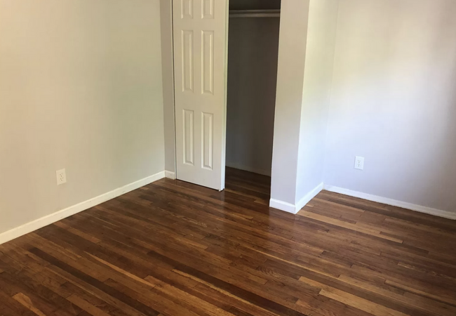
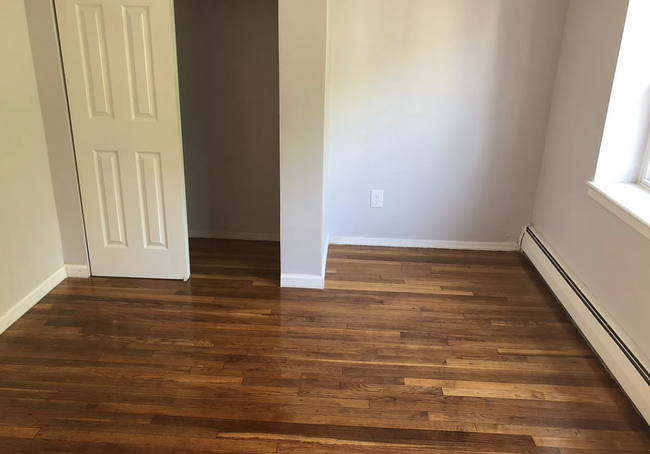
- Hardwood Floors
79 Broad St Unit 22

Favorites
About This Home
12 Month Lease,
$2,700 deposit,
Available Now
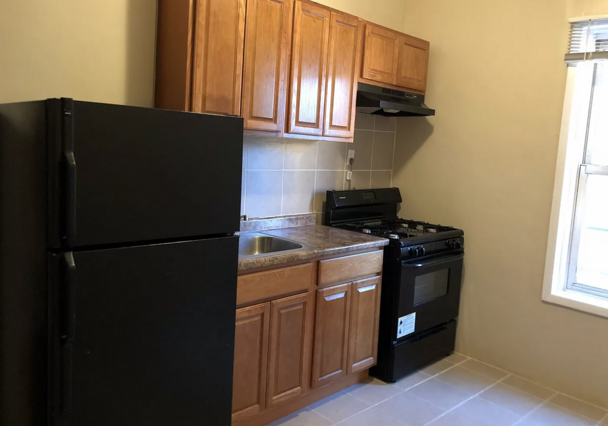
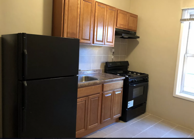
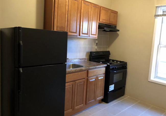
2 bedrooms 1 bath NO BROKER FEE Close to public transportation, a park, freeway access, dining, and shopping opportunities. Hardwood floor! Beautiful modern kitchen! Great natural light! We require proof of income and good credit.
2 bedrooms 1 bath NO BROKER FEE Close to public transportation, a park, freeway access, dining, and shopping opportunities. Hardwood floor! Beautiful modern kitchen! Great natural light! We require proof of income and good credit.
79 Broad St is an apartment community located in Essex County and the 07104 ZIP Code.
* Price shown is base rent and may not include non-optional fees and utilities.
Price, availability, fees, and any applicable rent special are subject to change without notice.
* Square footage definitions vary. Displayed square footage is approximate.
Apartment Features
- Kitchen
- Hardwood Floors
Fees and Policies
The fees below are based on community-supplied data and may exclude additional fees and utilities.
- Dogs Allowed
-
Fees not specified
- Cats Allowed
-
Fees not specified
Details
Property Information
-
4 units
Contact
- Contact
Location
Get Directions
Framed on the right by the Passaic River is the suburban neighborhood of Mount Pleasant-Lower Broadway. This community is ideal for commuters as it provides easy access to Interstate 280 and Highway 21, and it is situated just miles north of Downtown Newark. The suburb’s primarily residential streets are home to historic places of worship. Admire the impressive architecture of the community’s long-standing churches, including Saint Lucy's Church and the Archdiocese of Newark. Next, visit the city’s longest operating synagogue, the stunning Jewish Museum of New Jersey.
Moments away in Newark, renters in the Mount Pleasant-Lower Broadway area can enjoy exciting attractions including historic house museums, scenic parks, and a planetarium. To the west of the suburb is Branch Brook Park. Although good for recreation and fresh air year-round, this park really comes to life during the Cherry Blossom Festival.
Learn more about living in Mount Pleasant-Lower Broad
Education
| Colleges & Universities | Distance | ||
|---|---|---|---|
| Colleges & Universities | Distance | ||
| Drive: | 3 min | 1.5 mi | |
| Drive: | 4 min | 2.0 mi | |
| Drive: | 5 min | 2.0 mi | |
| Drive: | 7 min | 3.7 mi |
79 Broad St Unit 22 is within 3 minutes or 1.5 miles from Rutgers, Newark Campus. It is also near N.J. Inst. of Technology and Essex County College.
Transportation options available in Newark include Bloomfield Avenue, located 1.3 miles from 79 Broad St Unit 22. 79 Broad St Unit 22 is near Newark Liberty International, located 7.2 miles or 12 minutes away, and Laguardia, located 27.4 miles or 42 minutes away.
| Transit / Subway | Distance | ||
|---|---|---|---|
| Transit / Subway | Distance | ||
|
|
Drive: | 3 min | 1.3 mi |
|
|
Drive: | 3 min | 1.4 mi |
|
|
Drive: | 3 min | 1.5 mi |
|
|
Drive: | 5 min | 1.9 mi |
|
|
Drive: | 5 min | 2.2 mi |
| Commuter Rail | Distance | ||
|---|---|---|---|
| Commuter Rail | Distance | ||
|
|
Drive: | 4 min | 2.2 mi |
|
|
Drive: | 5 min | 2.2 mi |
|
|
Drive: | 5 min | 2.3 mi |
|
|
Drive: | 6 min | 3.0 mi |
|
|
Drive: | 7 min | 3.5 mi |
| Airports | Distance | ||
|---|---|---|---|
| Airports | Distance | ||
|
Newark Liberty International
|
Drive: | 12 min | 7.2 mi |
|
Laguardia
|
Drive: | 42 min | 27.4 mi |
Time and distance from 79 Broad St Unit 22.
| Shopping Centers | Distance | ||
|---|---|---|---|
| Shopping Centers | Distance | ||
| Walk: | 5 min | 0.3 mi | |
| Drive: | 5 min | 1.7 mi | |
| Drive: | 4 min | 1.7 mi |
79 Broad St Unit 22 has 3 shopping centers within 1.7 miles, which is about a 4-minute walk. The miles and minutes will be for the farthest away property.
| Parks and Recreation | Distance | ||
|---|---|---|---|
| Parks and Recreation | Distance | ||
|
Branch Brook Park
|
Drive: | 4 min | 1.5 mi |
|
Newark Museum and Dreyfuss Planetarium
|
Drive: | 4 min | 1.6 mi |
|
Kearny Marsh
|
Drive: | 9 min | 4.0 mi |
|
Richard W. DeKorte Park
|
Drive: | 11 min | 4.9 mi |
|
Meadowlands Environment Center
|
Drive: | 19 min | 7.7 mi |
79 Broad St Unit 22 has 5 parks within 7.7 miles, including Branch Brook Park, Newark Museum and Dreyfuss Planetarium, and Kearny Marsh.
| Hospitals | Distance | ||
|---|---|---|---|
| Hospitals | Distance | ||
| Drive: | 3 min | 1.6 mi | |
| Drive: | 6 min | 2.8 mi | |
| Drive: | 7 min | 3.7 mi |
79 Broad St Unit 22 has 3 hospitals within 3.7 miles, the nearest is Saint Michael's Medical Center which is 1.6 miles away and a 3 minute drive.
| Military Bases | Distance | ||
|---|---|---|---|
| Military Bases | Distance | ||
| Drive: | 18 min | 11.0 mi | |
| Drive: | 28 min | 13.1 mi | |
| Drive: | 33 min | 19.1 mi |
79 Broad St Unit 22 has 3 military bases within 19.1 miles, the nearest is Military Ocean Terminal which is 11.0 miles away and a 18 minute drive.
Amenities
- Kitchen
- Hardwood Floors
79 Broad St Unit 22 Photos
What Are Walk Score®, Transit Score®, and Bike Score® Ratings?
Walk Score® measures the walkability of any address. Transit Score® measures access to public transit. Bike Score® measures the bikeability of any address.
What is a Sound Score Rating?
A Sound Score Rating aggregates noise caused by vehicle traffic, airplane traffic and local sources

79 Broad St
Newark, NJ 07104