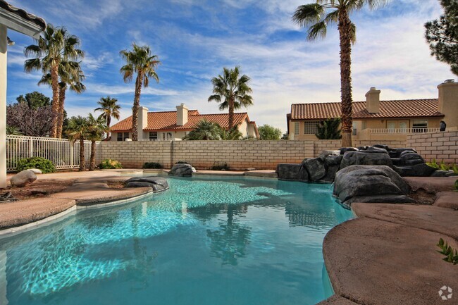
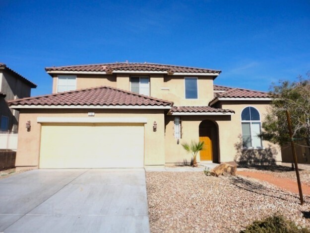
$3,500 / Month
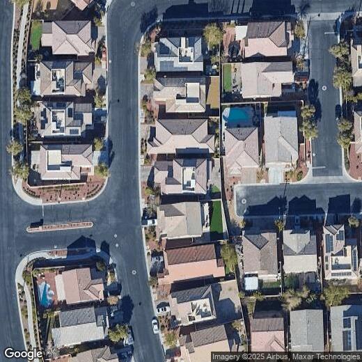
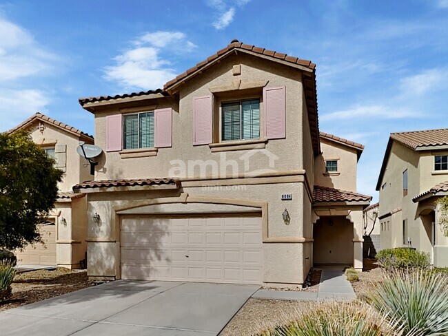
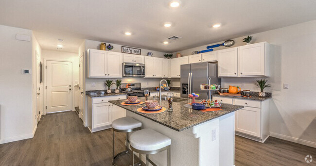
7926 Torreys Peak St
Las Vegas, NV 89166
Today
Favorites
408-888-2024
-
Bedrooms
4
-
Bathrooms
3.5
-
Square Feet
2,471 sq ft
-
Available
Available Now
7926 Torreys Peak St

Favorites
Providence holds a special place as a firmly established traditional Americana neighborhood, with over 4,000 trees lining the streets, beautiful custom-built homes, and a tight-knit community.
Located within minutes of I-95 and I-215, this expansive, pet-friendly neighborhood combines classic Las Vegas aesthetics with the amenities of modern living. You'll find a small-town spirit with a high-energy pace, all just minutes away from the Red Rock Canyon National Conservation Area.
Providence has a lot to offer in Las Vegas’ Upper West Side community. With outstanding schools located within walking distance, three distinct parks, and unique homes built by prominent home builders, residents are well taken care of.
Learn more about living in Providence
Education
| Colleges & Universities | Distance | ||
|---|---|---|---|
| Colleges & Universities | Distance | ||
| Drive: | 22 min | 14.8 mi | |
| Drive: | 28 min | 17.3 mi | |
| Drive: | 25 min | 18.1 mi | |
| Drive: | 35 min | 23.1 mi |
7926 Torreys Peak St is within 22 minutes or 14.8 miles from Southern Nevada, Charleston. It is also near Nev. State Coll., Shadow Lane and Southern Nevada, Cheyenne.
Schools


Public Elementary School
Grades PK-5
799 Students
Attendance Zone
Public Middle School
Grades 6-8
871 Students
Attendance Zone
Public High School
Grades 9-12
3,251 Students
Attendance Zone
Private Elementary, Middle & High School
Grades PK-12
226 Students
Nearby
Private Elementary, Middle & High School
Grades PK-10
28 Students
Nearby
Private Elementary School
Grades PK-5
96 Students
Nearby
School data provided by
 The GreatSchools Rating helps parents compare schools within a state based on a variety of school quality indicators and provides a helpful picture of how effectively each school serves all of its students. Ratings are on a scale of 1 (below average) to 10 (above average) and can include test scores, college readiness, academic progress, advanced courses, equity, discipline and attendance data. We also advise parents to visit schools, consider other information on school performance and programs, and consider family needs as part of the school selection process.
View GreatSchools Rating Methodology
View GreatSchools Rating Methodology
Transportation options available in Las Vegas include Sahara Station, located 20.0 miles from 7926 Torreys Peak St. 7926 Torreys Peak St is near Harry Reid International, located 24.3 miles or 37 minutes away.
| Transit / Subway | Distance | ||
|---|---|---|---|
| Transit / Subway | Distance | ||
|
|
Drive: | 28 min | 20.0 mi |
|
|
Drive: | 30 min | 20.5 mi |
|
|
Drive: | 29 min | 20.6 mi |
|
|
Drive: | 31 min | 21.3 mi |
|
|
Drive: | 31 min | 21.9 mi |
| Airports | Distance | ||
|---|---|---|---|
| Airports | Distance | ||
|
Harry Reid International
|
Drive: | 37 min | 24.3 mi |
Time and distance from 7926 Torreys Peak St.
| Shopping Centers | Distance | ||
|---|---|---|---|
| Shopping Centers | Distance | ||
| Drive: | 4 min | 1.4 mi | |
| Drive: | 5 min | 1.9 mi | |
| Drive: | 5 min | 2.1 mi |
7926 Torreys Peak St has 3 shopping centers within 2.1 miles, which is about a 5-minute drive. The miles and minutes will be for the farthest away property.
| Parks and Recreation | Distance | ||
|---|---|---|---|
| Parks and Recreation | Distance | ||
|
Floyd Lamb Park
|
Drive: | 13 min | 4.3 mi |
|
Spring Mountains National Recreation Area
|
Drive: | 14 min | 8.2 mi |
7926 Torreys Peak St has 2 parks within 8.2 miles, including Floyd Lamb Park, and Spring Mountains National Recreation Area.
| Hospitals | Distance | ||
|---|---|---|---|
| Hospitals | Distance | ||
| Drive: | 7 min | 3.6 mi | |
| Drive: | 14 min | 10.0 mi | |
| Drive: | 18 min | 12.5 mi |
7926 Torreys Peak St has 3 hospitals within 12.5 miles, the nearest is Centennial Hills Hospital Medical Center which is 3.6 miles away and a 7 minute drive.
| Military Bases | Distance | ||
|---|---|---|---|
| Military Bases | Distance | ||
| Drive: | 39 min | 23.5 mi |
7926 Torreys Peak St is 23.5 miles and a 39 minute drive from Nellis Air Force Base.
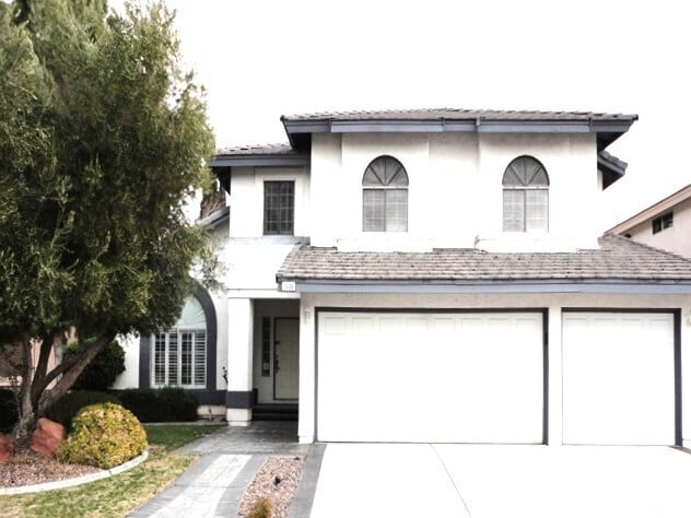
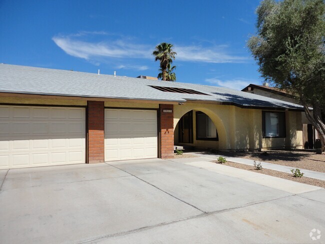
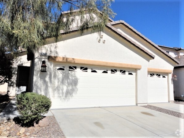
You May Also Like
Similar Rentals Nearby
-
-
-
-
-
-
 $2,2904 Beds, 2.5 Baths, 2,097 sq ftHouse for Rent
 -
-
-
-

What Are Walk Score®, Transit Score®, and Bike Score® Ratings?
Walk Score® measures the walkability of any address. Transit Score® measures access to public transit. Bike Score® measures the bikeability of any address.
What is a Sound Score Rating?
A Sound Score Rating aggregates noise caused by vehicle traffic, airplane traffic and local sources

7926 Torreys Peak St
Las Vegas, NV 89166