

$4,800 / Month
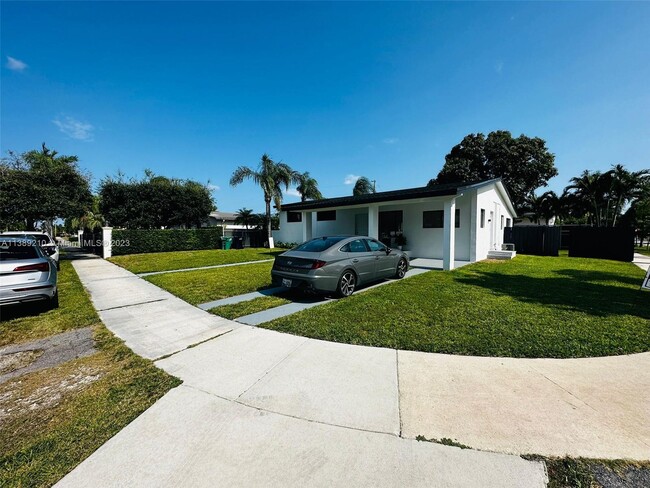
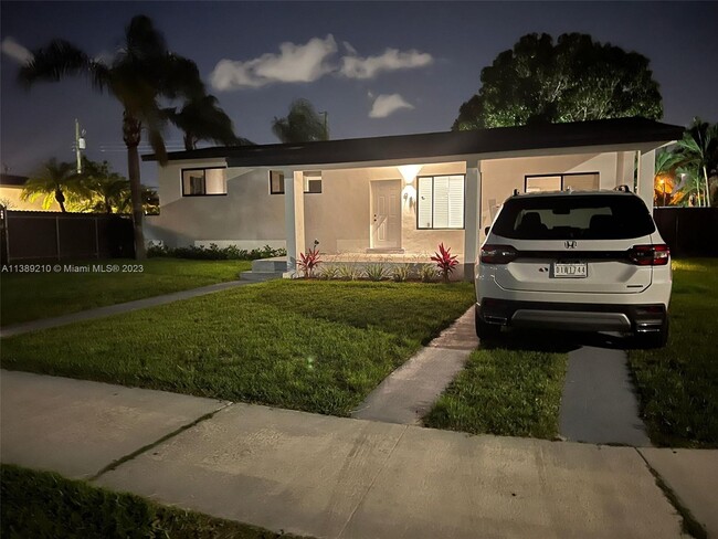
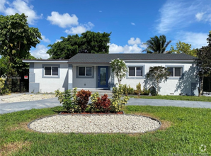
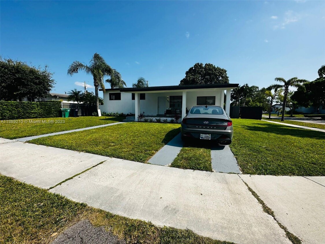
7950 SW 22nd St
Miami, FL 33155
2 Weeks Ago
Favorites
7950 SW 22nd St

Favorites
Check Back Soon for Upcoming Availability
| Beds | Baths | Average SF |
|---|---|---|
| 3 Bedrooms 3 Bedrooms 3 Br | 2 Baths 2 Baths 2 Ba | — |
About This Property
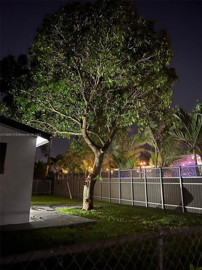
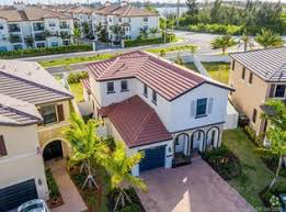
Beautiful and Comfortable Furnished 3beds 3baths house with a big backyard. Situated in a convenient location in Miami, you'll enjoy easy access to shopping centers, parks, schools, and transportation. You must see it. It won't last.
7950 SW 22nd St is a house located in Miami/Dade County and the 33155 ZIP Code. This area is served by the Miami-Dade County Public Schools attendance zone.
Fees and Policies
The fees below are based on community-supplied data and may exclude additional fees and utilities.
- Dogs Allowed
-
Fees not specified
- Cats Allowed
-
Fees not specified
Property Address:
7950 SW 22nd St,
Miami,
FL
33155
Nestled about 11 miles southwest of Downtown Miami, Westchester is a beloved suburb teeming with personality. Westchester boasts a broad range of delectable restaurants serving up everything from authentic Asian cuisine to diverse Latin fare and more.
Westchester is also home to tranquil, palm-tree-lined residential streets featuring an array of apartments, condos, townhomes, and houses available for rent at varying price points. The community claims Santa’s Enchanted Forest — the world’s largest holiday theme park — as its own, providing thrill rides and games from October to January at Tropical Park every year.
Westchester’s central locale is part of its allure, offering quick access to Miami’s premier educational institutions, Florida International University and the University of Miami, in addition to retail destinations like Dadeland Mall, Dolphin Mall, and Miami International Mall. Commuting from Westchester is a breeze with direct access to the Palmetto Expressway.
Learn more about living in WestchesterBelow are rent ranges for similar nearby apartments
Education
| Colleges & Universities | Distance | ||
|---|---|---|---|
| Colleges & Universities | Distance | ||
| Drive: | 11 min | 4.8 mi | |
| Drive: | 12 min | 5.5 mi | |
| Drive: | 14 min | 6.9 mi | |
| Drive: | 15 min | 8.6 mi |
7950 SW 22nd St is within 11 minutes or 4.8 miles from FIU, Modesto Maidique. It is also near Univ. of Miami, Coral Gables and USAHS.
Schools


Public Elementary & Middle School
Grades PK-8
953 Students
Attendance Zone
Public Middle School
Grades 6-8
655 Students
Attendance Zone
Public High School
Grades 9-12
2,190 Students
Attendance Zone
Private Elementary & Middle School
Grades PK-8
Nearby
Private Middle & High School
Grades 6-12
18 Students
Nearby
School data provided by
 The GreatSchools Rating helps parents compare schools within a state based on a variety of school quality indicators and provides a helpful picture of how effectively each school serves all of its students. Ratings are on a scale of 1 (below average) to 10 (above average) and can include test scores, college readiness, academic progress, advanced courses, equity, discipline and attendance data. We also advise parents to visit schools, consider other information on school performance and programs, and consider family needs as part of the school selection process.
View GreatSchools Rating Methodology
View GreatSchools Rating Methodology
Transportation options available in Miami include Miami Intl Airport Ground Level, located 8.3 miles from 7950 SW 22nd St. 7950 SW 22nd St is near Miami International, located 6.4 miles or 14 minutes away, and Fort Lauderdale/Hollywood International, located 32.6 miles or 46 minutes away.
| Transit / Subway | Distance | ||
|---|---|---|---|
| Transit / Subway | Distance | ||
|
|
Drive: | 16 min | 8.3 mi |
|
|
Drive: | 20 min | 10.0 mi |
|
|
Drive: | 18 min | 11.3 mi |
|
|
Drive: | 20 min | 12.5 mi |
|
|
Drive: | 20 min | 12.6 mi |
| Commuter Rail | Distance | ||
|---|---|---|---|
| Commuter Rail | Distance | ||
|
|
Drive: | 9 min | 5.5 mi |
|
|
Drive: | 10 min | 5.7 mi |
|
|
Drive: | 10 min | 5.9 mi |
|
|
Drive: | 13 min | 5.9 mi |
|
|
Drive: | 12 min | 6.8 mi |
| Airports | Distance | ||
|---|---|---|---|
| Airports | Distance | ||
|
Miami International
|
Drive: | 14 min | 6.4 mi |
|
Fort Lauderdale/Hollywood International
|
Drive: | 46 min | 32.6 mi |
Time and distance from 7950 SW 22nd St.
| Shopping Centers | Distance | ||
|---|---|---|---|
| Shopping Centers | Distance | ||
| Walk: | 6 min | 0.3 mi | |
| Drive: | 3 min | 1.2 mi | |
| Drive: | 3 min | 1.3 mi |
7950 SW 22nd St has 3 shopping centers within 1.3 miles, which is about a 3-minute walk. The miles and minutes will be for the farthest away property.
| Parks and Recreation | Distance | ||
|---|---|---|---|
| Parks and Recreation | Distance | ||
|
Sense of Wonder Nature Center and A.D. Barnes Park
|
Drive: | 4 min | 1.7 mi |
|
Gifford Arboretum
|
Drive: | 10 min | 4.8 mi |
|
The Barnacle Historic State Park
|
Drive: | 14 min | 6.9 mi |
|
The Kampong
|
Drive: | 15 min | 7.2 mi |
|
Fairchild Tropical Botanic Garden
|
Drive: | 19 min | 9.0 mi |
7950 SW 22nd St has 5 parks within 9.0 miles, including Sense of Wonder Nature Center and A.D. Barnes Park, Gifford Arboretum, and The Kampong.
| Hospitals | Distance | ||
|---|---|---|---|
| Hospitals | Distance | ||
| Walk: | 11 min | 0.6 mi | |
| Drive: | 5 min | 2.3 mi | |
| Drive: | 9 min | 5.4 mi |
7950 SW 22nd St has 3 hospitals within 5.4 miles, the nearest is Westchester General Hospital which is 0.6 mile away and a 11 minute walk.
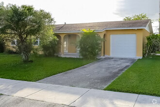
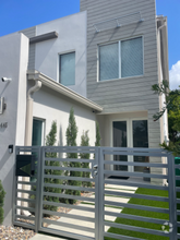
You May Also Like
Similar Rentals Nearby

What Are Walk Score®, Transit Score®, and Bike Score® Ratings?
Walk Score® measures the walkability of any address. Transit Score® measures access to public transit. Bike Score® measures the bikeability of any address.
What is a Sound Score Rating?
A Sound Score Rating aggregates noise caused by vehicle traffic, airplane traffic and local sources
7950 SW 22nd St
Miami, FL 33155