$1,900 / Month
8 Brand Ave
Wilmington, MA 01887
2 Weeks Ago
Favorites
8 Brand Ave

Favorites
Check Back Soon for Upcoming Availability
| Beds | Baths | Average SF |
|---|---|---|
| 1 Bedroom 1 Bedroom 1 Br | 1 Bath 1 Bath 1 Ba | 600 SF |
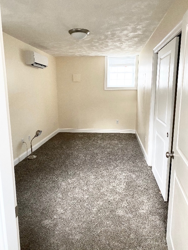
About This Property
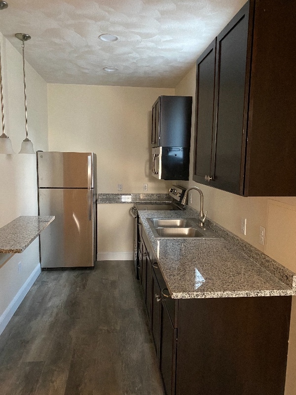
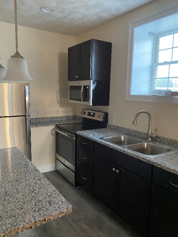
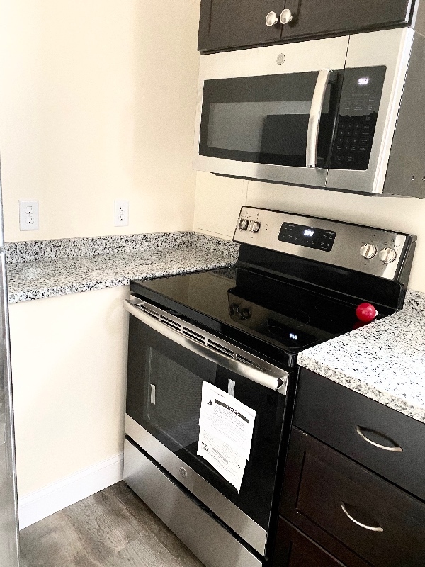
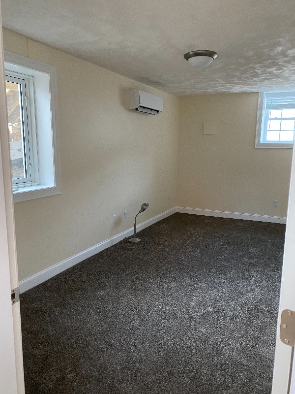
Property Id: 203128 Spacious modern lower level apt on a private street in the highly sought-after Wilmington, MA area. This unit is a lower level apt to a single-family home. This cozy open concept 600 sq ft apt with 1 bedroom & 1 bath boasts: - Quaint Kitchen with SS appliances & granite counter tops; Large bedroom with a substantial closet -Breakfast Bar with hanging lights- Washer/Dryer in Unit - Lovely Bathroom-Large windows bring in all the sunshine-Beautiful vinyl engineering wood through-out. Location, location! The property is minutes/walking distance from two commuter rail station stops (North Station Bound), #12 Bus, Market Basket, CVS, banks and other shops. Easy commute to Hospitals, HWY 93, 495 and RTE 3 AND Boston. •$1900/month •Utilities Included (heat, electricity, sewer, hot water, trash removal) •W/D in-unit •Stainless Steel Appliances •Parking available •Minutes to two commuter rail stops •Pets allowed for a small fee Call/Text today (originally from NY).
8 Brand Ave is an apartment community located in Middlesex County and the 01887 ZIP Code.
Features
Washer/Dryer
Microwave
Refrigerator
Oven
- Washer/Dryer
- Cable Ready
- Microwave
- Oven
- Refrigerator
Fees and Policies
The fees below are based on community-supplied data and may exclude additional fees and utilities.
- Dogs Allowed
-
Fees not specified
- Cats Allowed
-
Fees not specified
Details
Utilities Included
-
Gas
-
Water
-
Electricity
-
Trash Removal
-
Sewer
Property Address:
8 Brand Ave,
Wilmington,
MA
01887
Settled in 1665, Wilmington played a crucial role in the early colonies. The Middlesex Canal, a 27-mile canal connecting the port of Boston and the Merrimack River, passed through Wilmington. As one of the young nation's first engineering projects, the Middlesex Canal's aqueducts and other remnants are listed on the National Register of Historic Places.
Today, Wilmington is a wooded suburban community with some beautiful features, such as Silver Lake and Cranberry Bog. The Town Museum is a fascinating destination, housed in the Col. Joshua Harnden Tavern, built in 1770 and listed on the National Register of Historic Places. Harnden, the man who built the house, achieved the rank of colonel during the American Revolution.
In addition to being a beautiful town with a rich history, Wilmington is ideally located for commuters, roughly 15 miles northwest of Boston. Commuters can take I-93 or, for a car-free commute, hop on the MBTA Lowell Line and arrive downtown in about 20 minutes.
Learn more about living in WilmingtonBelow are rent ranges for similar nearby apartments
Amenities
- Washer/Dryer
- Cable Ready
- Microwave
- Oven
- Refrigerator
Expenses
Utilities Included
Gas, Water, Electricity, Trash Removal, Sewer
Included
Education
| Colleges & Universities | Distance | ||
|---|---|---|---|
| Colleges & Universities | Distance | ||
| Drive: | 20 min | 9.4 mi | |
| Drive: | 19 min | 9.6 mi | |
| Drive: | 20 min | 10.1 mi | |
| Drive: | 21 min | 10.5 mi |
8 Brand Ave is within 20 minutes or 9.4 miles from Middlesex C.C., Bedford Campus. It is also near Middlesex C.C., Lowell Campus and Merrimack College.
Transportation options available in Wilmington include Oak Grove Station, located 11.5 miles from 8 Brand Ave. 8 Brand Ave is near General Edward Lawrence Logan International, located 19.3 miles or 29 minutes away, and Manchester Boston Regional, located 36.5 miles or 55 minutes away.
| Transit / Subway | Distance | ||
|---|---|---|---|
| Transit / Subway | Distance | ||
|
|
Drive: | 19 min | 11.5 mi |
|
|
Drive: | 19 min | 12.8 mi |
| Drive: | 19 min | 13.0 mi | |
| Drive: | 20 min | 13.5 mi | |
|
|
Drive: | 24 min | 15.9 mi |
| Commuter Rail | Distance | ||
|---|---|---|---|
| Commuter Rail | Distance | ||
|
|
Walk: | 18 min | 1.0 mi |
|
|
Drive: | 5 min | 2.8 mi |
|
|
Drive: | 10 min | 5.0 mi |
|
|
Drive: | 9 min | 5.1 mi |
|
|
Drive: | 13 min | 6.6 mi |
| Airports | Distance | ||
|---|---|---|---|
| Airports | Distance | ||
|
General Edward Lawrence Logan International
|
Drive: | 29 min | 19.3 mi |
|
Manchester Boston Regional
|
Drive: | 55 min | 36.5 mi |
Time and distance from 8 Brand Ave.
| Shopping Centers | Distance | ||
|---|---|---|---|
| Shopping Centers | Distance | ||
| Walk: | 5 min | 0.3 mi | |
| Walk: | 7 min | 0.4 mi | |
| Walk: | 13 min | 0.7 mi |
8 Brand Ave has 3 shopping centers within 0.7 mile, which is about a 13-minute walk. The miles and minutes will be for the farthest away property.
| Parks and Recreation | Distance | ||
|---|---|---|---|
| Parks and Recreation | Distance | ||
|
Ralph Hill Conservation Area
|
Drive: | 18 min | 8.4 mi |
|
Walter D. Stone Memorial Zoo
|
Drive: | 15 min | 9.2 mi |
|
Middlesex Fells Reservation
|
Drive: | 15 min | 9.6 mi |
|
Harold Parker State Forest
|
Drive: | 23 min | 10.8 mi |
|
Great Brook Farm State Park
|
Drive: | 24 min | 12.3 mi |
8 Brand Ave has 5 parks within 12.3 miles, including Ralph Hill Conservation Area, Walter D. Stone Memorial Zoo, and Harold Parker State Forest.
| Hospitals | Distance | ||
|---|---|---|---|
| Hospitals | Distance | ||
| Drive: | 13 min | 7.3 mi | |
| Drive: | 15 min | 8.8 mi | |
| Drive: | 19 min | 11.0 mi |
8 Brand Ave has 3 hospitals within 11.0 miles, the nearest is Lahey Hospital & Medical Center, Burlington which is 7.3 miles away and a 13 minute drive.
| Military Bases | Distance | ||
|---|---|---|---|
| Military Bases | Distance | ||
| Drive: | 21 min | 11.8 mi | |
| Drive: | 35 min | 18.7 mi |
8 Brand Ave is 11.8 miles from Hanscom Air Force Base, and is convenient to other military bases, including Fort Pickering.
You May Also Like
Similar Rentals Nearby


What Are Walk Score®, Transit Score®, and Bike Score® Ratings?
Walk Score® measures the walkability of any address. Transit Score® measures access to public transit. Bike Score® measures the bikeability of any address.
What is a Sound Score Rating?
A Sound Score Rating aggregates noise caused by vehicle traffic, airplane traffic and local sources

8 Brand Ave
Wilmington, MA 01887