
$2,225 / Month
80 Robbins St Unit 3
Waltham, MA 02453
2 Weeks Ago
Favorites
781-386-0392
-
Bedrooms
1
-
Bathrooms
1
-
Square Feet
500 sq ft
-
Available
Available Sep 1
80 Robbins St

Favorites
About This Home
12 Month Lease,
$2,225 deposit,
Available Sep 1
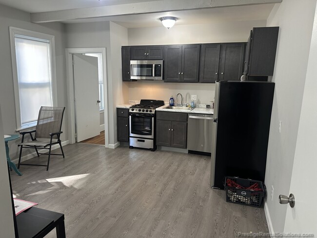
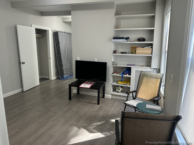
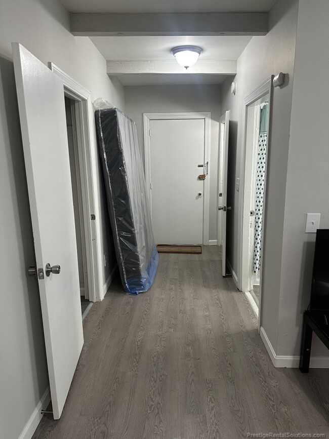
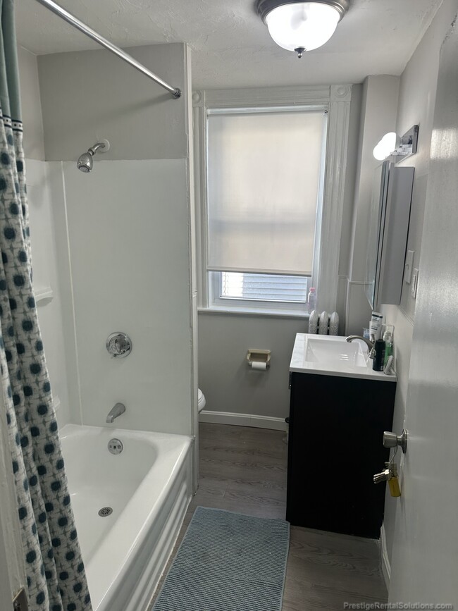
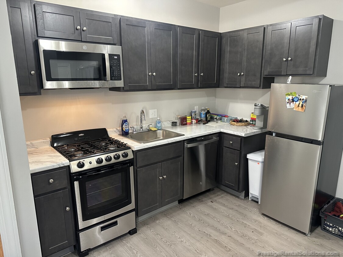
80 Robbins St off Moody St 600 Block... Cozy First Floor 1 Bed in three story house with a total of 5 units in it... Unit features modern full size bathroom with oak fixtures... Combo livingroom/kitchen with dishwasher/disposal.. Heat and hotwater included in the rent. Street parking and coin-op laundry in the house.
80 Robbins St is a house located in Middlesex County and the 02453 ZIP Code.
* Price shown is base rent and may not include non-optional fees and utilities.
Price, availability, fees, and any applicable rent special are subject to change without notice.
* Square footage definitions vary. Displayed square footage is approximate.
House Features
Dishwasher
High Speed Internet Access
Refrigerator
Tub/Shower
- High Speed Internet Access
- Heating
- Cable Ready
- Tub/Shower
- Dishwasher
- Disposal
- Kitchen
- Refrigerator
- Instant Hot Water
- Laundry Facilities
Fees and Policies
The fees below are based on community-supplied data and may exclude additional fees and utilities.
- Cats Allowed
-
Fees not specified
-
Weight limit--
-
Pet Limit--
- Parking
-
Street--
Details
Utilities Included
-
Water
-
Heat
-
Trash Removal
-
Sewer
Contact
- Listed by John Hanrahan
- Phone Number
- Contact
$2,430 / month
$379,000 Listing Price
2 Beds
•1 Baths
•
600 Sq Ft
$2,070 / month
$320,000 Listing Price
1 Beds
•1 Baths
•
500 Sq Ft
$2,036 / month
$269,900 Listing Price
2 Beds
•1 Baths
•
913 Sq Ft
Location
Get Directions
Nestled along Charles River, the South Side of Waltham, Massachusetts is a bustling neighborhood filled with historic homes, various businesses, local restaurants, and convenient amenities. Wine and dine someone special at Bistro781, or grab some brunch at In a Pickle, the best brunch spot in the city.
Directly south of Downtown Waltham, the South Side is a great place for families or those interested in cozy houses and upscale, modern apartment rentals with quick access to neighboring areas. Riverfront views are a major perk of this neighborhood, so be sure to gaze along the Charles River when you get a chance.
Situated just 10 miles west of Boston, Waltham isn’t your only option for urban conveniences.
Learn more about living in South Side
Education
| Colleges & Universities | Distance | ||
|---|---|---|---|
| Colleges & Universities | Distance | ||
| Drive: | 6 min | 1.8 mi | |
| Drive: | 6 min | 2.6 mi | |
| Drive: | 12 min | 5.7 mi | |
| Drive: | 14 min | 6.1 mi |
80 Robbins St is within 6 minutes or 1.8 miles from Brandeis University. It is also near Bentley University and Boston College.
Transportation options available in Waltham include Riverside Station, located 2.4 miles from 80 Robbins St. 80 Robbins St is near General Edward Lawrence Logan International, located 14.7 miles or 24 minutes away, and Worcester Regional, located 40.1 miles or 58 minutes away.
| Transit / Subway | Distance | ||
|---|---|---|---|
| Transit / Subway | Distance | ||
|
|
Drive: | 6 min | 2.4 mi |
|
|
Drive: | 6 min | 2.9 mi |
|
|
Drive: | 8 min | 3.5 mi |
|
|
Drive: | 10 min | 4.2 mi |
|
|
Drive: | 10 min | 4.3 mi |
| Commuter Rail | Distance | ||
|---|---|---|---|
| Commuter Rail | Distance | ||
| Walk: | 16 min | 0.9 mi | |
|
|
Walk: | 16 min | 0.9 mi |
|
|
Drive: | 4 min | 1.8 mi |
|
|
Drive: | 11 min | 6.2 mi |
|
|
Drive: | 12 min | 7.0 mi |
| Airports | Distance | ||
|---|---|---|---|
| Airports | Distance | ||
|
General Edward Lawrence Logan International
|
Drive: | 24 min | 14.7 mi |
|
Worcester Regional
|
Drive: | 58 min | 40.1 mi |
Time and distance from 80 Robbins St.
| Shopping Centers | Distance | ||
|---|---|---|---|
| Shopping Centers | Distance | ||
| Drive: | 3 min | 1.4 mi | |
| Drive: | 3 min | 1.5 mi | |
| Drive: | 4 min | 1.9 mi |
80 Robbins St has 3 shopping centers within 1.9 miles, which is about a 4-minute drive. The miles and minutes will be for the farthest away property.
| Parks and Recreation | Distance | ||
|---|---|---|---|
| Parks and Recreation | Distance | ||
|
Beaver Brook Reservation
|
Drive: | 7 min | 3.3 mi |
|
Land's Sake Farm
|
Drive: | 8 min | 4.2 mi |
|
Hemlock Gorge Reservation
|
Drive: | 12 min | 4.9 mi |
|
Hammond Pond Reservation
|
Drive: | 11 min | 5.1 mi |
|
Mass Audubon's Habitat Education Center and Wildlife Sanctuary
|
Drive: | 11 min | 5.1 mi |
80 Robbins St has 5 parks within 5.1 miles, including Beaver Brook Reservation, Land's Sake Farm, and Hemlock Gorge Reservation.
| Hospitals | Distance | ||
|---|---|---|---|
| Hospitals | Distance | ||
| Walk: | 14 min | 0.8 mi | |
| Drive: | 6 min | 3.0 mi | |
| Drive: | 7 min | 3.7 mi |
80 Robbins St has 3 hospitals within 3.7 miles, the nearest is Walden Behavioral Care which is 0.8 mile away and a 14 minute walk.
| Military Bases | Distance | ||
|---|---|---|---|
| Military Bases | Distance | ||
| Drive: | 18 min | 9.2 mi | |
| Drive: | 20 min | 10.7 mi |
80 Robbins St is 9.2 miles from Hanscom Air Force Base, and is convenient to other military bases, including US Military Reservation.
Amenities
- High Speed Internet Access
- Heating
- Cable Ready
- Tub/Shower
- Dishwasher
- Disposal
- Kitchen
- Refrigerator
- Instant Hot Water
- Laundry Facilities
80 Robbins St Photos
What Are Walk Score®, Transit Score®, and Bike Score® Ratings?
Walk Score® measures the walkability of any address. Transit Score® measures access to public transit. Bike Score® measures the bikeability of any address.
What is a Sound Score Rating?
A Sound Score Rating aggregates noise caused by vehicle traffic, airplane traffic and local sources
80 Robbins St
Waltham, MA 02453