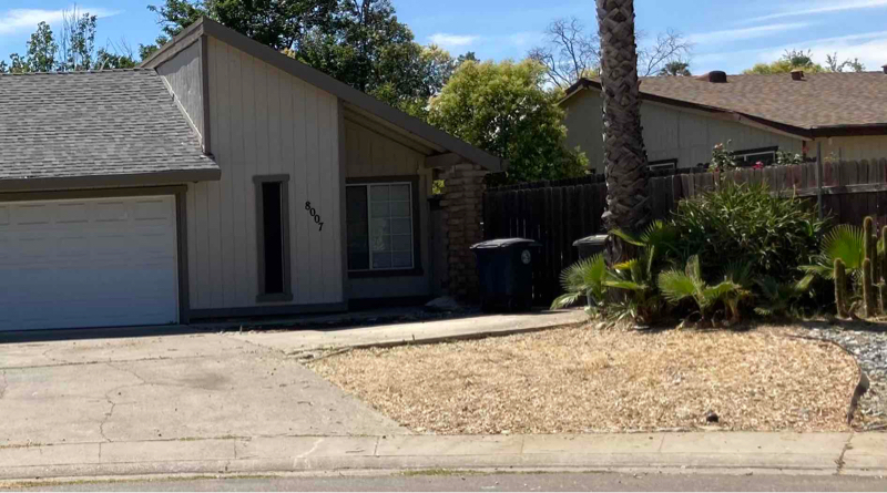
8007 Candy Cone Ct
Citrus Heights, CA 95621

Check Back Soon for Upcoming Availability
| Beds | Baths | Average SF |
|---|---|---|
| 2 Bedrooms 2 Bedrooms 2 Br | 2 Baths 2 Baths 2 Ba | 1,150 SF |
About This Property
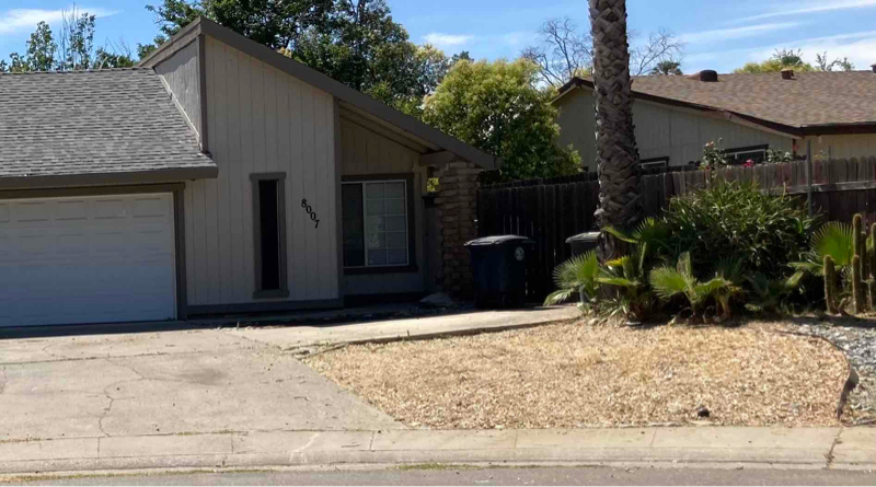
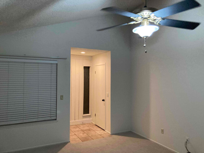
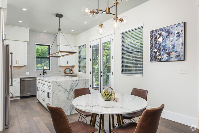
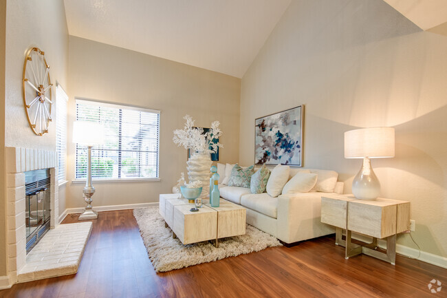
Property Id: 964972 This home is available now it is located in Antelope woods in Citrus Heights in a cul-de-sac. Close to hwy 80 and shopping center.Plenty of parking spots in the front of the garage and on the side of the home. Two car garage with a gated side yard. Newer carpeting throughout with tiled floor in kitchen and dining room, bathroom with backsplash bathtub. Inverter style cooling and heating system. Vaulted ceilings in dining room and living room with ceiling fans throughout the house. Spacious garage lots of shelves, compartments also comes with a pantry. Shaded backyard with a patio overlooking trees. Spacious with lots of parking and compartments. Application with a credit check first month payment $2095 and a deposit of $2095
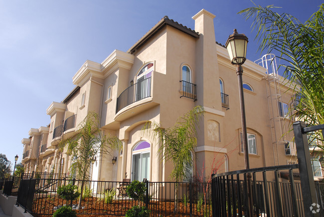
8007 Candy Cone Ct is a townhome located in Sacramento County and the 95621 ZIP Code. This area is served by the San Juan Unified attendance zone.
Townhome Features
Dishwasher
Disposal
Fireplace
Tile Floors
- Cable Ready
- Fireplace
- Dishwasher
- Disposal
- Oven
- Tile Floors
- Vaulted Ceiling
- Fenced Lot
Fees and Policies
The fees below are based on community-supplied data and may exclude additional fees and utilities.
- Parking
-
Garage--
Details
Utilities Included
-
Water
-
Trash Removal
-
Sewer
Defined by sun-drenched neighborhoods, tree-lined streets, and lacy palm trees against bright blue sky, Citrus Heights is a beautiful suburban city just 14 miles northeast of Downtown Sacramento. Citrus Heights residents enjoy easy access to I-80, for quick trips to Sacramento or northeast to Roseville, home of the Westfield Galleria at Roseville. Folsom Lake, a popular resort area, is minutes east of Citrus Heights.
Apartments in Citrus Heights provide a quieter option to city living while still being well within reach of everything this busy area has to offer -- including California State University, Sacramento, the Sacramento Zoo, and Sacramento International Airport. But as a busy city with plenty of businesses, shops, restaurants, and entertainment of its own, you'll find plenty to do closer to home. Go shopping at the Sunrise Mall, visit Rusch Park, home of the Historic Rusch Home and Gardens, and spend the afternoon golfing at Foothill Golf Center.
Learn more about living in Citrus Heights- Cable Ready
- Fireplace
- Dishwasher
- Disposal
- Oven
- Tile Floors
- Vaulted Ceiling
- Fenced Lot
| Colleges & Universities | Distance | ||
|---|---|---|---|
| Colleges & Universities | Distance | ||
| Drive: | 12 min | 5.8 mi | |
| Drive: | 14 min | 9.1 mi | |
| Drive: | 28 min | 14.1 mi | |
| Drive: | 22 min | 14.1 mi |
 The GreatSchools Rating helps parents compare schools within a state based on a variety of school quality indicators and provides a helpful picture of how effectively each school serves all of its students. Ratings are on a scale of 1 (below average) to 10 (above average) and can include test scores, college readiness, academic progress, advanced courses, equity, discipline and attendance data. We also advise parents to visit schools, consider other information on school performance and programs, and consider family needs as part of the school selection process.
View GreatSchools Rating Methodology
Transportation options available in Citrus Heights include Watt/I-80, located 6.5 miles from 8007 Candy Cone Ct. 8007 Candy Cone Ct is near Sacramento International, located 21.7 miles or 30 minutes away.
| Transit / Subway | Distance | ||
|---|---|---|---|
| Transit / Subway | Distance | ||
|
|
Drive: | 9 min | 6.5 mi |
|
|
Drive: | 11 min | 7.7 mi |
|
|
Drive: | 11 min | 7.8 mi |
| Drive: | 11 min | 8.3 mi | |
|
|
Drive: | 19 min | 11.1 mi |
| Commuter Rail | Distance | ||
|---|---|---|---|
| Commuter Rail | Distance | ||
|
|
Drive: | 9 min | 3.9 mi |
|
|
Drive: | 13 min | 8.2 mi |
| Drive: | 26 min | 20.4 mi | |
|
|
Drive: | 26 min | 20.5 mi |
|
|
Drive: | 35 min | 28.7 mi |
| Airports | Distance | ||
|---|---|---|---|
| Airports | Distance | ||
|
Sacramento International
|
Drive: | 30 min | 21.7 mi |
Time and distance from 8007 Candy Cone Ct.
| Shopping Centers | Distance | ||
|---|---|---|---|
| Shopping Centers | Distance | ||
| Walk: | 7 min | 0.4 mi | |
| Walk: | 13 min | 0.7 mi | |
| Walk: | 14 min | 0.7 mi |
| Parks and Recreation | Distance | ||
|---|---|---|---|
| Parks and Recreation | Distance | ||
|
Mahany Park
|
Drive: | 12 min | 5.8 mi |
|
Aerospace Museum of California
|
Drive: | 13 min | 6.1 mi |
|
Gibson Ranch County Park
|
Drive: | 14 min | 6.9 mi |
|
Mahan Park
|
Drive: | 15 min | 8.0 mi |
|
Luken Park
|
Drive: | 15 min | 8.1 mi |
| Hospitals | Distance | ||
|---|---|---|---|
| Hospitals | Distance | ||
| Drive: | 8 min | 4.0 mi | |
| Drive: | 9 min | 6.3 mi | |
| Drive: | 11 min | 6.4 mi |
| Military Bases | Distance | ||
|---|---|---|---|
| Military Bases | Distance | ||
| Drive: | 20 min | 8.0 mi |
You May Also Like
Similar Rentals Nearby
What Are Walk Score®, Transit Score®, and Bike Score® Ratings?
Walk Score® measures the walkability of any address. Transit Score® measures access to public transit. Bike Score® measures the bikeability of any address.
What is a Sound Score Rating?
A Sound Score Rating aggregates noise caused by vehicle traffic, airplane traffic and local sources
