
Check Back Soon for Upcoming Availability
| Beds | Baths | Average SF |
|---|---|---|
| 3 Bedrooms 3 Bedrooms 3 Br | 2.5 Baths 2.5 Baths 2.5 Ba | 1,350 SF |
About This Property
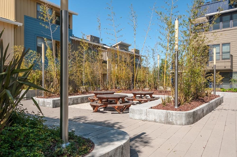
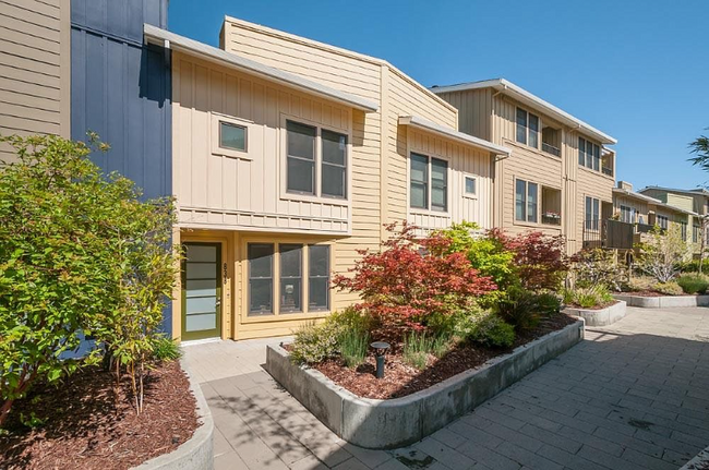
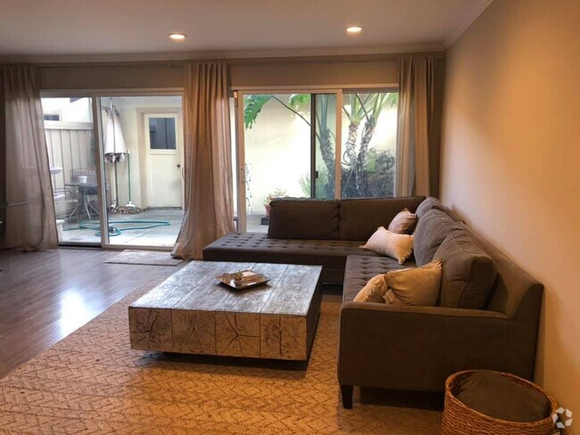
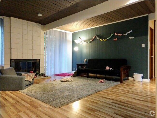
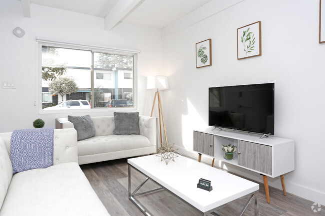
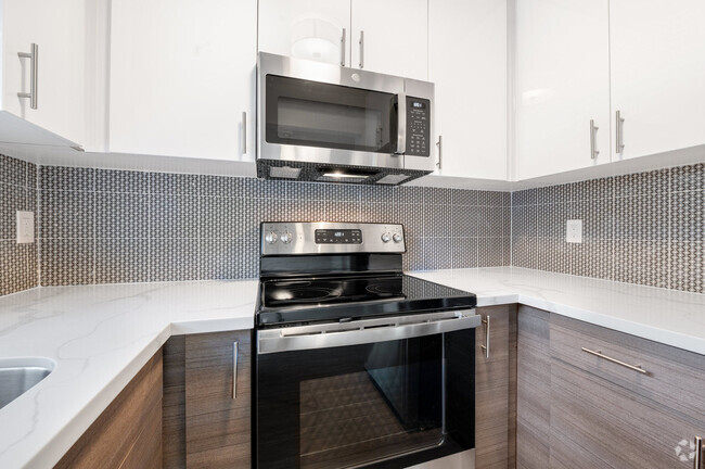
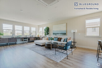
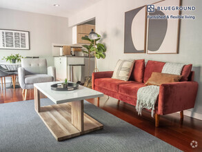
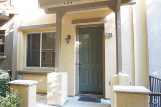
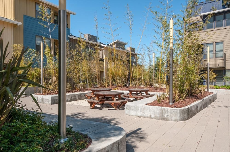
Property Id: 965370 Stylish 3 bed/2.5 bath townhouse-style home of 1,348 sq. ft. nestled inside gated, extremely convenient complex. Quartz countertops, Nest technology, central cooling. Well-appointed rooms include open living/dining area and kitchen w/ stainless-steel appliances. Upstairs laundry area. Well-maintained community w/ basement garage parking. Adjacent to pool and fitness facilities at JCC. Mere moments to parks, shopping, and tech companies. Exceptional schools: Fairmeadow Elem (API 953), JLS Middle (API 943), and Gunn High (API 917). Utilities to be paid by tenants. HOA might have move-in fee that tenants will be responsible for. Very close to a lot of tech companies - Google, Microsoft, Intuit, Stanford, Retail, etc.
838 Altaire Walk is a townhome located in Santa Clara County and the 94303 ZIP Code. This area is served by the Palo Alto Unified attendance zone.
Townhome Features
Washer/Dryer
Dishwasher
Hardwood Floors
Microwave
- Washer/Dryer
- Cable Ready
- Satellite TV
- Security System
- Dishwasher
- Disposal
- Microwave
- Oven
- Refrigerator
- Hardwood Floors
- Fenced Lot
Fees and Policies
The fees below are based on community-supplied data and may exclude additional fees and utilities.
- Parking
-
Garage--
Details
Utilities Included
-
Gas
-
Water
-
Electricity
-
Trash Removal
-
Sewer
 This Property
 Available Property
Palo Alto is known as the birthplace of Silicon Valley and that unique heritage is proudly on display, with the Computer History Museum just down the street from Google’s world headquarters and countless other tech companies all over town. The restaurant scene rivals that of nearby San Francisco, with many small, independent eateries serving up some of the best food in the Bay Area.
With close proximity to the country’s tech center, it’s no surprise that Palo Alto apartments come with some of the most incredible amenities around. Residents also have access to dozens of options for outdoor recreation, including the gorgeous hiking and biking trails through the surrounding nature preserves, several golf courses, and easy access to San Francisco Bay. Bicycling is a popular mode of transportation around Palo Alto, with many bike-friendly routes around the city.
Palo Alto is famous as the home of Stanford University, and the campus is one of the most dominant landmarks in the area.
Learn more about living in Palo AltoBelow are rent ranges for similar nearby apartments
- Washer/Dryer
- Cable Ready
- Satellite TV
- Security System
- Dishwasher
- Disposal
- Microwave
- Oven
- Refrigerator
- Hardwood Floors
- Fenced Lot
| Colleges & Universities | Distance | ||
|---|---|---|---|
| Colleges & Universities | Distance | ||
| Walk: | 16 min | 0.9 mi | |
| Drive: | 13 min | 4.7 mi | |
| Drive: | 13 min | 5.5 mi | |
| Drive: | 16 min | 9.4 mi |
Transportation options available in Palo Alto include Bayshore/Nasa Station, located 3.8 miles from 838 Altaire Walk. 838 Altaire Walk is near Norman Y Mineta San Jose International, located 11.3 miles or 16 minutes away, and San Francisco International, located 23.1 miles or 30 minutes away.
| Transit / Subway | Distance | ||
|---|---|---|---|
| Transit / Subway | Distance | ||
|
|
Drive: | 7 min | 3.8 mi |
|
|
Drive: | 7 min | 4.1 mi |
|
|
Drive: | 8 min | 4.3 mi |
|
|
Drive: | 8 min | 4.3 mi |
|
|
Drive: | 8 min | 4.7 mi |
| Commuter Rail | Distance | ||
|---|---|---|---|
| Commuter Rail | Distance | ||
| Drive: | 5 min | 1.9 mi | |
| Drive: | 8 min | 3.1 mi | |
| Drive: | 9 min | 3.8 mi | |
| Drive: | 12 min | 4.5 mi | |
| Drive: | 15 min | 7.7 mi |
| Airports | Distance | ||
|---|---|---|---|
| Airports | Distance | ||
|
Norman Y Mineta San Jose International
|
Drive: | 16 min | 11.3 mi |
|
San Francisco International
|
Drive: | 30 min | 23.1 mi |
Time and distance from 838 Altaire Walk.
| Shopping Centers | Distance | ||
|---|---|---|---|
| Shopping Centers | Distance | ||
| Walk: | 14 min | 0.7 mi | |
| Walk: | 14 min | 0.7 mi | |
| Walk: | 16 min | 0.8 mi |
| Parks and Recreation | Distance | ||
|---|---|---|---|
| Parks and Recreation | Distance | ||
|
J. Pearce Mitchell Park
|
Drive: | 5 min | 1.3 mi |
|
Terman Park
|
Drive: | 7 min | 2.3 mi |
|
Stevens Creek Shoreline Nature Study Area
|
Drive: | 8 min | 2.9 mi |
|
Bol Park
|
Drive: | 9 min | 3.1 mi |
|
The Environmental Volunteers EcoCenter
|
Drive: | 8 min | 3.8 mi |
| Hospitals | Distance | ||
|---|---|---|---|
| Hospitals | Distance | ||
| Drive: | 9 min | 5.3 mi | |
| Drive: | 14 min | 5.3 mi | |
| Drive: | 15 min | 5.8 mi |
| Military Bases | Distance | ||
|---|---|---|---|
| Military Bases | Distance | ||
| Drive: | 9 min | 4.2 mi |
You May Also Like
Similar Rentals Nearby
-
-
-
-
-
-
$5,4303 Beds, 3 Baths, 1,870 sq ftTownhome for Rent
-
$5,1303 Beds, 2.5 Baths, 1,663 sq ftTownhome for Rent
-
$5,0203 Beds, 3.5 Baths, 2,010 sq ftTownhome for Rent
-
$6,3503 Beds, 2.5 Baths, 1,200 sq ftTownhome for Rent
-
$4,0003 Beds, 3.5 Baths, 1,771 sq ftTownhome for Rent
What Are Walk Score®, Transit Score®, and Bike Score® Ratings?
Walk Score® measures the walkability of any address. Transit Score® measures access to public transit. Bike Score® measures the bikeability of any address.
What is a Sound Score Rating?
A Sound Score Rating aggregates noise caused by vehicle traffic, airplane traffic and local sources
