$1,900 / Month
8433 Norwood Dr,
Millersville,
MD
21108
-
Bedrooms
2
-
Bathrooms
1
-
Square Feet
930 sq ft
-
Available
Available Now
Highlight
- Pool

About This Home
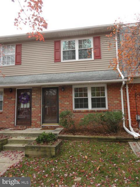
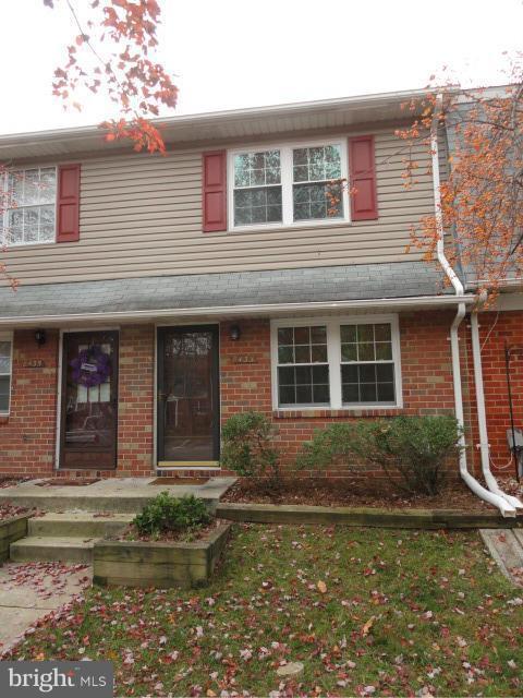
A fantastic 2-bedroom, 1-bathroom townhouse measuring 930 sqft is up for rent in the Sussex Square HOA community. The appliances have been recently upgraded. It features a 27 cuft French door refrigerator and a Samsung oven with an air fry option. The water heater, range, and heating system operate on natural gas. In addition to standard appliances, the unit also includes a range hood, an under-cabinet water filtration system and a nest thermostat.
8433 Norwood Dr is a townhome located in Anne Arundel County and the 21108 ZIP Code. This area is served by the Anne Arundel County Public Schools attendance zone.
Townhome Features
Washer/Dryer
High Speed Internet Access
Refrigerator
Tub/Shower
- High Speed Internet Access
- Washer/Dryer
- Heating
- Ceiling Fans
- Tub/Shower
- Handrails
- Oven
- Range
- Refrigerator
- Pool
Fees and Policies
The fees below are based on community-supplied data and may exclude additional fees and utilities.
- Parking
-
Surface Lot--
Details
Utilities Included
-
Water
Property Information
-
Built in 1973
Contact
- Listed by Jack Sun
- Contact
A southern suburb of Baltimore, South Gate maintains a quiet serenity in its residential blocks lined with Maryland greenery. Commercial districts located throughout the area are set apart from houses and apartments to create a perfect blend of peaceful living and nearby convenience.
South Gate residents can choose to take advantage of local entertainment, or head east to the beautiful vistas along the Chesapeake Bay, north into Baltimore, or southwest into Washington DC, meaning there's always something to do just around the corner. Mid-rise apartments and new single-family homes maintain the area’s reputation as a family-friendly spot just outside the cultural hearts of the Maryland-DC area.
Learn more about living in South Gate| Colleges & Universities | Distance | ||
|---|---|---|---|
| Colleges & Universities | Distance | ||
| Drive: | 17 min | 10.2 mi | |
| Drive: | 23 min | 13.9 mi | |
| Drive: | 24 min | 14.4 mi | |
| Drive: | 31 min | 16.6 mi |
Transportation options available in Millersville include Cromwell Station/Glen Burnie, located 5.5 miles from 8433 Norwood Dr. 8433 Norwood Dr is near Baltimore/Washington International Thurgood Marshall, located 9.2 miles or 16 minutes away, and Ronald Reagan Washington Ntl, located 37.1 miles or 56 minutes away.
| Transit / Subway | Distance | ||
|---|---|---|---|
| Transit / Subway | Distance | ||
|
|
Drive: | 9 min | 5.5 mi |
|
|
Drive: | 9 min | 5.8 mi |
|
|
Drive: | 14 min | 7.9 mi |
|
|
Drive: | 14 min | 8.0 mi |
|
|
Drive: | 17 min | 9.5 mi |
| Commuter Rail | Distance | ||
|---|---|---|---|
| Commuter Rail | Distance | ||
|
|
Drive: | 18 min | 9.0 mi |
|
|
Drive: | 17 min | 9.6 mi |
|
|
Drive: | 18 min | 11.9 mi |
|
|
Drive: | 20 min | 11.9 mi |
|
|
Drive: | 22 min | 13.1 mi |
| Airports | Distance | ||
|---|---|---|---|
| Airports | Distance | ||
|
Baltimore/Washington International Thurgood Marshall
|
Drive: | 16 min | 9.2 mi |
|
Ronald Reagan Washington Ntl
|
Drive: | 56 min | 37.1 mi |
Time and distance from 8433 Norwood Dr.
| Shopping Centers | Distance | ||
|---|---|---|---|
| Shopping Centers | Distance | ||
| Walk: | 12 min | 0.7 mi | |
| Walk: | 13 min | 0.7 mi | |
| Drive: | 5 min | 2.3 mi |
| Parks and Recreation | Distance | ||
|---|---|---|---|
| Parks and Recreation | Distance | ||
|
Kinder Farm Park
|
Drive: | 11 min | 5.3 mi |
|
Fort Smallwood Park
|
Drive: | 23 min | 12.4 mi |
|
Baltimore Rowing Center
|
Drive: | 19 min | 12.8 mi |
|
Patuxent Research Refuge - North Tract
|
Drive: | 26 min | 13.7 mi |
| Hospitals | Distance | ||
|---|---|---|---|
| Hospitals | Distance | ||
| Drive: | 7 min | 2.6 mi | |
| Drive: | 19 min | 11.4 mi | |
| Drive: | 23 min | 15.1 mi |
| Military Bases | Distance | ||
|---|---|---|---|
| Military Bases | Distance | ||
| Drive: | 21 min | 10.5 mi |
- High Speed Internet Access
- Washer/Dryer
- Heating
- Ceiling Fans
- Tub/Shower
- Handrails
- Oven
- Range
- Refrigerator
- Pool
8433 Norwood Dr Photos
What Are Walk Score®, Transit Score®, and Bike Score® Ratings?
Walk Score® measures the walkability of any address. Transit Score® measures access to public transit. Bike Score® measures the bikeability of any address.
What is a Sound Score Rating?
A Sound Score Rating aggregates noise caused by vehicle traffic, airplane traffic and local sources

