85 Ferrin St Unit #2
Boston, MA 02129
-
Bedrooms
2
-
Bathrooms
1
-
Square Feet
999 sq ft
-
Available
Available Now

About This Home
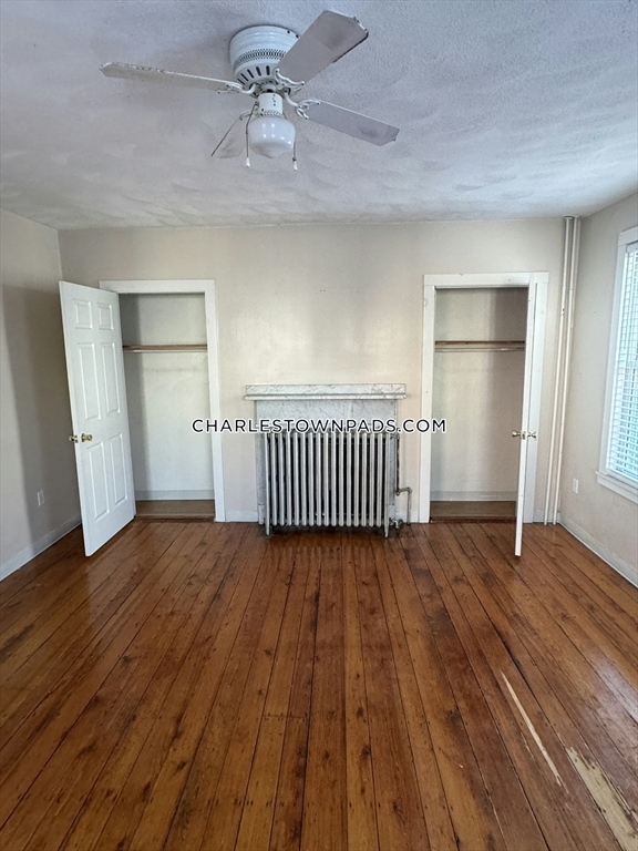
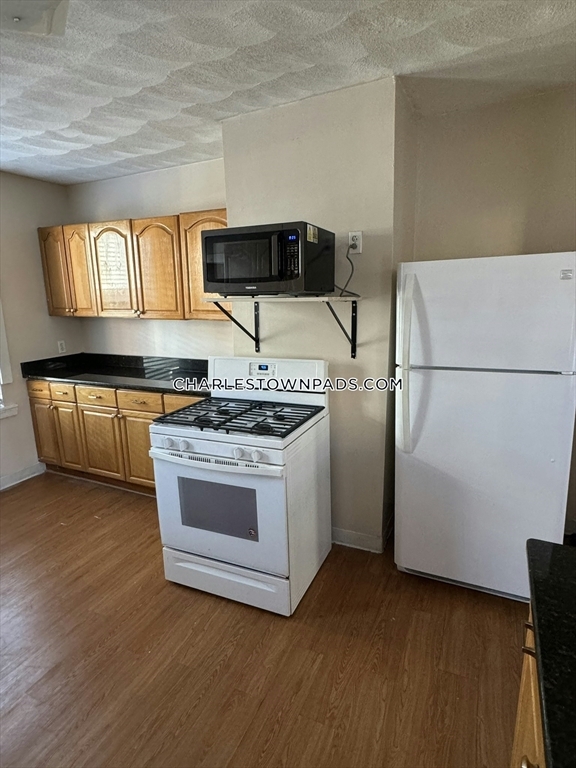
2 bed and 1 bath located in Charlestown. Easy access to downtown and public transportation!
85 Ferrin St is an apartment community located in Suffolk County and the 02129 ZIP Code. This area is served by the Boston Public Schools attendance zone.
Contact
- Phone Number
- Contact
Bunker Hill is a historic borough within Charleston, a Boston neighborhood. As the location of the Revolutionary War battle sharing its name, this neighborhood is filled with historic charm featuring triple decker apartments and red brick buildings with renovated lofts and apartments. The area brings in thousands of visitors each year who visit the Bunker Hill Monument and Museum. Proud of their roots, many restaurants and businesses in town pay tribute to the neighborhood’s connection to the American Revolution. Enjoy beer and delicious pub eats in a circa-1790 eatery at the legendary Warren Tavern, which was Paul Revere’s favorite tavern. The Bunker Hill Mall is on the outer edge of the community for locals and tourists alike to enjoy.
A true haven for history buffs, Bunker Hill is near several other historical sites, including the Boston National Historical Park and the USS Constitution Museum.
Learn more about living in Bunker Hill| Colleges & Universities | Distance | ||
|---|---|---|---|
| Colleges & Universities | Distance | ||
| Drive: | 4 min | 1.5 mi | |
| Drive: | 5 min | 1.9 mi | |
| Drive: | 7 min | 2.4 mi | |
| Drive: | 7 min | 3.6 mi |
 The GreatSchools Rating helps parents compare schools within a state based on a variety of school quality indicators and provides a helpful picture of how effectively each school serves all of its students. Ratings are on a scale of 1 (below average) to 10 (above average) and can include test scores, college readiness, academic progress, advanced courses, equity, discipline and attendance data. We also advise parents to visit schools, consider other information on school performance and programs, and consider family needs as part of the school selection process.
View GreatSchools Rating Methodology
Transportation options available in Boston include North Station, located 1.3 miles from 85 Ferrin St Unit #2. 85 Ferrin St Unit #2 is near General Edward Lawrence Logan International, located 4.3 miles or 10 minutes away.
| Transit / Subway | Distance | ||
|---|---|---|---|
| Transit / Subway | Distance | ||
|
|
Drive: | 3 min | 1.3 mi |
|
|
Drive: | 3 min | 1.4 mi |
|
|
Drive: | 4 min | 2.0 mi |
|
|
Drive: | 6 min | 2.4 mi |
|
|
Drive: | 5 min | 2.7 mi |
| Commuter Rail | Distance | ||
|---|---|---|---|
| Commuter Rail | Distance | ||
|
|
Drive: | 4 min | 1.3 mi |
|
|
Drive: | 5 min | 3.2 mi |
| Drive: | 7 min | 3.7 mi | |
|
|
Drive: | 11 min | 3.7 mi |
|
|
Drive: | 13 min | 6.4 mi |
| Airports | Distance | ||
|---|---|---|---|
| Airports | Distance | ||
|
General Edward Lawrence Logan International
|
Drive: | 10 min | 4.3 mi |
Time and distance from 85 Ferrin St Unit #2.
| Shopping Centers | Distance | ||
|---|---|---|---|
| Shopping Centers | Distance | ||
| Walk: | 13 min | 0.7 mi | |
| Drive: | 3 min | 1.3 mi | |
| Drive: | 3 min | 1.3 mi |
| Parks and Recreation | Distance | ||
|---|---|---|---|
| Parks and Recreation | Distance | ||
|
Museum of Science
|
Drive: | 5 min | 1.4 mi |
|
Boston National Historical Park
|
Drive: | 5 min | 1.9 mi |
|
New England Aquarium
|
Drive: | 5 min | 2.0 mi |
|
Boston African American National Historic Site
|
Drive: | 6 min | 2.1 mi |
|
Boston Harbor Islands National Recreation Area
|
Drive: | 5 min | 2.9 mi |
| Hospitals | Distance | ||
|---|---|---|---|
| Hospitals | Distance | ||
| Drive: | 5 min | 1.9 mi | |
| Drive: | 5 min | 2.0 mi | |
| Drive: | 6 min | 2.1 mi |
| Military Bases | Distance | ||
|---|---|---|---|
| Military Bases | Distance | ||
| Drive: | 28 min | 15.0 mi | |
| Drive: | 30 min | 18.4 mi |
85 Ferrin St Unit #2 Photos
What Are Walk Score®, Transit Score®, and Bike Score® Ratings?
Walk Score® measures the walkability of any address. Transit Score® measures access to public transit. Bike Score® measures the bikeability of any address.
What is a Sound Score Rating?
A Sound Score Rating aggregates noise caused by vehicle traffic, airplane traffic and local sources


