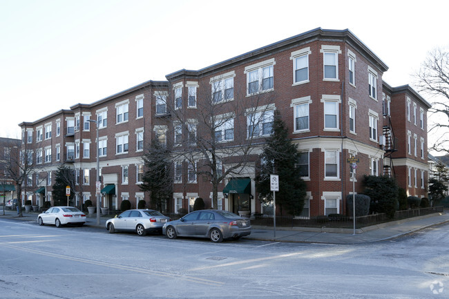
85 Hartford St Unit #85
Westwood, MA 02090
Favorites

85 Hartford St Unit #85
Favorites
Check Back Soon for Upcoming Availability
| Beds | Baths | Average SF |
|---|---|---|
| 4 Bedrooms 4 Bedrooms 4 Br | 2.5 Baths 2.5 Baths 2.5 Ba | 2,785 SF |
About This Property
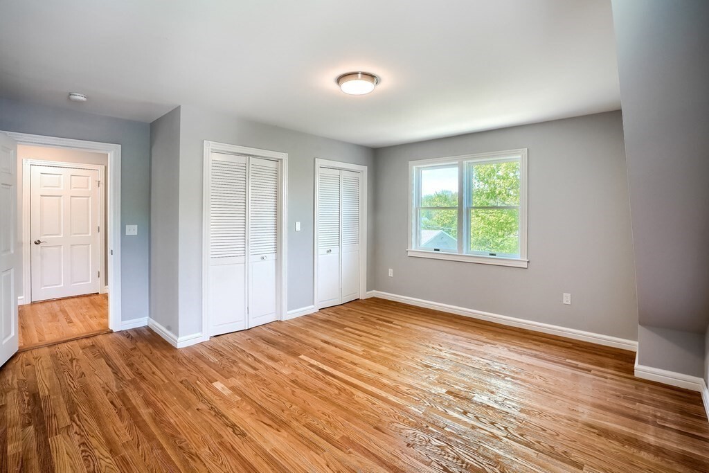
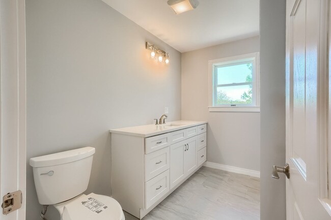
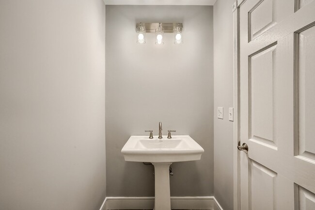
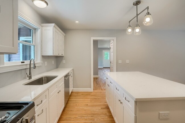
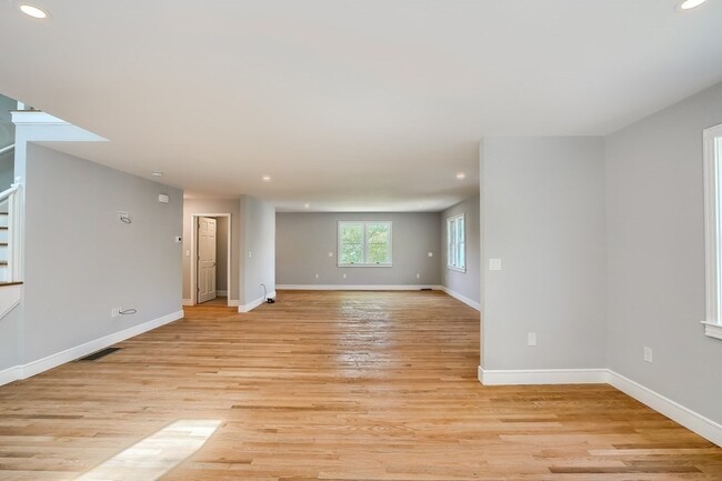
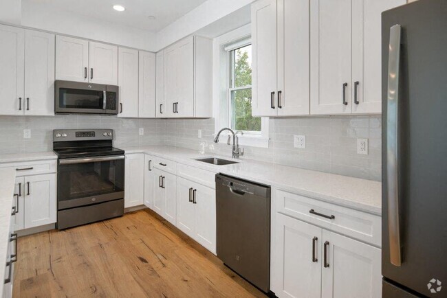
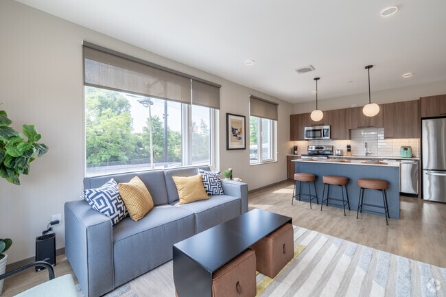
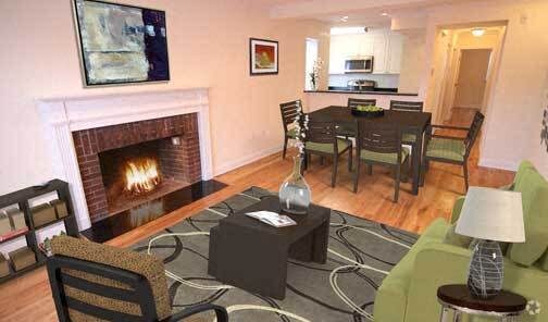
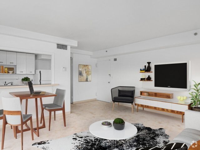
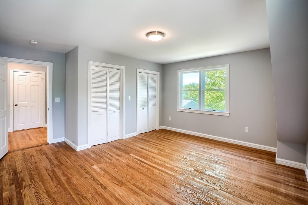
[UNIT] Welcome to Westwood! Newly remodeled 2022 4 bedrooms 2.5 bath townhome located in the heart of Westwood. Here is a golden opportunity to get into one of the top-rated school systems in Massachusetts. Short walking distance to shops, restaurants, schools, and library. This home features hardwood floors throughout, brand new kitchen with top-of-the-line appliances, central A/C and heat, and completely remodeled bathrooms, all with brand new quartz countertops. The wide-open floor plans are great for entertaining with walkouts to two private decks for outdoor enjoyment on the first floor. This unique floor plan features 2 interior stairways. Four large bedrooms upstairs with 2 full bathrooms round out the second floor. A full walkout basement offers great storage along with shed in the backyard. Large yard will feature an outdoor sitting area including a fire pit.
85 Hartford St is an apartment community located in Norfolk County and the 02090 ZIP Code.
Apartment Features
Washer/Dryer
Air Conditioning
Hardwood Floors
Fireplace
- Washer/Dryer
- Air Conditioning
- Fireplace
- Kitchen
- Hardwood Floors
- Basement
- Yard
Fees and Policies
The fees below are based on community-supplied data and may exclude additional fees and utilities.
- Parking
-
Garage--
Details
Utilities Included
-
Heat
-
Trash Removal
Property Information
-
9 units
Property Address:
85 Hartford St,
Westwood,
MA
02090
 This Property
 Available Property
Approximately 25 miles from Boston, the town of Westwood offers residents the simplicity of suburban living and the closeness to metropolitan nightlife and attractions. CNN/Money and Money Magazine named Westwood in their “100 Best Places to Live” in 2005.
Expansive greenspaces like Rice Reservation, Mulvehill- and Grimm Conservation, and Pheasant Hill makeup this unique, charming Norfolk County town. Ready for some fun-in-the-sun? Hale Reservation’s North Beach is a prime spot for sun and swim. Shopping and dining destinations include University Station, and college campuses and universities are easily accessible by I-95 and rail services provided by Massachusetts Bay Transportation Authority (MBTA).
Learn more about living in WestwoodBelow are rent ranges for similar nearby apartments
Amenities
- Washer/Dryer
- Air Conditioning
- Fireplace
- Kitchen
- Hardwood Floors
- Basement
- Yard
Expenses
Utilities Included
Heat, Trash Removal
Included
Education
| Colleges & Universities | Distance | ||
|---|---|---|---|
| Colleges & Universities | Distance | ||
| Drive: | 14 min | 6.6 mi | |
| Drive: | 17 min | 8.1 mi | |
| Drive: | 19 min | 8.9 mi | |
| Drive: | 17 min | 9.6 mi |
85 Hartford St Unit #85 is within 14 minutes or 6.6 miles from Babson College. It is also near Curry College and Wellesley College.
Transportation options available in Westwood include Newton Highlands Station, located 8.8 miles from 85 Hartford St Unit #85. 85 Hartford St Unit #85 is near General Edward Lawrence Logan International, located 18.3 miles or 35 minutes away, and Worcester Regional, located 48.3 miles or 69 minutes away.
| Transit / Subway | Distance | ||
|---|---|---|---|
| Transit / Subway | Distance | ||
|
|
Drive: | 15 min | 8.8 mi |
|
|
Drive: | 15 min | 9.3 mi |
|
|
Drive: | 16 min | 9.6 mi |
|
|
Drive: | 17 min | 9.9 mi |
|
|
Drive: | 19 min | 10.1 mi |
| Commuter Rail | Distance | ||
|---|---|---|---|
| Commuter Rail | Distance | ||
|
|
Drive: | 6 min | 2.8 mi |
|
|
Drive: | 7 min | 3.1 mi |
|
|
Drive: | 6 min | 3.2 mi |
|
|
Drive: | 8 min | 4.6 mi |
|
|
Drive: | 9 min | 4.9 mi |
| Airports | Distance | ||
|---|---|---|---|
| Airports | Distance | ||
|
General Edward Lawrence Logan International
|
Drive: | 35 min | 18.3 mi |
|
Worcester Regional
|
Drive: | 69 min | 48.3 mi |
Time and distance from 85 Hartford St Unit #85.
| Shopping Centers | Distance | ||
|---|---|---|---|
| Shopping Centers | Distance | ||
| Drive: | 6 min | 2.7 mi | |
| Drive: | 6 min | 2.8 mi | |
| Drive: | 6 min | 3.4 mi |
85 Hartford St Unit #85 has 3 shopping centers within 3.4 miles, which is about a 6-minute drive. The miles and minutes will be for the farthest away property.
| Parks and Recreation | Distance | ||
|---|---|---|---|
| Parks and Recreation | Distance | ||
|
Brook Farm Historic Site
|
Drive: | 11 min | 5.6 mi |
|
Stony Brook Reservation
|
Drive: | 12 min | 6.3 mi |
|
Cutler Park Reservation
|
Drive: | 11 min | 7.0 mi |
|
Lookout Farm
|
Drive: | 16 min | 7.7 mi |
|
Weezie's Garden for Children
|
Drive: | 22 min | 10.2 mi |
85 Hartford St Unit #85 has 5 parks within 10.2 miles, including Brook Farm Historic Site, Lookout Farm, and Stony Brook Reservation.
| Hospitals | Distance | ||
|---|---|---|---|
| Hospitals | Distance | ||
| Drive: | 6 min | 2.9 mi | |
| Drive: | 9 min | 4.5 mi | |
| Drive: | 16 min | 8.6 mi |
85 Hartford St Unit #85 has 3 hospitals within 8.6 miles, the nearest is Norwood Hospital which is 2.9 miles away and a 6 minutes drive.
| Military Bases | Distance | ||
|---|---|---|---|
| Military Bases | Distance | ||
| Drive: | 22 min | 11.6 mi |
85 Hartford St Unit #85 is 11.6 miles and a 22 minutes from US Military Reservation.
You May Also Like
Similar Rentals Nearby
-
-
-
-
-
1 / 20
-
1 / 18
-
-
-
-


What Are Walk Score®, Transit Score®, and Bike Score® Ratings?
Walk Score® measures the walkability of any address. Transit Score® measures access to public transit. Bike Score® measures the bikeability of any address.
What is a Sound Score Rating?
A Sound Score Rating aggregates noise caused by vehicle traffic, airplane traffic and local sources
85 Hartford St
Westwood, MA 02090