$1,700
2 Beds, 2 Baths, 1,176 sq ft
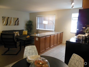
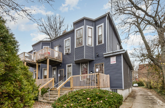
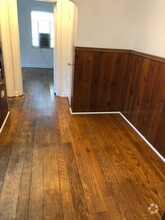
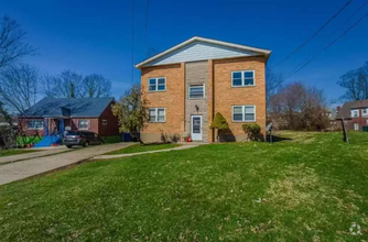
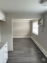
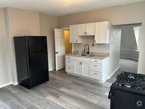
Apartment for Rent
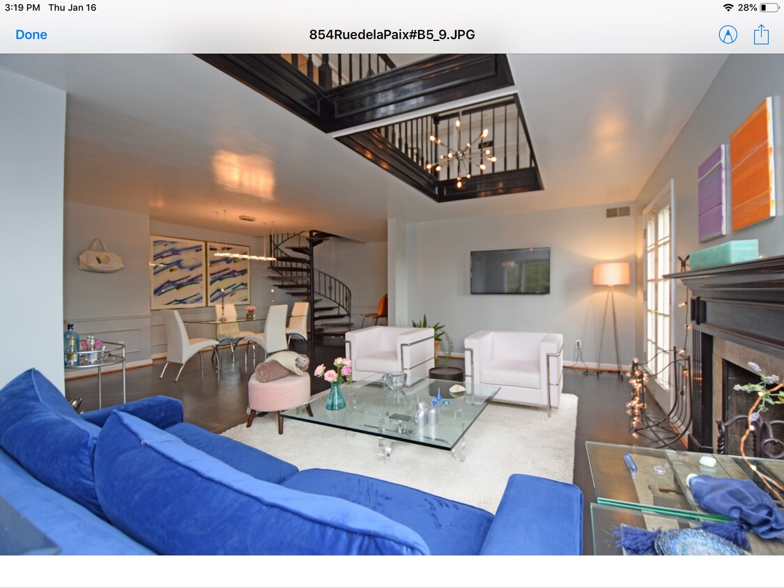

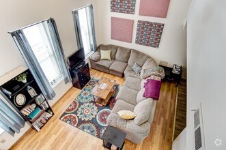
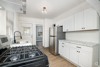
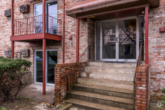
Spacious contemporary bright and airy townhouse in the heart of the Gaslight Urban views in front while tucked away on hill into Mt Storm for privacy. Private one car garage plus one off street parking space, large laundry room in unit. Lots of closet space and storage. Also available furnished for 30 days or more, call for pricing and availability.
854 Rue de la Paix Rue is a condo located in Hamilton County and the 45220 ZIP Code. This area is served by the Cincinnati Public Schools attendance zone.
The fees below are based on community-supplied data and may exclude additional fees and utilities.
 This Property
 Available Property
In Clifton there’s plenty to do and see. The rolling hills, lush parks and green spaces, hip shopping, and affordable apartments create a vibrancy in Clifton that can’t be ignored.
In addition to its active art scene, the neighborhood is encompassing of Mount Storm Park, Edgewood Grove Park, and the Cincinnati State Technical and Community College. Locals enjoy the direct access to Interstate 75, making commutes in and around the city a breeze.
Clifton is just north of the 90-acre Burnet Woods Park and the University of Cincinnati campus. When you have a craving for something sweet or savory, head on over to the Clifton Gaslight District for every kind of cuisine imaginable. Clifton sits atop a hill overlooking the Northside, and Ludlow Avenue has been dubbed Cincinnati’s first “Main Street.
Learn more about living in Clifton| Beds | Average Size | Lowest | Typical | Premium |
|---|---|---|---|---|
| Studio Studio Studio | 451-452 Sq Ft | $695 | $1,131 | $1,585 |
| 1 Bed 1 Bed 1 Bed | 716-719 Sq Ft | $610 | $1,178 | $2,380 |
| 2 Beds 2 Beds 2 Beds | 1017-1021 Sq Ft | $700 | $1,659 | $3,300 |
| 3 Beds 3 Beds 3 Beds | 1229-1241 Sq Ft | $975 | $1,576 | $3,900 |
| 4 Beds 4 Beds 4 Beds | 1585-1592 Sq Ft | $600 | $1,800 | $5,425 |
| Colleges & Universities | Distance | ||
|---|---|---|---|
| Colleges & Universities | Distance | ||
| Walk: | 5 min | 0.3 mi | |
| Drive: | 6 min | 2.3 mi | |
| Drive: | 7 min | 2.3 mi | |
| Drive: | 11 min | 3.9 mi |
Transportation options available in Cincinnati include Brewery District Station, Elm & Henry, located 3.4 miles from 854 Rue de la Paix Rue. 854 Rue de la Paix Rue is near Cincinnati/Northern Kentucky International, located 18.3 miles or 33 minutes away.
| Transit / Subway | Distance | ||
|---|---|---|---|
| Transit / Subway | Distance | ||
| Drive: | 8 min | 3.4 mi | |
| Drive: | 8 min | 3.6 mi | |
| Drive: | 9 min | 3.6 mi | |
| Drive: | 9 min | 3.7 mi | |
| Drive: | 9 min | 3.9 mi |
| Commuter Rail | Distance | ||
|---|---|---|---|
| Commuter Rail | Distance | ||
|
|
Drive: | 9 min | 4.3 mi |
| Airports | Distance | ||
|---|---|---|---|
| Airports | Distance | ||
|
Cincinnati/Northern Kentucky International
|
Drive: | 33 min | 18.3 mi |
Time and distance from 854 Rue de la Paix Rue.
| Shopping Centers | Distance | ||
|---|---|---|---|
| Shopping Centers | Distance | ||
| Drive: | 5 min | 1.6 mi | |
| Drive: | 4 min | 1.9 mi | |
| Drive: | 8 min | 3.2 mi |
| Parks and Recreation | Distance | ||
|---|---|---|---|
| Parks and Recreation | Distance | ||
|
Burnet Woods
|
Drive: | 4 min | 1.5 mi |
|
Buttercup Valley
|
Drive: | 5 min | 1.9 mi |
|
Cincinnati Zoo and Botanical Garden
|
Drive: | 5 min | 2.2 mi |
|
Trailside Nature Center
|
Drive: | 6 min | 2.2 mi |
|
LaBoiteaux Woods
|
Drive: | 9 min | 3.2 mi |
| Hospitals | Distance | ||
|---|---|---|---|
| Hospitals | Distance | ||
| Drive: | 4 min | 1.5 mi | |
| Drive: | 7 min | 2.6 mi | |
| Drive: | 7 min | 2.8 mi |
| Military Bases | Distance | ||
|---|---|---|---|
| Military Bases | Distance | ||
| Drive: | 69 min | 51.5 mi | |
| Drive: | 75 min | 56.6 mi | |
| Drive: | 77 min | 59.9 mi |

What Are Walk Score®, Transit Score®, and Bike Score® Ratings?
Walk Score® measures the walkability of any address. Transit Score® measures access to public transit. Bike Score® measures the bikeability of any address.
What is a Sound Score Rating?
A Sound Score Rating aggregates noise caused by vehicle traffic, airplane traffic and local sources