$3,195 / Month
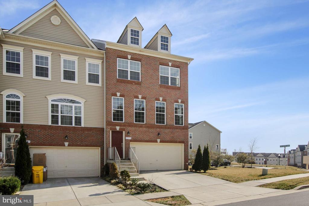
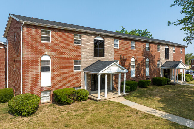
8570 Crooked Tree Ln
Laurel, MD 20724
2 Weeks Ago
Favorites
8570 Crooked Tree Ln

Favorites
Check Back Soon for Upcoming Availability
| Beds | Baths | Average SF |
|---|---|---|
| 3 Bedrooms 3 Bedrooms 3 Br | 3 Baths 3 Baths 3 Ba | 2,213 SF |
About This Property
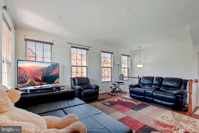
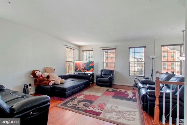
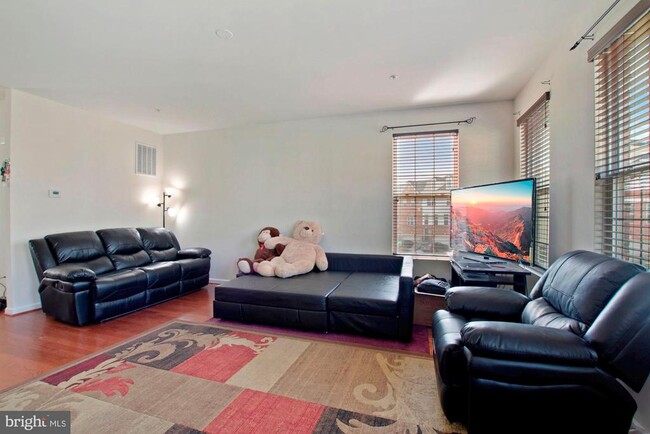
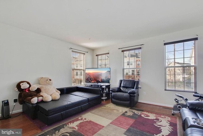
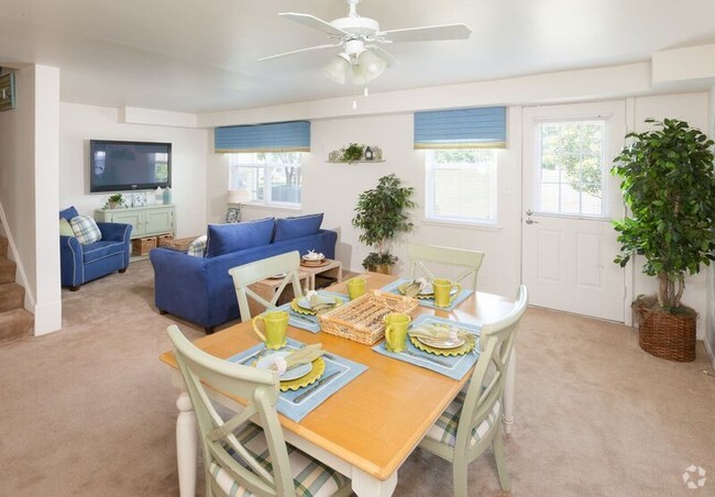
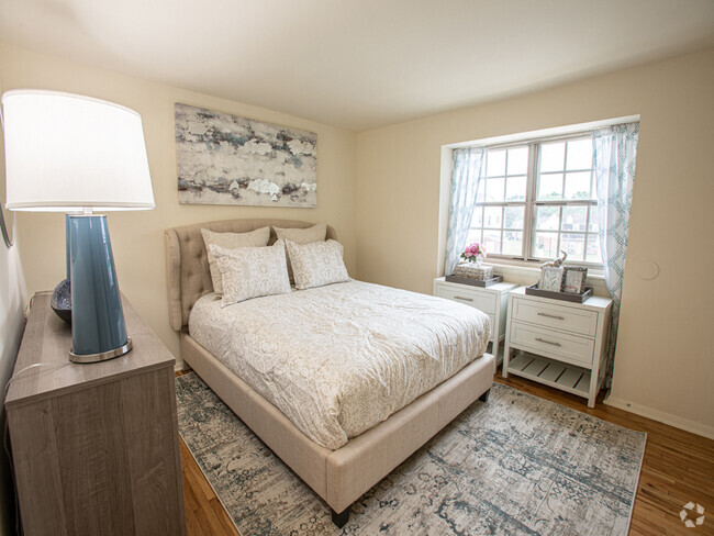
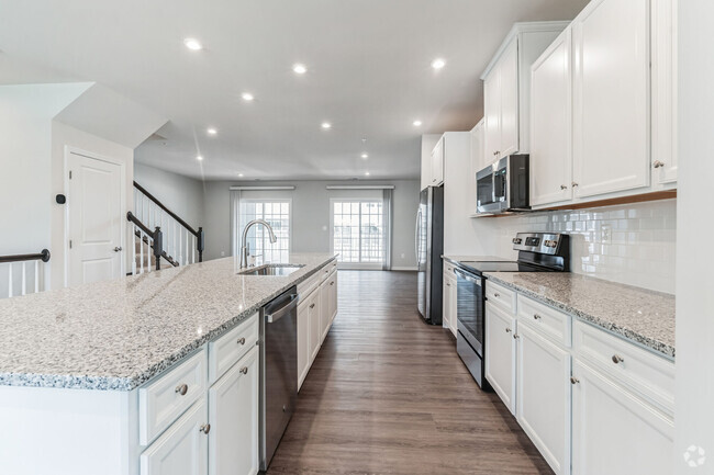
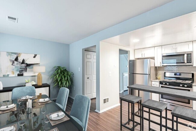
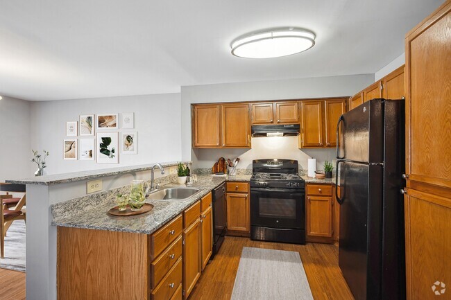
Excellent 3 level Brick front End Unit Town home with 3 bedroom,2 Full Bath,2 half bath & 2-car garage,Huge trex deck,2250 sq feet of living space.Kitchen includes granite counters, maple cabinetry & stainless steel appliances.Hardwood floors on entire main living level. Large master Bedroom with ceramic bath features dual vanities,granite and large walk-in shower.Convenient laundry on bedroom level. Show and rent today!!!
8570 Crooked Tree Ln is a townhome located in Anne Arundel County and the 20724 ZIP Code. This area is served by the Anne Arundel County Public Schools attendance zone.
Townhome Features
- Dishwasher
- Basement
Fees and Policies
Location
Get Directions
Laurel enjoys a unique position roughly halfway between DC and Baltimore, and its relative seclusion makes it an attractive option for commuters who work in either city but prefer a small-town home environment. The close proximity to Fort Mead also makes Laurel a popular option for Department of Defense employees and military personnel seeking off-base housing.
The cost of living is rather affordable, and apartments tend to rent for much more reasonable rates than closer to the major cities nearby. While almost exclusively residential, Laurel does feature a handful of large shopping centers along its major roadways as well as a quaint Main Street district, the perfect place to grab a cup of coffee in a friendly café before heading off to work.
Learn more about living in Laurel
Amenities
- Dishwasher
- Basement
Education
| Colleges & Universities | Distance | ||
|---|---|---|---|
| Colleges & Universities | Distance | ||
| Drive: | 19 min | 10.1 mi | |
| Drive: | 19 min | 10.8 mi | |
| Drive: | 24 min | 12.5 mi | |
| Drive: | 23 min | 14.3 mi |
8570 Crooked Tree Ln is within 19 minutes or 10.1 miles from Howard Community College. It is also near Bowie State University and University of Maryland.
Schools


Public Elementary School
Grades PK-5
436 Students
Attendance Zone
Public Middle School
Grades 6-8
788 Students
Attendance Zone
Public High School
Grades 9-12
2,330 Students
Attendance Zone
Private Elementary School
Grades PK-3
92 Students
Nearby
Private Elementary, Middle & High School
Grades 3-12
75 Students
Nearby
School data provided by
 The GreatSchools Rating helps parents compare schools within a state based on a variety of school quality indicators and provides a helpful picture of how effectively each school serves all of its students. Ratings are on a scale of 1 (below average) to 10 (above average) and can include test scores, college readiness, academic progress, advanced courses, equity, discipline and attendance data. We also advise parents to visit schools, consider other information on school performance and programs, and consider family needs as part of the school selection process.
View GreatSchools Rating Methodology
View GreatSchools Rating Methodology
Transportation options available in Laurel include Dorsey, located 8.5 miles from 8570 Crooked Tree Ln. 8570 Crooked Tree Ln is near Baltimore/Washington International Thurgood Marshall, located 13.7 miles or 23 minutes away, and Ronald Reagan Washington Ntl, located 26.3 miles or 43 minutes away.
| Transit / Subway | Distance | ||
|---|---|---|---|
| Transit / Subway | Distance | ||
|
|
Drive: | 16 min | 8.5 mi |
|
|
Drive: | 23 min | 13.8 mi |
|
|
Drive: | 24 min | 13.9 mi |
|
|
Drive: | 27 min | 15.5 mi |
|
|
Drive: | 26 min | 15.8 mi |
| Commuter Rail | Distance | ||
|---|---|---|---|
| Commuter Rail | Distance | ||
|
|
Walk: | 18 min | 1.0 mi |
|
|
Drive: | 5 min | 2.0 mi |
|
|
Drive: | 5 min | 2.3 mi |
|
|
Drive: | 11 min | 5.9 mi |
|
|
Drive: | 13 min | 6.1 mi |
| Airports | Distance | ||
|---|---|---|---|
| Airports | Distance | ||
|
Baltimore/Washington International Thurgood Marshall
|
Drive: | 23 min | 13.7 mi |
|
Ronald Reagan Washington Ntl
|
Drive: | 43 min | 26.3 mi |
Time and distance from 8570 Crooked Tree Ln.
| Shopping Centers | Distance | ||
|---|---|---|---|
| Shopping Centers | Distance | ||
| Drive: | 3 min | 1.2 mi | |
| Drive: | 4 min | 1.3 mi | |
| Drive: | 5 min | 1.7 mi |
8570 Crooked Tree Ln has 3 shopping centers within 1.7 miles, which is about a 5-minute drive. The miles and minutes will be for the farthest away property.
| Parks and Recreation | Distance | ||
|---|---|---|---|
| Parks and Recreation | Distance | ||
|
Patuxent Research Refuge - North Tract
|
Drive: | 11 min | 4.5 mi |
|
Fairland Regional Park
|
Drive: | 15 min | 7.1 mi |
|
Patuxent Research Refuge - South Tract
|
Drive: | 18 min | 8.6 mi |
|
Browns Bridge Recreation Area
|
Drive: | 20 min | 10.0 mi |
|
Maydale Conservation Park and Nature Center
|
Drive: | 21 min | 11.3 mi |
8570 Crooked Tree Ln has 5 parks within 11.3 miles, including Patuxent Research Refuge - North Tract, Fairland Regional Park, and Patuxent Research Refuge - South Tract.
| Hospitals | Distance | ||
|---|---|---|---|
| Hospitals | Distance | ||
| Drive: | 11 min | 4.8 mi | |
| Drive: | 19 min | 11.1 mi | |
| Drive: | 19 min | 11.2 mi |
8570 Crooked Tree Ln has 3 hospitals within 11.2 miles, the nearest is Laurel Regional Medical Center which is 4.8 miles away and a 11 minute drive.
| Military Bases | Distance | ||
|---|---|---|---|
| Military Bases | Distance | ||
| Drive: | 12 min | 6.0 mi |
8570 Crooked Tree Ln is 6.0 miles and a 12 minute drive from Fort George Meade.
You May Also Like
Similar Rentals Nearby


What Are Walk Score®, Transit Score®, and Bike Score® Ratings?
Walk Score® measures the walkability of any address. Transit Score® measures access to public transit. Bike Score® measures the bikeability of any address.
What is a Sound Score Rating?
A Sound Score Rating aggregates noise caused by vehicle traffic, airplane traffic and local sources

8570 Crooked Tree Ln
Laurel, MD 20724