$4,000 / Month
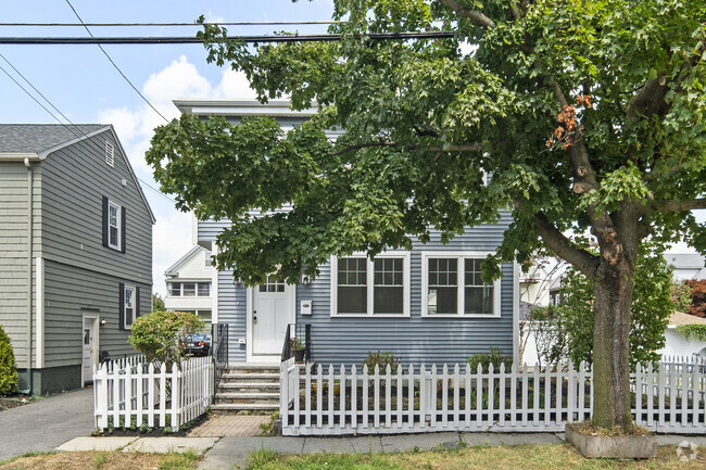
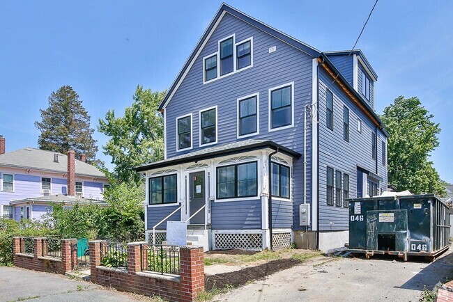
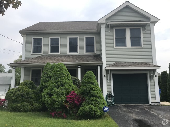
86 Poor St
Andover, MA 01810
2 Weeks Ago
Favorites
86 Poor St

Favorites
Check Back Soon for Upcoming Availability
| Beds | Baths | Average SF |
|---|---|---|
| 4 Bedrooms 4 Bedrooms 4 Br | 2.5 Baths 2.5 Baths 2.5 Ba | 2,150 SF |
About This Property
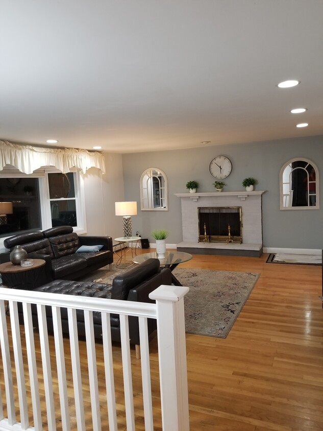
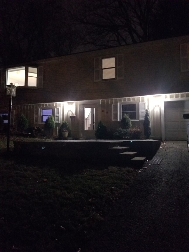
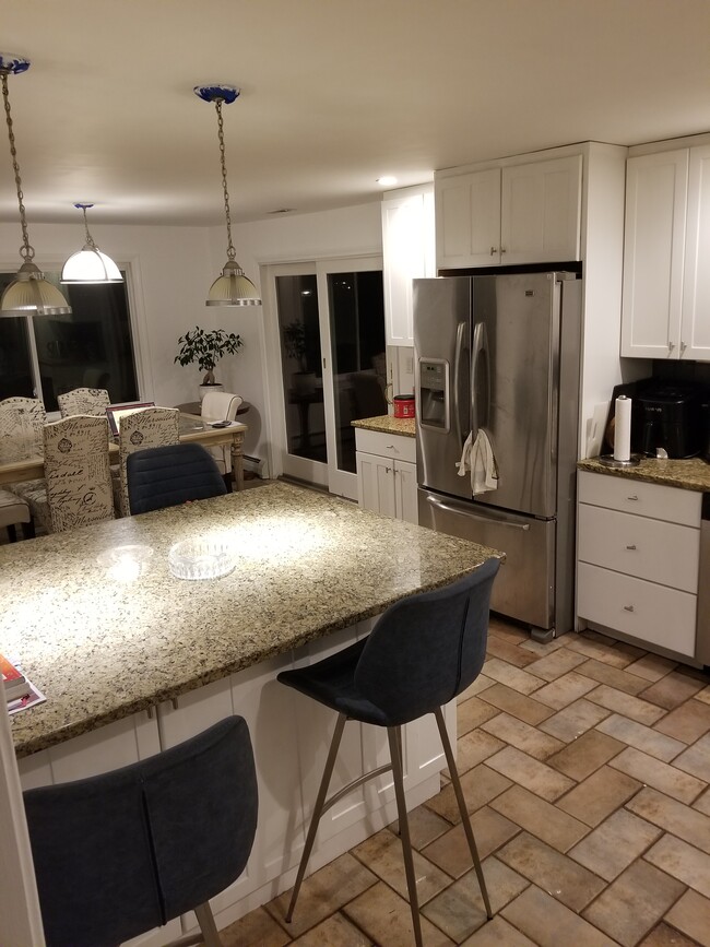
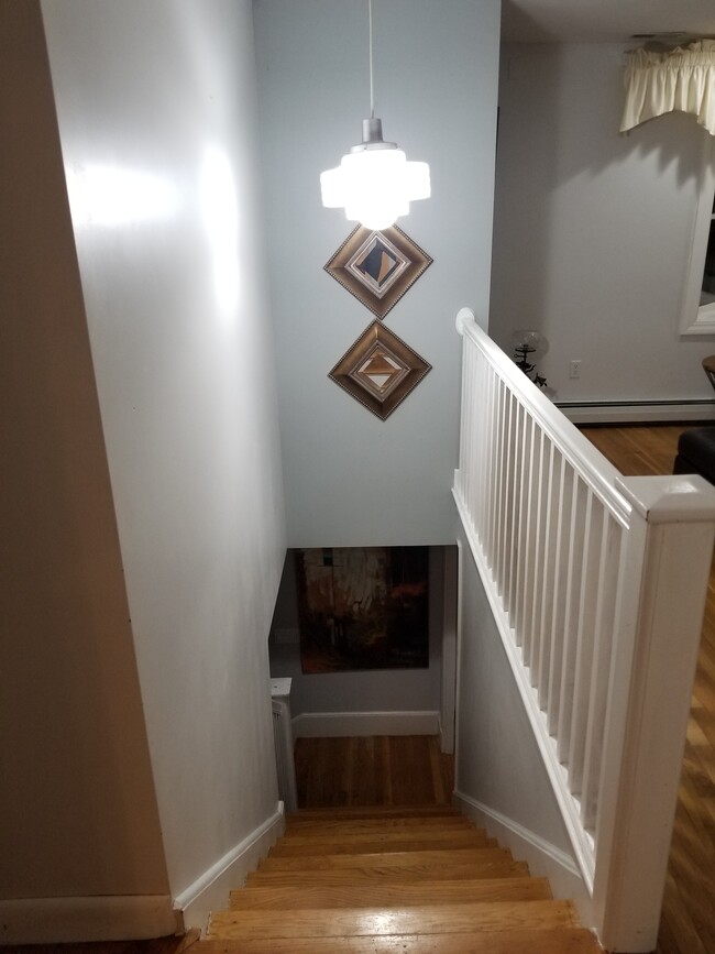
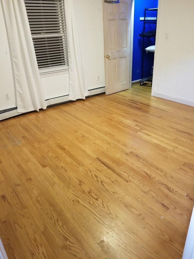
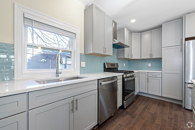
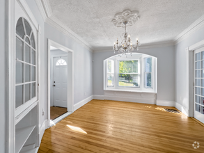
Welcome home to this beautifully renovated raised ranch located in Andover’s Shawsheen Heights. The spacious updated kitchen has granite counter tops, stainless steel appliances, Hickory cabinets with under-cabinet lighting and a generously sized island perfect for dining and entertaining. An open concept throughout the upper level connects the kitchen to the large living room with bay windows and a wood burning fireplace, and the dining area which has a sliding door out to the quiet back yard/patio. The upper level also consists of three bedrooms, a full bath and half bath. The first floor has a family room with a fireplace, fourth bedroom, full bath, laundry area and a door leading to the connected garage. With updates including a new roof, this home is truly move-in ready. Located just minutes from 495, 93 and Andover Center, the location can’t be beat!
86 Poor St is a house located in Essex County and the 01810 ZIP Code.
House Features
Washer/Dryer Hookup
Granite Countertops
Fireplace
Stainless Steel Appliances
- Washer/Dryer Hookup
- Fireplace
- Granite Countertops
- Stainless Steel Appliances
- Kitchen
- Dining Room
- Family Room
- Patio
- Yard
Fees and Policies
The fees below are based on community-supplied data and may exclude additional fees and utilities.
- Parking
-
Surface Lot--
Location
Get Directions
Located about 20 miles north of Downtown Boston, Andover is a classic and historic New England gem first settled in 1642. Andover features a beautiful downtown shopping district, complete with historic architecture and cobblestone walkways. Andover extends from the Merrimack River southeast to roughly the Andover Bypass. It is home to the historic Phillips Academy, a preparatory school established in 1778, making it one of the country's oldest high schools. The oldest home in Andover, the Chandler-Bigsby-Abbot House, was built sometime before 1673.
Merrimack College sits on the east side of Andover, making the city popular with students. Other destinations include the Robert S. Peabody Museum of Archaeology, the Addison Gallery of American Art, and Indian Ridge Reservation. Harold Parker State Forest covers more than 3,300 acres across Andover, North Andover, and Reading. Outdoor activities include camping, hiking, biking, and fishing.
Learn more about living in Andover
Amenities
- Washer/Dryer Hookup
- Fireplace
- Granite Countertops
- Stainless Steel Appliances
- Kitchen
- Dining Room
- Family Room
- Patio
- Yard
Education
| Colleges & Universities | Distance | ||
|---|---|---|---|
| Colleges & Universities | Distance | ||
| Drive: | 5 min | 2.3 mi | |
| Drive: | 16 min | 10.0 mi | |
| Drive: | 17 min | 10.9 mi | |
| Drive: | 19 min | 13.1 mi |
86 Poor St is within 5 minutes or 2.3 miles from Merrimack College. It is also near Middlesex C.C., Lowell Campus and UMass Lowell.
Transportation options available in Andover include Oak Grove Station, located 19.9 miles from 86 Poor St. 86 Poor St is near General Edward Lawrence Logan International, located 27.8 miles or 39 minutes away, and Manchester Boston Regional, located 30.3 miles or 45 minutes away.
| Transit / Subway | Distance | ||
|---|---|---|---|
| Transit / Subway | Distance | ||
|
|
Drive: | 28 min | 19.9 mi |
|
|
Drive: | 28 min | 21.2 mi |
| Drive: | 29 min | 21.4 mi | |
| Drive: | 29 min | 21.9 mi | |
|
|
Drive: | 34 min | 24.3 mi |
| Commuter Rail | Distance | ||
|---|---|---|---|
| Commuter Rail | Distance | ||
|
|
Drive: | 3 min | 1.6 mi |
|
|
Drive: | 4 min | 2.1 mi |
|
|
Drive: | 8 min | 4.0 mi |
|
|
Drive: | 14 min | 9.5 mi |
|
|
Drive: | 14 min | 9.8 mi |
| Airports | Distance | ||
|---|---|---|---|
| Airports | Distance | ||
|
General Edward Lawrence Logan International
|
Drive: | 39 min | 27.8 mi |
|
Manchester Boston Regional
|
Drive: | 45 min | 30.3 mi |
Time and distance from 86 Poor St.
| Shopping Centers | Distance | ||
|---|---|---|---|
| Shopping Centers | Distance | ||
| Drive: | 3 min | 1.2 mi | |
| Drive: | 3 min | 1.2 mi | |
| Drive: | 3 min | 1.4 mi |
86 Poor St has 3 shopping centers within 1.4 miles, which is about a 3-minute drive. The miles and minutes will be for the farthest away property.
| Parks and Recreation | Distance | ||
|---|---|---|---|
| Parks and Recreation | Distance | ||
|
Stevens-Coolidge Place
|
Drive: | 4 min | 2.3 mi |
|
Lawrence Heritage State Park
|
Drive: | 5 min | 2.5 mi |
|
Smolak Farms
|
Drive: | 10 min | 4.9 mi |
|
Harold Parker State Forest
|
Drive: | 16 min | 7.7 mi |
|
Windrush Farm
|
Drive: | 18 min | 7.9 mi |
86 Poor St has 5 parks within 7.9 miles, including Stevens-Coolidge Place, Lawrence Heritage State Park, and Smolak Farms.
| Hospitals | Distance | ||
|---|---|---|---|
| Hospitals | Distance | ||
| Drive: | 8 min | 4.0 mi | |
| Drive: | 15 min | 10.4 mi | |
| Drive: | 19 min | 12.0 mi |
86 Poor St has 3 hospitals within 12.0 miles, the nearest is Holy Family Hospital which is 4.0 miles away and a 8 minute drive.
| Military Bases | Distance | ||
|---|---|---|---|
| Military Bases | Distance | ||
| Drive: | 39 min | 20.0 mi | |
| Drive: | 46 min | 23.1 mi | |
| Drive: | 34 min | 23.2 mi |
86 Poor St has 3 military bases within 23.2 miles, the nearest is Fort Pickering which is 20.0 miles away and a 39 minute drive.
You May Also Like
Similar Rentals Nearby

What Are Walk Score®, Transit Score®, and Bike Score® Ratings?
Walk Score® measures the walkability of any address. Transit Score® measures access to public transit. Bike Score® measures the bikeability of any address.
What is a Sound Score Rating?
A Sound Score Rating aggregates noise caused by vehicle traffic, airplane traffic and local sources

86 Poor St
Andover, MA 01810