
$2,100 / Month
86 Safford St Unit 1
Quincy, MA 02170
1 Day Ago
Favorites
781-901-0155
-
Bedrooms
2
-
Bathrooms
1
-
Square Feet
950 sq ft
-
Available
Available Now
Highlights
- Golf Course Community
- Property is near public transit
- Main Floor Primary Bedroom
- No Cooling
- Park
- Bike Trail
86 Safford St Unit 1

Favorites
About This Home
$2,100 deposit,
Available Now
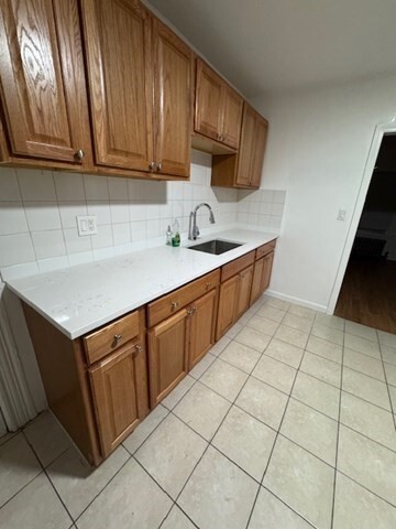
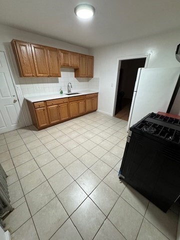
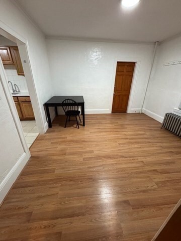
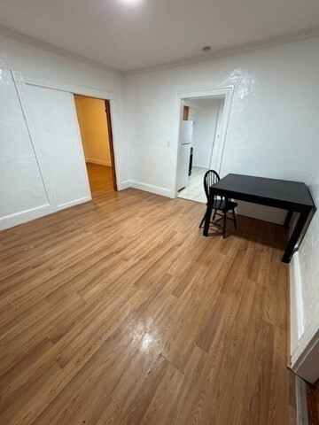
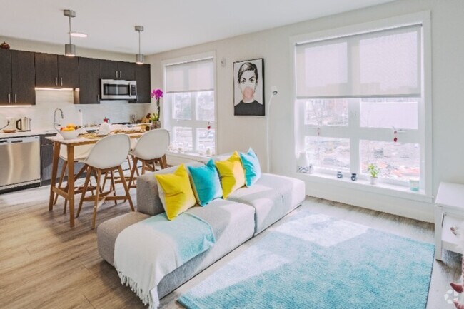
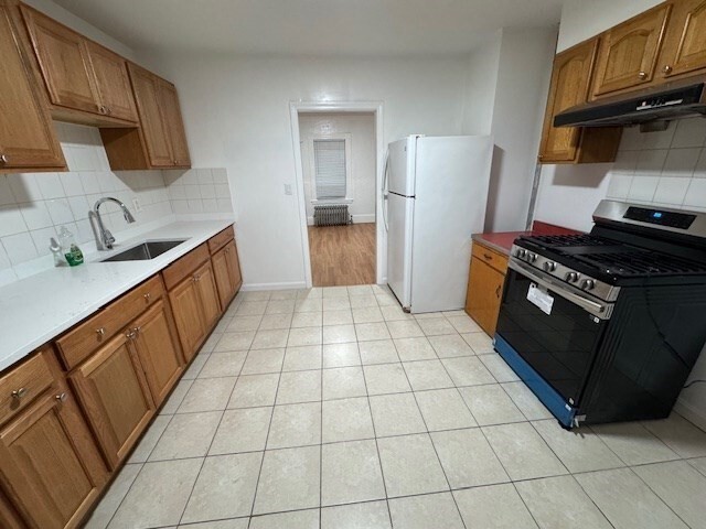
First floor of a two-family home available now. Located between North Quincy & Wollaston MBTA stations. Two large bedrooms and new flooring throughout. New quartz countertops and kitchen sink. Use of laundry machines included in rent. Pets negotiable. Off street parking requires city permit.
86 Safford St is an apartment community located in Norfolk County and the 02170 ZIP Code.
* Price shown is base rent and may not include non-optional fees and utilities.
Price, availability, fees, and any applicable rent special are subject to change without notice.
* Square footage definitions vary. Displayed square footage is approximate.
Home Details
Year Built
Built in 1930
Accessible Home Design
Entry on the 1st floor
Basement
Laundry in Basement
Bedrooms and Bathrooms
Primary Bedroom on Main
1 Full Bathroom
2 Bedrooms
Home Design
Apartment
Interior Spaces
950 Sq Ft Home
Kitchen
Range
Listing and Financial Details
Security Deposit $2,100
12 Month Lease Term
Assessor Parcel Number 194599
Rent includes water, laundry facilities
Location
Property is near public transit
Property is near schools
Lot Details
5,000 Sq Ft Lot
Utilities
No Cooling
Heating System Uses Natural Gas
Community Details
Amenities
Laundry Facilities
Overview
No Home Owners Association
Pet Policy
Call for details about the types of pets allowed
Recreation
Golf Course Community
Park
Bike Trail
Fees and Policies
The fees below are based on community-supplied data and may exclude additional fees and utilities.
Pet policies are negotiable.
Contact
- Listed by Gerald Powell | Fathom Realty MA
- Phone Number
-
Source
 MLS Property Information Network
The property listing data and information set forth herein were provided to MLS Property Information Network, Inc. from third party sources, including sellers, lessors and public records, and were compiled by MLS Property Information Network, Inc. The property listing data and information are for the personal, non-commercial use of consumers having a good faith interest in purchasing or leasing listed properties of the type displayed to them and may not be used for any purpose other than to identify prospective properties which such consumers may have a good faith interest in purchasing or leasing. MLS Property Information Network, Inc. and its subscribers disclaim any and all representations and warranties as to the accuracy of the property listing data and information set forth herein. All properties are subject to prior sale, change or withdrawal. Copyright © 2025 MLS Property Information Network, Inc. All rights reserved.
Location
Get Directions
Amenities
- Range
- Refrigerator
Across the Neponset River from Downtown Boston lies the Quincy neighborhood of Montclair. Commuters drive eight miles north on Interstate 93 to reach downtown, while residents without a car enjoy easy access using several bus lines or the Red Line's North Quincy subway station. This quiet residential community of apartments and bungalow-style houses provides a small-town atmosphere within a larger urban environment.
There’s a diverse mix of cuisine that belies Montclair’s relatively small size. Most of Montclair's businesses are found along Hancock Street near North Quincy station. Residents gather at Assembly Bar on Sundays for comfort food while watching the New England Patriots.
Learn more about living in Montclair
Education
| Colleges & Universities | Distance | ||
|---|---|---|---|
| Colleges & Universities | Distance | ||
| Drive: | 10 min | 4.4 mi | |
| Drive: | 15 min | 6.0 mi | |
| Drive: | 13 min | 6.8 mi | |
| Drive: | 13 min | 7.0 mi |
86 Safford St Unit 1 is within 10 minutes or 4.4 miles from UMass Boston. It is also near Curry College and Northeastern University.
Transportation options available in Quincy include North Quincy Station, located 0.5 mile from 86 Safford St Unit 1. 86 Safford St Unit 1 is near General Edward Lawrence Logan International, located 9.7 miles or 18 minutes away.
| Transit / Subway | Distance | ||
|---|---|---|---|
| Transit / Subway | Distance | ||
|
|
Walk: | 9 min | 0.5 mi |
|
|
Walk: | 15 min | 0.8 mi |
|
|
Drive: | 6 min | 2.9 mi |
|
|
Drive: | 6 min | 3.0 mi |
|
|
Drive: | 7 min | 3.3 mi |
| Commuter Rail | Distance | ||
|---|---|---|---|
| Commuter Rail | Distance | ||
|
|
Drive: | 5 min | 2.0 mi |
|
|
Drive: | 7 min | 4.2 mi |
| Drive: | 11 min | 4.2 mi | |
| Drive: | 9 min | 4.4 mi | |
| Drive: | 9 min | 4.7 mi |
| Airports | Distance | ||
|---|---|---|---|
| Airports | Distance | ||
|
General Edward Lawrence Logan International
|
Drive: | 18 min | 9.7 mi |
Time and distance from 86 Safford St Unit 1.
| Shopping Centers | Distance | ||
|---|---|---|---|
| Shopping Centers | Distance | ||
| Walk: | 6 min | 0.4 mi | |
| Drive: | 3 min | 1.2 mi | |
| Drive: | 4 min | 1.8 mi |
86 Safford St Unit 1 has 3 shopping centers within 1.8 miles, which is about a 4-minute walk. The miles and minutes will be for the farthest away property.
| Parks and Recreation | Distance | ||
|---|---|---|---|
| Parks and Recreation | Distance | ||
|
Adams National Historical Park
|
Drive: | 4 min | 1.8 mi |
|
Squantum Point Park
|
Drive: | 8 min | 2.6 mi |
|
Dorchester Shores Reservation
|
Drive: | 9 min | 4.3 mi |
|
Franklin Park Zoo
|
Drive: | 11 min | 6.0 mi |
|
Lower Neponset River Trail
|
Drive: | 11 min | 6.2 mi |
86 Safford St Unit 1 has 5 parks within 6.2 miles, including Adams National Historical Park, Squantum Point Park, and Dorchester Shores Reservation.
| Hospitals | Distance | ||
|---|---|---|---|
| Hospitals | Distance | ||
| Drive: | 6 min | 3.2 mi | |
| Drive: | 7 min | 3.3 mi | |
| Drive: | 10 min | 5.8 mi |
86 Safford St Unit 1 has 3 hospitals within 5.8 miles, the nearest is Carney Hospital which is 3.2 miles away and a 6 minute drive.
You May Also Like
Similar Rentals Nearby


What Are Walk Score®, Transit Score®, and Bike Score® Ratings?
Walk Score® measures the walkability of any address. Transit Score® measures access to public transit. Bike Score® measures the bikeability of any address.
What is a Sound Score Rating?
A Sound Score Rating aggregates noise caused by vehicle traffic, airplane traffic and local sources
86 Safford St
Quincy, MA 02170