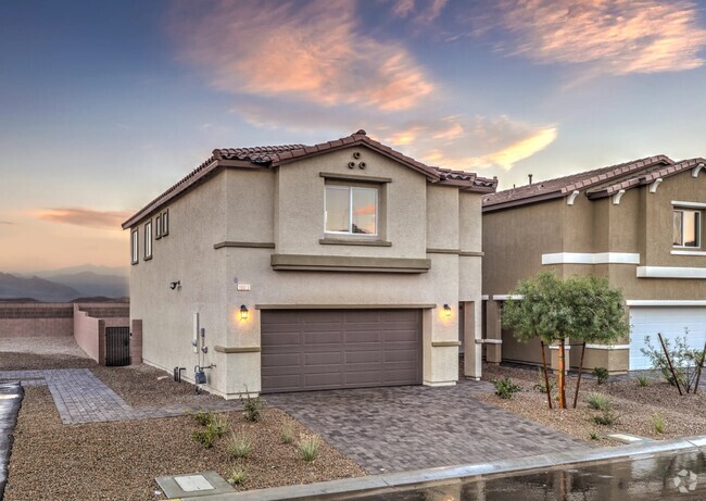
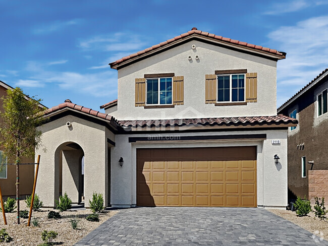
8600 W Charleston Blvd
Las Vegas, NV 89117
-
Habitaciones
2
-
Baños
2
-
Pies cuadrados
998 pies²
-
Disponible
Disp. ahora

Contactar
- Listado Por Xpand | Xpand Realty & Property Management
- Número de Teléfono
- Contactar
Ubicado en Las Vegas Valley y rodeado de las montañas Spring y el Red Rock Canyon National Reserve, Summerlin tiene una reputación como uno de las comunidades más prósperas de Nevada. El vecindario cuenta con más de 22.000 acres de tierra, que consiste en más de 150 parques, el lugar recreativas de primera categoría, diversas zonas y más de 150 millas de reconocidas a nivel nacional, galardonado, senderos para caminatas. Summerlin está ubicado aproximadamente a 10 millas del centro de Las Vegas, Nevada.
Obtén más información sobre la vida en Summerlin| Institutos y Universidades | Distancia de | ||
|---|---|---|---|
| Institutos y Universidades | Dist. | ||
| En coche: | 6 minutos | 3.1 mi | |
| En coche: | 11 minutos | 6.6 mi | |
| En coche: | 21 minutos | 11.3 mi | |
| En coche: | 20 minutos | 13.5 mi |
 La Calificación de GreatSchools ayuda a los padres a comparar las escuelas dentro de un Estado basado en una variedad de indicadores de calidad y proporciona una imagen útil de la eficacia con la que cada escuela sirve a todos sus estudiantes. Las calificaciones están en una escala de 1 (por debajo del promedio) a 10 (encima del promedio) y puede incluir los puntajes de prueba, preparación universitaria, progreso académico, cursos avanzados, equidad, disciplina y datos de asistencia. Nosotros también recomendamos a los padres visitar las escuelas, considerar otra información sobre el desempeño y los programas escolares, y tener en cuenta las necesidades de la familia como parte del proceso de selección de la escuela.
Ver la metodología de calificación de GreatSchools
Las opciones de transporte disponibles en Las Vegas incluyen Sahara Station, a 8.5 millas de 8600 W Charleston Blvd. 8600 W Charleston Blvd está cerca de Harry Reid International, a 12.5 millas o 22 minutos de distancia, y de Boulder City Municipal, a 35.1 millas o 45 minutos de distancia.
| Tránsito / metro | Distancia de | ||
|---|---|---|---|
| Tránsito / metro | Dist. | ||
|
|
En coche: | 14 minutos | 8.5 mi |
|
|
En coche: | 16 minutos | 8.9 mi |
|
|
En coche: | 17 minutos | 9.2 mi |
|
|
En coche: | 17 minutos | 9.4 mi |
|
|
En coche: | 18 minutos | 10.1 mi |
| Aeropuertos | Distancia de | ||
|---|---|---|---|
| Aeropuertos | Dist. | ||
|
Harry Reid International
|
En coche: | 22 minutos | 12.5 mi |
|
Boulder City Municipal
|
En coche: | 45 minutos | 35.1 mi |
Tiempo y distancia desde 8600 W Charleston Blvd.
| Centros comerciales | Distancia de | ||
|---|---|---|---|
| Centros comerciales | Dist. | ||
| A pie: | 3 minutos | 0.2 mi | |
| A pie: | 6 minutos | 0.4 mi | |
| A pie: | 9 minutos | 0.5 mi |
| Parques y recreación | Distancia de | ||
|---|---|---|---|
| Parques y recreación | Dist. | ||
|
Springs Preserve
|
En coche: | 11 minutos | 6.0 mi |
|
Spring Mountains National Recreation Area
|
En coche: | 14 minutos | 9.1 mi |
|
DISCOVERY Children's Museum
|
En coche: | 14 minutos | 9.8 mi |
|
Las Vegas Natural History Museum
|
En coche: | 13 minutos | 9.8 mi |
|
Shark Reef at Mandalay Bay
|
En coche: | 19 minutos | 11.0 mi |
| Medico | Distancia de | ||
|---|---|---|---|
| Medico | Dist. | ||
| En coche: | 5 minutos | 3.1 mi | |
| En coche: | 6 minutos | 3.8 mi | |
| En coche: | 7 minutos | 4.6 mi |
| Bases militares | Distancia de | ||
|---|---|---|---|
| Bases militares | Dist. | ||
| En coche: | 34 minutos | 21.4 mi |
También te puede gustar
Alquileres Similares Cercanos
¿Qué son las clasificaciones Walk Score®, Transit Score® y Bike Score®?
Walk Score® mide la viabilidad peatonal de cualquier dirección. Transit Score® mide el acceso a transporte público. Bike Score® mide la infraestructura de rutas para bicicletas de cualquier dirección.
¿Qué es una clasificación de puntaje de ruido?
La clasificación de puntaje de ruido es el conjunto del ruido provocado por el transito de vehículos o de aviones y de fuentes locales.


