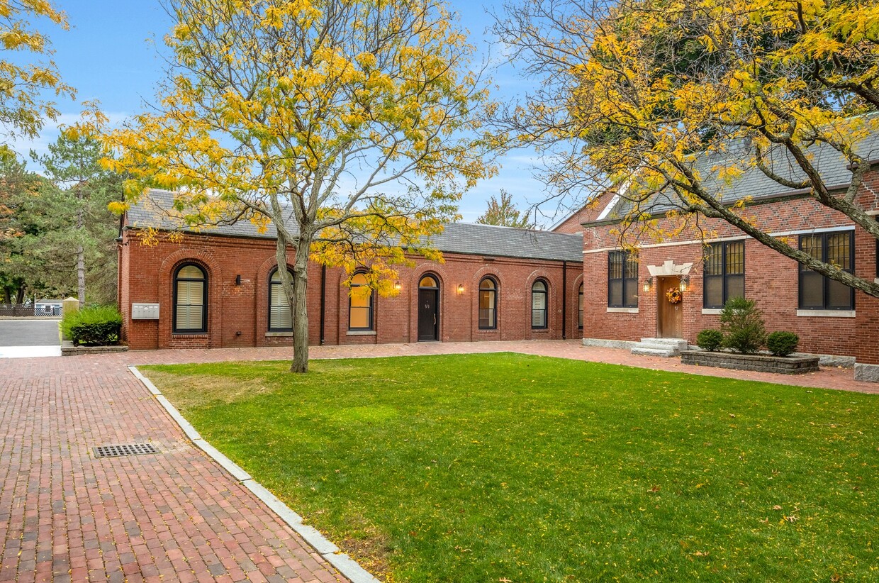
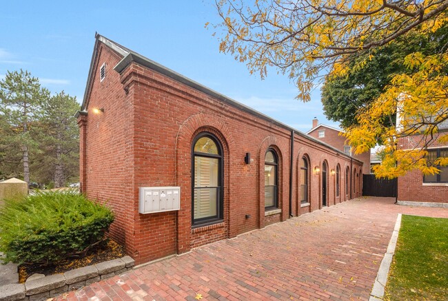
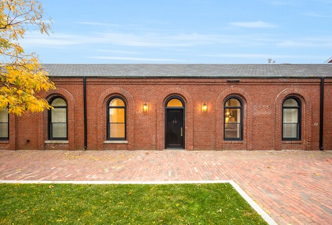
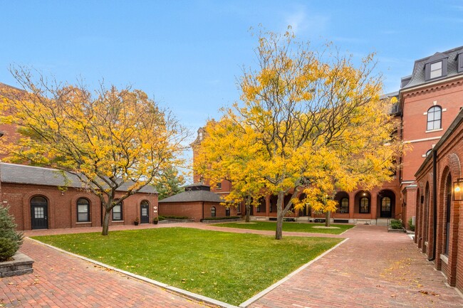
88 Captains Row Unit 1
Chelsea, MA 02150
-
Bedrooms
2
-
Bathrooms
2
-
Square Feet
1,250 sq ft
-
Available
Available Now

88 Captains Row is an apartment community located in Suffolk County and the 02150 ZIP Code. This area is served by the Chelsea attendance zone.
Apartment Features
- Laundry Facilities
Fees and Policies
The fees below are based on community-supplied data and may exclude additional fees and utilities.
- Parking
-
Surface Lot--
Details
Property Information
-
3 units
Contact
- Contact
Admirals Hill provides a relaxed escape, but still offers easy access to Boston’s most popular destinations. Admirals Hills rests at the convergence of Island End River, Mystic River, and Chelsea Creek, so you’ll find locals at the marinas preparing to sail. Residents of this hilltop neighborhood enjoy an exceptional view of Boston's Inner Harbor and waterfront green spaces like Mary O'Malley State Park, which boasts phenomenal views of the Maurice J. Tobin Memorial Bridge. This scenic neighborhood has a variety of apartments and condos available for rent. Along with being less than a mile from Downtown Chelsea, Admirals Hills is only four miles from Boston, giving residents easy access to plenty of shopping, dining, and entertainment. The neighborhood is also convenient to several institutions including Massachusetts Institute of Technology and Harvard.
Learn more about living in Admirals Hill| Colleges & Universities | Distance | ||
|---|---|---|---|
| Colleges & Universities | Distance | ||
| Drive: | 9 min | 4.1 mi | |
| Drive: | 9 min | 4.7 mi | |
| Drive: | 10 min | 5.3 mi | |
| Drive: | 11 min | 5.6 mi |
Transportation options available in Chelsea include Maverick Station, located 1.9 miles from 88 Captains Row Unit 1. 88 Captains Row Unit 1 is near General Edward Lawrence Logan International, located 3.2 miles or 8 minutes away.
| Transit / Subway | Distance | ||
|---|---|---|---|
| Transit / Subway | Distance | ||
|
|
Drive: | 5 min | 1.9 mi |
|
|
Drive: | 6 min | 2.1 mi |
|
|
Drive: | 9 min | 3.5 mi |
|
|
Drive: | 9 min | 3.8 mi |
| Drive: | 9 min | 4.6 mi |
| Commuter Rail | Distance | ||
|---|---|---|---|
| Commuter Rail | Distance | ||
| Walk: | 21 min | 1.1 mi | |
|
|
Drive: | 8 min | 3.4 mi |
|
|
Drive: | 9 min | 4.0 mi |
|
|
Drive: | 8 min | 4.9 mi |
|
|
Drive: | 14 min | 5.4 mi |
| Airports | Distance | ||
|---|---|---|---|
| Airports | Distance | ||
|
General Edward Lawrence Logan International
|
Drive: | 8 min | 3.2 mi |
Time and distance from 88 Captains Row Unit 1.
| Shopping Centers | Distance | ||
|---|---|---|---|
| Shopping Centers | Distance | ||
| Walk: | 16 min | 0.8 mi | |
| Drive: | 4 min | 1.5 mi | |
| Drive: | 4 min | 1.6 mi |
| Parks and Recreation | Distance | ||
|---|---|---|---|
| Parks and Recreation | Distance | ||
|
Museum of Science
|
Drive: | 9 min | 3.6 mi |
|
Boston African American National Historic Site
|
Drive: | 10 min | 3.8 mi |
|
New England Aquarium
|
Drive: | 9 min | 4.5 mi |
|
Boston National Historical Park
|
Drive: | 9 min | 4.5 mi |
|
Boston Harbor Islands National Recreation Area
|
Drive: | 8 min | 4.6 mi |
| Hospitals | Distance | ||
|---|---|---|---|
| Hospitals | Distance | ||
| Drive: | 9 min | 4.0 mi | |
| Drive: | 9 min | 4.4 mi | |
| Drive: | 10 min | 5.4 mi |
| Military Bases | Distance | ||
|---|---|---|---|
| Military Bases | Distance | ||
| Drive: | 27 min | 15.3 mi | |
| Drive: | 31 min | 16.1 mi |
- Laundry Facilities
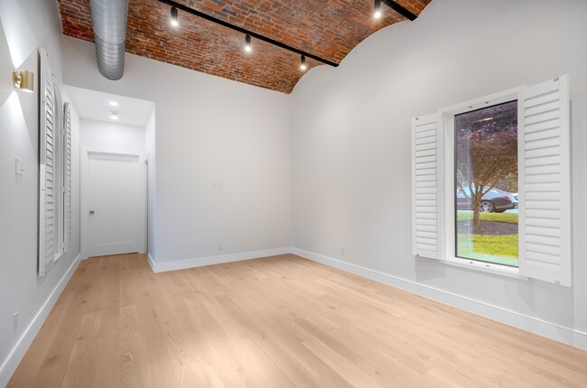
88 Captains Row Unit 1 Photos
What Are Walk Score®, Transit Score®, and Bike Score® Ratings?
Walk Score® measures the walkability of any address. Transit Score® measures access to public transit. Bike Score® measures the bikeability of any address.
What is a Sound Score Rating?
A Sound Score Rating aggregates noise caused by vehicle traffic, airplane traffic and local sources

88 Captains Row
Chelsea, MA 02150