

$3,800
/ Month
88 Fairmont Dr
Daly City, CA 94015
2 Weeks Ago
|
Edit
Favorites
88 Fairmont Dr

Favorites
Check Back Soon for Upcoming Availability
| Beds | Baths | Average SF |
|---|---|---|
| 3 Bedrooms 3 Bedrooms 3 Br | 2 Baths 2 Baths 2 Ba | 1,560 SF |
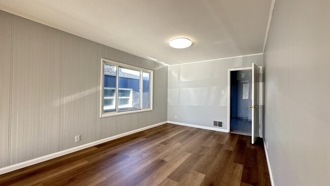
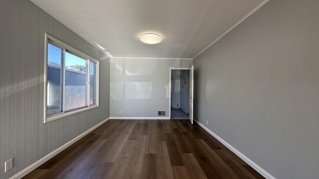
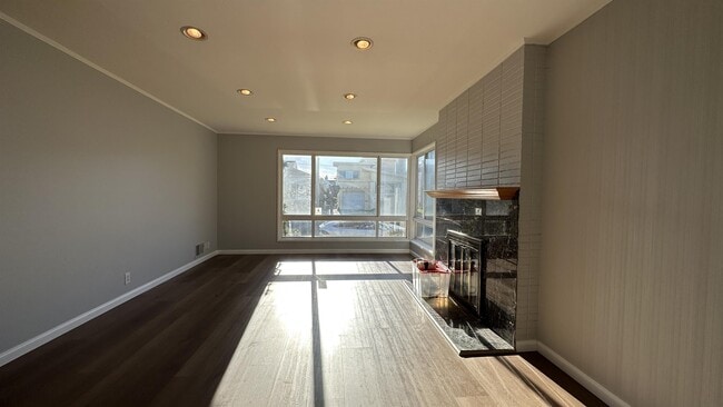
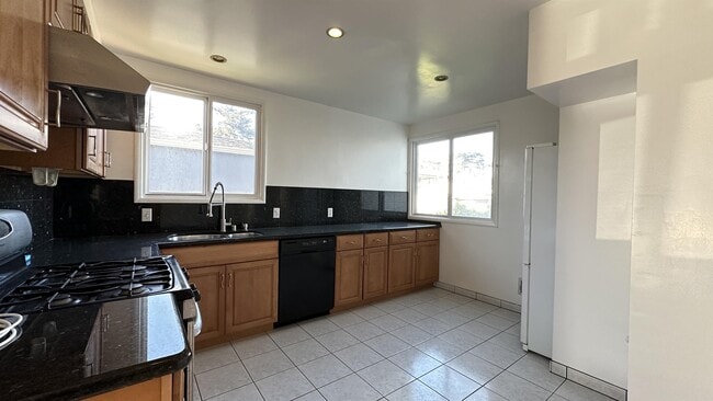
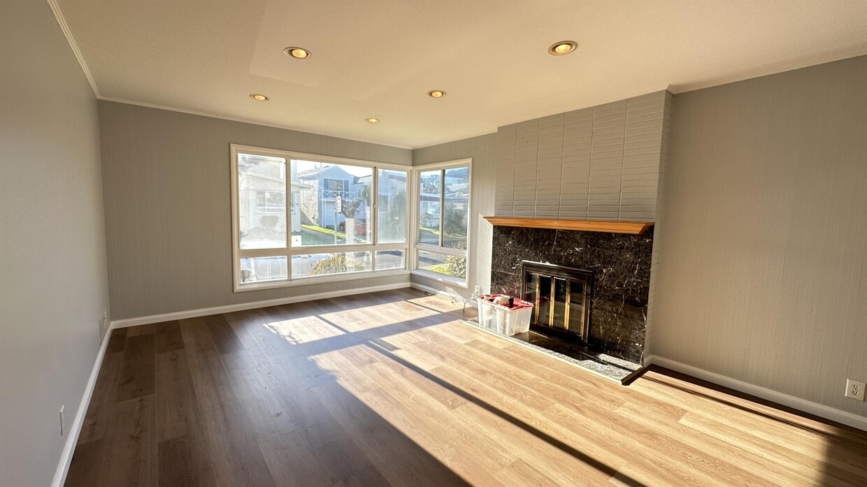
About This Property
Large Three Bedroom, Two Bath With Large Bonus Room or home office. Just Minutes From Coma Bart station and Downtown San Francisco And S. F. Airport. Westlake neighborhood in Daly City. Nearby parks include Westlake Park, Palisades Park and Marchbank Park. Minutes to Original Joe and West Lake Mall with Nation's Burger and Trader Joe and Target.
88 Fairmont Dr is a house located in San Mateo County and the 94015 ZIP Code. This area is served by the Jefferson Elementary attendance zone.
Location
Get Directions
Located about nine miles southwest of San Francisco, Westlake is a picturesque Daly City neighborhood nestled alongside the Pacific Ocean. Westlake is renowned for its distinctive architecture, serving as an early example of a master-planned community after World War II.
Today, Westlake is revered for its exceptional schools and stunning oceanside vistas. The neighborhood’s steep hills afford many of Westlake’s rentals beautiful views. Residents enjoy their gorgeous surroundings at the local Mussel Rock Park and Thornton State Beach, as well as the nearby Fort Funston, Lake Merced Park, and Pacifica State Beach.
Although the neighborhood is mostly residential, there are plenty of great shopping and dining options at Westlake Shopping Center in the northeastern portion of the community. Commuting from Westlake is simple with convenience to Interstate 280 and the Daly City BART Station.
Learn more about living in WestlakeBelow are rent ranges for similar nearby apartments
Education
| Colleges & Universities | Distance | ||
|---|---|---|---|
| Colleges & Universities | Distance | ||
| Drive: | 8 min | 2.9 mi | |
| Drive: | 8 min | 3.8 mi | |
| Drive: | 14 min | 6.0 mi | |
| Drive: | 13 min | 6.7 mi |
88 Fairmont Dr is within 8 minutes or 2.9 miles from San Francisco State University. It is also near City College of San Francisco and UC San Francisco, Parnassus.
Schools


Public Elementary School
Grades K-5
394 Students
Nearby
Public Elementary School
Grades K-5
330 Students
Attendance Zone
Public Middle School
Grades 6-8
500 Students
Attendance Zone
Public High School
Grades 9-12
1,159 Students
Attendance Zone
Public High School
Grades 9-12
1,302 Students
Attendance Zone
Private Elementary & Middle School
Grades PK-8
131 Students
Nearby
Private Elementary & Middle School
Grades K-8
454 Students
Nearby
Private High School
Grades 10-12
Nearby
School data provided by
 The GreatSchools Rating helps parents compare schools within a state based on a variety of school quality indicators and provides a helpful picture of how effectively each school serves all of its students. Ratings are on a scale of 1 (below average) to 10 (above average) and can include test scores, college readiness, academic progress, advanced courses, equity, discipline and attendance data. We also advise parents to visit schools, consider other information on school performance and programs, and consider family needs as part of the school selection process.
View GreatSchools Rating Methodology
Data provided by GreatSchools.org © 2025. All rights reserved.
View GreatSchools Rating Methodology
Data provided by GreatSchools.org © 2025. All rights reserved.
Transportation options available in Daly City include Daly City Station, located 1.8 miles from 88 Fairmont Dr. 88 Fairmont Dr is near San Francisco International, located 11.3 miles or 19 minutes away, and Metro Oakland International, located 28.4 miles or 42 minutes away.
| Transit / Subway | Distance | ||
|---|---|---|---|
| Transit / Subway | Distance | ||
|
|
Drive: | 5 min | 1.8 mi |
|
|
Drive: | 5 min | 2.4 mi |
| Drive: | 5 min | 2.4 mi | |
|
|
Drive: | 5 min | 2.5 mi |
|
|
Drive: | 6 min | 2.6 mi |
| Commuter Rail | Distance | ||
|---|---|---|---|
| Commuter Rail | Distance | ||
| Drive: | 12 min | 7.8 mi | |
| Drive: | 15 min | 8.3 mi | |
| Drive: | 13 min | 8.7 mi | |
| Drive: | 13 min | 8.8 mi | |
| Drive: | 13 min | 8.9 mi |
| Airports | Distance | ||
|---|---|---|---|
| Airports | Distance | ||
|
San Francisco International
|
Drive: | 19 min | 11.3 mi |
|
Metro Oakland International
|
Drive: | 42 min | 28.4 mi |
Time and distance from 88 Fairmont Dr.
| Shopping Centers | Distance | ||
|---|---|---|---|
| Shopping Centers | Distance | ||
| Walk: | 17 min | 0.9 mi | |
| Drive: | 4 min | 2.0 mi | |
| Drive: | 5 min | 2.2 mi |
88 Fairmont Dr has 3 shopping centers within 2.2 miles, which is about a 5-minute drive. The miles and minutes will be for the farthest away property.
| Parks and Recreation | Distance | ||
|---|---|---|---|
| Parks and Recreation | Distance | ||
|
San Francisco State Univ. Observatory
|
Drive: | 8 min | 2.7 mi |
|
Charles F. Hagar Planetarium
|
Drive: | 8 min | 2.7 mi |
|
San Francisco Zoo
|
Drive: | 7 min | 3.4 mi |
|
San Francisco Botanical Garden
|
Drive: | 15 min | 6.0 mi |
|
San Bruno Mountain State Park
|
Drive: | 17 min | 7.0 mi |
88 Fairmont Dr has 5 parks within 7.0 miles, including San Francisco State Univ. Observatory, Charles F. Hagar Planetarium, and San Francisco Zoo.
| Hospitals | Distance | ||
|---|---|---|---|
| Hospitals | Distance | ||
| Drive: | 6 min | 3.0 mi | |
| Drive: | 10 min | 4.7 mi | |
| Drive: | 9 min | 5.5 mi |
88 Fairmont Dr has 3 hospitals within 5.5 miles, the nearest is Seton Medical Center which is 3.0 miles away and a 6 minute drive.
| Military Bases | Distance | ||
|---|---|---|---|
| Military Bases | Distance | ||
| Drive: | 17 min | 7.6 mi | |
| Drive: | 21 min | 8.5 mi |
88 Fairmont Dr is 7.6 miles from West Fort Miley, and is convenient to other military bases, including East Fort Miley.
You May Also Like
Similar Rentals Nearby


What Are Walk Score®, Transit Score®, and Bike Score® Ratings?
Walk Score® measures the walkability of any address. Transit Score® measures access to public transit. Bike Score® measures the bikeability of any address.
What is a Sound Score Rating?
A Sound Score Rating aggregates noise caused by vehicle traffic, airplane traffic and local sources
88 Fairmont Dr
Daly City, CA 94015