-
Monthly Rent
$2,550
-
Bedrooms
3 bd
-
Bathrooms
2 ba
-
Square Feet
1,325 sq ft
Details

 This Property
 Available Property
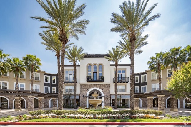
Pedley is a small neighborhood within the Jurupa Valley, about seven miles west of Downtown Riverside. Featuring rolling hills and palm trees, Pedley offers a variety of housing options for every budget, but there are some rentals that are much more affordable compared to other SoCal neighborhoods. Along with Mediterranean-style houses, Pedley has mid-rise apartments available for rent.
This suburban neighborhood has several schools, daycare centers, parks, and golf courses like Paradise Knolls Golf Course. Along Limonite Avenue, residents have access to a variety of restaurants and retailers. For entertainment, you’ll find that locals travel a few miles outside the neighborhood to the Cove Waterpark, Jurupa Mountains Discovery Center, or Castle Park, a carnival-style amusement park. Great for renters who want to be close to campus, Pedley is convenient to California Baptist University, Riverside City College, and University of California, Riverside.
Learn more about living in Pedley| Colleges & Universities | Distance | ||
|---|---|---|---|
| Colleges & Universities | Distance | ||
| Drive: | 13 min | 6.6 mi | |
| Drive: | 15 min | 7.9 mi | |
| Drive: | 18 min | 8.7 mi | |
| Drive: | 19 min | 10.2 mi |
Transportation options available in Riverside include Apu / Citrus College Station, located 32.0 miles from 8818 56th St Unit 1. 8818 56th St Unit 1 is near Ontario International, located 11.9 miles or 19 minutes away, and John Wayne/Orange County, located 40.3 miles or 53 minutes away.
| Transit / Subway | Distance | ||
|---|---|---|---|
| Transit / Subway | Distance | ||
| Drive: | 43 min | 32.0 mi | |
| Drive: | 42 min | 32.6 mi | |
| Drive: | 43 min | 33.8 mi | |
| Drive: | 46 min | 36.2 mi | |
| Drive: | 48 min | 37.7 mi |
| Commuter Rail | Distance | ||
|---|---|---|---|
| Commuter Rail | Distance | ||
|
|
Walk: | 13 min | 0.7 mi |
|
|
Drive: | 16 min | 8.3 mi |
|
|
Drive: | 16 min | 8.8 mi |
|
|
Drive: | 16 min | 9.2 mi |
|
|
Drive: | 19 min | 10.6 mi |
| Airports | Distance | ||
|---|---|---|---|
| Airports | Distance | ||
|
Ontario International
|
Drive: | 19 min | 11.9 mi |
|
John Wayne/Orange County
|
Drive: | 53 min | 40.3 mi |
Time and distance from 8818 56th St Unit 1.
| Shopping Centers | Distance | ||
|---|---|---|---|
| Shopping Centers | Distance | ||
| Walk: | 21 min | 1.1 mi | |
| Drive: | 3 min | 1.2 mi | |
| Drive: | 4 min | 1.5 mi |
| Parks and Recreation | Distance | ||
|---|---|---|---|
| Parks and Recreation | Distance | ||
|
Louis Robidoux Nature Center
|
Drive: | 8 min | 3.6 mi |
|
Hidden Valley Nature Center
|
Drive: | 13 min | 7.6 mi |
|
Mary Vagle Nature Center
|
Drive: | 16 min | 8.2 mi |
|
California Citrus State Historical Park
|
Drive: | 20 min | 8.8 mi |
|
UCR Botanic Gardens
|
Drive: | 21 min | 12.3 mi |
| Hospitals | Distance | ||
|---|---|---|---|
| Hospitals | Distance | ||
| Drive: | 10 min | 5.4 mi | |
| Drive: | 14 min | 7.5 mi | |
| Drive: | 14 min | 8.0 mi |
| Military Bases | Distance | ||
|---|---|---|---|
| Military Bases | Distance | ||
| Drive: | 40 min | 20.1 mi |
You May Also Like
Similar Rentals Nearby
-
-
-
Single-Family Homes 2 Months Free
Pets Allowed Pool Refrigerator Kitchen Pavillon Oven
-
-
-
-
-
-
-
What Are Walk Score®, Transit Score®, and Bike Score® Ratings?
Walk Score® measures the walkability of any address. Transit Score® measures access to public transit. Bike Score® measures the bikeability of any address.
What is a Sound Score Rating?
A Sound Score Rating aggregates noise caused by vehicle traffic, airplane traffic and local sources
