

$1,800 / Month
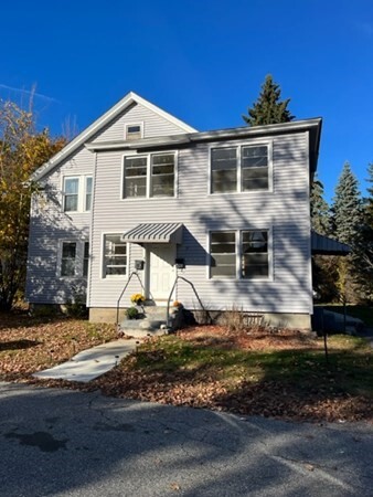
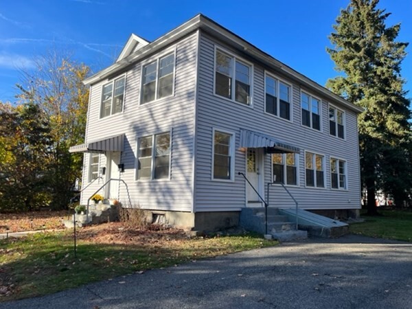
9 Bowles Ave Unit 1
West Boylston, MA 01583
2 Weeks Ago
Favorites
9 Bowles Ave Unit 1

Favorites
Check Back Soon for Upcoming Availability
| Beds | Baths | Average SF |
|---|---|---|
| 2 Bedrooms 2 Bedrooms 2 Br | 1 Bath 1 Bath 1 Ba | 1,612 SF |
About This Property
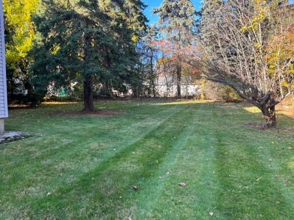
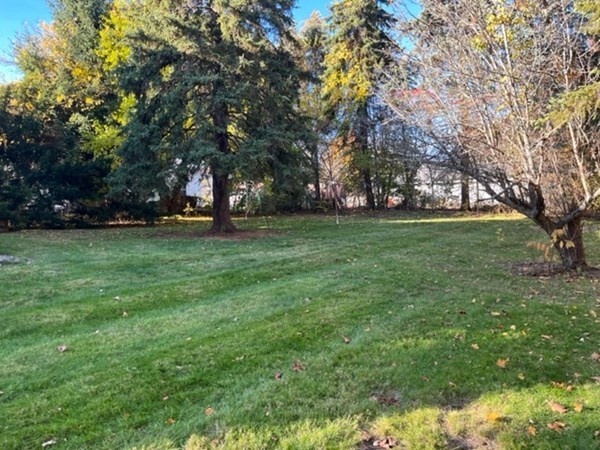
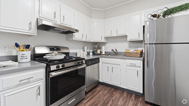
Here's your chance to rent a wonderful,Apartment in WEST BOYLSTON. Apartment has 2 bedroom,offers designated laundry space,built-ins,beautiful hardwood floors along with plenty of storage. The well-appointed galley kitchen offers plenty of space for cooking and gathering. Good size flat yard offers great space for picnics,toys and games. Recent updates include new hot water heater,chimney cap and well insulated. Easy highway access,yet located in a beautiful town with great schools and nearby restaurants. Want fresh food? Delicious fresh farm vegetables,fruit and meats are around the corner! And a fish market too! Buy it as an investment property or move in yourself. Clean and ready! Showings SUNDAY 11/6 11-12:30
9 Bowles Ave is an apartment community located in Worcester County and the 01583 ZIP Code.
Location
Get Directions
Wrapped around the Wachusett Reservoir, West Boylston provides a classic New England setting complete with expansive, wooded areas, historic charm, and large homes. First settled in 1642 and incorporated in 1808, West Boylston is known as the “small town with a big heart.” Today, it is a popular suburb of Worcester, located directly south. Residents of West Boylston enjoy easy access to the University of Massachusetts Medical School, Quinsigamond Community College, and Tower Hill Botanic Garden.
If you believe classic New England is synonymous with the Farmer’s Almanac, then it’s worth noting that the founder and editor of the Farmer’s Almanac, Robert B. Thomas, lived in West Boylston. He started the Farmer’s Almanac in 1792, making it the oldest continuously published periodical in the country. Other historic locations include Bigelow Tavern, built in 1810; the Oakdale Village Historic District, dating back to 1780; and the Quinapoxet River Bridge, built in 1903.
Learn more about living in West Boylston
Education
| Colleges & Universities | Distance | ||
|---|---|---|---|
| Colleges & Universities | Distance | ||
| Drive: | 6 min | 2.5 mi | |
| Drive: | 9 min | 5.9 mi | |
| Drive: | 12 min | 5.9 mi | |
| Drive: | 14 min | 6.9 mi |
9 Bowles Ave Unit 1 is within 6 minutes or 2.5 miles from Quinsigamond Community College. It is also near Worcester Polytechnic Inst. and Assumption College.
Transportation options available in West Boylston include Riverside Station, located 34.7 miles from 9 Bowles Ave Unit 1. 9 Bowles Ave Unit 1 is near Worcester Regional, located 11.1 miles or 20 minutes away.
| Transit / Subway | Distance | ||
|---|---|---|---|
| Transit / Subway | Distance | ||
|
|
Drive: | 54 min | 34.7 mi |
|
|
Drive: | 54 min | 35.0 mi |
|
|
Drive: | 55 min | 35.7 mi |
|
|
Drive: | 57 min | 37.3 mi |
|
|
Drive: | 58 min | 37.5 mi |
| Commuter Rail | Distance | ||
|---|---|---|---|
| Commuter Rail | Distance | ||
|
|
Drive: | 10 min | 6.6 mi |
|
|
Drive: | 11 min | 6.7 mi |
|
|
Drive: | 22 min | 11.9 mi |
|
|
Drive: | 23 min | 12.6 mi |
|
|
Drive: | 22 min | 17.7 mi |
| Airports | Distance | ||
|---|---|---|---|
| Airports | Distance | ||
|
Worcester Regional
|
Drive: | 20 min | 11.1 mi |
Time and distance from 9 Bowles Ave Unit 1.
| Shopping Centers | Distance | ||
|---|---|---|---|
| Shopping Centers | Distance | ||
| Walk: | 4 min | 0.2 mi | |
| Walk: | 5 min | 0.3 mi | |
| Walk: | 8 min | 0.4 mi |
9 Bowles Ave Unit 1 has 3 shopping centers within 0.4 mile, which is about a 8-minute walk. The miles and minutes will be for the farthest away property.
| Parks and Recreation | Distance | ||
|---|---|---|---|
| Parks and Recreation | Distance | ||
|
Tower Hill Botanic Garden
|
Drive: | 11 min | 5.9 mi |
|
Quinsigamond State Park
|
Drive: | 12 min | 6.2 mi |
|
EcoTarium
|
Drive: | 15 min | 6.9 mi |
|
Mass Audubon's Eagle Lake Wildlife Sanctuary
|
Drive: | 14 min | 7.0 mi |
|
Mount Pisgah Conservation Area
|
Drive: | 24 min | 9.5 mi |
9 Bowles Ave Unit 1 has 5 parks within 9.5 miles, including Tower Hill Botanic Garden, Quinsigamond State Park, and Mass Audubon's Eagle Lake Wildlife Sanctuary.
| Hospitals | Distance | ||
|---|---|---|---|
| Hospitals | Distance | ||
| Drive: | 9 min | 5.7 mi | |
| Drive: | 12 min | 5.9 mi | |
| Drive: | 10 min | 6.4 mi |
9 Bowles Ave Unit 1 has 3 hospitals within 6.4 miles, the nearest is Adcare Hospital of Worcester which is 5.7 miles away and a 9 minute drive.
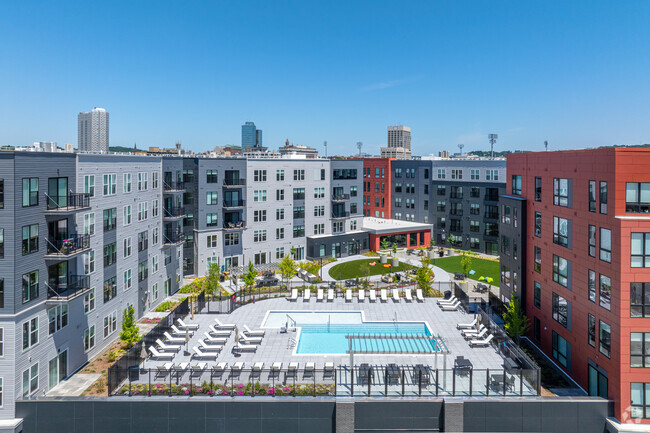
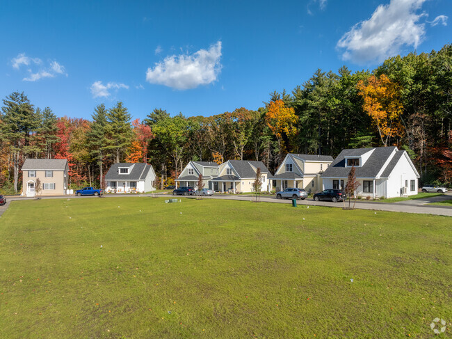
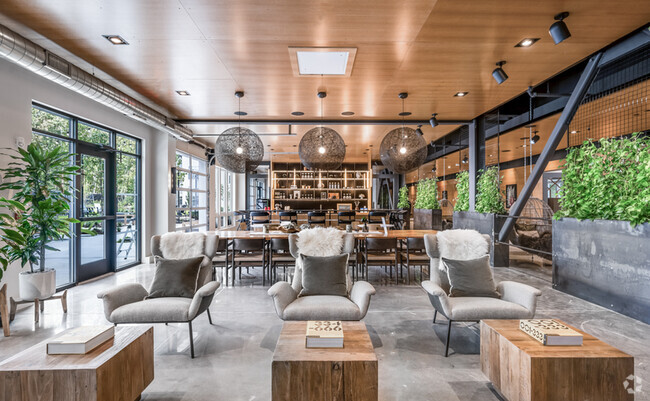
You May Also Like
Similar Rentals Nearby

What Are Walk Score®, Transit Score®, and Bike Score® Ratings?
Walk Score® measures the walkability of any address. Transit Score® measures access to public transit. Bike Score® measures the bikeability of any address.
What is a Sound Score Rating?
A Sound Score Rating aggregates noise caused by vehicle traffic, airplane traffic and local sources
9 Bowles Ave
West Boylston, MA 01583