9 Chesterton St Unit 1
Boston, MA 02119
-
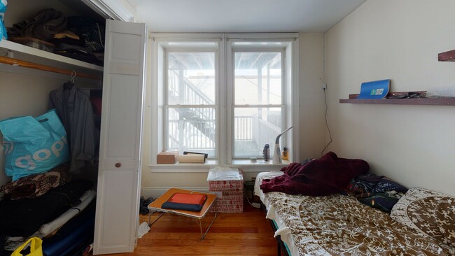
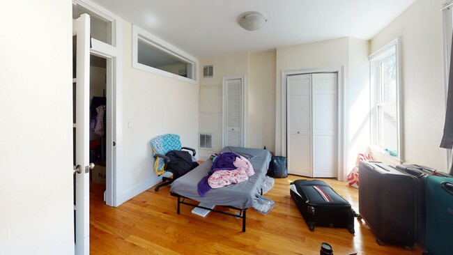
Bedrooms
2
-
Bathrooms
2
-
Square Feet
950 sq ft
-
Available
Available Sep 1

9 Chesterton St is a condo located in Suffolk County and the 02119 ZIP Code.
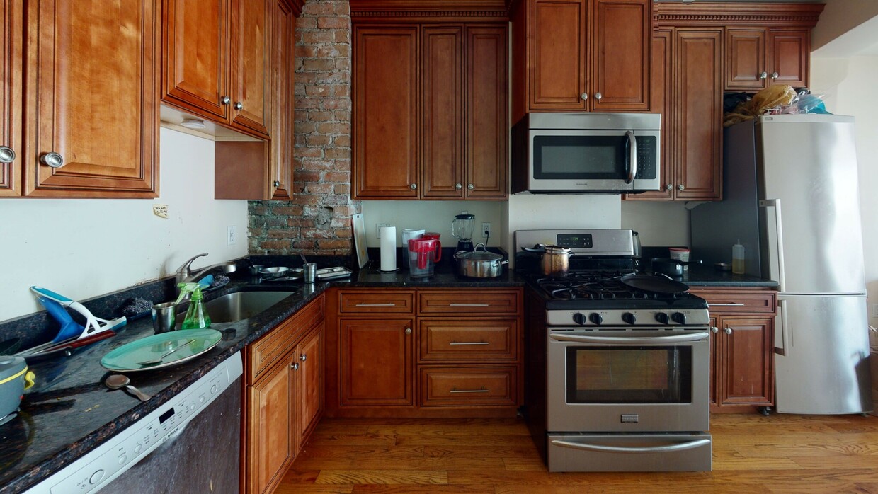
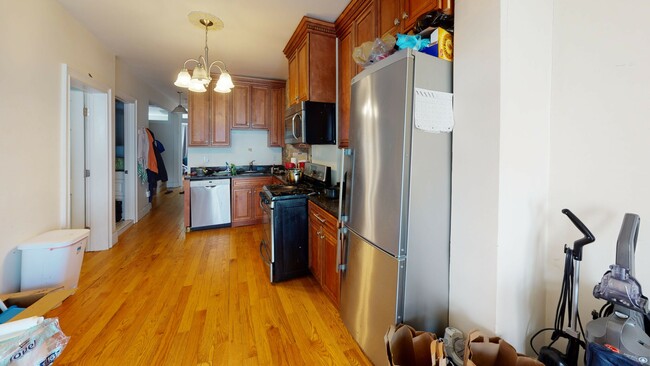
Condo Features
- Dishwasher
- Laundry Facilities
Fees and Policies
The fees below are based on community-supplied data and may exclude additional fees and utilities.
- Parking
-
Street--
Details
Utilities Included
-
Water
-
Sewer
Contact
- Contact
Situated between the South End and Dudley Square, Lower Roxbury is a predominantly residential neighborhood brimming with apartments and town houses available for rent. Residents enjoy a walkable urban environment filled with diverse historical architecture.
Warren Street and Washington Street are the neighborhood’s main commercial thoroughfares, touting rows of specialty shops, markets, and eateries in historic buildings. Northeastern University, Wentworth Institute of Technology, and Massachusetts College of Art and Design are all just northwest of Lower Roxbury, offering the community a bevy of cultural and educational amenities. Getting around from Lower Roxbury is easy with access to multiple T stops on the Orange Line.
Learn more about living in Lower Roxbury| Colleges & Universities | Distance | ||
|---|---|---|---|
| Colleges & Universities | Distance | ||
| Drive: | 4 min | 1.6 mi | |
| Drive: | 4 min | 1.8 mi | |
| Drive: | 5 min | 1.9 mi | |
| Drive: | 5 min | 2.3 mi |
Transportation options available in Boston include Andrew Station, located 0.8 mile from 9 Chesterton St Unit 1. 9 Chesterton St Unit 1 is near General Edward Lawrence Logan International, located 5.3 miles or 10 minutes away.
| Transit / Subway | Distance | ||
|---|---|---|---|
| Transit / Subway | Distance | ||
|
|
Walk: | 16 min | 0.8 mi |
|
|
Drive: | 4 min | 1.5 mi |
|
|
Drive: | 4 min | 1.6 mi |
|
|
Drive: | 4 min | 1.7 mi |
|
|
Drive: | 3 min | 1.9 mi |
| Commuter Rail | Distance | ||
|---|---|---|---|
| Commuter Rail | Distance | ||
| Walk: | 9 min | 0.5 mi | |
|
|
Drive: | 2 min | 1.4 mi |
|
|
Drive: | 4 min | 1.8 mi |
|
|
Drive: | 7 min | 2.2 mi |
|
|
Drive: | 5 min | 2.2 mi |
| Airports | Distance | ||
|---|---|---|---|
| Airports | Distance | ||
|
General Edward Lawrence Logan International
|
Drive: | 10 min | 5.3 mi |
Time and distance from 9 Chesterton St Unit 1.
| Shopping Centers | Distance | ||
|---|---|---|---|
| Shopping Centers | Distance | ||
| Walk: | 14 min | 0.7 mi | |
| Drive: | 4 min | 1.4 mi | |
| Drive: | 11 min | 6.2 mi |
| Parks and Recreation | Distance | ||
|---|---|---|---|
| Parks and Recreation | Distance | ||
|
Roxbury Heritage State Park
|
Drive: | 3 min | 1.6 mi |
|
Boston Public Garden
|
Drive: | 6 min | 2.5 mi |
|
Boston Children's Museum
|
Drive: | 5 min | 2.5 mi |
|
Lower Neponset River Trail
|
Drive: | 5 min | 2.6 mi |
|
Boston African American National Historic Site
|
Drive: | 7 min | 2.9 mi |
| Hospitals | Distance | ||
|---|---|---|---|
| Hospitals | Distance | ||
| Walk: | 8 min | 0.4 mi | |
| Walk: | 11 min | 0.6 mi | |
| Drive: | 4 min | 2.0 mi |
| Military Bases | Distance | ||
|---|---|---|---|
| Military Bases | Distance | ||
| Drive: | 32 min | 16.9 mi |
- Dishwasher
- Laundry Facilities
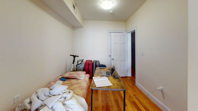
9 Chesterton St Unit 1 Photos
What Are Walk Score®, Transit Score®, and Bike Score® Ratings?
Walk Score® measures the walkability of any address. Transit Score® measures access to public transit. Bike Score® measures the bikeability of any address.
What is a Sound Score Rating?
A Sound Score Rating aggregates noise caused by vehicle traffic, airplane traffic and local sources

9 Chesterton St
Boston, MA 02119