
$2,745 / Month
9 Chesterton St Unit 2
Boston, MA 02119
1 Week Ago
Favorites
857-587-0943
-
Bedrooms
2
-
Bathrooms
2
-
Square Feet
950 sq ft
-
Available
Available Aug 31
Highlight
- Smoke Free
9 Chesterton St Unit 2

Favorites
About This Home
12 Month Lease,
$2,745 deposit,
Available Aug 31
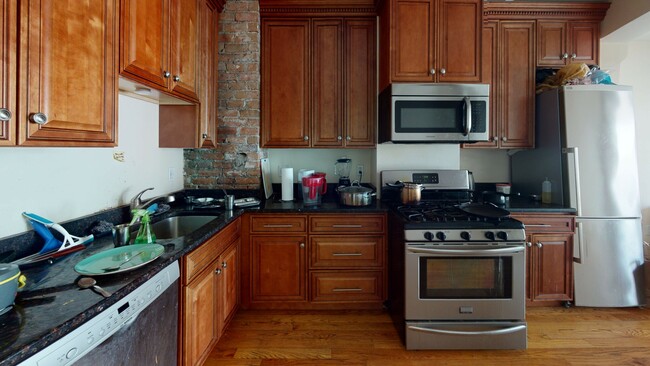
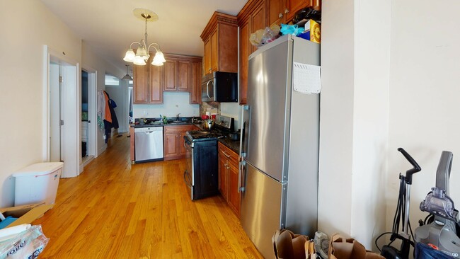
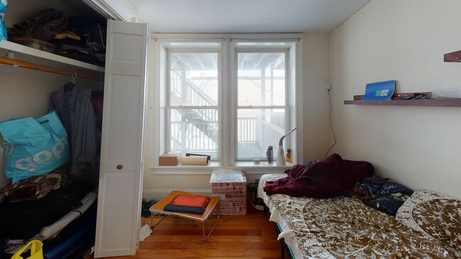
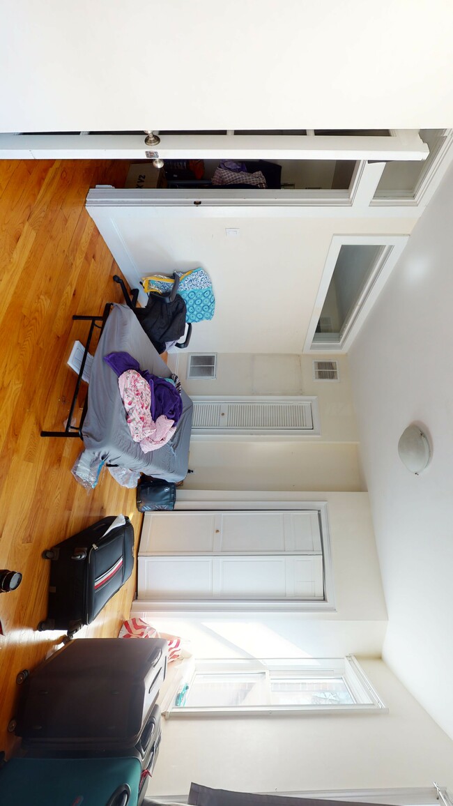
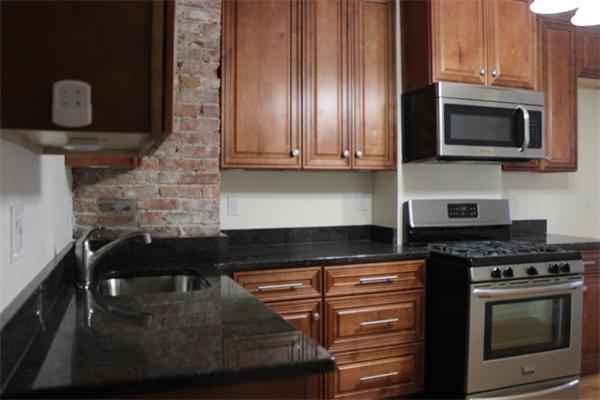
This spacious 2-bedroom, 2-bathroom apartment is available for rent starting September 1, 2025. Offering 950 square feet of living space, this unit provides ample room for comfortable living. Water is included in the rent, and the apartment is heated by gas for warmth and efficiency. Laundry facilities are available in the building for your convenience. While pets are not allowed, the apartment is student-friendly, making it a great choice for students. Street parking is available, and the apartment is located on the second floor of a multi-family building. Don’t miss out on this wonderful opportunity to make this apartment your new home!
9 Chesterton St is an apartment community located in Suffolk County and the 02119 ZIP Code. This area is served by the Boston Public Schools attendance zone.
* Price shown is base rent and may not include non-optional fees and utilities.
Price, availability, fees, and any applicable rent special are subject to change without notice.
* Square footage definitions vary. Displayed square footage is approximate.
Apartment Features
- Washer/Dryer
- Smoke Free
- Laundry Facilities
Fees and Policies
The fees below are based on community-supplied data and may exclude additional fees and utilities.
- Parking
-
Surface Lot--
Details
Utilities Included
-
Water
Property Information
-
2 units
Contact
- Phone Number
- Contact
Location
Get Directions
Situated between the South End and Dudley Square, Lower Roxbury is a predominantly residential neighborhood brimming with apartments and town houses available for rent. Residents enjoy a walkable urban environment filled with diverse historical architecture.
Warren Street and Washington Street are the neighborhood’s main commercial thoroughfares, touting rows of specialty shops, markets, and eateries in historic buildings. Northeastern University, Wentworth Institute of Technology, and Massachusetts College of Art and Design are all just northwest of Lower Roxbury, offering the community a bevy of cultural and educational amenities. Getting around from Lower Roxbury is easy with access to multiple T stops on the Orange Line.
Learn more about living in Lower Roxbury
Education
| Colleges & Universities | Distance | ||
|---|---|---|---|
| Colleges & Universities | Distance | ||
| Drive: | 4 min | 1.6 mi | |
| Drive: | 4 min | 1.8 mi | |
| Drive: | 5 min | 1.9 mi | |
| Drive: | 5 min | 2.3 mi |
9 Chesterton St Unit 2 is within 4 minutes or 1.6 miles from Northeastern University. It is also near Berklee College of Music and Wentworth Inst. of Technology.
Schools


Public Elementary School
Grades PK-5
188 Students
Attendance Zone
Public Elementary & Middle School
Grades PK-8
724 Students
Attendance Zone
Public Middle & High School
Grades 7-12
1,567 Students
Attendance Zone
Public Middle & High School
Grades 7-12
26 Students
Attendance Zone
Charter High School
Grades 9-10 & 12
321 Students
Attendance Zone
Public High School
Grades 9-12
1,087 Students
Attendance Zone
Private Elementary School
Grades PK-6
128 Students
Nearby
Private Middle & High School
Grades 7-12
292 Students
Nearby
School data provided by
 The GreatSchools Rating helps parents compare schools within a state based on a variety of school quality indicators and provides a helpful picture of how effectively each school serves all of its students. Ratings are on a scale of 1 (below average) to 10 (above average) and can include test scores, college readiness, academic progress, advanced courses, equity, discipline and attendance data. We also advise parents to visit schools, consider other information on school performance and programs, and consider family needs as part of the school selection process.
View GreatSchools Rating Methodology
View GreatSchools Rating Methodology
Transportation options available in Boston include Andrew Station, located 0.8 mile from 9 Chesterton St Unit 2. 9 Chesterton St Unit 2 is near General Edward Lawrence Logan International, located 5.3 miles or 10 minutes away.
| Transit / Subway | Distance | ||
|---|---|---|---|
| Transit / Subway | Distance | ||
|
|
Walk: | 16 min | 0.8 mi |
|
|
Drive: | 4 min | 1.5 mi |
|
|
Drive: | 4 min | 1.6 mi |
|
|
Drive: | 4 min | 1.7 mi |
|
|
Drive: | 3 min | 1.9 mi |
| Commuter Rail | Distance | ||
|---|---|---|---|
| Commuter Rail | Distance | ||
| Walk: | 9 min | 0.5 mi | |
|
|
Drive: | 2 min | 1.4 mi |
|
|
Drive: | 4 min | 1.8 mi |
|
|
Drive: | 7 min | 2.2 mi |
|
|
Drive: | 5 min | 2.2 mi |
| Airports | Distance | ||
|---|---|---|---|
| Airports | Distance | ||
|
General Edward Lawrence Logan International
|
Drive: | 10 min | 5.3 mi |
Time and distance from 9 Chesterton St Unit 2.
| Shopping Centers | Distance | ||
|---|---|---|---|
| Shopping Centers | Distance | ||
| Walk: | 14 min | 0.7 mi | |
| Drive: | 4 min | 1.4 mi | |
| Drive: | 11 min | 6.2 mi |
9 Chesterton St Unit 2 has 3 shopping centers within 6.2 miles, which is about a 11-minute walk. The miles and minutes will be for the farthest away property.
| Parks and Recreation | Distance | ||
|---|---|---|---|
| Parks and Recreation | Distance | ||
|
Roxbury Heritage State Park
|
Drive: | 3 min | 1.6 mi |
|
Boston Public Garden
|
Drive: | 6 min | 2.5 mi |
|
Boston Children's Museum
|
Drive: | 5 min | 2.5 mi |
|
Lower Neponset River Trail
|
Drive: | 5 min | 2.6 mi |
|
Boston African American National Historic Site
|
Drive: | 7 min | 2.9 mi |
9 Chesterton St Unit 2 has 5 parks within 2.9 miles, including Roxbury Heritage State Park, Lower Neponset River Trail, and Boston Public Garden.
| Hospitals | Distance | ||
|---|---|---|---|
| Hospitals | Distance | ||
| Walk: | 8 min | 0.4 mi | |
| Walk: | 11 min | 0.6 mi | |
| Drive: | 4 min | 2.0 mi |
9 Chesterton St Unit 2 has 3 hospitals within 2.0 miles, the nearest is Boston Medical Center which is 0.4 mile away and a 8 minute walk.
| Military Bases | Distance | ||
|---|---|---|---|
| Military Bases | Distance | ||
| Drive: | 32 min | 16.9 mi |
9 Chesterton St Unit 2 is 16.9 miles and a 32 minute drive from Hanscom Air Force Base.
Amenities
- Washer/Dryer
- Smoke Free
- Laundry Facilities
9 Chesterton St Unit 2 Photos
What Are Walk Score®, Transit Score®, and Bike Score® Ratings?
Walk Score® measures the walkability of any address. Transit Score® measures access to public transit. Bike Score® measures the bikeability of any address.
What is a Sound Score Rating?
A Sound Score Rating aggregates noise caused by vehicle traffic, airplane traffic and local sources
9 Chesterton St
Boston, MA 02119