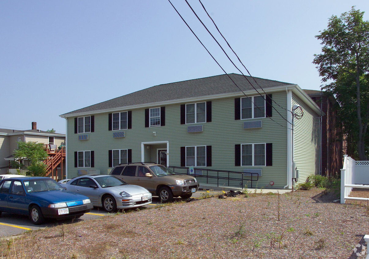
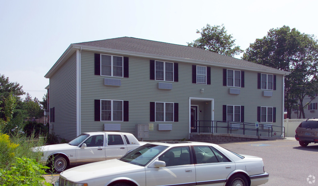
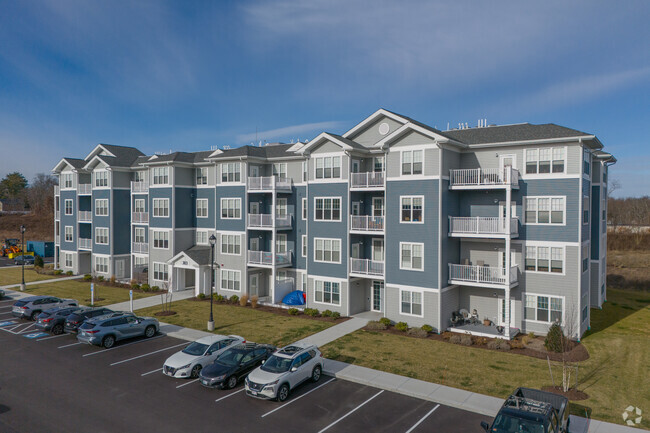
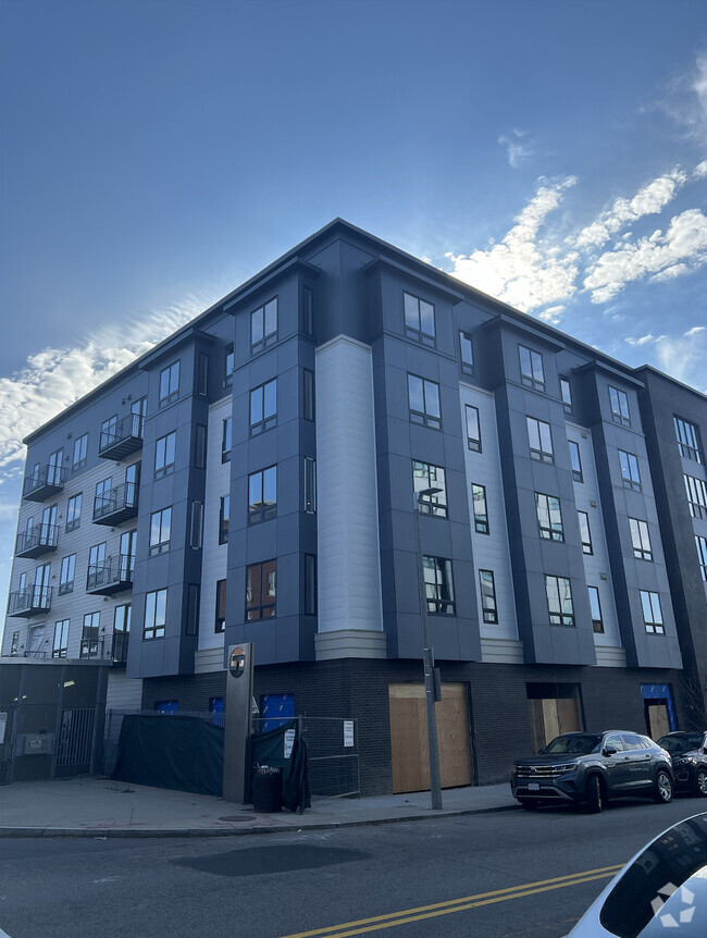
9 Pratt St
9 Pratt St,
Mansfield,
MA
02048
2 Weeks Ago
Favorites
9 Pratt St
Favorites
Check Back Soon for Upcoming Availability
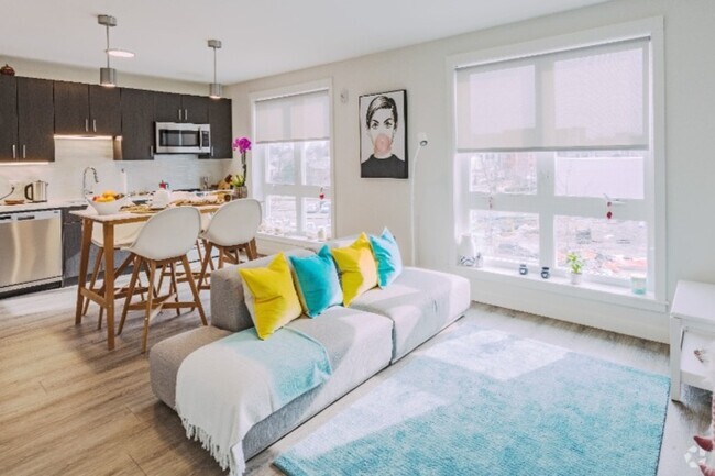
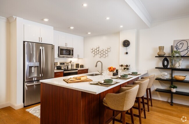
About 9 Pratt St Mansfield, MA 02048
Discover your next home at 9 Pratt St in Mansfield, MA. The 02048 location has so much to offer its residents. Come by to see the available floorplan options. The professional leasing staff will be ready to help you find the perfect apartment. Drop by to talk about your next apartment.
9 Pratt St is an apartment community located in Bristol County and the 02048 ZIP Code. This area is served by the Mansfield attendance zone.
Fees and Policies
The fees below are based on community-supplied data and may exclude additional fees and utilities.
- Parking
-
Surface Lot--1 Max
Details
Property Information
-
7 units/2 stories
Property Address:
9 Pratt St,
Mansfield,
MA
02048
 This Property
 Available Property
Mansfield is a peaceful suburb about 30 miles south of Boston and 20 miles north of Providence, Rhode Island. This family-friendly city is home to great schools and scenic outdoor areas like the sprawling Great Woods Conservation Area and Marie Streese Conservation Area. The Interstate 95 and 495 junction and the Mansfield train station, served by MBTA’s commuter line between Providence and Boston, make the city great for commuters as well. The Mansfield Municipal Airport is situated towards the south of town, making further travel accessible. Other amenities in Mansfield include Mansfield Crossing, a large shopping center off Interstate 495, and great local restaurants off Main Street in Mansfield Center. Several sprawling golf courses reside outside of the city, and residents enjoy the quick travel time to Boston and Providence for big-city amenities and attractions.
Learn more about living in Mansfield
Education
| Colleges & Universities | Distance | ||
|---|---|---|---|
| Colleges & Universities | Distance | ||
| Drive: | 12 min | 5.7 mi | |
| Drive: | 18 min | 9.2 mi | |
| Drive: | 28 min | 13.9 mi | |
| Drive: | 27 min | 16.8 mi |
9 Pratt St is within 12 minutes or 5.7 miles from Wheaton College, Norton. It is also near Stonehill College and Massasoit C.C., Brockton.
Schools
Public Elementary School
Grades 3-5
704 Students
Attendance Zone
6
Out of 10
Public Elementary School
Grades K-2
754 Students
Attendance Zone
Public Elementary School
Grades PK-4
333 Students
Nearby
5
Out of 10
Public Middle School
Grades 6-8
790 Students
Attendance Zone
8
Out of 10
Public High School
Grades 9-12
1,092 Students
Attendance Zone
7
Out of 10
Private Elementary, Middle & High School
Grades PK-12
209 Students
Nearby
Private Elementary & Middle School
Grades PK-8
185 Students
Nearby
Private Elementary & Middle School
Grades PK-8
Nearby
School data provided by
GreatSchools
The GreatSchools Rating helps parents compare schools within a state based on a variety of school quality indicators and provides a helpful picture of how effectively each school serves all of its students. Ratings are on a scale of 1 (below average) to 10 (above average) and can include test scores, college readiness, academic progress, advanced courses, equity, discipline and attendance data. We also advise parents to visit schools, consider other information on school performance and programs, and consider family needs as part of the school selection process.
Transportation options available in Mansfield include Mattapan Station, located 21.6 miles from 9 Pratt St. 9 Pratt St is near Rhode Island Tf Green International, located 29.9 miles or 45 minutes away, and General Edward Lawrence Logan International, located 34.5 miles or 49 minutes away.
| Transit / Subway | Distance | ||
|---|---|---|---|
| Transit / Subway | Distance | ||
|
|
Drive: | 32 min | 21.6 mi |
|
|
Drive: | 33 min | 21.9 mi |
|
|
Drive: | 33 min | 22.0 mi |
|
|
Drive: | 33 min | 22.9 mi |
|
|
Drive: | 35 min | 23.7 mi |
| Commuter Rail | Distance | ||
|---|---|---|---|
| Commuter Rail | Distance | ||
|
|
Walk: | 3 min | 0.2 mi |
|
|
Drive: | 13 min | 6.6 mi |
|
|
Drive: | 16 min | 9.2 mi |
|
|
Drive: | 17 min | 10.9 mi |
|
|
Drive: | 18 min | 11.6 mi |
| Airports | Distance | ||
|---|---|---|---|
| Airports | Distance | ||
|
Rhode Island Tf Green International
|
Drive: | 45 min | 29.9 mi |
|
General Edward Lawrence Logan International
|
Drive: | 49 min | 34.5 mi |
Time and distance from 9 Pratt St.
| Shopping Centers | Distance | ||
|---|---|---|---|
| Shopping Centers | Distance | ||
| Walk: | 6 min | 0.3 mi | |
| Drive: | 3 min | 1.2 mi | |
| Drive: | 3 min | 1.3 mi |
9 Pratt St has 3 shopping centers within 1.3 miles, which is about a 3-minute drive. The miles and minutes will be for the farthest away property.
| Parks and Recreation | Distance | ||
|---|---|---|---|
| Parks and Recreation | Distance | ||
|
Borderland State Park
|
Drive: | 12 min | 4.5 mi |
|
F. Gilbert Hills State Forest
|
Drive: | 13 min | 5.4 mi |
|
North Attleboro National Fish Hatchery
|
Drive: | 14 min | 5.6 mi |
|
Mass Audubon's Moose Hill Wildlife Sanctuary
|
Drive: | 17 min | 8.6 mi |
|
The Children's Museum in Easton
|
Drive: | 17 min | 8.9 mi |
9 Pratt St has 5 parks within 8.9 miles, including Borderland State Park, F. Gilbert Hills State Forest, and North Attleboro National Fish Hatchery.
| Hospitals | Distance | ||
|---|---|---|---|
| Hospitals | Distance | ||
| Drive: | 17 min | 11.2 mi | |
| Drive: | 23 min | 12.9 mi |
9 Pratt St is 11.2 miles from Sturdy Memorial Hospital, and is convenient to other hospitals, including Good Samaritan Medical Center.
| Military Bases | Distance | ||
|---|---|---|---|
| Military Bases | Distance | ||
| Drive: | 43 min | 24.9 mi |
9 Pratt St is 24.9 miles and a 43 minutes from US Military Reservation.
You May Also Like
Similar Rentals Nearby


What Are Walk Score®, Transit Score®, and Bike Score® Ratings?
Walk Score® measures the walkability of any address. Transit Score® measures access to public transit. Bike Score® measures the bikeability of any address.
What is a Sound Score Rating?
A Sound Score Rating aggregates noise caused by vehicle traffic, airplane traffic and local sources
Responded To This Review