
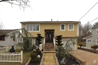
$3,950 / Month
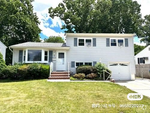
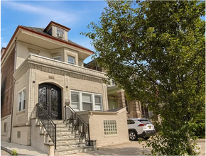
9 Roger Ave
Cranford, NJ 07016
1 Day Ago
Favorites
862-206-4665
-
Bedrooms
4
-
Bathrooms
3
-
Square Feet
2,500 sq ft
-
Available
Available Jun 3
Highlight
- Pets Allowed
9 Roger Ave

Favorites
About This Home
$5,925 deposit,
Available Jun 3
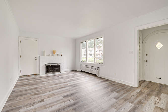
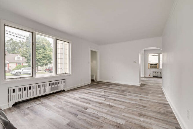
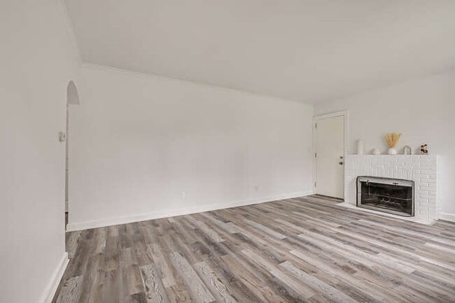
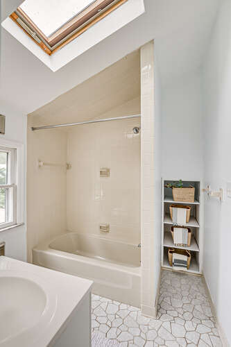
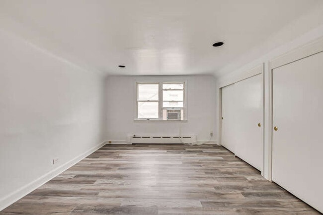
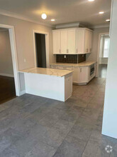
Enjoy all the amenities the town of Cranford has to offer! Close to Cranford & Westfield train station with access to NYC! 3 rooms + 1 office room, 3 full baths with finished basement. Screened-in porch on the first floor accessible from the living room, full size garage with additional shed in the fenced in backyard and pet friendly. Currently tenant occupied and available move in date: 6/3/2025. Required: 700+ credit score, employment verification, income verification and background check. Lease terms 1-2 years.
9 Roger Ave is a house located in Union County and the 07016 ZIP Code. This area is served by the Cranford Public attendance zone.
* Price shown is base rent and may not include non-optional fees and utilities.
Price, availability, fees, and any applicable rent special are subject to change without notice.
* Square footage definitions vary. Displayed square footage is approximate.
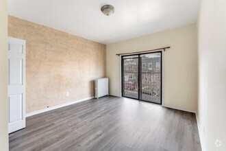
House Features
- Washer/Dryer
- Washer/Dryer Hookup
- Dishwasher
- Balcony
Contact
- Listed by Jason
- Phone Number (862) 206-4665
- Contact
$4,009 / month
$625,000 Listing Price
5 Beds
•3.5 Baths
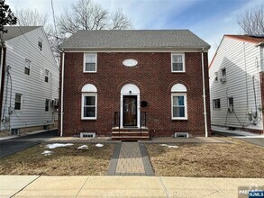
$4,239 / month
$649,000 Listing Price
4 Beds
•3 Baths
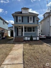
$3,679 / month
$449,900 Listing Price
4 Beds
•3 Baths
•
1,965 Sq Ft
Location
Get Directions
Amenities
- Washer/Dryer
- Washer/Dryer Hookup
- Dishwasher
- Balcony
Cranford is a peaceful suburb situated in the heart of Union County. Lush with township and county parks as well as the Rahway River Parkway, Cranford offers ample opportunities to engage in outdoor recreation and connect with nature. Cranford is also home to the last working farm in Union County, Dreyer Farms, which provides fresh produce in addition to hosting a variety of special events.
Cranford’s vibrant downtown area contains a slew of restaurants, specialty shops, cafes, and art galleries in colorful buildings, serving as a gathering place for the close-knit community. Commuting and traveling from Cranford is easy with access to the NJ Transit bus, Raritan Valley train line, and the Garden State Parkway. New York City and its many dynamic amenities are less than an hour’s drive or train ride away from Cranford.
Learn more about living in Cranford
Education
| Colleges & Universities | Distance | ||
|---|---|---|---|
| Colleges & Universities | Distance | ||
| Drive: | 10 min | 2.8 mi | |
| Drive: | 15 min | 6.0 mi | |
| Drive: | 16 min | 7.3 mi | |
| Drive: | 19 min | 7.4 mi |
9 Roger Ave is within 10 minutes or 2.8 miles from Union County College, Cranford. It is also near Kean University and Union County Coll., Elizabeth.
Schools
Public Elementary & Middle School
Grades PK-8
357 Students
Nearby
6
Out of 10
Public Elementary School
Grades PK-2
294 Students
Nearby
Public Elementary School
Grades 3-5
253 Students
Nearby
8
Out of 10
Public High School
Grades 9-12
1,095 Students
Attendance Zone
7
Out of 10
Private Elementary & Middle School
Grades PK-9
81 Students
Nearby
Private Elementary & Middle School
Grades PK-8
234 Students
Nearby
School data provided by
GreatSchools
The GreatSchools Rating helps parents compare schools within a state based on a variety of school quality indicators and provides a helpful picture of how effectively each school serves all of its students. Ratings are on a scale of 1 (below average) to 10 (above average) and can include test scores, college readiness, academic progress, advanced courses, equity, discipline and attendance data. We also advise parents to visit schools, consider other information on school performance and programs, and consider family needs as part of the school selection process.
Transportation options available in Cranford include Warren Street, located 11.1 miles from 9 Roger Ave. 9 Roger Ave is near Newark Liberty International, located 12.8 miles or 21 minutes away, and Laguardia, located 32.1 miles or 55 minutes away.
| Transit / Subway | Distance | ||
|---|---|---|---|
| Transit / Subway | Distance | ||
|
|
Drive: | 20 min | 11.1 mi |
|
|
Drive: | 20 min | 11.2 mi |
|
|
Drive: | 20 min | 11.3 mi |
|
|
Drive: | 20 min | 11.6 mi |
| Drive: | 26 min | 13.9 mi |
| Commuter Rail | Distance | ||
|---|---|---|---|
| Commuter Rail | Distance | ||
|
|
Drive: | 4 min | 1.2 mi |
|
|
Drive: | 5 min | 1.3 mi |
|
|
Drive: | 7 min | 2.2 mi |
|
|
Drive: | 11 min | 3.8 mi |
|
|
Drive: | 10 min | 4.2 mi |
| Airports | Distance | ||
|---|---|---|---|
| Airports | Distance | ||
|
Newark Liberty International
|
Drive: | 21 min | 12.8 mi |
|
Laguardia
|
Drive: | 55 min | 32.1 mi |
Time and distance from 9 Roger Ave.
| Shopping Centers | Distance | ||
|---|---|---|---|
| Shopping Centers | Distance | ||
| Walk: | 16 min | 0.8 mi | |
| Walk: | 17 min | 0.9 mi | |
| Walk: | 18 min | 1.0 mi |
9 Roger Ave has 3 shopping centers within 1.0 mile, which is about a 18-minute walk. The miles and minutes will be for the farthest away property.
| Parks and Recreation | Distance | ||
|---|---|---|---|
| Parks and Recreation | Distance | ||
|
William Miller Sperry Observatory
|
Drive: | 8 min | 2.6 mi |
|
Trailside Museum Watchung Reservation
|
Drive: | 15 min | 5.2 mi |
|
Hawk Rise Sanctuary
|
Drive: | 14 min | 5.5 mi |
|
Liberty State Park
|
Drive: | 17 min | 7.2 mi |
|
Merrill Park
|
Drive: | 15 min | 7.5 mi |
9 Roger Ave has 5 parks within 7.5 miles, including William Miller Sperry Observatory, Trailside Museum Watchung Reservation, and Hawk Rise Sanctuary.
| Hospitals | Distance | ||
|---|---|---|---|
| Hospitals | Distance | ||
| Drive: | 9 min | 3.2 mi | |
| Drive: | 17 min | 6.4 mi | |
| Drive: | 19 min | 8.1 mi |
9 Roger Ave has 3 hospitals within 8.1 miles, the nearest is Robert Wood Johnson University Hospital at Rahway which is 3.2 miles away and a 9 minute drive.
| Military Bases | Distance | ||
|---|---|---|---|
| Military Bases | Distance | ||
| Drive: | 11 min | 2.9 mi | |
| Drive: | 10 min | 4.3 mi | |
| Drive: | 26 min | 16.6 mi |
9 Roger Ave has 3 military bases within 16.6 miles, the nearest is Tamdques Reservation which is 2.9 miles away and a 11 minute drive.
You May Also Like
Similar Rentals Nearby
-
-
-
-
-
 $5,0004 Beds, 2.5 Baths, 2,200 sq ftHouse for Rent
 -
-
-
 $4,4004 Beds, 2 BathsHouse for Rent
 -
 $4,9007 Beds, 3 BathsHouse for Rent
 -
What Are Walk Score®, Transit Score®, and Bike Score® Ratings?
Walk Score® measures the walkability of any address. Transit Score® measures access to public transit. Bike Score® measures the bikeability of any address.
What is a Sound Score Rating?
A Sound Score Rating aggregates noise caused by vehicle traffic, airplane traffic and local sources

9 Roger Ave
Cranford, NJ 07016