$2,600 / Month
91 Burrell St
Boston, MA 02119
1 Day Ago
Favorites
216-287-4584
-
Bedrooms
2
-
Bathrooms
1
-
Square Feet
677 sq ft
-
Available
Available Now
Highlights
- Property is near public transit
- Fenced Yard
- No Cooling
- Shops
- Baseboard Heating
91 Burrell St Unit 1

Favorites
About This Home
$2,600 deposit,
Available Now
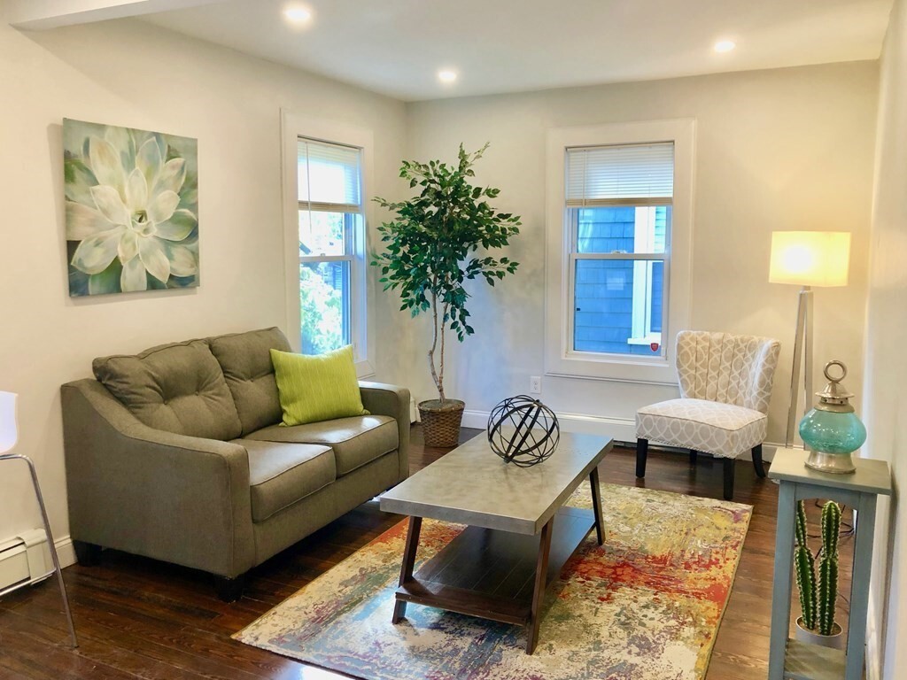
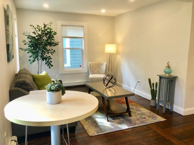
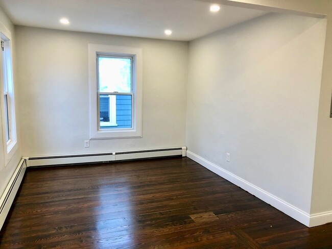
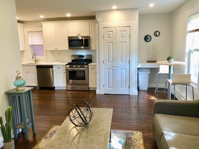
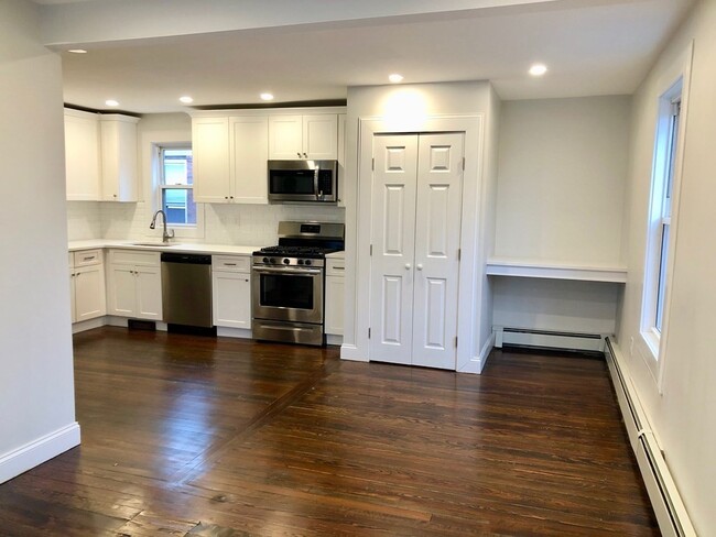
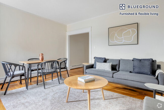
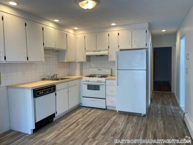
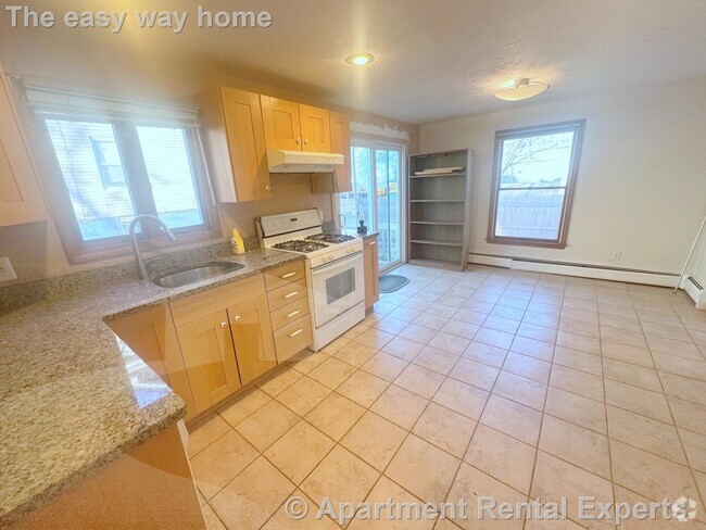
Beautifully renovated 2bed/1bath unit with hardwood floors throughout and lots of windows & light. The spacious kitchen features white granite countertops,stainless steel appliances,and white subway tile backsplash. The open floor plan allows the kitchen to flow seamlessly into the dining room/living room space for a variety of living options. Other highlights include a renovated bathroom with shower & tub combo and floating vanity,built-in desk area (perfect for working from home or additional storage),in-unit washer & dryer,shared outdoor space,and private extra storage in basement. Close proximity to various bus routes,1 mile from Andrew T-stop (Red Line) and a half mile from the shops of South Bay Center. Tenant responsible for all utilities. No undergrads. Cats considered with owner approval. No dogs. Flexible lease start in early April.
91 Burrell St is a condo located in Suffolk County and the 02119 ZIP Code.
* Price shown is base rent and may not include non-optional fees and utilities.
Price, availability, fees, and any applicable rent special are subject to change without notice.
* Square footage definitions vary. Displayed square footage is approximate.
Home Details
Home Type
Condominium
Year Built
Built in 1892
Accessible Home Design
Entry on the 1st floor
Bedrooms and Bathrooms
1 Full Bathroom
2 Bedrooms
Interior Spaces
677 Sq Ft Home
Kitchen
Range
Freezer
Microwave
Dishwasher
Disposal
Laundry
Dryer
Laundry in unit
Washer
Listing and Financial Details
Security Deposit $2,600
Property Available on 4/15/24
Assessor Parcel Number 5136562
Rent includes water, sewer, extra storage
Location
Property is near public transit
Lot Details
Fenced Yard
Fenced
Utilities
No Cooling
Baseboard Heating
Community Details
Amenities
Shops
Common Area
Overview
Property has a Home Owners Association
Pet Policy
Call for details about the types of pets allowed
Contact
- Listed by Carlisle Ettenborough
- Phone Number (216) 287-4584
-
Source
 MLS Property Information Network
The property listing data and information set forth herein were provided to MLS Property Information Network, Inc. from third party sources, including sellers, lessors and public records, and were compiled by MLS Property Information Network, Inc. The property listing data and information are for the personal, non-commercial use of consumers having a good faith interest in purchasing or leasing listed properties of the type displayed to them and may not be used for any purpose other than to identify prospective properties which such consumers may have a good faith interest in purchasing or leasing. MLS Property Information Network, Inc. and its subscribers disclaim any and all representations and warranties as to the accuracy of the property listing data and information set forth herein. All properties are subject to prior sale, change or withdrawal. Copyright © 2025 MLS Property Information Network, Inc. All rights reserved.
Location
Get Directions
Amenities
- Dishwasher
- Disposal
- Microwave
- Range
- Refrigerator
- Freezer
- Fenced Lot
Less than four miles outside of Downtown Boston sits Dudley-Brunswick King. Full of non-profit organizations committed to advancing the community, Dudley-Brunswick King is home to the Food Project, CommonWealth Kitchen, Project Hope, and the Dudley Street Neighborhood Initiative.
Dudley-Brunswick King residents enjoy access to cultural and educational venues such as the Boston Public Library and Oodua African Movie Center. There are a number of parks and green spaces in Dudley-Brunswick King including Clifford Playground, Mary Hannon Park, Ceylon Park, Brunswick-King Play Area, Dacia/Woodcliff Streets Garden, and multiple community gardens sponsored by the Food Project. Boston’s biggest park, Franklin Park, is also nearby and contains numerous amenities.
Convenient to the MBTA Commuter Rail, bus routes, and major highways as well as Boston Logan International Airport, Dudley-Brunswick King allows for easy commutes and travels.
Learn more about living in Dudley-Brunswick King
Education
| Colleges & Universities | Distance | ||
|---|---|---|---|
| Colleges & Universities | Distance | ||
| Drive: | 5 min | 1.9 mi | |
| Drive: | 6 min | 2.1 mi | |
| Drive: | 5 min | 2.1 mi | |
| Drive: | 6 min | 2.8 mi |
91 Burrell St Unit 1 is within 5 minutes or 2.1 miles from Northeastern University. It is also near Wentworth Inst. of Technology and UMass Boston.
Transportation options available in Boston include Andrew Station, located 1.3 miles from 91 Burrell St Unit 1. 91 Burrell St Unit 1 is near General Edward Lawrence Logan International, located 5.6 miles or 12 minutes away.
| Transit / Subway | Distance | ||
|---|---|---|---|
| Transit / Subway | Distance | ||
|
|
Drive: | 3 min | 1.3 mi |
|
|
Drive: | 4 min | 1.7 mi |
|
|
Drive: | 4 min | 1.8 mi |
|
|
Drive: | 5 min | 2.0 mi |
|
|
Drive: | 4 min | 2.3 mi |
| Commuter Rail | Distance | ||
|---|---|---|---|
| Commuter Rail | Distance | ||
| Walk: | 7 min | 0.4 mi | |
|
|
Walk: | 11 min | 0.6 mi |
|
|
Drive: | 4 min | 1.5 mi |
| Drive: | 4 min | 2.0 mi | |
|
|
Drive: | 6 min | 2.3 mi |
| Airports | Distance | ||
|---|---|---|---|
| Airports | Distance | ||
|
General Edward Lawrence Logan International
|
Drive: | 12 min | 5.6 mi |
Time and distance from 91 Burrell St Unit 1.
| Shopping Centers | Distance | ||
|---|---|---|---|
| Shopping Centers | Distance | ||
| Walk: | 12 min | 0.6 mi | |
| Drive: | 3 min | 1.1 mi | |
| Drive: | 4 min | 1.5 mi |
91 Burrell St Unit 1 has 3 shopping centers within 1.5 miles, which is about a 4-minute drive. The miles and minutes will be for the farthest away property.
| Parks and Recreation | Distance | ||
|---|---|---|---|
| Parks and Recreation | Distance | ||
|
Roxbury Heritage State Park
|
Drive: | 3 min | 1.5 mi |
|
Dorchester Shores Reservation
|
Drive: | 5 min | 2.1 mi |
|
Lower Neponset River Trail
|
Drive: | 4 min | 2.2 mi |
|
Franklin Park Zoo
|
Drive: | 4 min | 2.2 mi |
|
Boston Public Garden
|
Drive: | 7 min | 3.0 mi |
91 Burrell St Unit 1 has 5 parks within 3.0 miles, including Roxbury Heritage State Park, Lower Neponset River Trail, and Franklin Park Zoo.
| Hospitals | Distance | ||
|---|---|---|---|
| Hospitals | Distance | ||
| Walk: | 18 min | 0.9 mi | |
| Drive: | 3 min | 1.3 mi | |
| Drive: | 5 min | 2.4 mi |
91 Burrell St Unit 1 has 3 hospitals within 2.4 miles, the nearest is Boston Medical Center which is 0.9 mile away and a 18 minutes drive.
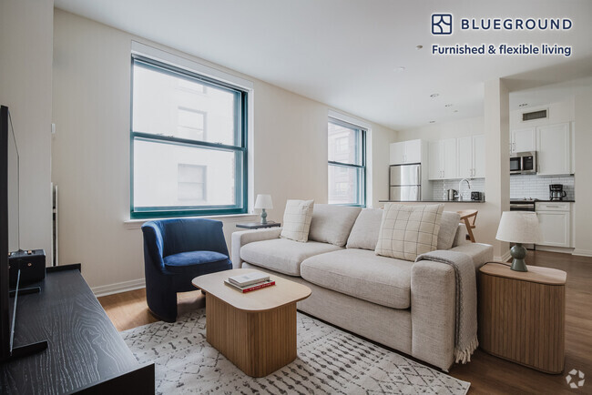
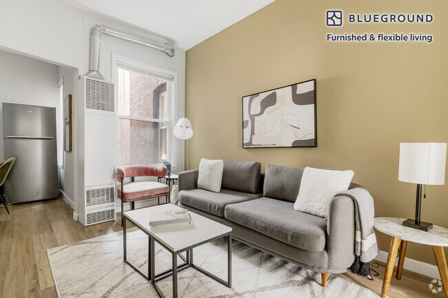
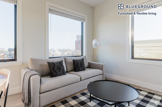
You May Also Like
Similar Rentals Nearby


What Are Walk Score®, Transit Score®, and Bike Score® Ratings?
Walk Score® measures the walkability of any address. Transit Score® measures access to public transit. Bike Score® measures the bikeability of any address.
What is a Sound Score Rating?
A Sound Score Rating aggregates noise caused by vehicle traffic, airplane traffic and local sources

91 Burrell St
Boston, MA 02119