-
Monthly Rent
$3,275
-
Bedrooms
2 bd
-
Bathrooms
1.5 ba
-
Square Feet
900 sq ft
Details

94 Perkins St is a condo located in Suffolk County and the 02130 ZIP Code. This area is served by the Boston Public Schools attendance zone.
Condo Features
- Smoke Free
- Dishwasher
Fees and Policies
The fees below are based on community-supplied data and may exclude additional fees and utilities.
Located about five miles southwest of downtown Boston, Jamaica Hills-Pond has many historic multi-family homes for rent. The commercial district lies along Centre Street and provides residents with a wide choice of local restaurants and stores.
Nature lovers will find much to explore in Jamaica Hills-Pond. Your apartment puts you within easy walking distance of Jamaica Pond, a 68-acre body of water surrounded by a 1.5-mile path perfect for walking or running. Go for a jog around the pond or rent a kayak from the boathouse and take to the water. Locals who prefer gardens head to the 281-acre Arnold Arboretum to stroll among plants and trees from around the world. Go birdwatching, admire the lilac collection, or sit under one of the maple trees on a lovely spring day. Afterward, walk over to Wonder Spice Cafe for Cambodian cuisine, and then visit J.P. Licks for ice cream.
Learn more about living in Jamaica Hills-Pond| Colleges & Universities | Distance | ||
|---|---|---|---|
| Colleges & Universities | Distance | ||
| Drive: | 4 min | 1.6 mi | |
| Drive: | 4 min | 2.0 mi | |
| Drive: | 4 min | 2.0 mi | |
| Drive: | 5 min | 2.2 mi |
Transportation options available in Boston include Heath Street Station, located 0.6 mile from 94 Perkins St. 94 Perkins St is near General Edward Lawrence Logan International, located 7.9 miles or 16 minutes away.
| Transit / Subway | Distance | ||
|---|---|---|---|
| Transit / Subway | Distance | ||
|
|
Walk: | 12 min | 0.6 mi |
|
|
Walk: | 14 min | 0.8 mi |
|
|
Walk: | 15 min | 0.8 mi |
|
|
Walk: | 16 min | 0.8 mi |
|
|
Drive: | 4 min | 1.2 mi |
| Commuter Rail | Distance | ||
|---|---|---|---|
| Commuter Rail | Distance | ||
|
|
Drive: | 4 min | 1.6 mi |
|
|
Drive: | 5 min | 2.3 mi |
| Drive: | 8 min | 3.1 mi | |
|
|
Drive: | 7 min | 3.3 mi |
|
|
Drive: | 11 min | 5.6 mi |
| Airports | Distance | ||
|---|---|---|---|
| Airports | Distance | ||
|
General Edward Lawrence Logan International
|
Drive: | 16 min | 7.9 mi |
Time and distance from 94 Perkins St.
| Shopping Centers | Distance | ||
|---|---|---|---|
| Shopping Centers | Distance | ||
| Drive: | 3 min | 1.4 mi | |
| Drive: | 5 min | 2.0 mi | |
| Drive: | 6 min | 2.1 mi |
| Parks and Recreation | Distance | ||
|---|---|---|---|
| Parks and Recreation | Distance | ||
|
Frederick Law Olmsted National Historic Site
|
Drive: | 3 min | 1.2 mi |
|
Roxbury Heritage State Park
|
Drive: | 4 min | 1.9 mi |
|
Arnold Arboretum of Harvard University
|
Drive: | 5 min | 2.4 mi |
|
John Fitzgerald Kennedy National Historic Site
|
Drive: | 6 min | 2.5 mi |
|
Lower Neponset River Trail
|
Drive: | 6 min | 2.7 mi |
| Hospitals | Distance | ||
|---|---|---|---|
| Hospitals | Distance | ||
| Drive: | 3 min | 1.3 mi | |
| Drive: | 3 min | 1.4 mi | |
| Drive: | 3 min | 1.6 mi |
| Military Bases | Distance | ||
|---|---|---|---|
| Military Bases | Distance | ||
| Drive: | 27 min | 14.4 mi | |
| Drive: | 32 min | 16.3 mi |
- Smoke Free
- Dishwasher
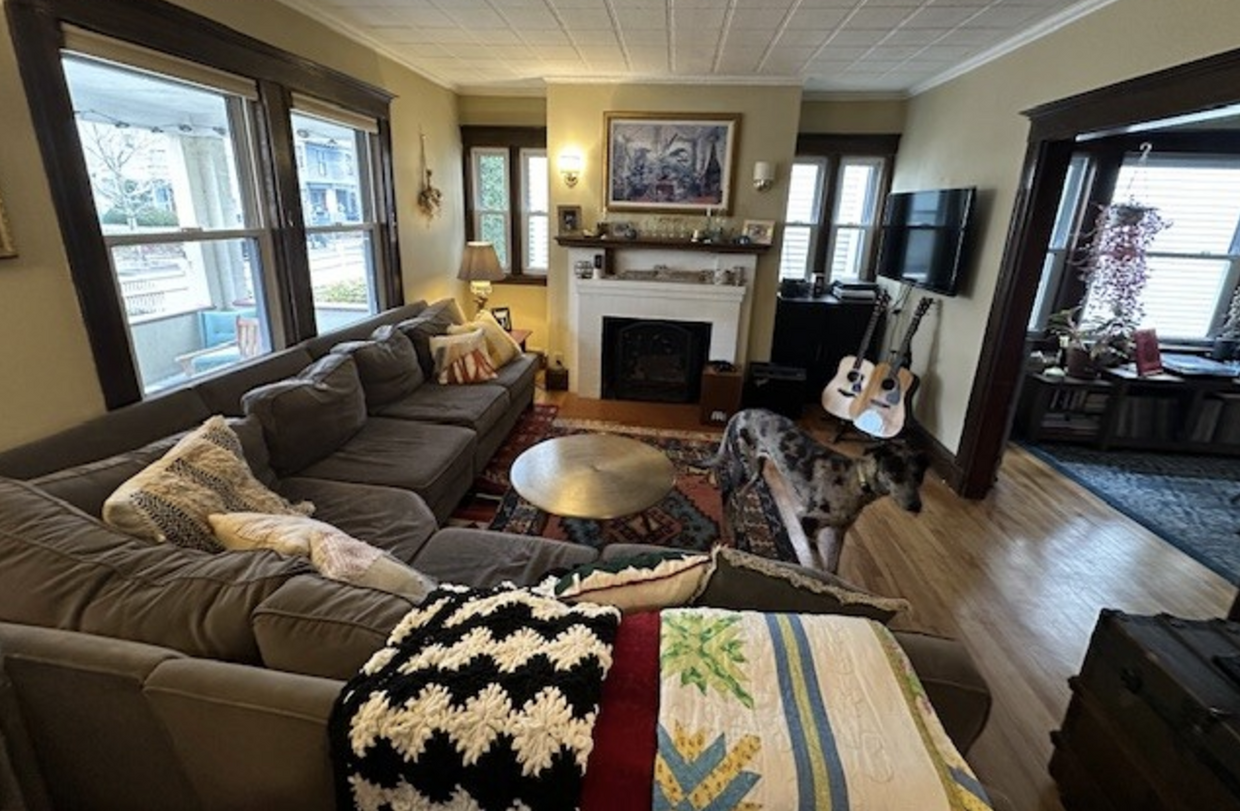
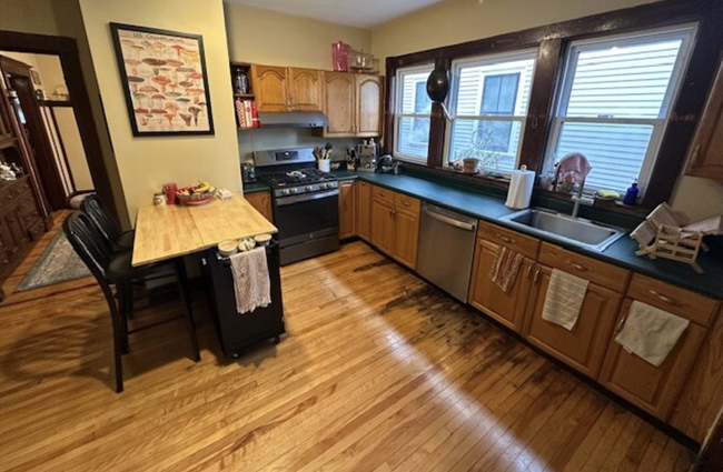
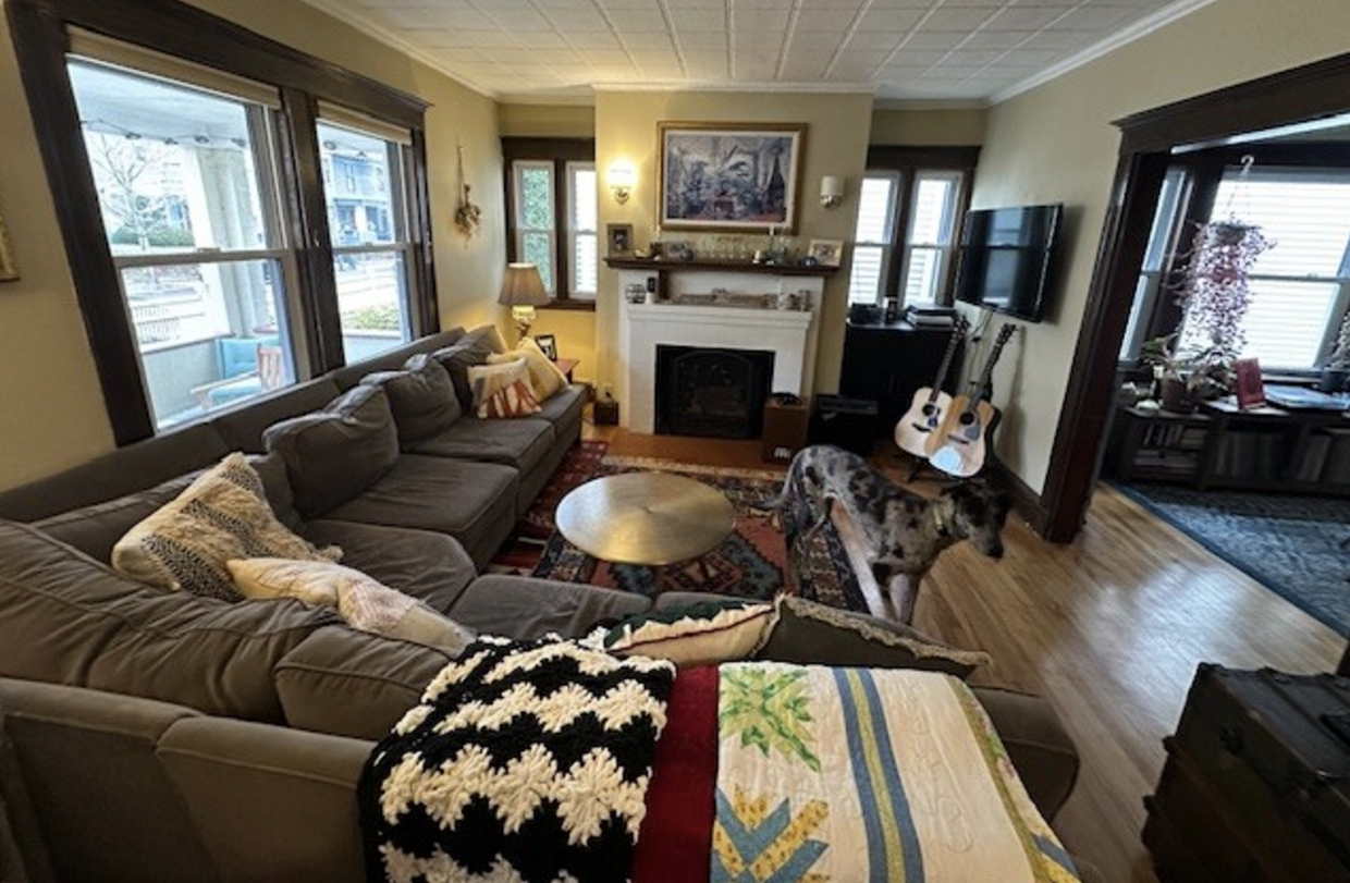
94 Perkins St Photos
What Are Walk Score®, Transit Score®, and Bike Score® Ratings?
Walk Score® measures the walkability of any address. Transit Score® measures access to public transit. Bike Score® measures the bikeability of any address.
What is a Sound Score Rating?
A Sound Score Rating aggregates noise caused by vehicle traffic, airplane traffic and local sources


