

$1,400 / Month
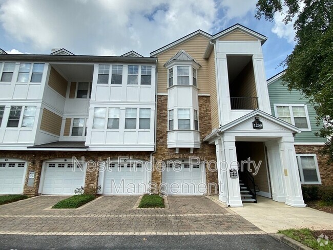
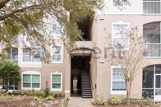
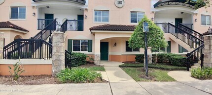
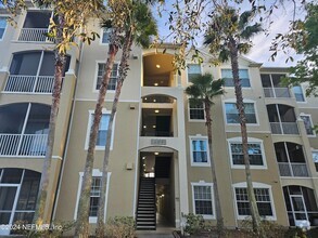
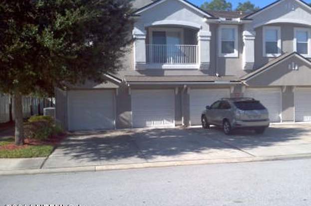
9420 Osprey Branch Trail
Jacksonville, FL 32257
Today
Favorites
-
Bedrooms
3
-
Bathrooms
2
-
Square Feet
1,354 sq ft
9420 Osprey Branch Trail

Favorites
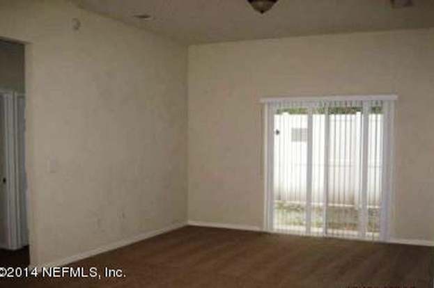
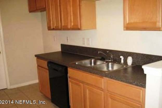
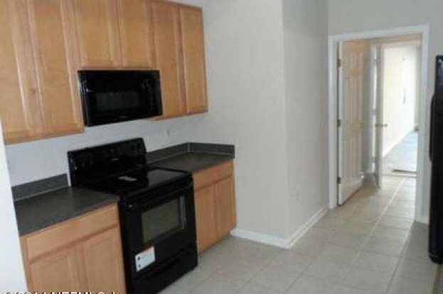
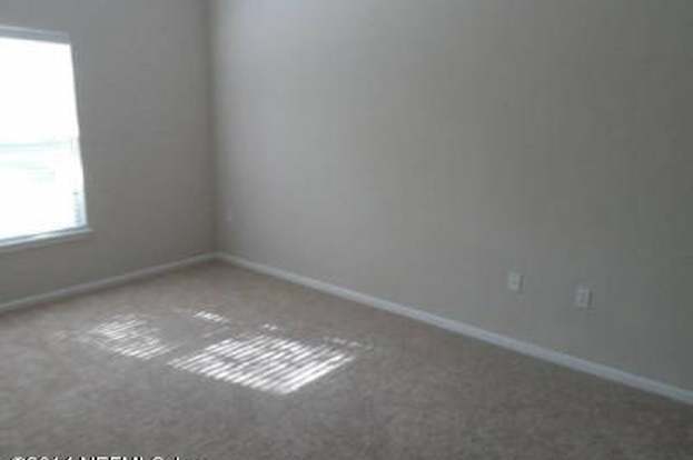
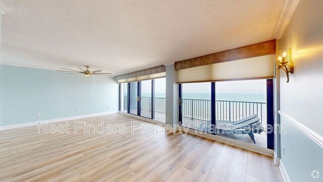
About This Home
---- SCHEDULE A SHOWING ONLINE AT: ----
9420 Osprey Branch Trail is a condo located in Duval County and the 32257 ZIP Code.
* Price shown is base rent and may not include non-optional fees and utilities.
Price, availability, fees, and any applicable rent special are subject to change without notice.
* Square footage definitions vary. Displayed square footage is approximate.
Location
Get Directions
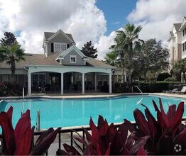
Located just off the Saint Johns River, Craven is a quaint community lined with ranch-style and two-story single-family homes and paved sidewalks. Although there are some luxury rentals available in Craven, most of the housing options are affordable. The neighborhood is mainly residential, but there are a few local businesses spread around the edges of the community. Popular establishments nearby include Wicked Barley Brewing Company and Los Loros Mexican Restaurant. Craven is located roughly 12 miles south of Downtown Jacksonville, offering residents a quick commute into the heart of the city via Interstate 95 or Highway 1. Although locals enjoy riverfront views in Craven, they can easily reach popular beaches like Ponte Vedra Beach and Jacksonville Beach, located approximately 20 miles east.
Learn more about living in Craven
Education
| Colleges & Universities | Distance | ||
|---|---|---|---|
| Colleges & Universities | Distance | ||
| Drive: | 10 min | 4.1 mi | |
| Drive: | 22 min | 11.8 mi | |
| Drive: | 23 min | 12.3 mi | |
| Drive: | 28 min | 12.7 mi |
9420 Osprey Branch Trail is within 10 minutes or 4.1 miles from Florida Coastal School of Law. It is also near University of North Florida and Fla. State Coll. Jacksonville.
Transportation options available in Jacksonville include Kings Avenue, located 9.4 miles from 9420 Osprey Branch Trail. 9420 Osprey Branch Trail is near Jacksonville International, located 26.0 miles or 43 minutes away.
| Transit / Subway | Distance | ||
|---|---|---|---|
| Transit / Subway | Distance | ||
|
|
Drive: | 19 min | 9.4 mi |
|
|
Drive: | 19 min | 9.5 mi |
|
|
Drive: | 18 min | 10.6 mi |
|
|
Drive: | 21 min | 11.5 mi |
|
|
Drive: | 21 min | 11.6 mi |
| Commuter Rail | Distance | ||
|---|---|---|---|
| Commuter Rail | Distance | ||
|
|
Drive: | 31 min | 17.4 mi |
| Airports | Distance | ||
|---|---|---|---|
| Airports | Distance | ||
|
Jacksonville International
|
Drive: | 43 min | 26.0 mi |
Time and distance from 9420 Osprey Branch Trail.
| Shopping Centers | Distance | ||
|---|---|---|---|
| Shopping Centers | Distance | ||
| Walk: | 10 min | 0.5 mi | |
| Drive: | 3 min | 1.1 mi | |
| Drive: | 3 min | 1.2 mi |
9420 Osprey Branch Trail has 3 shopping centers within 1.2 miles, which is about a 3-minute walk. The miles and minutes will be for the farthest away property.
| Parks and Recreation | Distance | ||
|---|---|---|---|
| Parks and Recreation | Distance | ||
|
Camp Tomahawk
|
Drive: | 7 min | 2.8 mi |
|
Walter Jones Historical Park
|
Drive: | 9 min | 4.5 mi |
|
Mandarin Park
|
Drive: | 14 min | 6.2 mi |
|
Lovelace Park
|
Drive: | 14 min | 6.6 mi |
|
Touchton Road Park
|
Drive: | 15 min | 8.1 mi |
9420 Osprey Branch Trail has 5 parks within 8.1 miles, including Camp Tomahawk, Walter Jones Historical Park, and Mandarin Park.
| Hospitals | Distance | ||
|---|---|---|---|
| Hospitals | Distance | ||
| Drive: | 12 min | 5.5 mi | |
| Drive: | 14 min | 6.3 mi | |
| Drive: | 20 min | 10.9 mi |
9420 Osprey Branch Trail has 3 hospitals within 10.9 miles, the nearest is Ascension St. Vincent's Southside which is 5.5 miles away and a 12 minute drive.
| Military Bases | Distance | ||
|---|---|---|---|
| Military Bases | Distance | ||
| Drive: | 18 min | 10.8 mi | |
| Drive: | 42 min | 24.6 mi |
9420 Osprey Branch Trail is 10.8 miles from Jacksonville Naval Air Station, and is convenient to other military bases, including Mayport Naval Air Station.
You May Also Like
Similar Rentals Nearby
-
-
-
-

-

-
-
 $1,6503 Beds, 2 Baths, 1,408 sq ftCondo for Rent
 -
 $1,8503 Beds, 2 Baths, 1,181 sq ftCondo for Rent
 -
 $1,6953 Beds, 2 Baths, 1,247 sq ftCondo for Rent
 -
 $1,8003 Beds, 2 Baths, 1,345 sq ftCondo for Rent
What Are Walk Score®, Transit Score®, and Bike Score® Ratings?
Walk Score® measures the walkability of any address. Transit Score® measures access to public transit. Bike Score® measures the bikeability of any address.
What is a Sound Score Rating?
A Sound Score Rating aggregates noise caused by vehicle traffic, airplane traffic and local sources
9420 Osprey Branch Trail
Jacksonville, FL 32257