
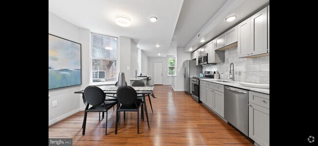
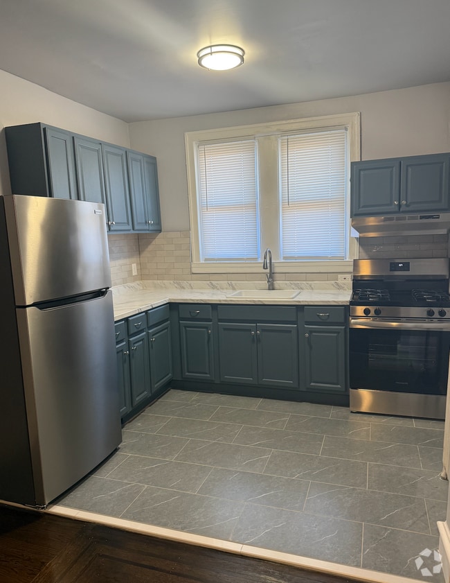
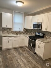
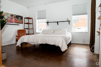
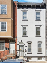
$1,950 / Month
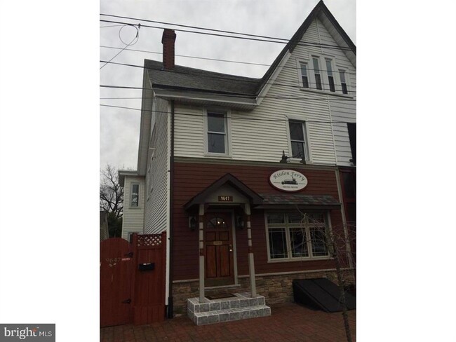
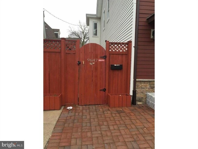
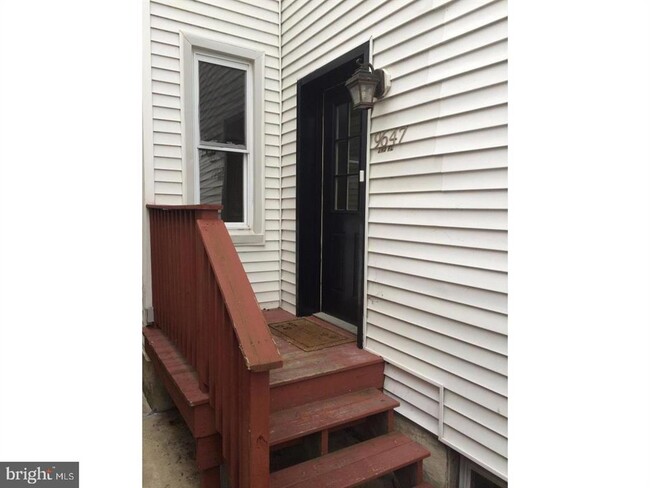
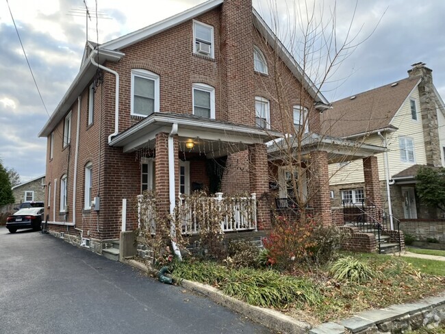
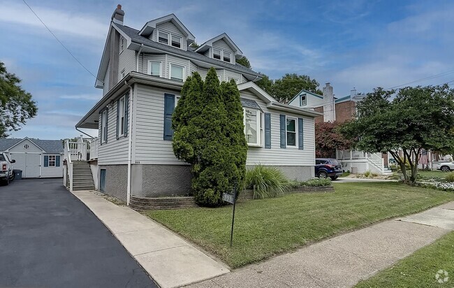
9647 James St
Philadelphia, PA 19114
Today
Favorites
215-498-5660
-
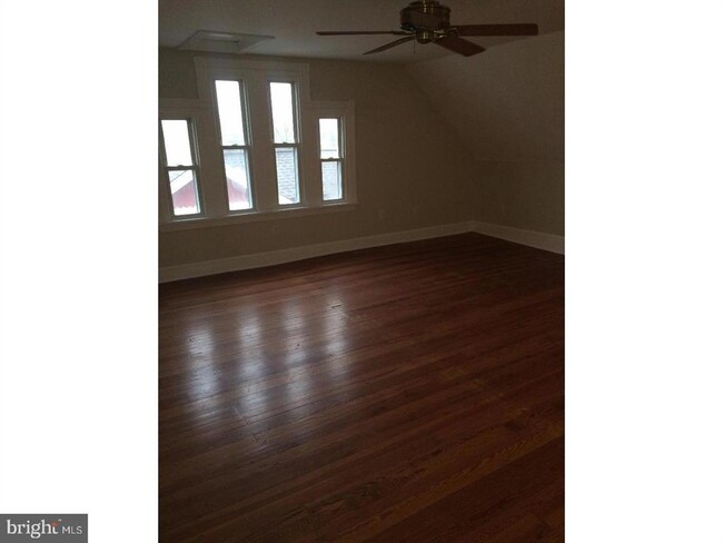
Bedrooms
3
-
Bathrooms
1
-
Square Feet
--
-
Available
Available Now
9647 James St

Favorites
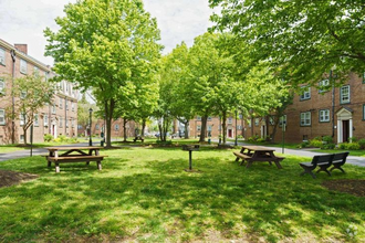
Nestled along the Delaware River, Torresdale is a wooded neighborhood located about 13 miles northeast of Center City, Philadelphia’s downtown district. There are several parks and a golf course for residents to enjoy. Pennypack Park neighbors Torresdale to the west and is a popular spot for mountain biking and fishing. There are multiple restaurants, grocers, and shopping plazas located in and around Torresdale, so residents have access to plenty of amenities. There is a wide variety of rental options available for every budget and style including houses, apartments, condos, and townhomes. Along with a train station, U.S. Route 13 and Interstate 13 run through Torresdale, so the neighborhood is a great option for renters who commute to work or want a quieter setting that isn’t too far from the heart of the city.
Learn more about living in Torresdale
Education
| Colleges & Universities | Distance | ||
|---|---|---|---|
| Colleges & Universities | Distance | ||
| Walk: | 8 min | 0.4 mi | |
| Drive: | 12 min | 5.2 mi | |
| Drive: | 24 min | 11.3 mi | |
| Drive: | 30 min | 16.9 mi |
9647 James St is within 8 minutes or 0.4 mile from Holy Family University. It is also near C.C. of Philadelphia, NE Ctr and Penn State Abington.
Transportation options available in Philadelphia include Riverton, located 7.3 miles from 9647 James St. 9647 James St is near Trenton Mercer, located 21.9 miles or 34 minutes away, and Philadelphia International, located 22.6 miles or 36 minutes away.
| Transit / Subway | Distance | ||
|---|---|---|---|
| Transit / Subway | Distance | ||
|
|
Drive: | 17 min | 7.3 mi |
|
|
Drive: | 19 min | 8.2 mi |
|
|
Drive: | 23 min | 10.9 mi |
|
|
Drive: | 23 min | 11.9 mi |
|
|
Drive: | 25 min | 12.2 mi |
| Commuter Rail | Distance | ||
|---|---|---|---|
| Commuter Rail | Distance | ||
|
|
Walk: | 1 min | 0.1 mi |
|
|
Drive: | 5 min | 2.8 mi |
|
|
Drive: | 6 min | 2.8 mi |
|
|
Drive: | 7 min | 3.8 mi |
|
|
Drive: | 8 min | 4.3 mi |
| Airports | Distance | ||
|---|---|---|---|
| Airports | Distance | ||
|
Trenton Mercer
|
Drive: | 34 min | 21.9 mi |
|
Philadelphia International
|
Drive: | 36 min | 22.6 mi |
Time and distance from 9647 James St.
| Shopping Centers | Distance | ||
|---|---|---|---|
| Shopping Centers | Distance | ||
| Walk: | 11 min | 0.6 mi | |
| Drive: | 4 min | 1.6 mi | |
| Drive: | 4 min | 1.9 mi |
9647 James St has 3 shopping centers within 1.9 miles, which is about a 4-minute walk. The miles and minutes will be for the farthest away property.
| Parks and Recreation | Distance | ||
|---|---|---|---|
| Parks and Recreation | Distance | ||
|
Insectarium
|
Drive: | 7 min | 3.6 mi |
|
Neshaminy State Park
|
Drive: | 9 min | 4.5 mi |
|
Pennypack Park
|
Drive: | 11 min | 5.4 mi |
|
Benjamin Rush State Park
|
Drive: | 17 min | 7.2 mi |
|
Amico Island Park
|
Drive: | 24 min | 10.5 mi |
9647 James St has 5 parks within 10.5 miles, including Insectarium, Pennypack Park, and Neshaminy State Park.
| Hospitals | Distance | ||
|---|---|---|---|
| Hospitals | Distance | ||
| Drive: | 5 min | 2.1 mi | |
| Drive: | 9 min | 3.9 mi | |
| Drive: | 12 min | 6.0 mi |
9647 James St has 3 hospitals within 6.0 miles, the nearest is Aria Health which is 2.1 miles away and a 5 minute drive.
| Military Bases | Distance | ||
|---|---|---|---|
| Military Bases | Distance | ||
| Drive: | 27 min | 15.2 mi | |
| Drive: | 31 min | 17.1 mi |
9647 James St is 15.2 miles from Naval Air Development Center, and is convenient to other military bases, including Willow Grove Naval Air Station.
You May Also Like
Similar Rentals Nearby
What Are Walk Score®, Transit Score®, and Bike Score® Ratings?
Walk Score® measures the walkability of any address. Transit Score® measures access to public transit. Bike Score® measures the bikeability of any address.
What is a Sound Score Rating?
A Sound Score Rating aggregates noise caused by vehicle traffic, airplane traffic and local sources

9647 James St
Philadelphia, PA 19114