
$3,700 / Month
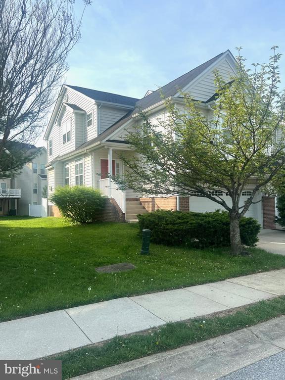
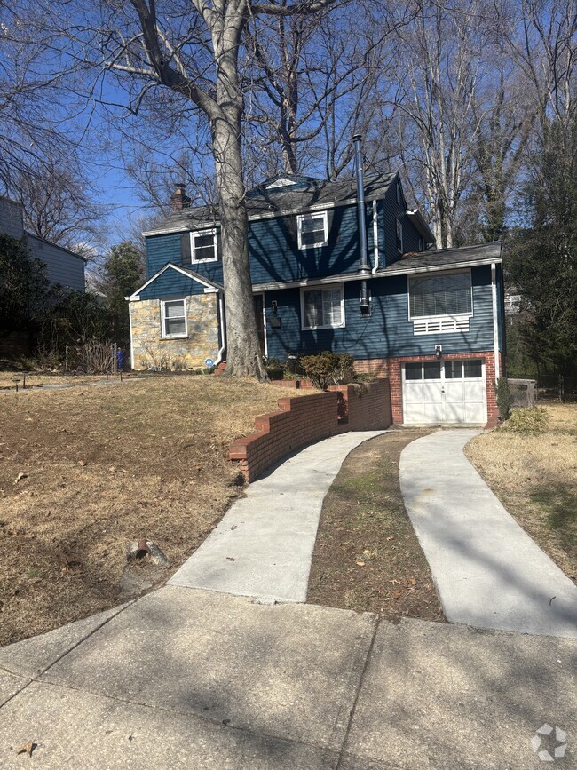
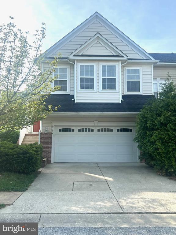
9702 Evening Bird Ln
Laurel, MD 20723
Today
Favorites
301-332-3606
-
Bedrooms
4
-
Bathrooms
3.5
-
Square Feet
2,968 sq ft
-
Available
Available Apr 27
Highlights
- Fireplace
- Basement
9702 Evening Bird Ln

Favorites
About This Home
Available Apr 27
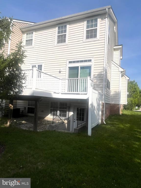
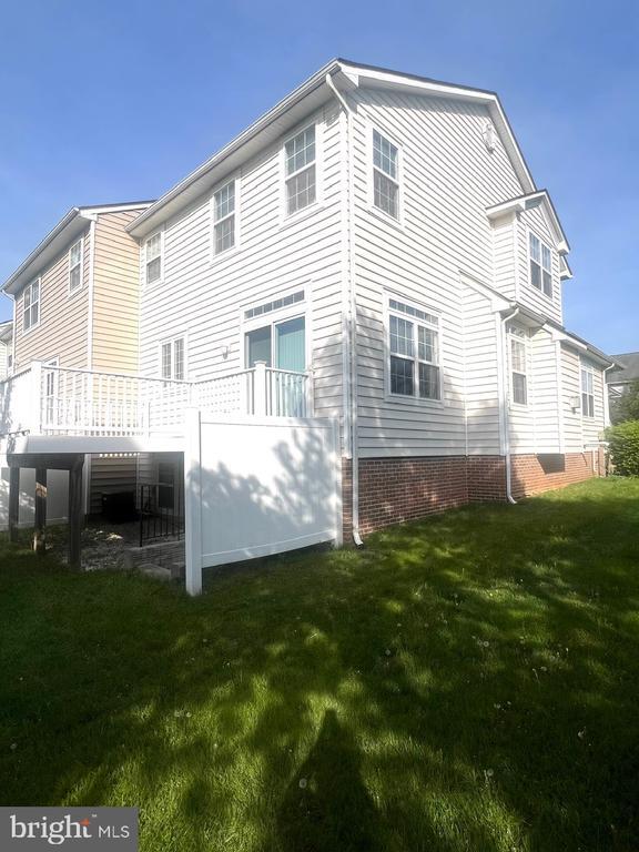
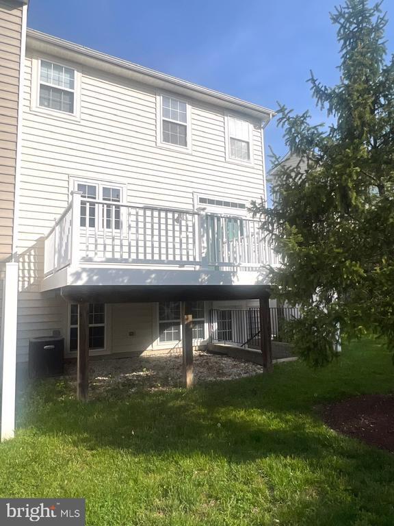
Location!!!!! Tons of Space !!!!! Over 3,000 square feet !!!!!!!!!!!!!!!l End unit,Chase" Model ... 2-Car Garage and so much more!!!!!!!!!!!!!! !!Large Master Bedroom with sitting room & a huge walk-in closet. Four bedrooms, three and a half baths, fireplace, This home has it all. Large Sundeck off of the main level. Spacious Foyer, Emerson community, way too many options to list. Available February 1, 2021!"
9702 Evening Bird Ln is a house located in Howard County and the 20723 ZIP Code. This area is served by the Howard County Public Schools attendance zone.
* Price shown is base rent and may not include non-optional fees and utilities.
Price, availability, fees, and any applicable rent special are subject to change without notice.
* Square footage definitions vary. Displayed square footage is approximate.
House Features
- Fireplace
- Dishwasher
- Basement
Fees and Policies
Contact
- Listed by Tammy Perkins-Mack | RESCOM, REALTORS
- Phone Number
- Contact
-
Source
 Bright MLS, Inc.
Copyright © 2025 Bright MLS, Inc.
Location
Get Directions
Amenities
- Fireplace
- Dishwasher
- Basement
North Laurel lies 20 miles southwest of Baltimore and roughly the same distance from Washington, DC. This suburban swath of Laurel offers upscale houses and apartments for rent, all with spacious lots and plenty of breathing room for residents. Well-maintained green spaces and an overall sense of the natural world make North Laurel a sought-after Maryland locale.
You’ll find the majority of the shopping and dining opportunities in neighboring communities, but there are a few local spots to be found along Scaggsville Road. There are plenty of parks along the Patuxent River, but when it comes time to head to the city, the Columbia Pike and Interstate 95 will ferry you anywhere with ease.
Learn more about living in North Laurel
Education
| Colleges & Universities | Distance | ||
|---|---|---|---|
| Colleges & Universities | Distance | ||
| Drive: | 16 min | 7.0 mi | |
| Drive: | 25 min | 13.4 mi | |
| Drive: | 25 min | 13.9 mi | |
| Drive: | 25 min | 14.5 mi |
9702 Evening Bird Ln is within 16 minutes or 7.0 miles from Howard Community College. It is also near Bowie State University and UMBC.
Schools


Public Elementary School
Grades PK-5
743 Students
Attendance Zone
Public Middle School
Grades 6-8
591 Students
Attendance Zone
Public High School
Grades 9-12
1,467 Students
Attendance Zone
Private Elementary & Middle School
Grades PK-8
248 Students
Nearby
Private Elementary, Middle & High School
Grades 4-11
71 Students
Nearby
Private High School
Grades 9-12
406 Students
Nearby
School data provided by
 The GreatSchools Rating helps parents compare schools within a state based on a variety of school quality indicators and provides a helpful picture of how effectively each school serves all of its students. Ratings are on a scale of 1 (below average) to 10 (above average) and can include test scores, college readiness, academic progress, advanced courses, equity, discipline and attendance data. We also advise parents to visit schools, consider other information on school performance and programs, and consider family needs as part of the school selection process.
View GreatSchools Rating Methodology
View GreatSchools Rating Methodology
Transportation options available in Laurel include Dorsey, located 8.7 miles from 9702 Evening Bird Ln. 9702 Evening Bird Ln is near Baltimore/Washington International Thurgood Marshall, located 15.3 miles or 27 minutes away, and Ronald Reagan Washington Ntl, located 28.5 miles or 49 minutes away.
| Transit / Subway | Distance | ||
|---|---|---|---|
| Transit / Subway | Distance | ||
|
|
Drive: | 18 min | 8.7 mi |
|
|
Drive: | 27 min | 15.4 mi |
|
|
Drive: | 28 min | 15.6 mi |
|
|
Drive: | 27 min | 17.3 mi |
|
|
Drive: | 29 min | 17.5 mi |
| Commuter Rail | Distance | ||
|---|---|---|---|
| Commuter Rail | Distance | ||
|
|
Drive: | 10 min | 3.7 mi |
|
|
Drive: | 10 min | 3.9 mi |
|
|
Drive: | 11 min | 4.8 mi |
|
|
Drive: | 14 min | 6.3 mi |
|
|
Drive: | 15 min | 7.6 mi |
| Airports | Distance | ||
|---|---|---|---|
| Airports | Distance | ||
|
Baltimore/Washington International Thurgood Marshall
|
Drive: | 27 min | 15.3 mi |
|
Ronald Reagan Washington Ntl
|
Drive: | 49 min | 28.5 mi |
Time and distance from 9702 Evening Bird Ln.
| Shopping Centers | Distance | ||
|---|---|---|---|
| Shopping Centers | Distance | ||
| Drive: | 6 min | 2.1 mi | |
| Drive: | 6 min | 2.4 mi | |
| Drive: | 9 min | 3.4 mi |
9702 Evening Bird Ln has 3 shopping centers within 3.4 miles, which is about a 9-minute drive. The miles and minutes will be for the farthest away property.
| Parks and Recreation | Distance | ||
|---|---|---|---|
| Parks and Recreation | Distance | ||
|
Patuxent Research Refuge - North Tract
|
Drive: | 19 min | 7.7 mi |
|
Browns Bridge Recreation Area
|
Drive: | 17 min | 8.1 mi |
|
Fairland Regional Park
|
Drive: | 15 min | 8.3 mi |
|
Maydale Conservation Park and Nature Center
|
Drive: | 22 min | 11.5 mi |
|
Clark's Elioak Farm
|
Drive: | 20 min | 11.8 mi |
9702 Evening Bird Ln has 5 parks within 11.8 miles, including Fairland Regional Park, Patuxent Research Refuge - North Tract, and Browns Bridge Recreation Area.
| Hospitals | Distance | ||
|---|---|---|---|
| Hospitals | Distance | ||
| Drive: | 14 min | 5.8 mi | |
| Drive: | 17 min | 7.6 mi | |
| Drive: | 19 min | 12.5 mi |
9702 Evening Bird Ln has 3 hospitals within 12.5 miles, the nearest is Laurel Regional Medical Center which is 5.8 miles away and a 14 minute drive.
| Military Bases | Distance | ||
|---|---|---|---|
| Military Bases | Distance | ||
| Drive: | 18 min | 9.1 mi |
9702 Evening Bird Ln is 9.1 miles and a 18 minute drive from Fort George Meade.
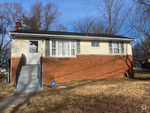
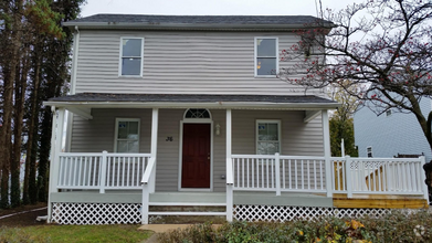
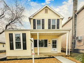
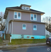
You May Also Like
Similar Rentals Nearby

What Are Walk Score®, Transit Score®, and Bike Score® Ratings?
Walk Score® measures the walkability of any address. Transit Score® measures access to public transit. Bike Score® measures the bikeability of any address.
What is a Sound Score Rating?
A Sound Score Rating aggregates noise caused by vehicle traffic, airplane traffic and local sources
9702 Evening Bird Ln
Laurel, MD 20723