
9708 E Via Linda
9708 E Via Linda
Scottsdale, AZ 85258
2 Weeks Ago
Favorites
9708 E Via Linda

Favorites
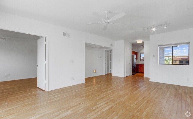
Check Back Soon for Upcoming Availability
Property Address:
9708 E Via Linda,
Scottsdale,
AZ
85258
Bordered by an expansive nature preserve of mountains and desert, Scottsdale proudly embraces an Old West aesthetic, and even bills itself as “the West’s most Western town.” However, the city’s energetic nightlife has also drawn comparisons to Miami’s South Beach, with thousands of residents and visitors from all over the Phoenix area coming to live it up on the weekends. To top it off, Scottsdale boasts a thriving arts scene, which incorporates well over 100 galleries and the famous Scottsdale Art Festival; the Scottsdale ArtWalk is a popular community event on Thursday nights as well.
As if that weren’t enough to convince you to become a renter in this thriving metropolis, Scottsdale’s public schools are among the best in the state. The crime rate is well below the state and national averages, making this city a terrific place to raise a family.
Learn more about living in Scottsdale
Education
| Colleges & Universities | Distance | ||
|---|---|---|---|
| Colleges & Universities | Distance | ||
| Drive: | 14 min | 6.7 mi | |
| Drive: | 22 min | 14.4 mi | |
| Drive: | 21 min | 15.2 mi | |
| Drive: | 24 min | 15.6 mi |
9708 E Via Linda is within 14 minutes or 6.7 miles from Scottsdale Community College. It is also near Paradise Valley Comm. Coll. and Arizona State Univ., Tempe.
Transportation options available in Scottsdale include Marina Heights/Rio Salado, located 13.5 miles from 9708 E Via Linda. 9708 E Via Linda is near Phoenix Sky Harbor International, located 17.5 miles or 26 minutes away, and Phoenix-Mesa Gateway, located 32.5 miles or 45 minutes away.
| Transit / Subway | Distance | ||
|---|---|---|---|
| Transit / Subway | Distance | ||
|
|
Drive: | 20 min | 13.5 mi |
|
|
Drive: | 21 min | 14.1 mi |
|
|
Drive: | 20 min | 14.3 mi |
|
|
Drive: | 21 min | 15.1 mi |
|
|
Drive: | 24 min | 16.9 mi |
| Airports | Distance | ||
|---|---|---|---|
| Airports | Distance | ||
|
Phoenix Sky Harbor International
|
Drive: | 26 min | 17.5 mi |
|
Phoenix-Mesa Gateway
|
Drive: | 45 min | 32.5 mi |
Time and distance from 9708 E Via Linda.
| Shopping Centers | Distance | ||
|---|---|---|---|
| Shopping Centers | Distance | ||
| Walk: | 9 min | 0.5 mi | |
| Drive: | 3 min | 1.1 mi | |
| Drive: | 3 min | 1.4 mi |
9708 E Via Linda has 3 shopping centers within 1.4 miles, which is about a 3-minute walk. The miles and minutes will be for the farthest away property.
| Parks and Recreation | Distance | ||
|---|---|---|---|
| Parks and Recreation | Distance | ||
|
Butterfly Wonderland
|
Drive: | 7 min | 3.0 mi |
|
McDowell Sonoran Preserve
|
Drive: | 13 min | 6.3 mi |
|
Cholla Trailhead - Camelback Mountain
|
Drive: | 16 min | 8.0 mi |
|
Arcadia Park
|
Drive: | 19 min | 10.9 mi |
|
Venturoso Park
|
Drive: | 22 min | 11.8 mi |
9708 E Via Linda has 5 parks within 11.8 miles, including Butterfly Wonderland, McDowell Sonoran Preserve, and Cholla Trailhead - Camelback Mountain.
| Hospitals | Distance | ||
|---|---|---|---|
| Hospitals | Distance | ||
| Drive: | 3 min | 1.7 mi | |
| Drive: | 15 min | 9.1 mi | |
| Drive: | 15 min | 9.4 mi |
9708 E Via Linda has 3 hospitals within 9.4 miles, the nearest is Honorhealth Scottsdale Shea Medical Center which is 1.7 miles away and a 3 minute drive.
| Military Bases | Distance | ||
|---|---|---|---|
| Military Bases | Distance | ||
| Drive: | 32 min | 22.3 mi | |
| Drive: | 52 min | 40.6 mi | |
| Drive: | 124 min | 101.6 mi |
9708 E Via Linda has 3 military bases within 101.6 miles, the nearest is Phoenix Sky Harbor Airport Air Guard Station which is 22.3 miles away and a 32 minute drive.
You May Also Like
Similar Rentals Nearby

What Are Walk Score®, Transit Score®, and Bike Score® Ratings?
Walk Score® measures the walkability of any address. Transit Score® measures access to public transit. Bike Score® measures the bikeability of any address.
What is a Sound Score Rating?
A Sound Score Rating aggregates noise caused by vehicle traffic, airplane traffic and local sources