-
Amburgy
Amburgy
41 E Broadway St,
South Lebanon,
OH
45065
2 Weeks Ago
Favorites
Amburgy
Favorites
Check Back Soon for Upcoming Availability
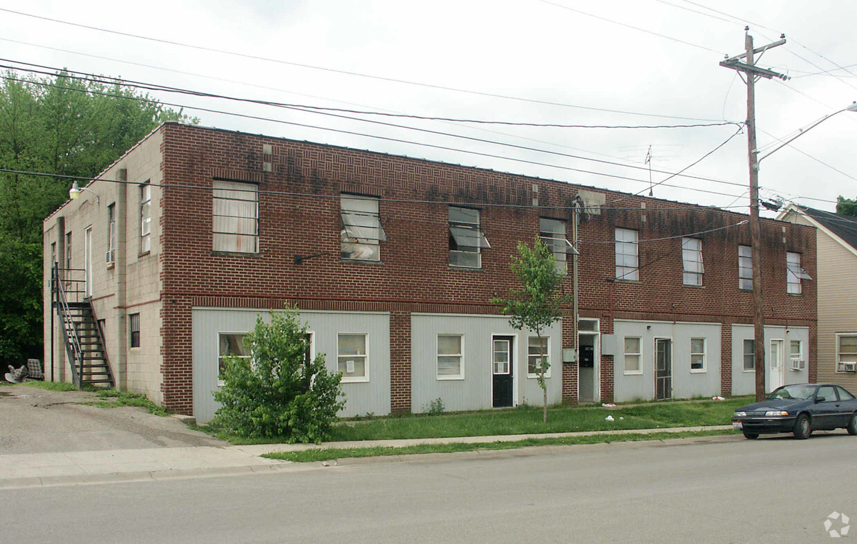
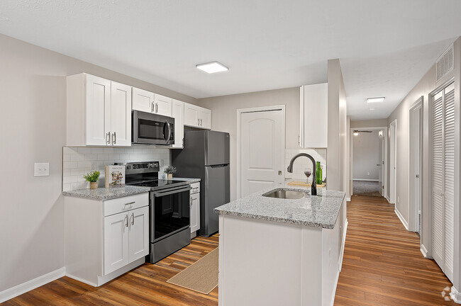
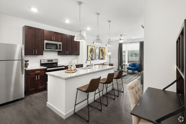
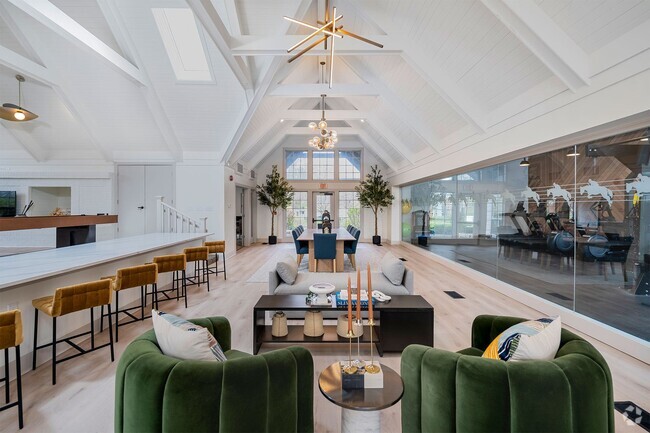
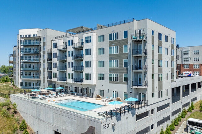
About Amburgy
Discover a new place to live at Amburgy. The premium E. Broadway St. location in the 45065 Zip code of South Lebanon is a popular place for those looking for their new home. Here at this community, the leasing team is ready to match you with your perfect new place. Make sure you to view the available floorplans. Stop by to schedule a tour.
Amburgy is an apartment community located in Warren County and the 45065 ZIP Code. This area is served by the Kings Local attendance zone.
Fees and Policies
The fees below are based on community-supplied data and may exclude additional fees and utilities.
- Parking
-
Surface LotParking Available--
Details
Property Information
-
Built in 1952
-
13 units/2 stories
Location
Get Directions
The quaint village of South Lebanon is just outside of Cincinnati, with easy accessibility to Dayton and Columbus. Settled in the 1790s, South Lebanon was actually called “Deerfield” – but eventually renamed because of its proximity to Lebanon.
Located off I-71, residents enjoy the convenience of a Kohl’s and Target nearby, along with great local restaurants such as Chubby’s Pizza. Many parks are in walking distance of each other and include Rogers and Oeders Park – both with river views – plus Spicer Memorial Park. Valley Vineyards winery and brewery is just a short drive away. You’ll find many family-friendly theme parks and entertainment venues in nearby Kings Mills.
Learn more about living in South Lebanon
Education
| Colleges & Universities | Distance | ||
|---|---|---|---|
| Colleges & Universities | Distance | ||
| Drive: | 26 min | 17.1 mi | |
| Drive: | 27 min | 18.9 mi | |
| Drive: | 35 min | 18.9 mi | |
| Drive: | 38 min | 21.0 mi |
Amburgy is within 26 minutes or 17.1 miles from Univ. of Cincinnati, Blue Ash. It is also near Cincinnati State, WDC and Miami University Middletown.
Schools


Public Elementary School
Grades PK-2
1,203 Students
Nearby
Public Elementary School
Grades 5-6
707 Students
Attendance Zone
Public Elementary School
Grades K-4
557 Students
Attendance Zone
Public Middle School
Grades 7-8
714 Students
Attendance Zone
Public High School
Grades 9-12
1,435 Students
Attendance Zone
Private Elementary, Middle & High School
Grades PK-12
154 Students
Nearby
Private Elementary & Middle School
Grades PK-8
257 Students
Nearby
School data provided by
 The GreatSchools Rating helps parents compare schools within a state based on a variety of school quality indicators and provides a helpful picture of how effectively each school serves all of its students. Ratings are on a scale of 1 (below average) to 10 (above average) and can include test scores, college readiness, academic progress, advanced courses, equity, discipline and attendance data. We also advise parents to visit schools, consider other information on school performance and programs, and consider family needs as part of the school selection process.
View GreatSchools Rating Methodology
View GreatSchools Rating Methodology
Transportation options available in South Lebanon include Hanke Exchange Station, 12Th & Main, located 28.6 miles from Amburgy. Amburgy is near Cincinnati/Northern Kentucky International, located 43.1 miles or 64 minutes away.
| Transit / Subway | Distance | ||
|---|---|---|---|
| Transit / Subway | Distance | ||
| Drive: | 38 min | 28.6 mi | |
| Drive: | 39 min | 28.8 mi | |
| Drive: | 40 min | 29.0 mi | |
| Drive: | 40 min | 29.2 mi | |
| Drive: | 40 min | 29.2 mi |
| Commuter Rail | Distance | ||
|---|---|---|---|
| Commuter Rail | Distance | ||
|
|
Drive: | 42 min | 30.8 mi |
| Airports | Distance | ||
|---|---|---|---|
| Airports | Distance | ||
|
Cincinnati/Northern Kentucky International
|
Drive: | 64 min | 43.1 mi |
Time and distance from Amburgy.
| Shopping Centers | Distance | ||
|---|---|---|---|
| Shopping Centers | Distance | ||
| Walk: | 17 min | 0.9 mi | |
| Drive: | 4 min | 1.7 mi | |
| Drive: | 5 min | 2.2 mi |
Amburgy has 3 shopping centers within 2.2 miles, which is about a 5-minute walk. The miles and minutes will be for the farthest away property.
| Parks and Recreation | Distance | ||
|---|---|---|---|
| Parks and Recreation | Distance | ||
|
Lebanon Mason Monroe Railroad
|
Drive: | 10 min | 6.3 mi |
|
Corwin M. Nixon Park
|
Drive: | 14 min | 7.2 mi |
|
Makino Park
|
Drive: | 16 min | 7.7 mi |
|
Ozone ZipLine Adventures
|
Drive: | 13 min | 8.4 mi |
|
Fort Ancient
|
Drive: | 16 min | 9.3 mi |
Amburgy has 5 parks within 9.3 miles, including Corwin M. Nixon Park, Lebanon Mason Monroe Railroad, and Makino Park.
| Hospitals | Distance | ||
|---|---|---|---|
| Hospitals | Distance | ||
| Drive: | 12 min | 7.6 mi | |
| Drive: | 21 min | 9.7 mi |
Amburgy is 7.6 miles from Lindner Center of Hope, and is convenient to other hospitals, including West Chester Hospital.
| Military Bases | Distance | ||
|---|---|---|---|
| Military Bases | Distance | ||
| Drive: | 46 min | 28.8 mi | |
| Drive: | 55 min | 35.8 mi | |
| Drive: | 55 min | 38.2 mi |
Amburgy has 3 military bases within 38.2 miles, the nearest is Gentile Air Force Station which is 28.8 miles away and a 46 minute drive.
You May Also Like
Similar Rentals Nearby


What Are Walk Score®, Transit Score®, and Bike Score® Ratings?
Walk Score® measures the walkability of any address. Transit Score® measures access to public transit. Bike Score® measures the bikeability of any address.
What is a Sound Score Rating?
A Sound Score Rating aggregates noise caused by vehicle traffic, airplane traffic and local sources
Responded To This Review