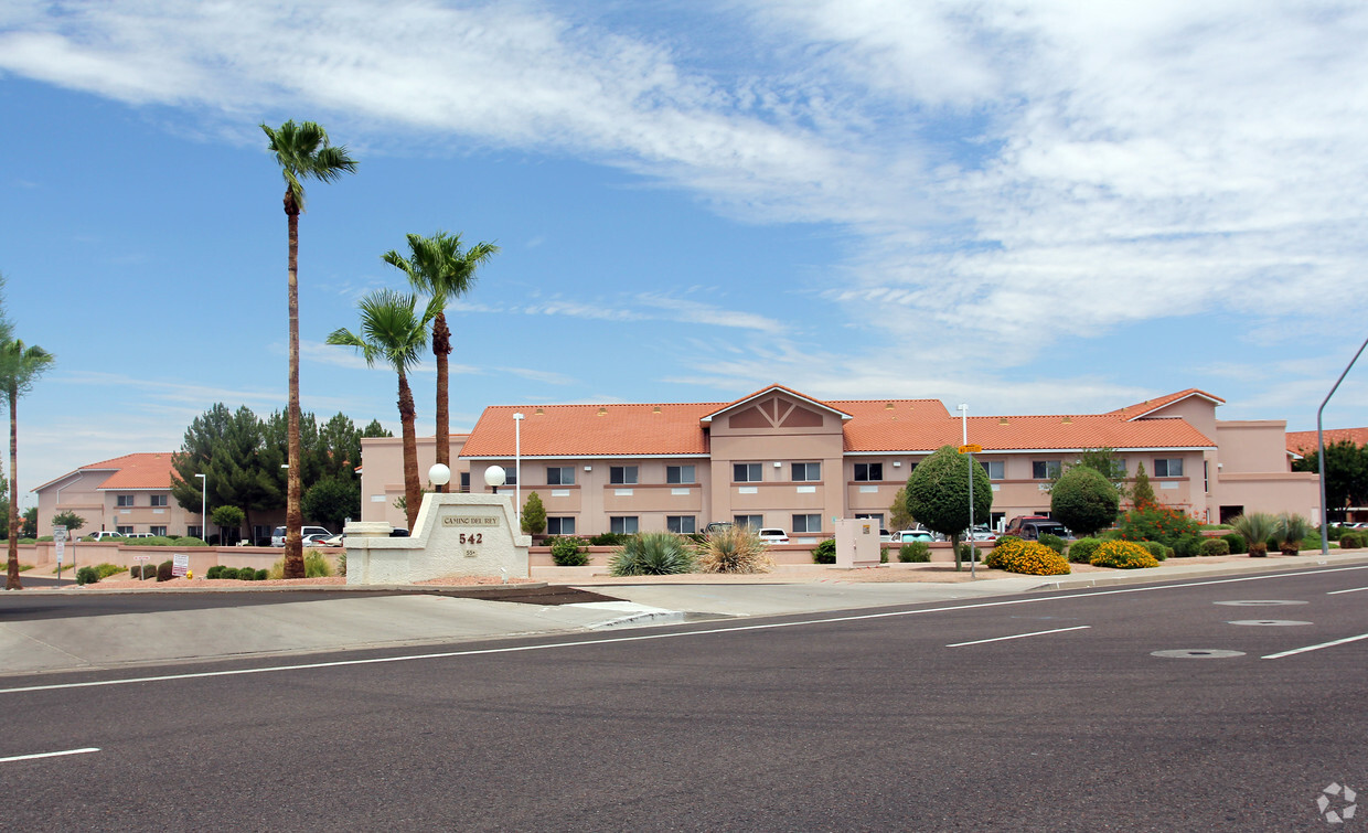
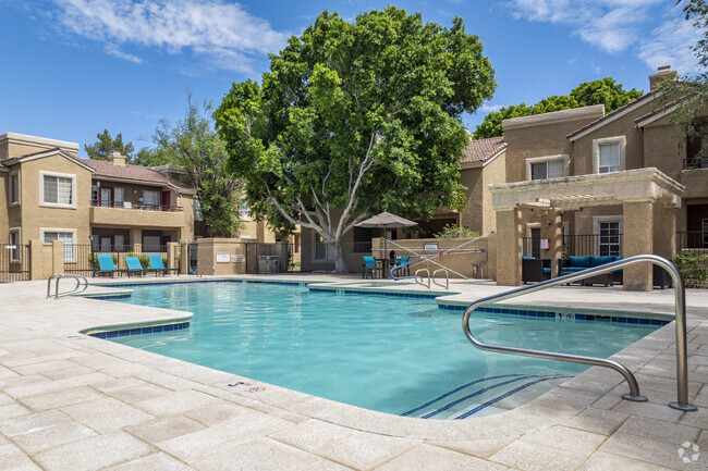
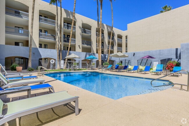
Camino Del Rey
542 S Higley Rd,
Mesa,
AZ
85206
2 Weeks Ago
Favorites
Camino Del Rey
Favorites
Check Back Soon for Upcoming Availability
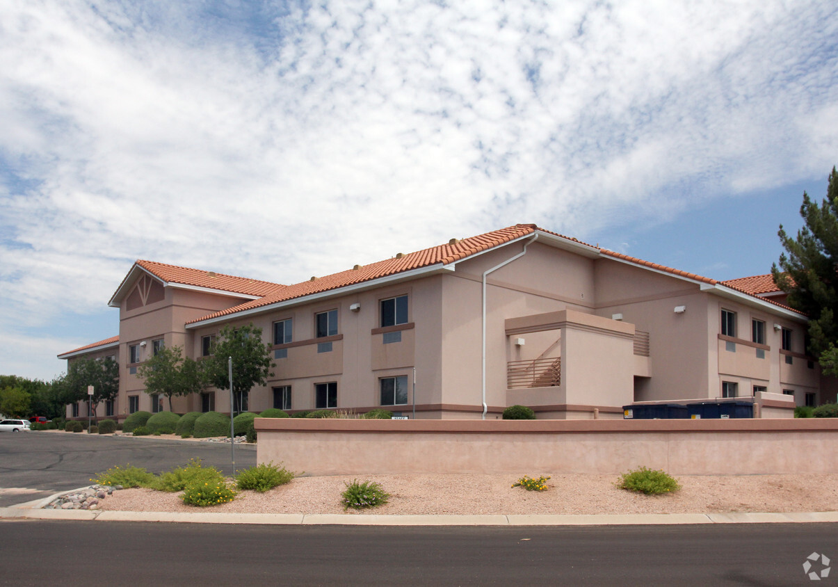
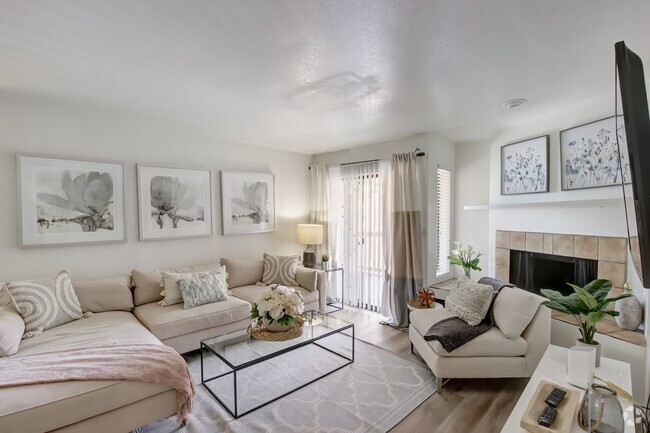
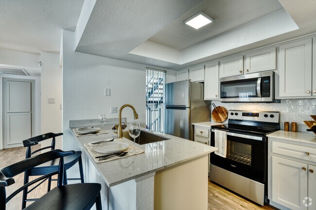
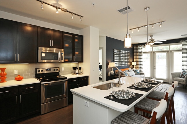
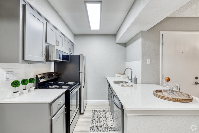
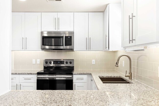
About Camino Del Rey
Visit Camino Del Rey in Mesa, AZ. This community is located in the 85206 area of Mesa. The professional leasing team is available to help you find the best floor plan for your lifestyle. Contact us today to learn more about our community and make your move to Camino Del Rey.
Camino Del Rey is an apartment community located in Maricopa County and the 85206 ZIP Code. This area is served by the Mesa Unified attendance zone.
Fees and Policies
Details
Property Information
-
Built in 1988
-
6 units/2 stories
Location
Get Directions
North of the Phoenix Mesa Gateway Airport is Superstition Springs, a community just 20 minutes outside of Mesa. The north section of the neighborhood boasts an expansive variety of shops and dining establishments.
The Superstition Springs Center mall is a major fashion hub, surrounded by Burlington, Target, and WinCo Foods market. Restaurants in the area include Olive Garden, The Cheesecake Factory, and BJ’s Restaurant and Brewhouse. The mall itself houses its own food court, along with an outdoor amphitheater and movie theater. Residents enjoy the convenience of being close to Mesa, Scottsdale, and Phoenix. Golfers will appreciate the championship golf course at the Superstition Springs Golf Club off Baseline Road.
Learn more about living in Superstition SpringsBelow are rent ranges for similar nearby apartments
| Beds | Average Size | Lowest | Typical | Premium |
|---|---|---|---|---|
| Studio Studio Studio | 585-627 Sq Ft | $695 | $1,374 | $1,653 |
| 1 Bed 1 Bed 1 Bed | 732-737 Sq Ft | $906 | $1,586 | $3,588 |
| 2 Beds 2 Beds 2 Beds | 1044-1046 Sq Ft | $1,060 | $1,889 | $3,984 |
| 3 Beds 3 Beds 3 Beds | 1452-1455 Sq Ft | $1,600 | $2,415 | $5,000 |
| 4 Beds 4 Beds 4 Beds | 2198 Sq Ft | $1,825 | $4,240 | $25,000 |
Education
| Colleges & Universities | Distance | ||
|---|---|---|---|
| Colleges & Universities | Distance | ||
| Drive: | 7 min | 3.1 mi | |
| Drive: | 11 min | 6.1 mi | |
| Drive: | 13 min | 7.2 mi | |
| Drive: | 13 min | 7.4 mi |
Camino Del Rey is within 7 minutes or 3.1 miles from A.T. Still Univ. AZ. It is also near Mesa C.C., Red Mountain Campus and Benedictine University.
Schools


Public Elementary School
Grades PK-6
393 Students
Attendance Zone
Public Middle & High School
Grades 6-12
Nearby
Public Middle School
Grades 7-8
995 Students
Attendance Zone
Public High School
Grades 9-12
3,475 Students
Attendance Zone
Private Elementary, Middle & High School
Grades K-12
92 Students
Nearby
Private Elementary & Middle School
Grades PK-8
77 Students
Nearby
School data provided by
 The GreatSchools Rating helps parents compare schools within a state based on a variety of school quality indicators and provides a helpful picture of how effectively each school serves all of its students. Ratings are on a scale of 1 (below average) to 10 (above average) and can include test scores, college readiness, academic progress, advanced courses, equity, discipline and attendance data. We also advise parents to visit schools, consider other information on school performance and programs, and consider family needs as part of the school selection process.
View GreatSchools Rating Methodology
View GreatSchools Rating Methodology
Transportation options available in Mesa include Gilbert Rd/Main St, located 5.5 miles from Camino Del Rey. Camino Del Rey is near Phoenix-Mesa Gateway, located 10.0 miles or 18 minutes away, and Phoenix Sky Harbor International, located 21.7 miles or 30 minutes away.
| Transit / Subway | Distance | ||
|---|---|---|---|
| Transit / Subway | Distance | ||
|
|
Drive: | 9 min | 5.5 mi |
|
|
Drive: | 10 min | 6.0 mi |
|
|
Drive: | 12 min | 6.8 mi |
|
|
Drive: | 14 min | 7.4 mi |
|
|
Drive: | 15 min | 10.4 mi |
| Commuter Rail | Distance | ||
|---|---|---|---|
| Commuter Rail | Distance | ||
|
|
Drive: | 52 min | 39.8 mi |
| Airports | Distance | ||
|---|---|---|---|
| Airports | Distance | ||
|
Phoenix-Mesa Gateway
|
Drive: | 18 min | 10.0 mi |
|
Phoenix Sky Harbor International
|
Drive: | 30 min | 21.7 mi |
Time and distance from Camino Del Rey.
| Shopping Centers | Distance | ||
|---|---|---|---|
| Shopping Centers | Distance | ||
| Walk: | 17 min | 0.9 mi | |
| Drive: | 2 min | 1.1 mi | |
| Drive: | 3 min | 1.4 mi |
Camino Del Rey has 3 shopping centers within 1.4 miles, which is about a 3-minute walk. The miles and minutes will be for the farthest away property.
| Parks and Recreation | Distance | ||
|---|---|---|---|
| Parks and Recreation | Distance | ||
|
Riparian Preserve at Water Ranch
|
Drive: | 7 min | 3.9 mi |
|
Red Mountain Park
|
Drive: | 10 min | 5.6 mi |
|
Arizona Museum of Natural History
|
Drive: | 14 min | 7.6 mi |
|
i.d.e.a. Museum
|
Drive: | 14 min | 7.8 mi |
|
Usery Mountain Recreation Area
|
Drive: | 23 min | 12.0 mi |
Camino Del Rey has 5 parks within 12.0 miles, including Riparian Preserve at Water Ranch, Red Mountain Park, and Arizona Museum of Natural History.
| Hospitals | Distance | ||
|---|---|---|---|
| Hospitals | Distance | ||
| Drive: | 3 min | 1.7 mi | |
| Drive: | 5 min | 2.3 mi | |
| Drive: | 5 min | 2.6 mi |
Camino Del Rey has 3 hospitals within 2.6 miles, the nearest is Banner Gateway Medical Center which is 1.7 miles away and a 3 minute drive.
| Military Bases | Distance | ||
|---|---|---|---|
| Military Bases | Distance | ||
| Drive: | 29 min | 22.4 mi | |
| Drive: | 59 min | 46.9 mi | |
| Drive: | 120 min | 98.5 mi |
Camino Del Rey has 3 military bases within 98.5 miles, the nearest is Phoenix Sky Harbor Airport Air Guard Station which is 22.4 miles away and a 29 minute drive.
You May Also Like
What neighborhood is the property located in?
Camino Del Rey is in Superstition Springs in the city of Mesa. Here you’ll find three shopping centers within 1.4 miles of the property. Five parks are within 12.0 miles, including Riparian Preserve at Water Ranch, Red Mountain Park, and Arizona Museum of Natural History.
Similar Rentals Nearby


What Are Walk Score®, Transit Score®, and Bike Score® Ratings?
Walk Score® measures the walkability of any address. Transit Score® measures access to public transit. Bike Score® measures the bikeability of any address.
What is a Sound Score Rating?
A Sound Score Rating aggregates noise caused by vehicle traffic, airplane traffic and local sources
Responded To This Review