Property Image Coming Soon

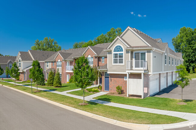
Carriage Way
29800 Guilford Cir,
Chesterfield,
MI
48051
2 Weeks Ago
Favorites
Carriage Way

Favorites
Check Back Soon for Upcoming Availability
| Beds | Baths | Average SF | Availability |
|---|---|---|---|
| 1 Bedroom 1 Bedroom 1 Br | 1 Bath 1 Bath 1 Ba | 800 SF | Not Available |
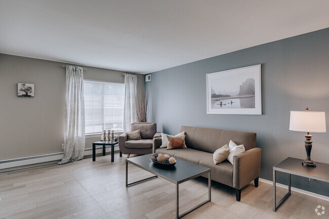
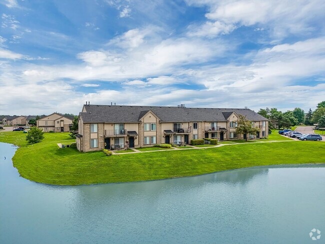
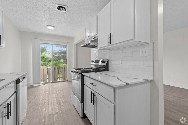
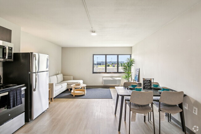
About Carriage Way
Discover your new place at Carriage Way in Chesterfield, MI. This community is located at 29800 Guilford Cir. in the New Baltimore area of Chesterfield. The leasing staff is ready to help you find your ideal place. It's time to love where you live. Stop by for a visit today.
Carriage Way is an apartment community located in Macomb County and the 48051 ZIP Code. This area is served by the L'anse Creuse Public Schools attendance zone.
Fees and Policies
Details
Property Information
-
Built in 1979
-
798 units/1 story
Location
Get Directions
Chesterfield is a small township on the northern edge of the greater Detroit area, bordered on its east side by Anchor Bay. Waterfront apartments are surprisingly affordable, giving folks an opportunity to see the sun rise over the bay from their bedroom windows. Interstate 94 runs through the city, providing a direct route to Detroit and beyond. Selfridge Air National Guard Base sits on the south end of town, making Chesterfield a great location for military service members and civilian military employees.
Learn more about living in Chesterfield
Education
| Colleges & Universities | Distance | ||
|---|---|---|---|
| Colleges & Universities | Distance | ||
| Drive: | 21 min | 11.8 mi | |
| Drive: | 19 min | 13.8 mi | |
| Drive: | 28 min | 19.3 mi | |
| Drive: | 39 min | 25.9 mi |
Carriage Way is within 21 minutes or 11.8 miles from Univ. of Detroit Mercy, Ctr. It is also near Baker Coll. Clinton Township and Macomb Community College.
Schools


Charter Elementary & Middle School
Grades PK-8
200 Students
Nearby
Public Elementary School
Grades PK-5
421 Students
Attendance Zone
Public Middle School
Grades 6-8
618 Students
Attendance Zone
Public High School
Grades 9-12
1,588 Students
Attendance Zone
Private Elementary & Middle School
Grades PK-8
155 Students
Nearby
Private High School
Grades 9-12
560 Students
Nearby
Private High School
Grades 9-12
81 Students
Nearby
School data provided by
 The GreatSchools Rating helps parents compare schools within a state based on a variety of school quality indicators and provides a helpful picture of how effectively each school serves all of its students. Ratings are on a scale of 1 (below average) to 10 (above average) and can include test scores, college readiness, academic progress, advanced courses, equity, discipline and attendance data. We also advise parents to visit schools, consider other information on school performance and programs, and consider family needs as part of the school selection process.
View GreatSchools Rating Methodology
View GreatSchools Rating Methodology
Transportation options available in Chesterfield include Amsterdam St - Northbound, located 31.0 miles from Carriage Way.
| Transit / Subway | Distance | ||
|---|---|---|---|
| Transit / Subway | Distance | ||
| Drive: | 40 min | 31.0 mi | |
| Drive: | 40 min | 31.0 mi | |
| Drive: | 41 min | 31.2 mi | |
| Drive: | 41 min | 31.2 mi | |
| Drive: | 41 min | 31.3 mi |
| Commuter Rail | Distance | ||
|---|---|---|---|
| Commuter Rail | Distance | ||
|
|
Drive: | 44 min | 28.6 mi |
|
|
Drive: | 42 min | 28.8 mi |
|
|
Drive: | 38 min | 29.2 mi |
|
|
Drive: | 37 min | 30.0 mi |
|
|
Drive: | 41 min | 31.2 mi |
Time and distance from Carriage Way.
| Shopping Centers | Distance | ||
|---|---|---|---|
| Shopping Centers | Distance | ||
| Drive: | 3 min | 1.5 mi | |
| Drive: | 7 min | 3.7 mi | |
| Drive: | 7 min | 3.8 mi |
Carriage Way has 3 shopping centers within 3.8 miles, which is about a 7-minute drive. The miles and minutes will be for the farthest away property.
| Parks and Recreation | Distance | ||
|---|---|---|---|
| Parks and Recreation | Distance | ||
|
Wetzel State Recreation Area
|
Drive: | 16 min | 6.7 mi |
|
Michigan Transit Museum
|
Drive: | 16 min | 8.7 mi |
|
Wolcott Mill Metropark
|
Drive: | 25 min | 13.1 mi |
|
Lake St. Clair Metropark
|
Drive: | 21 min | 14.0 mi |
Carriage Way has 4 parks within 14.0 miles, including Wetzel State Recreation Area, Michigan Transit Museum, and Lake St. Clair Metropark.
| Hospitals | Distance | ||
|---|---|---|---|
| Hospitals | Distance | ||
| Drive: | 10 min | 6.1 mi | |
| Drive: | 17 min | 10.3 mi | |
| Drive: | 20 min | 12.1 mi |
Carriage Way has 3 hospitals within 12.1 miles, the nearest is Harbor Oaks Hospital which is 6.1 miles away and a 10 minute drive.
You May Also Like
Similar Rentals Nearby


What Are Walk Score®, Transit Score®, and Bike Score® Ratings?
Walk Score® measures the walkability of any address. Transit Score® measures access to public transit. Bike Score® measures the bikeability of any address.
What is a Sound Score Rating?
A Sound Score Rating aggregates noise caused by vehicle traffic, airplane traffic and local sources
Responded To This Review