-
Charleston Heights
-
-
-
Charleston Heights
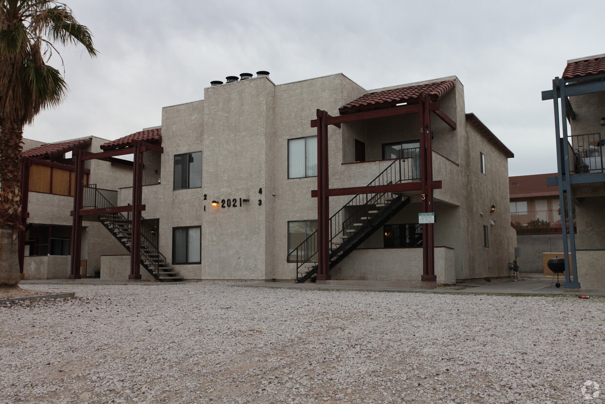
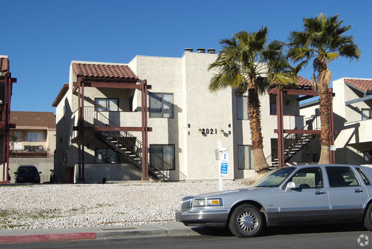
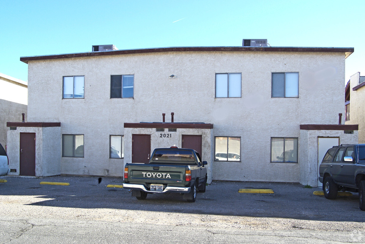
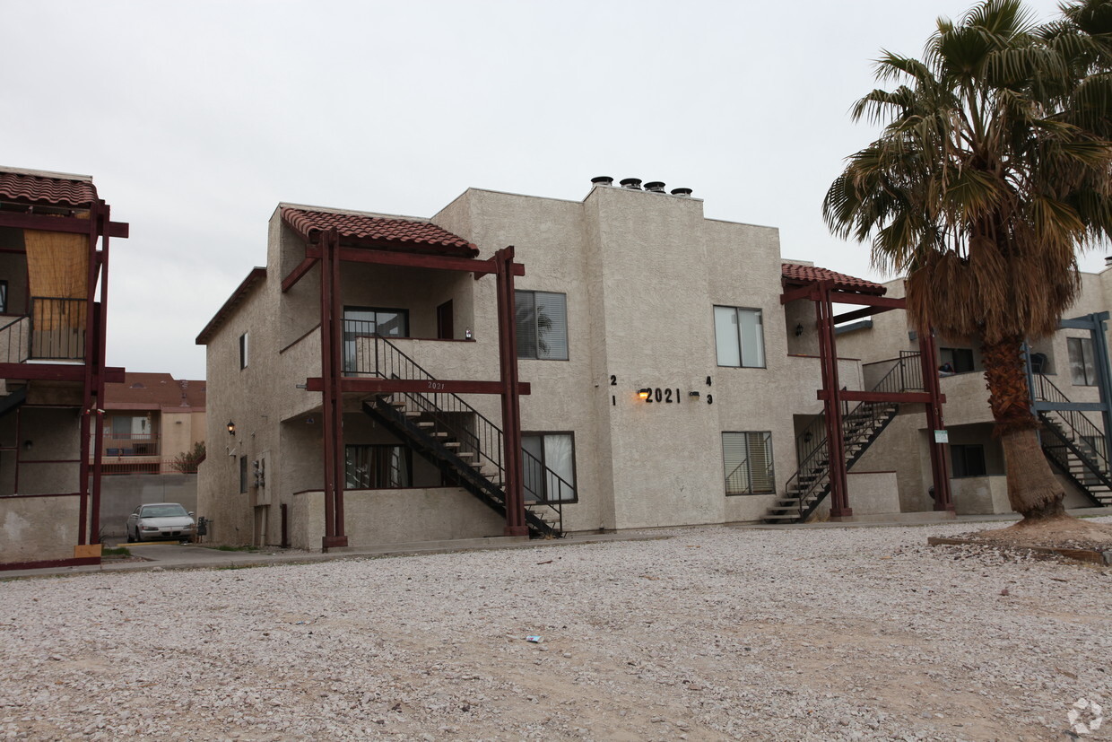
2021 Winwood St,
Las Vegas,
NV
89108
2 Weeks Ago
Favorites
Charleston Heights
Favorites
Check Back Soon for Upcoming Availability
| Beds | Baths | Average SF | Availability |
|---|---|---|---|
| 1 Bedroom 1 Bedroom 1 Br | 2 Baths 2 Baths 2 Ba | 900 SF | Not Available |
| 2 Bedrooms 2 Bedrooms 2 Br | 2 Baths 2 Baths 2 Ba | 900 SF | Not Available |
Charleston Heights is an apartment community located in Clark County and the 89108 ZIP Code. This area is served by the Clark County attendance zone.
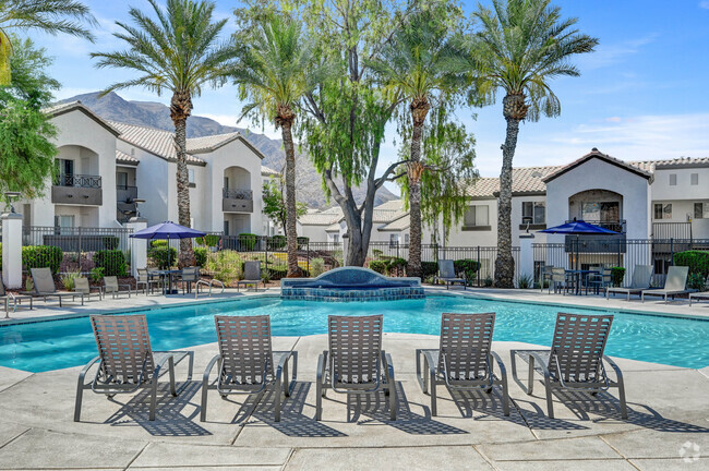
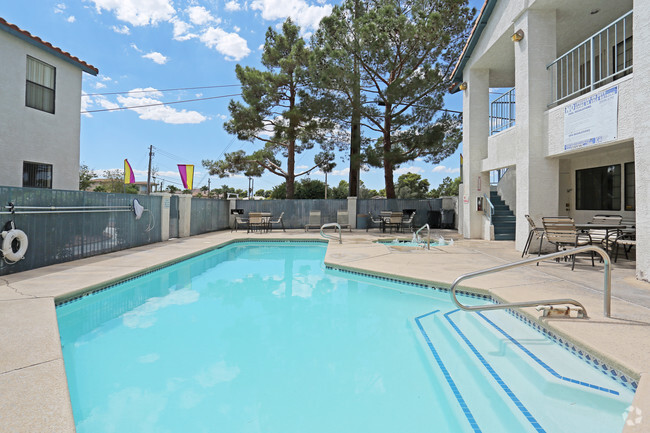
Community Amenities
- Laundry Facilities
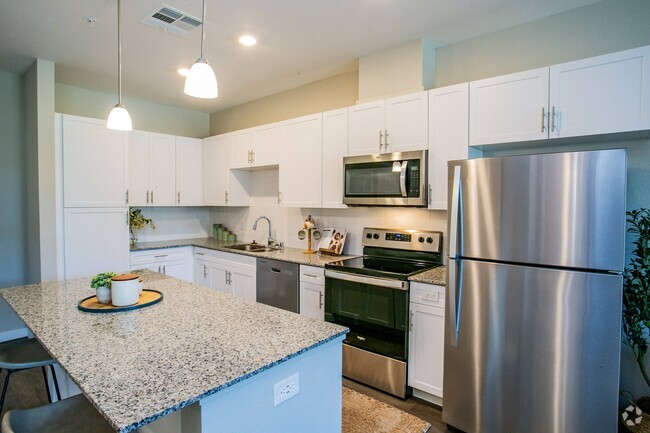
Apartment Features
- High Speed Internet Access
- Air Conditioning
- Smoke Free
- Balcony
Fees and Policies
The fees below are based on community-supplied data and may exclude additional fees and utilities.
- Parking
-
Surface Lot--1 Max
Details
Property Information
-
Built in 1984
-
4 units/2 stories
Location
Get Directions
Tucked between Rancho Drive and the 95, Michael Way encompasses a number of prime suburban hotspots, all of them just six miles from the famous Las Vegas Strip. The area is classic Vegas with its towering palm trees, succulent gardens, and stucco homes. Three parks and the Las Vegas Golf Club round out Michael Way’s green space access, making for plenty of recreational escape from the desert landscape.
Chain restaurants and well-known retailers cater to most needs, but with the Strip so close there’s more unique fare and shopping to experience in just a matter of minutes. Domestic travelers will get plenty of use out of the North Las Vegas Airport that sits just across the 95, and those who commute for work by car are right next to the 15 and 95 junction.
Learn more about living in Michael WayBelow are rent ranges for similar nearby apartments
Amenities
- Laundry Facilities
- High Speed Internet Access
- Air Conditioning
- Smoke Free
- Balcony
Education
| Colleges & Universities | Distance | ||
|---|---|---|---|
| Colleges & Universities | Distance | ||
| Drive: | 9 min | 3.9 mi | |
| Drive: | 9 min | 5.3 mi | |
| Drive: | 14 min | 8.0 mi | |
| Drive: | 20 min | 10.3 mi |
Charleston Heights is within 9 minutes or 3.9 miles from Southern Nevada, Charleston. It is also near Nev. State Coll., Shadow Lane and Southern Nevada, Cheyenne.
Schools


Public Elementary School
Grades PK-5
711 Students
Attendance Zone
Public Middle School
Grades 6-8
929 Students
Attendance Zone
Public High School
Grades 9-12
2,949 Students
Attendance Zone
Private Elementary School
Grades PK-2
Nearby
Private Elementary, Middle & High School
Grades K-12
153 Students
Nearby
School data provided by
 The GreatSchools Rating helps parents compare schools within a state based on a variety of school quality indicators and provides a helpful picture of how effectively each school serves all of its students. Ratings are on a scale of 1 (below average) to 10 (above average) and can include test scores, college readiness, academic progress, advanced courses, equity, discipline and attendance data. We also advise parents to visit schools, consider other information on school performance and programs, and consider family needs as part of the school selection process.
View GreatSchools Rating Methodology
View GreatSchools Rating Methodology
Transportation options available in Las Vegas include Sahara Station, located 7.2 miles from Charleston Heights. Charleston Heights is near Harry Reid International, located 11.5 miles or 21 minutes away, and Boulder City Municipal, located 31.4 miles or 41 minutes away.
| Transit / Subway | Distance | ||
|---|---|---|---|
| Transit / Subway | Distance | ||
|
|
Drive: | 12 min | 7.2 mi |
|
|
Drive: | 14 min | 7.6 mi |
|
|
Drive: | 14 min | 7.8 mi |
|
|
Drive: | 16 min | 8.5 mi |
|
|
Drive: | 15 min | 9.1 mi |
| Airports | Distance | ||
|---|---|---|---|
| Airports | Distance | ||
|
Harry Reid International
|
Drive: | 21 min | 11.5 mi |
|
Boulder City Municipal
|
Drive: | 41 min | 31.4 mi |
Time and distance from Charleston Heights.
| Shopping Centers | Distance | ||
|---|---|---|---|
| Shopping Centers | Distance | ||
| Walk: | 6 min | 0.4 mi | |
| Walk: | 9 min | 0.5 mi | |
| Walk: | 12 min | 0.6 mi |
Charleston Heights has 3 shopping centers within 0.6 mile, which is about a 12-minute walk. The miles and minutes will be for the farthest away property.
| Parks and Recreation | Distance | ||
|---|---|---|---|
| Parks and Recreation | Distance | ||
|
Springs Preserve
|
Drive: | 8 min | 3.6 mi |
|
Spring Mountains National Recreation Area
|
Drive: | 8 min | 4.0 mi |
|
DISCOVERY Children's Museum
|
Drive: | 10 min | 6.2 mi |
|
Las Vegas Natural History Museum
|
Drive: | 10 min | 6.2 mi |
|
Old Las Vegas Mormon State Historic Park
|
Drive: | 10 min | 6.3 mi |
Charleston Heights has 5 parks within 6.3 miles, including Springs Preserve, Spring Mountains National Recreation Area, and Las Vegas Natural History Museum.
| Hospitals | Distance | ||
|---|---|---|---|
| Hospitals | Distance | ||
| Drive: | 6 min | 3.0 mi | |
| Drive: | 6 min | 3.5 mi | |
| Drive: | 8 min | 4.8 mi |
Charleston Heights has 3 hospitals within 4.8 miles, the nearest is Southern Nevada Adult Mental Health Services which is 3.0 miles away and a 6 minute drive.
| Military Bases | Distance | ||
|---|---|---|---|
| Military Bases | Distance | ||
| Drive: | 28 min | 15.3 mi |
Charleston Heights is 15.3 miles and a 28 minute drive from Nellis Air Force Base.
You May Also Like
What neighborhood is the property located in?
Charleston Heights is in Michael Way in the city of Las Vegas. Here you’ll find three shopping centers within 0.6 mile of the property. Five parks are within 6.3 miles, including Springs Preserve, Spring Mountains National Recreation Area, and Las Vegas Natural History Museum.
Similar Rentals Nearby


What Are Walk Score®, Transit Score®, and Bike Score® Ratings?
Walk Score® measures the walkability of any address. Transit Score® measures access to public transit. Bike Score® measures the bikeability of any address.
What is a Sound Score Rating?
A Sound Score Rating aggregates noise caused by vehicle traffic, airplane traffic and local sources

2021 Winwood St
Las Vegas, NV 89108
Responded To This Review