
Peninsula Pines Apartments
842-858 Antoinette Ln,
South San Francisco, CA 94080
$3,141 - $10,000
2-3 Beds
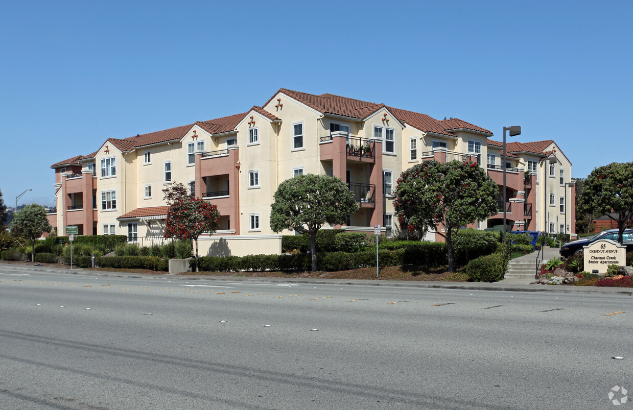

At Chestnut Creek in South San Francisco, you've discovered your new home. The location of this community is on Chestnut Ave S. in South San Francisco. A unique collection of amenities is available at this community. Some of these include: planned social activities, convenient on-site parking options, and smoke free options. From location to floorplan options, the professional leasing staff is ready to help you find the perfect place. Get a head start on moving now. Contact or stop by the Chestnut Creek leasing office to talk about leasing your new apartment.
Chestnut Creek is an apartment community located in San Mateo County and the 94080 ZIP Code. This area is served by the South San Francisco Unified attendance zone.
South San Francisco, known locally as "South City," sits between San Bruno Mountain and San Francisco Bay. Once an industrial center, it's now home to numerous biotechnology companies. The rental market offers options at various price points, with average rents ranging from $2,432 for studios to $4,068 for three-bedroom apartments.
The city's downtown along Grand Avenue features independent shops and local eateries that contribute to its community atmosphere. Sign Hill Park, home to the historic "South San Francisco The Industrial City" sign, provides hiking trails with sweeping views of the bay. Orange Memorial Park offers recreational facilities, including a swimming pool and seasonal farmers' market. East of Highway 101, the city has developed into a biotechnology research center, with Genentech's campus serving as a major employer.
Learn more about living in South San Francisco| Colleges & Universities | Distance | ||
|---|---|---|---|
| Colleges & Universities | Distance | ||
| Drive: | 9 min | 4.0 mi | |
| Drive: | 13 min | 7.0 mi | |
| Drive: | 12 min | 7.4 mi | |
| Drive: | 19 min | 9.5 mi |


Transportation options available in South San Francisco include South San Francisco Station, located 0.8 mile from Chestnut Creek. Chestnut Creek is near San Francisco International, located 5.2 miles or 11 minutes away, and Metro Oakland International, located 29.9 miles or 44 minutes away.
| Transit / Subway | Distance | ||
|---|---|---|---|
| Transit / Subway | Distance | ||
|
|
Walk: | 16 min | 0.8 mi |
|
|
Walk: | 16 min | 0.9 mi |
|
|
Drive: | 4 min | 2.2 mi |
| Drive: | 7 min | 3.7 mi | |
|
|
Drive: | 8 min | 3.9 mi |
| Commuter Rail | Distance | ||
|---|---|---|---|
| Commuter Rail | Distance | ||
| Drive: | 5 min | 2.2 mi | |
| Drive: | 5 min | 2.7 mi | |
| Drive: | 10 min | 6.4 mi | |
| Drive: | 11 min | 6.6 mi | |
| Drive: | 11 min | 7.4 mi |
| Airports | Distance | ||
|---|---|---|---|
| Airports | Distance | ||
|
San Francisco International
|
Drive: | 11 min | 5.2 mi |
|
Metro Oakland International
|
Drive: | 44 min | 29.9 mi |
Time and distance from Chestnut Creek.
| Shopping Centers | Distance | ||
|---|---|---|---|
| Shopping Centers | Distance | ||
| Walk: | 5 min | 0.3 mi | |
| Walk: | 6 min | 0.3 mi | |
| Walk: | 13 min | 0.7 mi |
| Parks and Recreation | Distance | ||
|---|---|---|---|
| Parks and Recreation | Distance | ||
|
Pacifica State Beach
|
Drive: | 13 min | 6.9 mi |
|
San Bruno Mountain State Park
|
Drive: | 16 min | 7.4 mi |
|
Candlestick Point State Recreation Area
|
Drive: | 15 min | 7.5 mi |
|
San Francisco State Univ. Observatory
|
Drive: | 14 min | 7.6 mi |
|
Charles F. Hagar Planetarium
|
Drive: | 14 min | 7.6 mi |
| Hospitals | Distance | ||
|---|---|---|---|
| Hospitals | Distance | ||
| Walk: | 10 min | 0.5 mi | |
| Drive: | 7 min | 3.4 mi | |
| Drive: | 10 min | 5.4 mi |
| Military Bases | Distance | ||
|---|---|---|---|
| Military Bases | Distance | ||
| Drive: | 26 min | 11.6 mi | |
| Drive: | 26 min | 12.1 mi |
What Are Walk Score®, Transit Score®, and Bike Score® Ratings?
Walk Score® measures the walkability of any address. Transit Score® measures access to public transit. Bike Score® measures the bikeability of any address.
What is a Sound Score Rating?
A Sound Score Rating aggregates noise caused by vehicle traffic, airplane traffic and local sources

65 Chestnut Ave S
South San Francisco, CA 94080


