$1,750 / Month
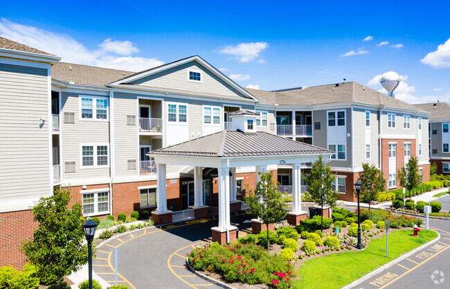
692 Henry St
Brooklyn, NY 11231
2 Weeks Ago
Favorites
HENRY STREET

Favorites
Check Back Soon for Upcoming Availability
| Beds | Baths | Average SF |
|---|---|---|
| 1 Bedroom 1 Bedroom 1 Br | 1 Bath 1 Bath 1 Ba | — |
About This Property
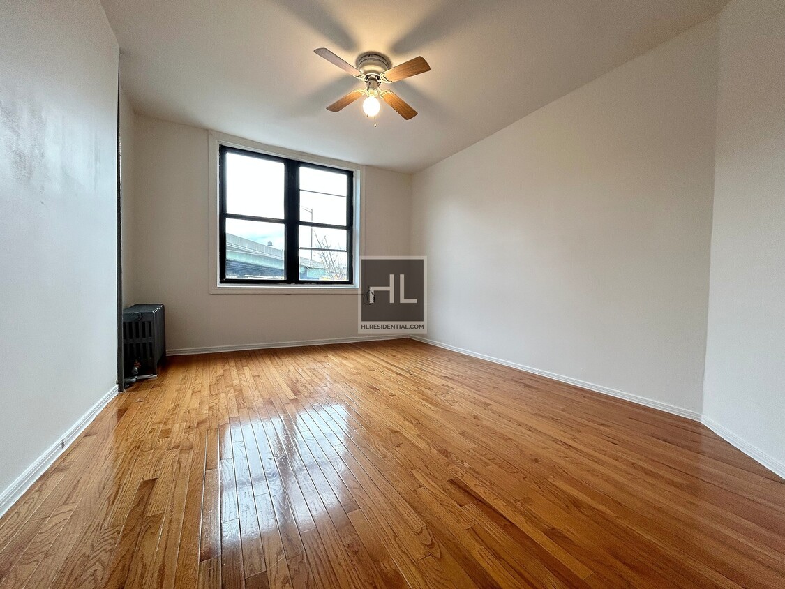
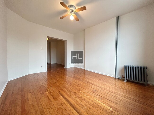
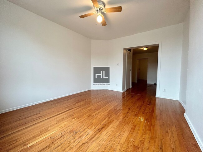
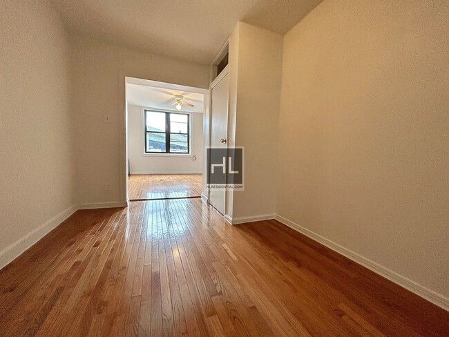
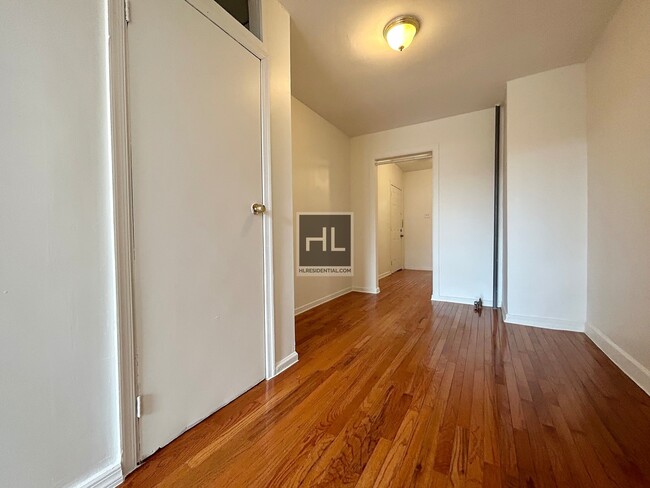
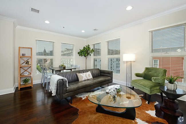
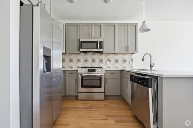
Beautiful / Spacious 1.5 Bed Includes the following: King size bedroomOffice room / Walk in closetOpen concept apartmentHardwood floorsHeat and hot water includedPets are welcome*2nd floor walk up Short walk to F & G TrainsEmail today for an Appointment!===Ref:1619951===
HENRY STREET is an apartment community located in Kings County and the 11231 ZIP Code.
Property Address:
692 Henry St,
Brooklyn,
NY
11231
Once a thriving shipping and port area, Red Hook has transformed into an eclectic seaside neighborhood possessing a close-knit community. Located on a peninsula in Brooklyn overlooking the Upper New York Bay and smaller waterways like Gowanus Bay, Red Hook houses many brick buildings, charming storefronts, and longstanding homes, townhomes, and apartment buildings.
The local businesses in Red Hook are what you would expect from a seaside village – charming, unique, and welcoming. From restaurants and bars to breweries and markets, you’ll find plenty of local charm in this neighborhood – not to mention the artistic vibe that exudes from local art galleries and museums.
Learn more about living in Red HookBelow are rent ranges for similar nearby apartments
Education
| Colleges & Universities | Distance | ||
|---|---|---|---|
| Colleges & Universities | Distance | ||
| Drive: | 5 min | 1.8 mi | |
| Drive: | 4 min | 1.8 mi | |
| Drive: | 5 min | 2.0 mi | |
| Drive: | 7 min | 2.2 mi |
HENRY STREET is within 4 minutes or 1.8 miles from St. Francis College. It is also near Brooklyn Law School and ASA College Brooklyn.
Transportation options available in Brooklyn include Smith-9 Streets, located 0.4 mile from HENRY STREET. HENRY STREET is near Laguardia, located 12.0 miles or 22 minutes away, and Newark Liberty International, located 15.5 miles or 26 minutes away.
| Transit / Subway | Distance | ||
|---|---|---|---|
| Transit / Subway | Distance | ||
|
|
Walk: | 8 min | 0.4 mi |
|
|
Walk: | 14 min | 0.7 mi |
|
|
Walk: | 17 min | 0.9 mi |
|
|
Walk: | 19 min | 1.0 mi |
|
|
Drive: | 4 min | 1.3 mi |
| Commuter Rail | Distance | ||
|---|---|---|---|
| Commuter Rail | Distance | ||
|
|
Drive: | 8 min | 2.5 mi |
|
|
Drive: | 11 min | 4.0 mi |
|
|
Drive: | 16 min | 6.7 mi |
|
|
Drive: | 17 min | 6.9 mi |
|
|
Drive: | 18 min | 7.3 mi |
| Airports | Distance | ||
|---|---|---|---|
| Airports | Distance | ||
|
Laguardia
|
Drive: | 22 min | 12.0 mi |
|
Newark Liberty International
|
Drive: | 26 min | 15.5 mi |
Time and distance from HENRY STREET.
| Shopping Centers | Distance | ||
|---|---|---|---|
| Shopping Centers | Distance | ||
| Drive: | 6 min | 1.9 mi | |
| Drive: | 8 min | 2.5 mi | |
| Drive: | 6 min | 2.9 mi |
HENRY STREET has 3 shopping centers within 2.9 miles, which is about a 6-minute drive. The miles and minutes will be for the farthest away property.
| Parks and Recreation | Distance | ||
|---|---|---|---|
| Parks and Recreation | Distance | ||
|
Coffey Park
|
Walk: | 7 min | 0.4 mi |
|
Red Hook Park
|
Walk: | 8 min | 0.5 mi |
|
Gowanus Canal
|
Walk: | 19 min | 1.0 mi |
|
Waterfront Museum & Showboat Barge
|
Drive: | 3 min | 1.4 mi |
|
Valentino Pier
|
Drive: | 3 min | 1.5 mi |
HENRY STREET has 5 parks within 1.5 miles, including Coffey Park, Red Hook Park, and Gowanus Canal.
| Hospitals | Distance | ||
|---|---|---|---|
| Hospitals | Distance | ||
| Drive: | 5 min | 1.8 mi | |
| Drive: | 8 min | 2.4 mi | |
| Drive: | 8 min | 3.7 mi |
HENRY STREET has 3 hospitals within 3.7 miles, the nearest is New York-Presbyterian Brooklyn Methodist Hospital which is 1.8 miles away and a 5 minutes drive.
| Military Bases | Distance | ||
|---|---|---|---|
| Military Bases | Distance | ||
| Drive: | 8 min | 4.1 mi | |
| Drive: | 24 min | 12.9 mi |
HENRY STREET is 4.1 miles from Governors Island Support Center, and is convenient to other military bases, including Military Ocean Terminal.
You May Also Like
Similar Rentals Nearby


What Are Walk Score®, Transit Score®, and Bike Score® Ratings?
Walk Score® measures the walkability of any address. Transit Score® measures access to public transit. Bike Score® measures the bikeability of any address.
What is a Sound Score Rating?
A Sound Score Rating aggregates noise caused by vehicle traffic, airplane traffic and local sources

692 Henry St
Brooklyn, NY 11231