-
HERKIMER STREET
-
-
-
400 Herkimer St Unit 6AA
Brooklyn, NY 11213
-
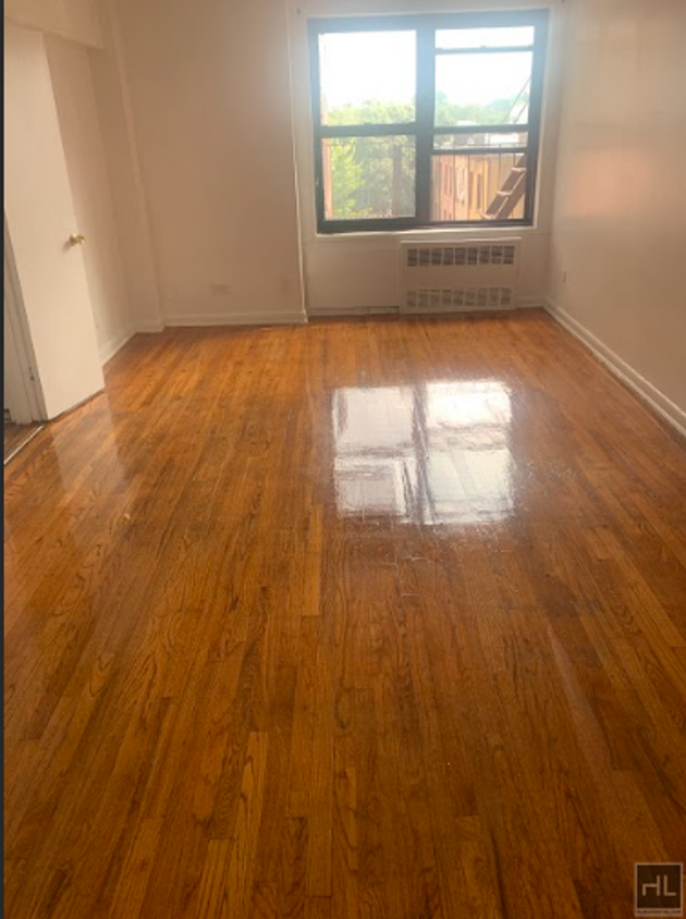
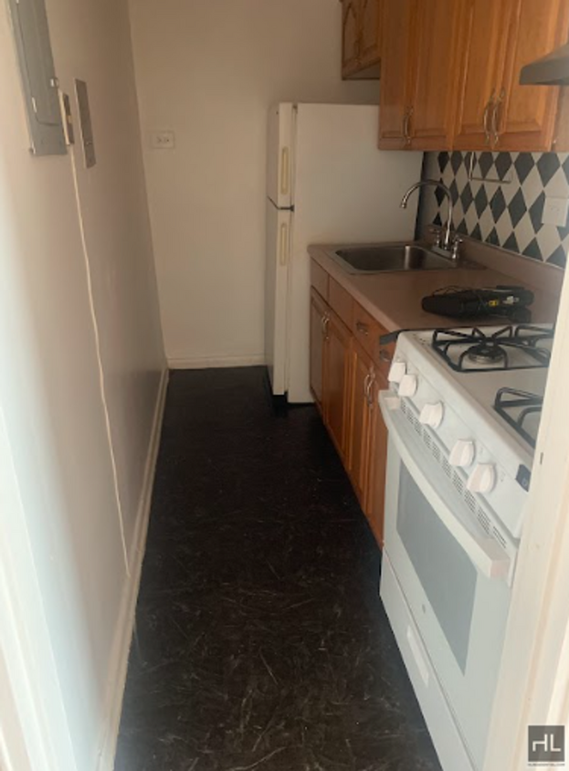
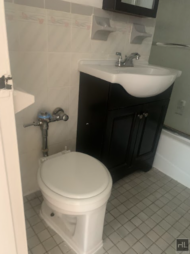
Bedrooms
Studio
-
Bathrooms
1
-
Square Feet
--
-
Available
Available Now

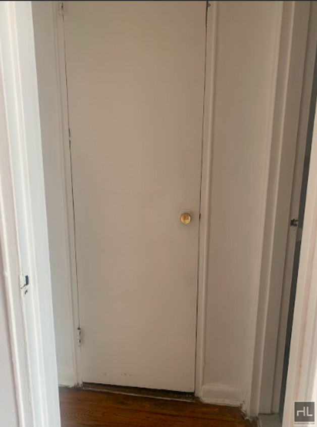
About This Home
Description coming soon, please contact your Highline Residential agent for more information ===Ref:2296094===
HERKIMER STREET is an apartment community located in Kings County and the 11213 ZIP Code.
Contact
- Phone Number
- Website View Property Website
- Contact
-
Source

Bedford-Stuyvesant, often shortened to Bed-Stuy, sits in north central Brooklyn, touting plenty of classic brownstones along tree-lined streets. Bed-Stuy is revered for its historic architecture, containing one of the highest concentrations of Victorian properties in all of New York City.
Residents enjoy a strong sense of community in Bed-Stuy along with an array of diverse eateries, cafes, and bodegas. Herbert Von King Park lies at the center of the neighborhood, exuding a lively town-square atmosphere with an outdoor amphitheater, Cultural Arts Center, and athletic facilities. Convenience to public transportation and I-278 makes commuting and traveling from Bed-Stuy a breeze.
Learn more about living in Bedford-Stuyvesant| Colleges & Universities | Distance | ||
|---|---|---|---|
| Colleges & Universities | Distance | ||
| Drive: | 6 min | 1.9 mi | |
| Drive: | 7 min | 2.2 mi | |
| Drive: | 6 min | 2.4 mi | |
| Drive: | 7 min | 2.9 mi |
Transportation options available in Brooklyn include Kingston-Throop Avenues, located 0.1 mile from HERKIMER STREET. HERKIMER STREET is near John F Kennedy International, located 10.4 miles or 21 minutes away, and Laguardia, located 11.1 miles or 22 minutes away.
| Transit / Subway | Distance | ||
|---|---|---|---|
| Transit / Subway | Distance | ||
|
|
Walk: | 2 min | 0.1 mi |
|
|
Walk: | 9 min | 0.5 mi |
|
|
Walk: | 10 min | 0.5 mi |
|
|
Walk: | 14 min | 0.7 mi |
|
|
Drive: | 4 min | 1.1 mi |
| Commuter Rail | Distance | ||
|---|---|---|---|
| Commuter Rail | Distance | ||
|
|
Walk: | 9 min | 0.5 mi |
|
|
Drive: | 6 min | 2.0 mi |
|
|
Drive: | 7 min | 2.4 mi |
|
|
Drive: | 16 min | 6.8 mi |
|
|
Drive: | 17 min | 7.1 mi |
| Airports | Distance | ||
|---|---|---|---|
| Airports | Distance | ||
|
John F Kennedy International
|
Drive: | 21 min | 10.4 mi |
|
Laguardia
|
Drive: | 22 min | 11.1 mi |
Time and distance from HERKIMER STREET.
| Shopping Centers | Distance | ||
|---|---|---|---|
| Shopping Centers | Distance | ||
| Drive: | 5 min | 1.7 mi | |
| Drive: | 6 min | 2.1 mi | |
| Drive: | 7 min | 2.5 mi |
| Parks and Recreation | Distance | ||
|---|---|---|---|
| Parks and Recreation | Distance | ||
|
Brooklyn Children's Museum
|
Walk: | 9 min | 0.5 mi |
|
St. John's Park
|
Walk: | 11 min | 0.6 mi |
|
Crispus Attucks Playground
|
Drive: | 3 min | 1.4 mi |
|
Wingate Park
|
Drive: | 7 min | 1.9 mi |
|
Hattie Carthan Garden
|
Drive: | 6 min | 2.1 mi |
| Hospitals | Distance | ||
|---|---|---|---|
| Hospitals | Distance | ||
| Walk: | 4 min | 0.2 mi | |
| Drive: | 6 min | 1.9 mi | |
| Drive: | 6 min | 2.0 mi |
| Military Bases | Distance | ||
|---|---|---|---|
| Military Bases | Distance | ||
| Drive: | 19 min | 7.6 mi | |
| Drive: | 23 min | 8.2 mi |
You May Also Like
What Are Walk Score®, Transit Score®, and Bike Score® Ratings?
Walk Score® measures the walkability of any address. Transit Score® measures access to public transit. Bike Score® measures the bikeability of any address.
What is a Sound Score Rating?
A Sound Score Rating aggregates noise caused by vehicle traffic, airplane traffic and local sources

400 Herkimer St
Brooklyn, NY 11213